close
-
Layers w
- Weather Layers
- Pro
- Pro
- Pro
- Pro
- Pro
- Pro
- More Layers
- Pro
- Pro
- Pro
- Pro
-
Upgrade to

3D
Trail Conditions
- Unknown
- Snow Groomed
- Snow Packed
- Snow Covered
- Snow Cover Partial
- Freeze/thaw Cycle
- Icy
- Prevalent Mud
- Wet
- Variable
- Ideal
- Dry
- Very Dry
Trail Flow (Ridden Direction)
Trailforks scans users ridelogs to determine the most popular direction each trail is ridden. A good flowing trail network will have most trails flowing in a single direction according to their intension.
The colour categories are based on what percentage of riders are riding a trail in its intended direction.
The colour categories are based on what percentage of riders are riding a trail in its intended direction.
- > 96%
- > 90%
- > 80%
- > 70%
- > 50%
- < 50%
- bi-directional trail
- no data
Trail Last Ridden
Trailforks scans ridelogs to determine the last time a trail was ridden.
- < 2 days
- < 1 week
- < 2 weeks
- < 1 month
- < 6 months
- > 6 months
Trail Ridden Direction
The intended direction a trail should be ridden.
- Downhill Only
- Downhill Primary
- Both Directions
- Uphill Primary
- Uphill Only
- One Direction
Contribute Details
Colors indicate trail is missing specified detail.
- Description
- Photos
- Description & Photos
- Videos
Trail Popularity ?
Trailforks scans ridelogs to determine which trails are ridden the most in the last 9 months.
Trails are compared with nearby trails in the same city region with a possible 25 colour shades.
Think of this as a heatmap, more rides = more kinetic energy = warmer colors.
- most popular
- popular
- less popular
- not popular
ATV/ORV/OHV Filter
Max Vehicle Width
inches
US Cell Coverage
Legend

Radar Time
Activity Recordings
Trailforks uses anonymized public activity data.
?
Activity Recordings
Trailforks uses anonymized public activity data.
?
Personal Heatmap
▶
Activity Types
all
/
none
▶
Options
2
Date range
month
–
Winter Trails
Warning
A routing network for winter maps does not exist. Selecting trails using the winter trails layer has been disabled.
Missing Trails
Most Popular
Least Popular
Trails are colored based on popularity. The more popular a trail is, the more red. Less popular trails trend towards green.
Jump Magnitude Heatmap
Heatmap of where riders jump on trails. Zoom in to see individual jumps, click circles to view jump details.
BC Backroad Status
![map legend]()
Service Road Atlas is a free to use, community-driven service for viewing and creating reports on the numerous back-country service roads around B.C. and Alberta.

Slope Aspect
Direction the slope faces
Trails Deemphasized
Trails are shown in grey.
Only show trails with no bike usage.
Suggested Layers
Based on selected activity type
Save the current map location and zoom level as your default home location whenever this page is loaded.
Save
No description for Markuševac has been added yet!
Login or register to submit one.
Primary Trail Type: Cross-Country
Shuttleable: YES
Land Status: State Park
This region uses the Uk/Euro style trail grading system.
Activities Click to view
- Mountain Bike
24 trails
- E-Bike
20 trails
- Hike
9 trails
- Trail Running
9 trails
Region Details
- 3
- 7
- 7
Region Status
Open as of Jun 20, 2026Stats
- Avg Trail Rating
- Trails (view details)
- 17
- Trails Mountain Bike
- 24
- Trails E-Bike
- 20
- Trails Hike
- 9
- Trails Trail Running
- 9
- Total Distance
- 12 miles
- Total Descent
- 8,198 ft
- Total Vertical
- 2,247 ft
- Highest Trailhead
- 3,153 ft
- Reports
- 215
- Photos
- 67
- Ridden Counter
- 973
Popular Markuševac Mountain Biking Trails
• 85 ★ 4.9 • 1 mile • 0 ft • 151 •
Highly rated popular blue difficulty singletrack. This mountain bike primary trail can be used downhill primary. Trail visibility is sometimes hard to follow. On average it takes 9 minutes to complete this trail.
• 80 ★ 4.7 • 2,779 ft • 0 ft • 126 •
Popular blue difficulty singletrack. This mountain bike primary trail can be used downhill only. It features jump and gap jump. Trail visibility is sometimes hard to follow. On average it takes 5 minutes to complete this trail.
• 75 ★ 5.0 • 2 miles • 0 ft • 76 •
Popular red difficulty singletrack. This mountain bike primary trail can be used downhill only. On average it takes 13 minutes to complete this trail.
• 5 ★ 5.0 • 5,157 ft • 0 ft • 58 •
Jedinica is red rated trail. Most of the time bikers start from MTC. If you wanna start from beginning, you need to take Jedinica uphill (short push). First part is easy with several turns. After you cross MTC (Markusevec gravel road)...
• 65 ★ 5.0 • 2,434 ft • 0 ft • 46 •
sits somewhere between blue nad red trail. Upper part is easy, with a lot of turns, and one steeper part (can be tricky when it is wet). Lower part is off camber all the time; also at some places pumping is requested if you wanna carry...
Markuševac Mountain Bike Routes
★ 4.0 • 26 miles • 3,719 ft • 0 •
GPS log kreće od tunela jer rijetko tko ne zna do tamo doći. Od tunela se ide do Bidrovečkog makadama...
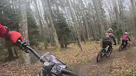
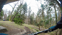
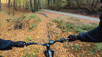
Photos of Markuševac Mountain Bike
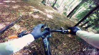
Videos of Markuševac Mountain Bike
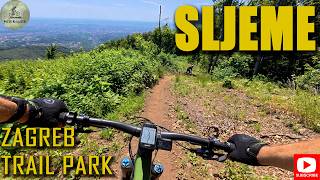
trail: Pinta
0:29 |
144 |
Mar 16, 2024
trail: Kolorado
0:48 |
90 |
Apr 11, 2021
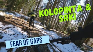
trail: Srki
0:18 |
112 |
Nov 18, 2020
trail: Trobec
9:46 |
10 |
May 24, 2026 , Zagreb
trail: Kolorado
49:58 |
21 |
Jan 6, 2026 , Zagreb
trail: Kolorado
8:55 |
256 |
Jan 20, 2023 , Zagreb

trail: Pinta
20:58 |
220 |
Jan 20, 2023 , Zagreb
trail: Srki
20:58 |
126 |
Jan 20, 2023 , Zagreb
Recent Trail Reports
| status | trail | date | condition | info | user |
|---|---|---|---|---|---|
| Pinta | Jun 20, 2026 @ 2:38pm (Europe/Zagreb) Jun 20, 2026 | Dry | adkarzen | ||
| Trojka | May 27, 2026 @ 7:18pm (Europe/Zagreb) May 27, 2026 | Dry | adkarzen | ||
| Srki | May 25, 2026 @ 12:47pm (Europe/Zagreb) May 25, 2026 | Dry | adkarzen | ||
| Trobec | May 25, 2026 @ 12:47pm (Europe/Zagreb) May 25, 2026 | Dry | adkarzen | ||
| Kolorado | May 22, 2026 @ 6:12pm (Europe/Zagreb) May 22, 2026 | Ideal | adkarzen | ||
| Cetvorka uphill | Apr 10, 2026 @ 4:15pm (Europe/Zagreb) Apr 10, 2026 | Ideal | adkarzen | ||
| DHMZ 2 | Feb 12, 2026 @ 7:17pm (Europe/Zagreb) Feb 12, 2026 | Prevalent Mud | adkarzen | ||
| Divlje Podsljeme | Oct 16, 2025 @ 1:53pm (Europe/Zagreb) Oct 16, 2025 | Variable | yurrasickpark | ||
| Velje | Oct 8, 2025 @ 12:30pm (Europe/Zagreb) Oct 8, 2025 | Ideal | adkarzen | ||
| DHMZ | Oct 8, 2025 @ 12:30pm (Europe/Zagreb) Oct 8, 2025 | Ideal | adkarzen |
Activity Feed
| username | action | type | title | date |
|---|---|---|---|---|
| adkarzen | add | report | activity #97397036 | Jun 20, 2026 @ 8:12am Jun 20, 2026 |
| Darko5mvfdA | wishlist | trail | activity #97099239 | Jun 16, 2026 @ 4:23am Jun 16, 2026 |
| adkarzen | add | report | activity #96876431 | Jun 13, 2026 @ 7:48am Jun 13, 2026 |
| adkarzen | add | report | activity #95643612 | May 27, 2026 @ 10:18am May 27, 2026 |
| adkarzen | add | report | activity #95549445 and 1 more | May 26, 2026 @ 1:13am May 26, 2026 |
Recent Comments
| username | type | title | comment | date |
|---|---|---|---|---|
| trail | Couple of fallen trees on the trail. | May 9, 2026 @ 4:40am May 9, 2026 | ||
| trail | There is no such thing as DHMZ 2. This is... | Jan 7, 2026 @ 6:22am Jan 7, 2026 | ||
| report | a | Nov 30, 2025 @ 2:29am Nov 30, 2025 | ||
| report | super leafy in some points is not clear where... | Nov 18, 2025 @ 4:10pm Nov 18, 2025 | ||
| trail | Logging activity at the middle, so couple of... | Jul 16, 2025 @ 4:30am Jul 16, 2025 |
Nearby Areas
| name | distance | ||||
|---|---|---|---|---|---|
| Dotka | 1.6 km | ||||
| Vidovec | 2.4 km | ||||
| Medvedgrad | 7 | 9 | 3 km | ||
| Maksimir | 2 | 3.6 km | |||
| Savski nasip | 5.2 km |
Local Badges
-

Completionist0 awarded
Activity Type Stats
| activitytype | trails | distance | descent | descent distance | total vertical | rating | global rank | state rank | photos | reports | routes | ridelogs |
|---|---|---|---|---|---|---|---|---|---|---|---|---|
| Mountain Bike | 24 | 12 miles | 8,199 ft | 10 miles | 2,247 ft | #1,318 | #5 | 67 | 215 | 1 | 1,549 | |
| E-Bike | 20 | 9 miles | 6,283 ft | 7 miles | 2,178 ft | #1,085 | #13 | 198 | 777 | |||
| Hike | 9 | 5 miles | 1,965 ft | 3 miles | 909 ft | #2,180 | #21 | 166 | 160 | |||
| Trail Running | 9 | 5 miles | 1,965 ft | 3 miles | 909 ft | #1,495 | #22 | 166 | 16 |
Frequently Asked Questions About Markuševac
▼
What are the highest rated mountain biking trails in Markuševac?
▼
What is the best time of the year to ride in Markuševac?
Based on ride log data, the most popular months to ride in Markuševac are:
- August (9 activities)
- March (8 activities)
- July (7 activities)
▼
Where can I park to ride in Markuševac?
Check the Markuševac trail map for trailhead and parking information. Community members regularly update access and parking details for trails in the area.
▼
What is the longest trail in Markuševac?
The longest trail in Markuševac is Divlje Podsljeme at 2.4 miles. View all trails sorted by distance.
- By Forever420Flow & contributors
- Admins: BKO
- #13402 - 5,216 views
- markuševac activity log | embed map of Markuševac mountain bike trails | markuševac mountain biking points of interest
Downloading of trail gps tracks in kml & gpx formats is enabled for Markuševac.
You must login to download files.