close
-
Layers w
- Weather Layers
- Pro
- Pro
- Pro
- Pro
- Pro
- Pro
- More Layers
- Pro
- Pro
- Pro
- Pro
-
Upgrade to

3D
Trail Conditions
- Unknown
- Snow Groomed
- Snow Packed
- Snow Covered
- Snow Cover Partial
- Freeze/thaw Cycle
- Icy
- Prevalent Mud
- Wet
- Variable
- Ideal
- Dry
- Very Dry
Trail Flow (Ridden Direction)
Trailforks scans users ridelogs to determine the most popular direction each trail is ridden. A good flowing trail network will have most trails flowing in a single direction according to their intension.
The colour categories are based on what percentage of riders are riding a trail in its intended direction.
The colour categories are based on what percentage of riders are riding a trail in its intended direction.
- > 96%
- > 90%
- > 80%
- > 70%
- > 50%
- < 50%
- bi-directional trail
- no data
Trail Last Ridden
Trailforks scans ridelogs to determine the last time a trail was ridden.
- < 2 days
- < 1 week
- < 2 weeks
- < 1 month
- < 6 months
- > 6 months
Trail Ridden Direction
The intended direction a trail should be ridden.
- Downhill Only
- Downhill Primary
- Both Directions
- Uphill Primary
- Uphill Only
- One Direction
Contribute Details
Colors indicate trail is missing specified detail.
- Description
- Photos
- Description & Photos
- Videos
Trail Popularity ?
Trailforks scans ridelogs to determine which trails are ridden the most in the last 9 months.
Trails are compared with nearby trails in the same city region with a possible 25 colour shades.
Think of this as a heatmap, more rides = more kinetic energy = warmer colors.
- most popular
- popular
- less popular
- not popular
ATV/ORV/OHV Filter
Max Vehicle Width
inches
US Cell Coverage
Legend

Radar Time
Activity Recordings
Trailforks uses anonymized public activity data.
?
Activity Recordings
Trailforks uses anonymized public activity data.
?
Personal Heatmap
▶
Activity Types
all
/
none
▶
Options
2
Date range
month
–
Winter Trails
Warning
A routing network for winter maps does not exist. Selecting trails using the winter trails layer has been disabled.
Missing Trails
Most Popular
Least Popular
Trails are colored based on popularity. The more popular a trail is, the more red. Less popular trails trend towards green.
Jump Magnitude Heatmap
Heatmap of where riders jump on trails. Zoom in to see individual jumps, click circles to view jump details.
BC Backroad Status
![map legend]()
Service Road Atlas is a free to use, community-driven service for viewing and creating reports on the numerous back-country service roads around B.C. and Alberta.

Slope Aspect
Direction the slope faces
Trails Deemphasized
Trails are shown in grey.
Only show trails with no bike usage.
Suggested Layers
Based on selected activity type
Save the current map location and zoom level as your default home location whenever this page is loaded.
Save
No description for Marlborough has been added yet!
Login or register to submit one.
Activities Click to view
- Mountain Bike
165 trails
- E-Bike
52 trails
- Horse
1 trails
- Hike
156 trails
- Trail Running
171 trails
- Dirtbike/Moto
5 trails
- ATV/ORV/OHV
4 trails
- Snowmobile
1 trails
- Snowshoe
1 trails
- Downhill Ski
1 trails
- Backcountry Ski
1 trails
- Nordic Ski
1 trails
Stats
- Avg Trail Rating
- Trails (view details)
- 147
- Trails Mountain Bike
- 165
- Trails E-Bike
- 52
- Trails Gravel Bike
- 1
- Trails Horse
- 1
- Trails Hike
- 169
- Trails Trail Running
- 171
- Trails Dirtbike/Moto
- 5
- Trails ATV/ORV/OHV
- 4
- Trails Snowmobile
- 1
- Trails Snowshoe
- 1
- Trails Downhill Ski
- 1
- Trails Backcountry Ski
- 1
- Trails Nordic Ski
- 1
- Total Distance
- 223 miles
- Total Descent
- 54,966 ft
- Total Vertical
- 5,567 ft
- Highest Trailhead
- 5,568 ft
- Reports
- 462
- Photos
- 414
- Ridden Counter
- 16,247
Sub Regions
- Blenheim (76)
- Duncan Bay (11)
- Havelock (1)
- Picton (58)
- Picton MTB Trails (40)
- Rarangi (6)
- Rarangi (1)
- Pelorus Bridge Scenic Reserve (0)
- Pelorus Sound / Te Hoiere (0)
- Queen Charlotte Sound/Tōtaranui Area (5)
Popular Marlborough Mountain Biking Trails
• ★ 4.4 • 13 miles • 2,253 ft • 406 •
The section of the track leads bikers on a long climb to the main ridge between Queen Charlotte and Kenepuru Sounds, but offers spectacular views. The track is wide and can be quite steep in places. Watch out for drop offs and rocky...
• ★ 4.9 • 12 miles • 2,516 ft • 404 •
This section of the track begins with a long steep climb, lots of pushing, switch backs on descent. Track begins undulating, track becoming wider and more moderate in the mid section with a long descent to Anakiwa.
• 100 ★ 5.0 • 2 miles • 277 ft • 301 •
Bike trail leading out to the snout,starts at the northern end of the trail.Some narrow parts in places and some steep drop offs along the way.The trail joins onto the walking track and the last 200m is a shared track to the snout...
• 95 ★ 4.0 • 3,699 ft • 87 ft • 284 •
Highly rated popular blue difficulty doubletrack. This mountain bike primary trail can be used downhill only and has a moderate overall physical rating with a 87 ft blue climb. It features jump. On average it takes 3 minutes to complete this trail.
• 100 ★ 4.0 • 2,713 ft • 35 ft • 274 •
is a Bike Trail only, NO walking/hiking/running/Dogs on this trail.
• 95 ★ 3.7 • 4,527 ft • 469 ft • 266 •
Popular green difficulty doubletrack. This mountain bike primary trail can be used uphill only and has a moderate overall physical rating with a 469 ft blue climb. On average it takes 7 minutes to complete this trail.
Marlborough Mountain Bike Routes
21 miles • 4,263 ft • 2 • Point to Point •
The is a 42-kilometre walking and mountain bike track that connects Havelock, Picton, Anakiwa and the...
★ 4.0 • 46 miles • 12,267 ft • 3 • Point to Point •
Renowned for its stunning scenery and challenging terrain the Queen Charlotte Track is a mountain biking...
★ 3.0 • 4 miles • 531 ft • 0 • Loop •
This is a practise XC course for the 2021 Skoda National Schools MTB Champs. It's roughly 90% of the...
704 miles • 29,990 ft • 0 •
Shorted version of Jonathon Kennet's Sounds to Sounds. Removed QC and Milford sections.
• 2 miles • 803 ft • 2 •
• 3 miles • 768 ft • 10 •
Photos of Marlborough Mountain Bike
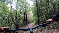
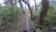
Videos of Marlborough Mountain Bike
trail: Wakamarina Track
2:27 |
288 |
Jul 19, 2025
trail: Wakamarina Track
0:38 |
|
Mar 18, 2024
trail: Pukaka Valley
5:37 |
97 |
Jan 5, 2020
trail: Scenic Route
2:37 |
329 |
Nov 25, 2016
trail: Pamploma
2:58 |
618 |
Apr 30, 2016
trail: Skyline
0:42 |
215 |
Sep 28, 2015
trail: Pamploma
2:45 |
257 |
Apr 19, 2014
trail: Pamploma
2:44 |
226 |
Mar 10, 2014
Current Trail Warnings
| status | trail | date | condition | user | info |
|---|---|---|---|---|---|
| Link Pathway Picton | Jun 9, 2026 @ 6:44am (Pacific/Auckland) Jun 8, 2026 | Unknown | djhnzdjhnz | Major erosion (major ruts or slumping,... |
Recent Trail Reports
| status | trail | date | condition | info | user |
|---|---|---|---|---|---|
| Wilsons Road Havelock | Apr 7, 2026 @ 6:03am (Pacific/Auckland) Apr 6, 2026 | Ideal | Bb1shot | ||
| Good for Nothing Picton | Apr 6, 2026 @ 2:08pm (Pacific/Auckland) Apr 5, 2026 | Ideal | Bb1shot | ||
| Link Pathway - Section 4 Picton | Mar 28, 2026 @ 9:05pm (Pacific/Auckland) Mar 28, 2026 | Unknown | Floki1 | ||
| Link Pathway - Section 1 Picton | Mar 16, 2026 @ 8:46am (Pacific/Auckland) Mar 15, 2026 | Ideal | DavidJonesRider DOT | ||
| Ngakuta Bay Track Picton | Mar 16, 2026 @ 8:46am (Pacific/Auckland) Mar 15, 2026 | Ideal | DavidJonesRider DOT | ||
| Link Pathway - Anakiwa Branch Picton | Mar 16, 2026 @ 8:46am (Pacific/Auckland) Mar 15, 2026 | Ideal | DavidJonesRider DOT | ||
| Pukaka Valley Rarangi | Mar 8, 2026 @ 8:23pm (Pacific/Auckland) Mar 7, 2026 | Ideal | timotei99 | ||
| Mount Vernon Blenheim | Mar 6, 2026 @ 4:38pm (Pacific/Auckland) Mar 5, 2026 | Very Dry | timotei99 | ||
| Punga Track Picton MTB Trails | Mar 5, 2026 @ 12:39pm (Pacific/Auckland) Mar 4, 2026 | Dry | GraemeLJ980J | ||
| Picton to Waikawa Track Picton MTB Trails | Mar 5, 2026 @ 12:39pm (Pacific/Auckland) Mar 4, 2026 | Dry | GraemeLJ980J |
Activity Feed
| username | action | type | title | date |
|---|---|---|---|---|
| Blackmore39 | wishlist | trail | activity #97375040 and 1 more | Jun 20, 2026 @ 2:31am Jun 20, 2026 |
| Gefblk | add | photo | activity #97358520 and 2 more | Jun 19, 2026 @ 6:16pm Jun 19, 2026 |
| Summqunte | comment | trail | activity #96851483 | Jun 13, 2026 @ 12:10am Jun 13, 2026 |
| Bazzabumble | wishlist | badge | activity #96717894 | Jun 10, 2026 @ 9:33pm Jun 10, 2026 |
| sopcc26 | wishlist | route | activity #96674987 | Jun 10, 2026 @ 8:30am Jun 10, 2026 |
Recent Comments
| username | type | title | comment | date |
|---|---|---|---|---|
| trail | Just pushed an ebike up today what an effort,... | Jun 13, 2026 @ 12:10am Jun 13, 2026 | ||
| report | A big slip in a prone area. Not passable. | Jun 8, 2026 @ 12:20pm Jun 8, 2026 | ||
| trail | Grassy in the middle | Apr 10, 2026 @ 9:08pm Apr 10, 2026 | ||
| trail | I did this track by mountain bike and would... | Mar 4, 2026 @ 5:11pm Mar 4, 2026 | ||
| trail | Kauima Bay track exit has moved about 500m... | Feb 16, 2026 @ 10:33pm Feb 16, 2026 |
Local Badges
-

Big Ride 30k1,523 awarded -

Epic Ride 50k491 awarded -
Big Ride 30k429 awarded -
Epic Ride 50k181 awarded -

Descent 100k Badge0 awarded -
Descent 100k Badge7 awarded
Bike & Skill Parks
| name | type | city | rating |
|---|---|---|---|
| Taylor River Trail Pumptrack | skill park | Blenheim |
Local Trail Supporters
- Oliver Brown
![]()
Activity Type Stats
| activitytype | trails | distance | descent | descent distance | total vertical | rating | global rank | state rank | photos | reports | routes | ridelogs |
|---|---|---|---|---|---|---|---|---|---|---|---|---|
| Mountain Bike | 165 | 215 miles | 54,793 ft | 87 miles | 5,568 ft | 410 | 462 | 4 | 20,691 | |||
| E-Bike | 52 | 46 miles | 10,246 ft | 16 miles | 5,568 ft | 3 | 318 | 2,151 | ||||
| Gravel Bike | 1 | 3 | 2 | 167 | ||||||||
| Horse | 1 | 46 | ||||||||||
| Hike | 156 | 211 miles | 48,491 ft | 82 miles | 5,568 ft | 1 | 421 | 1,532 | ||||
| Trail Running | 171 | 211 miles | 48,491 ft | 82 miles | 5,568 ft | 421 | 1,548 | |||||
| Dirtbike/Moto | 5 | 8 miles | 10 ft | 673 ft | 4,810 ft | 46 | ||||||
| ATV/ORV/OHV | 4 | 9 miles | 20 ft | 925 ft | 5,197 ft | 46 | ||||||
| Snowmobile | 1 | |||||||||||
| Snowshoe | 1 | |||||||||||
| Downhill Ski | 1 | 16 | ||||||||||
| Backcountry Ski | 1 | 3 | ||||||||||
| Nordic Ski | 1 | 5 |
Frequently Asked Questions About Marlborough
▼
What are the best places to ride in Marlborough?
Marlborough has 7 areas to explore for mountain biking. The top rated areas are:
▼
What are the highest rated mountain biking trails in Marlborough?
The highest rated mountain biking trails in Marlborough are:
- Wakamarina Track (4.6/5)
- Pukaka Valley (4.4/5)
- Kanuka MTB trail. (4.4/5)
- Queen Charlotte (Torea to Anakiwa) (4.3/5)
- Another Mans Treasure (4.2/5)
▼
What is the best time of the year to ride in Marlborough?
Based on ride log data, the most popular months to ride in Marlborough are:
- January (125 activities)
- December (104 activities)
- November (90 activities)
▼
What is the longest trail in Marlborough?
The longest trail in Marlborough is Nydia Track at 24.6 km. View all trails sorted by distance.
Activities
Trails
Points of Interest
- Pelorus Bridge Campground Camping
- Mount Royal Summit
- Nydia Lodge
- Hilltop View Viewpoint
- Lochmara Lodge
- Camp Bay Campsite Camping
- Parororangi / Mount Stokes Summit
- Queen Charlotte Track Viewpoint
- Rarangi Campsite Camping
- [cave] Blow Hole Other
- Barometer (1,772 m)
- Glenlee North (1,703 m)
- Glenlee South (1,675 m)
- By YogiNZ & contributors
- Admins: TFNZ, lintbagger, Alps2Ocean-Cycle-Trail, MMBC, rhino333
- #3653 - 10,419 views
- marlborough activity log | embed map of Marlborough mountain bike trails | marlborough mountain biking points of interest
Downloading of trail gps tracks in kml & gpx formats is enabled for Marlborough.
You must login to download files.