close
-
Layers w
- Weather Layers
- Pro
- Pro
- Pro
- Pro
- Pro
- Pro
- More Layers
- Pro
- Pro
- Pro
- Pro
-
Upgrade to

3D
Trail Conditions
- Unknown
- Snow Groomed
- Snow Packed
- Snow Covered
- Snow Cover Partial
- Freeze/thaw Cycle
- Icy
- Prevalent Mud
- Wet
- Variable
- Ideal
- Dry
- Very Dry
Trail Flow (Ridden Direction)
Trailforks scans users ridelogs to determine the most popular direction each trail is ridden. A good flowing trail network will have most trails flowing in a single direction according to their intension.
The colour categories are based on what percentage of riders are riding a trail in its intended direction.
The colour categories are based on what percentage of riders are riding a trail in its intended direction.
- > 96%
- > 90%
- > 80%
- > 70%
- > 50%
- < 50%
- bi-directional trail
- no data
Trail Last Ridden
Trailforks scans ridelogs to determine the last time a trail was ridden.
- < 2 days
- < 1 week
- < 2 weeks
- < 1 month
- < 6 months
- > 6 months
Trail Ridden Direction
The intended direction a trail should be ridden.
- Downhill Only
- Downhill Primary
- Both Directions
- Uphill Primary
- Uphill Only
- One Direction
Contribute Details
Colors indicate trail is missing specified detail.
- Description
- Photos
- Description & Photos
- Videos
Trail Popularity ?
Trailforks scans ridelogs to determine which trails are ridden the most in the last 9 months.
Trails are compared with nearby trails in the same city region with a possible 25 colour shades.
Think of this as a heatmap, more rides = more kinetic energy = warmer colors.
- most popular
- popular
- less popular
- not popular
ATV/ORV/OHV Filter
Max Vehicle Width
inches
US Cell Coverage
Legend

Radar Time
Activity Recordings
Trailforks uses anonymized public activity data.
?
Activity Recordings
Trailforks uses anonymized public activity data.
?
Personal Heatmap
▶
Activity Types
all
/
none
▶
Options
2
Date range
month
–
Winter Trails
Warning
A routing network for winter maps does not exist. Selecting trails using the winter trails layer has been disabled.
Missing Trails
Most Popular
Least Popular
Trails are colored based on popularity. The more popular a trail is, the more red. Less popular trails trend towards green.
Jump Magnitude Heatmap
Heatmap of where riders jump on trails. Zoom in to see individual jumps, click circles to view jump details.
BC Backroad Status
![map legend]()
Service Road Atlas is a free to use, community-driven service for viewing and creating reports on the numerous back-country service roads around B.C. and Alberta.

Slope Aspect
Direction the slope faces
Trails Deemphasized
Trails are shown in grey.
Only show trails with no bike usage.
Suggested Layers
Based on selected activity type
Save the current map location and zoom level as your default home location whenever this page is loaded.
Save
No description for Marmara has been added yet!
Login or register to submit one.
Region Details
- 13
- 11
- 59
- 49
- 12
- 7
Stats
- Avg Trail Rating
- Trails (view details)
- 152
- Trails Mountain Bike
- 152
- Trails E-Bike
- 20
- Trails Horse
- 11
- Trails Hike
- 127
- Trails Trail Running
- 118
- Trails Dirtbike/Moto
- 4
- Total Distance
- 302 miles
- Total Descent
- 69,868 ft
- Total Vertical
- 8,217 ft
- Highest Trailhead
- 8,310 ft
- Reports
- 423
- Photos
- 120
- Ridden Counter
- 316
Articles

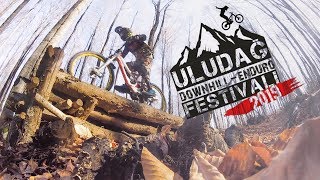
Video: Urban Downhill on Istanbul's Historic Streets
Dec 23, 2020 from pinkbike.com
Stair gaps narrow streets make for an urban mtb playground.
Sub Regions
- Balikesir (39)
- Edremit bay (7)
- Ida mount (26)
- Kapıdağ Yarımadası (0)
- Mount Madra (9)
- Bursa (101)
- Mysia (52)
- Istanbul (9)
- Belgrad (5)
- Buyukada (2)
- Sazlıdere - Samlar (0)
- Sakarya (2)
- Kartepe (2)
Popular Marmara Mountain Biking Trails
• 70 ★ 5.0 • 1 mile • 55 ft • 9 •
The island has no motor vehicles therefore you have to climb with your bike. The climb is moderate but the second half is a bit more tiring. It is mainly a wilderness trail , the route contains some downhill segments and few dirt jumps....
• 5 ★ 5.0 • 3 miles • 39 ft • 9 •
Less popular double black diamond difficulty singletrack. This mountain bike primary trail can be used both directions. On average it takes 1 hour10 minutes to complete this trail.
• 75 ★ 5.0 • 10 miles • 282 ft • 5 •
Popular blue difficulty wilderness trail. This mountain bike primary trail can be used both directions and has a hard overall physical rating with a 282 ft black diamond climb. It features rock face. Trail visibility is always easy to follow. On average it takes 1 hour40 minutes to complete this trail.
• 5 ★ 5.0 • 4 miles • 669 ft • 5 •
Less popular white difficulty singletrack. This mountain bike primary trail can be used downhill primary and has a moderate overall physical rating with a 669 ft blue climb. It features log ride and pump track. On average it takes 27 minutes to complete this trail.
• 100 ★ 0.0 • 3 miles • 26 ft • 5 •
High gradient sections. Loose and rocky sections. on last 1km stay clear of right side, warning cliff.
• 95 ★ 0.0 • 2 miles • 3 ft • 4 •
Tırmanışta çok abartılı zorluğu olmayan, inişi de keyifli bir yol. Yer yer çakıl taşlı gevşek bölümler var oralarda ekstra dikkatli olunmalı inişte. Yoğun yağış sonrası tırmanmak zor ancak inişi çok keyifli....
• 75 ★ 0.0 • 1 mile • 291 ft • 4 •
Popular green difficulty singletrack. This mountain bike primary trail can be used both directions and has a easy overall physical rating with a 291 ft green climb. Trail visibility is always easy to follow. On average it takes 13 minutes to complete this trail.
Marmara Mountain Bike Routes
★ 5.0 • 32 miles • 5,048 ft • 0 • Point to Point •
Starting with soft climbing to Çalı Lake, route reaches to Atlas village. After Atlas village "taştepe...
11 miles • 1,288 ft • 1 •
No trails on the island too much because it's not a very large area. But the track is fun .. :)
33 miles • 3,978 ft • 1 • Loop •
Intermediate cross country route. great scenery and forest trails
37 miles • 6,075 ft • 0 • Loop •
Very beautiful nature but a hard route. Some dirt/gravel path, some blue trail, some a hard trail,...
13 miles • 3,126 ft • 0 • Loop •
Half day long, fun route Start by climbing the Fırla Dede hill, then follow blue trail to the dağyenice...
61 miles • 11,398 ft • 0 • Loop •
Some parts are hard on this route. The route may be closed in December and January.
Photos of Marmara Mountain Bike
Recent Trail Reports
| status | trail | date | condition | info | user |
|---|---|---|---|---|---|
| Hidden Lake To Saitabat Bursa | Apr 23, 2026 @ 7:10am (Europe/Istanbul) Apr 22, 2026 | Unknown | DWUrDY | ||
| Tahtalı köy içinden sert tırmanış Mysia | Jun 10, 2023 @ 3:57am Jun 10, 2023 | Ideal | Wildwraith | ||
| Kanepeli Singletrack Mysia | Jun 10, 2023 @ 3:57am Jun 10, 2023 | Ideal | Wildwraith | ||
| Üçpınar Inegazi toprak doubletrack Mysia | Jun 10, 2023 @ 3:57am Jun 10, 2023 | Dry | Wildwraith | ||
| Parkur Buyukada | Sep 17, 2022 @ 9:05am Sep 17, 2022 | Dry | A7xYE1a | ||
| inegazi - yaylacık iniş Bursa | Sep 15, 2022 @ 8:25am Sep 15, 2022 | Dry | chals | ||
| Karanlıktarla tepesi - yaylacık iniş Bursa | Sep 15, 2022 @ 8:24am Sep 15, 2022 | Dry | chals | ||
| Kapı Downhill Bursa | Aug 6, 2022 @ 7:09pm Aug 6, 2022 | Very Dry | Wildwraith | ||
| Deliklitaş mağarası - inegazi Bursa | Aug 13, 2022 @ 8:58pm Aug 13, 2022 | Ideal | Wildwraith | ||
| Trans misi 4 üçpınar çıkışı Mysia | Aug 13, 2022 @ 8:58pm Aug 13, 2022 | Dry | Wildwraith |
Activity Feed
| username | action | type | title | date |
|---|---|---|---|---|
| exantt | add | photo | activity #96857153 and 3 more | Jun 13, 2026 @ 2:51am Jun 13, 2026 |
| oguzkaganayar09 | ridden | trail | activity #95268344 and 1 more | May 22, 2026 @ 2:29pm May 22, 2026 |
| Alwaystravelling | wishlist | route | activity #94203632 | May 7, 2026 @ 1:17am May 7, 2026 |
| Alwaystravelling | wishlist | trail | activity #94203610 and 1 more | May 7, 2026 @ 1:15am May 7, 2026 |
| Alwaystravelling | wishlist | trail | activity #94203482 | May 7, 2026 @ 1:08am May 7, 2026 |
Recent Comments
| username | type | title | comment | date |
|---|---|---|---|---|
| trail | Trail is not rideable | Oct 29, 2023 @ 1:08am Oct 29, 2023 | ||
| trail | Most of this loop is overgrown doubletrack.... | Oct 21, 2023 @ 2:56am Oct 21, 2023 | ||
| trail | Başlangıcından Tefer3 ' ekadar büyük... | Aug 17, 2022 @ 6:01am Aug 17, 2022 |
Local Badges
-

Descent 100k Badge0 awarded -

Epic Ride 50k206 awarded -

Big Ride 30k65 awarded -
Epic Ride 50k44 awarded -
Descent 100k Badge2 awarded -

Descent 10k Badge1 awarded
Bike & Skill Parks
| name | type | city | rating |
|---|---|---|---|
| Avcılar Skate Park | skill park | Istanbul | |
| BursaBikePark | skill park | Bursa | |
| Hezarfen MX | skill park | Istanbul |
Activity Type Stats
| activitytype | trails | distance | descent | descent distance | total vertical | rating | global rank | state rank | photos | reports | routes | ridelogs |
|---|---|---|---|---|---|---|---|---|---|---|---|---|
| Mountain Bike | 152 | 301 miles | 69,364 ft | 152 miles | 8,219 ft | 120 | 422 | 24 | 10,058 | |||
| E-Bike | 20 | 56 miles | 7,057 ft | 21 miles | 8,219 ft | 409 | 5 | 306 | ||||
| Horse | 11 | 34 miles | 2,995 ft | 11 miles | 2,559 ft | 14 | 2 | |||||
| Hike | 127 | 250 miles | 49,613 ft | 115 miles | 8,219 ft | 421 | 3 | 377 | ||||
| Trail Running | 118 | 227 miles | 45,794 ft | 105 miles | 7,999 ft | 420 | 2 | 40 | ||||
| Dirtbike/Moto | 4 | 13 miles | 1,499 ft | 5 miles | 1,601 ft | 7 | 1 | 9 |
Activities
Trails
Points of Interest
- By canadaka
 Trailforks & contributors
 - Admins: apply
- #32477 - 1,734 views
- marmara activity log | embed map of Marmara mountain bike trails | marmara mountain biking points of interest
Downloading of trail gps tracks in kml & gpx formats is enabled for Marmara.
You must login to download files.