close
-
Layers w
- Weather Layers
- Pro
- Pro
- Pro
- Pro
- Pro
- Pro
- More Layers
- Pro
- Pro
- Pro
- Pro
-
Upgrade to

3D
Trail Conditions
- Unknown
- Snow Groomed
- Snow Packed
- Snow Covered
- Snow Cover Partial
- Freeze/thaw Cycle
- Icy
- Prevalent Mud
- Wet
- Variable
- Ideal
- Dry
- Very Dry
Trail Flow (Ridden Direction)
Trailforks scans users ridelogs to determine the most popular direction each trail is ridden. A good flowing trail network will have most trails flowing in a single direction according to their intension.
The colour categories are based on what percentage of riders are riding a trail in its intended direction.
The colour categories are based on what percentage of riders are riding a trail in its intended direction.
- > 96%
- > 90%
- > 80%
- > 70%
- > 50%
- < 50%
- bi-directional trail
- no data
Trail Last Ridden
Trailforks scans ridelogs to determine the last time a trail was ridden.
- < 2 days
- < 1 week
- < 2 weeks
- < 1 month
- < 6 months
- > 6 months
Trail Ridden Direction
The intended direction a trail should be ridden.
- Downhill Only
- Downhill Primary
- Both Directions
- Uphill Primary
- Uphill Only
- One Direction
Contribute Details
Colors indicate trail is missing specified detail.
- Description
- Photos
- Description & Photos
- Videos
Trail Popularity ?
Trailforks scans ridelogs to determine which trails are ridden the most in the last 9 months.
Trails are compared with nearby trails in the same city region with a possible 25 colour shades.
Think of this as a heatmap, more rides = more kinetic energy = warmer colors.
- most popular
- popular
- less popular
- not popular
ATV/ORV/OHV Filter
Max Vehicle Width
inches
US Cell Coverage
Legend

Radar Time
Activity Recordings
Trailforks uses anonymized public activity data.
?
Activity Recordings
Trailforks uses anonymized public activity data.
?
Personal Heatmap
▶
Activity Types
all
/
none
▶
Options
2
Date range
month
–
Winter Trails
Warning
A routing network for winter maps does not exist. Selecting trails using the winter trails layer has been disabled.
Missing Trails
Most Popular
Least Popular
Trails are colored based on popularity. The more popular a trail is, the more red. Less popular trails trend towards green.
Jump Magnitude Heatmap
Heatmap of where riders jump on trails. Zoom in to see individual jumps, click circles to view jump details.
BC Backroad Status
![map legend]()
Service Road Atlas is a free to use, community-driven service for viewing and creating reports on the numerous back-country service roads around B.C. and Alberta.

Slope Aspect
Direction the slope faces
Trails Deemphasized
Trails are shown in grey.
Only show trails with no bike usage.
Suggested Layers
Based on selected activity type
Save the current map location and zoom level as your default home location whenever this page is loaded.
Save
No description for Marradi has been added yet!
Login or register to submit one.
This region uses the Uk/Euro style trail grading system.
Activities Click to view
- Mountain Bike
10 trails
- E-Bike
10 trails
- Hike
10 trails
- Trail Running
7 trails
Region Details
- 2
- 6
- 1
Region Status
Open as of May 8, 2026Stats
- Avg Trail Rating
- Trails (view details)
- 10
- Trails Mountain Bike
- 10
- Trails E-Bike
- 10
- Trails Hike
- 10
- Trails Trail Running
- 7
- Total Distance
- 7 miles
- Total Descent Distance
- 6 miles
- Total Descent
- 3,491 ft
- Total Vertical
- 1,577 ft
- Highest Trailhead
- 2,465 ft
- Reports
- 16
- Photos
- 1
- Ridden Counter
- 48
Popular Marradi Mountain Biking Trails
• 70 ★ 2.0 • 3 miles • 266 ft • 15 •
One of the nicest and longest trails in the area. Easy access from Eremo di Gamogna, take the fire road towards Marradi and then turn left on the 521 CAI trail marker. Rocky terrain, with drops and rock gardens in the upper part, smooth...
• 90 ★ 4.0 • 3 miles • 75 ft • 8 •
Inizialmente non troviamo grosse complicazioni anche se il sentiero non é mai banale, ma a mano a mano che scendiamo diventa veramente difficile e divertente con alcuni passaggi che classificherei S4. Fino a Biforco il sentiero...
• 100 ★ 0.0 • 2 miles • 87 ft • 6 •
Discesa prima flow molto veloce poi tecnica con brevi rilanci e finale scassato . Fondo buono anche dopo intemperie.
• 80 ★ 0.0 • 4,393 ft • 0 ft • 3 •
Divertente Single Track di recente realizzazione come finale della discesa da Monte Carnevale , Tecnico e duro. Moderare la velocità una volta giunti sulla strada finale.
• 5 ★ 1.0 • 2 miles • 11 ft • 2 •
Discesa classica della zona molto apprezzata dai praticanti di enduro/mtb.
• 5 ★ 0.0 • 2 miles • 257 ft • 2 •
Less popular green difficulty singletrack. This mountain bike primary trail can be used both directions.
• 60 ★ 0.0 • 3,812 ft • 0 ft • 1 •
Moderately popular blue difficulty singletrack. This mountain bike primary trail can be used both directions.
Photos of Marradi Mountain Bike
Videos of Marradi Mountain Bike

trail: CAI 547
16:59 |
12 |
May 28, 2026 , Marradi
youtuber
![Cypress Hill, Marradi (FI), 10-03-2026]()

trail: Cypress Hill
6:11 |
114 |
Mar 11, 2026 , Marradi
Recent Trail Reports
| status | trail | date | condition | info | user |
|---|---|---|---|---|---|
| Gamogna to Marradi | May 8, 2026 @ 5:29pm (Europe/Rome) May 8, 2026 | Ideal | massimomilani | ||
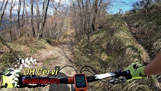
| DH Cervi | Mar 10, 2026 @ 9:06am (Europe/San_Marino) Mar 10, 2026 | Dry | gpaoloconti | ||
| Cypress Hill | Mar 10, 2026 @ 9:06am (Europe/San_Marino) Mar 10, 2026 | Dry | gpaoloconti | ||
| Crinale Grilletta | Jun 10, 2025 @ 2:09pm Jun 10, 2025 | Dry | Avoig88 | ||
| Faldi | May 24, 2025 @ 8:55am May 24, 2025 | Variable | gpaoloconti | ||
| Gamogna - Rio di Mesola | May 17, 2025 @ 10:14am May 17, 2025 | Ideal | boicmtb | ||
| Dh Eremo | May 17, 2025 @ 10:14am May 17, 2025 | Ideal | boicmtb |
Activity Feed
| username | action | type | title | date |
|---|---|---|---|---|
| gpaoloconti | add | video | activity #95713239 | May 28, 2026 @ 9:31am May 28, 2026 |
| gpaoloconti | add | trail | activity #95710577 | May 28, 2026 @ 8:51am May 28, 2026 |
| massimomilani | add | report | activity #94272498 | May 8, 2026 @ 8:29am May 8, 2026 |
| alessandrozacheo | ridden | trail | activity #93699146 | Apr 30, 2026 @ 1:11am Apr 30, 2026 |
| gpaoloconti | add | video | activity #90387364 and 1 more | Mar 11, 2026 @ 8:48am Mar 11, 2026 |
Recent Comments
| username | type | title | comment | date |
|---|---|---|---|---|
| trail | trail bello e vario con tratti rocciosi e... | Aug 31, 2025 @ 5:53am Aug 31, 2025 |
Activity Type Stats
| activitytype | trails | distance | descent | descent distance | total vertical | rating | global rank | state rank | photos | reports | routes | ridelogs |
|---|---|---|---|---|---|---|---|---|---|---|---|---|
| Mountain Bike | 10 | 7 miles | 3,491 ft | 6 miles | 1,578 ft | #11,194 | #1,081 | 16 | 75 | |||
| E-Bike | 10 | 7 miles | 3,491 ft | 6 miles | 1,578 ft | #7,392 | #802 | 1 | 16 | 51 | ||
| Hike | 10 | 7 miles | 3,491 ft | 6 miles | 1,578 ft | #11,151 | #810 | 16 | 1 | |||
| Trail Running | 7 | 7 miles | 3,491 ft | 6 miles | 1,578 ft | #11,024 | #835 | 16 |
Frequently Asked Questions About Marradi
▼
What are the highest rated mountain biking trails in Marradi?
The highest rated mountain biking trails in Marradi are:
- Faldi (4/5)
- Gamogna to Marradi (3.7/5)
- DH Monte Bello (3.6/5)
- DH Cervi (0/5)
- Cypress Hill (0/5)
▼
Where can I park to ride in Marradi?
Check the Marradi trail map for trailhead and parking information. Community members regularly update access and parking details for trails in the area.
▼
What is the longest trail in Marradi?
The longest trail in Marradi is Gamogna to Marradi at 3.3 miles. View all trails sorted by distance.
▼
What are the best & highest rated hiking trails in Marradi?
The best hiking trails in Marradi are: View all hiking trails sorted by popularity score.
- By riccardolucchi-92
 & contributors
 - Admins: DanielePracchia
- #67452 - 503 views
- marradi activity log | embed map of Marradi mountain bike trails |
Downloading of trail gps tracks in kml & gpx formats is enabled for Marradi.
You must login to download files.