close
-
Layers w
- Weather Layers
- Pro
- Pro
- Pro
- Pro
- Pro
- Pro
- More Layers
- Pro
- Pro
- Pro
- Pro
-
Upgrade to

3D
Trail Conditions
- Unknown
- Snow Groomed
- Snow Packed
- Snow Covered
- Snow Cover Partial
- Freeze/thaw Cycle
- Icy
- Prevalent Mud
- Wet
- Variable
- Ideal
- Dry
- Very Dry
Trail Flow (Ridden Direction)
Trailforks scans users ridelogs to determine the most popular direction each trail is ridden. A good flowing trail network will have most trails flowing in a single direction according to their intension.
The colour categories are based on what percentage of riders are riding a trail in its intended direction.
The colour categories are based on what percentage of riders are riding a trail in its intended direction.
- > 96%
- > 90%
- > 80%
- > 70%
- > 50%
- < 50%
- bi-directional trail
- no data
Trail Last Ridden
Trailforks scans ridelogs to determine the last time a trail was ridden.
- < 2 days
- < 1 week
- < 2 weeks
- < 1 month
- < 6 months
- > 6 months
Trail Ridden Direction
The intended direction a trail should be ridden.
- Downhill Only
- Downhill Primary
- Both Directions
- Uphill Primary
- Uphill Only
- One Direction
Contribute Details
Colors indicate trail is missing specified detail.
- Description
- Photos
- Description & Photos
- Videos
Trail Popularity ?
Trailforks scans ridelogs to determine which trails are ridden the most in the last 9 months.
Trails are compared with nearby trails in the same city region with a possible 25 colour shades.
Think of this as a heatmap, more rides = more kinetic energy = warmer colors.
- most popular
- popular
- less popular
- not popular
ATV/ORV/OHV Filter
Max Vehicle Width
inches
US Cell Coverage
Legend

Radar Time
Activity Recordings
Trailforks uses anonymized public activity data.
?
Activity Recordings
Trailforks uses anonymized public activity data.
?
Personal Heatmap
▶
Activity Types
all
/
none
▶
Options
2
Date range
month
–
Winter Trails
Warning
A routing network for winter maps does not exist. Selecting trails using the winter trails layer has been disabled.
Missing Trails
Most Popular
Least Popular
Trails are colored based on popularity. The more popular a trail is, the more red. Less popular trails trend towards green.
Jump Magnitude Heatmap
Heatmap of where riders jump on trails. Zoom in to see individual jumps, click circles to view jump details.
BC Backroad Status
![map legend]()
Service Road Atlas is a free to use, community-driven service for viewing and creating reports on the numerous back-country service roads around B.C. and Alberta.

Slope Aspect
Direction the slope faces
Trails Deemphasized
Trails are shown in grey.
Only show trails with no bike usage.
Suggested Layers
Based on selected activity type
Save the current map location and zoom level as your default home location whenever this page is loaded.
Save
No description for Martin has been added yet!
Login or register to submit one.
Activities Click to view
- Mountain Bike
117 trails
- E-Bike
45 trails
- Gravel Bike
0 trails
- Adaptive Bike
0 trails
- Winter Fat Bike
0 trails
- Hike
97 trails
- Trail Running
97 trails
- Snowshoe
6 trails
- Downhill Ski
7 trails
- Backcountry Ski
47 trails
Region Details
- 24
- 13
- 26
- 27
- 2
- 1
Region Status
Open as of 1 dayStats
- Avg Trail Rating
- Trails (view details)
- 135
- Trails Mountain Bike
- 117
- Trails E-Bike
- 45
- Trails Horse
- 1
- Trails Hike
- 97
- Trails Trail Running
- 97
- Trails Snowshoe
- 6
- Trails Downhill Ski
- 7
- Trails Backcountry Ski
- 47
- Total Distance
- 178 miles
- Total Descent
- 78,809 ft
- Total Vertical
- 4,736 ft
- Highest Trailhead
- 5,508 ft
- Reports
- 2,247
- Photos
- 276
- Ridden Counter
- 12,310
Sub Regions
-
Bike Park Jasenska
- 2
- 2
-
Chata pod Chlebom
- 1
- 3
- 2
-
Chata Pod Kľačianskou Magurou
- 1
- 1
- 5
-
Martinské Hole
- 8
- 18
- 15
- 2
-
Žabokreky
- 1
Popular Martin Mountain Biking Trails
• 95 ★ 4.6 • 3,157 ft • 0 ft • 162 •
Highly rated popular blue difficulty singletrack. This mountain bike primary trail can be used downhill primary and has a moderate overall physical rating. It features drop, jump and rock garden. Trail visibility is always easy to follow. On average it takes 4 minutes to complete this trail.
• 75 ★ 4.4 • 2 miles • 0 ft • 156 • • hike
Modrá turistická značka z Veľkej Lúky do Kuneradu. Trail začína ako hôľny chodník medzi čučoriedkami, striedajú sa úseky v lese s množstvom rockgardenov a koreňov.
• 100 ★ 4.9 • 2,254 ft • 22 ft • 155 •
Highly rated popular blue difficulty family friendly alpine singletrack. This mountain bike primary trail can be used downhill only. It features a-frame, berm, bridge, jump, gap jump, pump track, rock garden and roller coaster. Adaptive MTB rating: amtb blue. On average it takes 2 minutes to complete this trail.
• 70 ★ 4.9 • 4,104 ft • 56 ft • 148 •
Highly rated popular blue difficulty family friendly singletrack. This mountain bike primary trail can be used downhill only and has a moderate overall physical rating with a 56 ft green climb. It features a-frame, berm, bridge, drop, jump, gap jump, rock face and rock garden. Trail visibility is always easy to follow. On average it takes 4 minutes to complete this trail.
• 80 ★ 5.0 • 3,255 ft • 8 ft • 148 •
Popular black difficulty family friendly alpine singletrack. This mountain bike primary trail can be used downhill only and has a hard overall physical rating. It features a-frame, berm, drop, jump, gap jump, rock face, rock garden and other. On average it takes 6 minutes to complete this trail.
• 95 ★ 4.2 • 1,745 ft • 0 ft • 132 •
*Trail je stále v procese výstavby a začiatok sa bude upravovať kvoli plynulemu prepojeniu s " " Príjemný trail cez listnatý les s pár skokmi a pár odklopenými úsekmi v traverze... Schádza sa na "Medvediu cestu" odkiaľ sa...
• 80 ★ 4.9 • 1,982 ft • 0 ft • 129 •
Trailu začína z asfaltovej cesty odkial ide lesom, ďalej križuje zvážnicu a pokračuje po vrstevnici lesom až k prvému Rockgardenu. Od Rockgardenu #1 sa pokračuje cez vykosenú rúbaň ku velkej skale, ktorá sa dá obijsť po...
Martin Mountain Bike Routes
★ 5.0 • 13 miles • 3,130 ft • 8 • Point to Point •
AM/EN route from Turie to Strecno.
6 miles • 2,632 ft • 0 • Loop •
Lysec (1 380 m n. m.) je vrch vo Veľkej Fatre. Nachádza sa západne od hlavného hrebeňa, medzi...
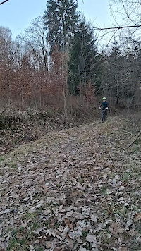
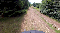
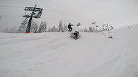
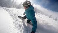
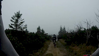
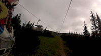
Photos of Martin Mountain Bike
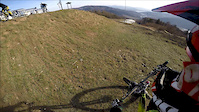
Videos of Martin Mountain Bike
trail: V.V. MTB
0:07 |
15 |
Mar 18, 2026
trail: Magura vrch
4:27 |
207 |
Aug 17, 2019
trail: DH TRAIL
3:50 |
102 |
Mar 21, 2016
trail: Martinky
3:40 |
54 |
Feb 18, 2015
trail: Martinky
0:17 |
152 |
Feb 5, 2015
trail: Martinky
0:26 |
302 |
Jan 6, 2015
trail: Martinky
3:02 |
147 |
Oct 15, 2014
trail: DH TRAIL
4:29 |
180 |
Jun 16, 2013
Current Trail Warnings
| status | trail | date | condition | user | info |
|---|---|---|---|---|---|
| Duky Trail | Jun 10, 2026 @ 10:42am (Europe/Bratislava) Jun 10, 2026 | Unknown | Tomasz91kwdp | Tazba na koncu traila. Treba isc prez... |
Recent Trail Reports
| status | trail | date | condition | info | user |
|---|---|---|---|---|---|
| Na Minčol | Jun 21, 2026 @ 3:29pm (Europe/Bratislava) 1 day | Ideal | skorpionx7 | ||
| Osikove | Jun 21, 2026 @ 10:31am (Europe/Bratislava) 2 days | Ideal | Ivokevi | ||
| Medvedia cesta | Jun 21, 2026 @ 10:31am (Europe/Bratislava) 2 days | Variable | Ivokevi | ||
| Kobylie | Jun 21, 2026 @ 6:05am (Europe/Bratislava) 2 days | Ideal | spit1 | ||
| Krížava | Jun 20, 2026 @ 10:16am (Europe/Bratislava) 3 days | Ideal | katko | ||
| Veľká Lúka | Jun 20, 2026 @ 10:16am (Europe/Bratislava) 3 days | Ideal | katko | ||
| Veľká Lúka | Jun 15, 2026 @ 8:32am (Europe/Bratislava) Jun 14, 2026 | Variable | jurosik | ||
| Vidlica | Jun 15, 2026 @ 8:32am (Europe/Bratislava) Jun 14, 2026 | Variable | jurosik | ||
| Javorina | Jun 6, 2026 @ 1:49pm (Europe/Bratislava) Jun 6, 2026 | Ideal | Bolsevik | ||
| Martinky | Jun 6, 2026 @ 1:49pm (Europe/Bratislava) Jun 6, 2026 | Ideal | Bolsevik |
Activity Feed
| username | action | type | title | date |
|---|---|---|---|---|
| skorpionx7 | add | report | activity #97502719 | Jun 21, 2026 @ 11:05am 1 day |
| Ivokevi | add | report | activity #97490091 and 1 more | Jun 21, 2026 @ 8:55am 1 day |
| spit1 | add | report | activity #97463208 | Jun 21, 2026 @ 2:05am 2 days |
| Radovan9yTB0w | wishlist | region | activity #97456926 | Jun 20, 2026 @ 11:11pm 2 days |
| katko | add | report | activity #97404726 and 1 more | Jun 20, 2026 @ 9:30am 2 days |
Recent Comments
| username | type | title | comment | date |
|---|---|---|---|---|
| trail | Potvrdzujem trail niekto označil modrou... | Apr 23, 2026 @ 12:43pm Apr 23, 2026 | ||
| trail | omylom som dal palec dole .Chcel som dat palec... | Apr 23, 2026 @ 12:36pm Apr 23, 2026 | ||
| trail | trail niekto vyznačil po stromoch modrou... | Apr 23, 2026 @ 12:31pm Apr 23, 2026 | ||
| trail | Dobrý trail prejazdný ľahký. Odporúčam... | Apr 14, 2026 @ 3:55am Apr 14, 2026 | ||
| trail | Pohode zjazdný | Mar 29, 2026 @ 5:24am Mar 29, 2026 |
Local Badges
-

10 Blue Trails54 awarded -

10 Black Trails46 awarded -

Epic Ride Climb 2k236 awarded -

Climbing 10k Badge69 awarded -

Climbing 100k Badge12 awarded -

Epic Ride Descent 2k276 awarded
Bike & Skill Parks
| name | type | city | rating |
|---|---|---|---|
| Bike Park Jasenska | bike park | Martin | |
| Pumptrack Žabokreky | skill park | Martin | |
| Pumptrack Martin | skill park | Martin | |
| SKILL PARK | skill park | Martin |
Activity Type Stats
| activitytype | trails | distance | descent | descent distance | total vertical | rating | global rank | state rank | photos | reports | routes | ridelogs |
|---|---|---|---|---|---|---|---|---|---|---|---|---|
| Mountain Bike | 117 | 138 miles | 54,416 ft | 69 miles | 3,632 ft | #667 | #5 | 273 | 2,220 | 2 | 13,702 | |
| E-Bike | 45 | 32 miles | 7,654 ft | 13 miles | 3,497 ft | #1,004 | #9 | 1 | 1,968 | 1,112 | ||
| Horse | 1 | 709 ft | 13 ft | 252 | ||||||||
| Hike | 97 | 157 miles | 68,986 ft | 82 miles | 4,173 ft | #523 | #7 | 1 | 2,163 | 3,339 | ||
| Trail Running | 97 | 156 miles | 68,438 ft | 81 miles | 4,173 ft | #462 | #4 | 2,159 | 482 | |||
| Snowshoe | 6 | 8 miles | 3,878 ft | 3 miles | 3,146 ft | #64 | #6 | 21 | 5 | |||
| Downhill Ski | 7 | 5 miles | 7,326 ft | 4 miles | 2,493 ft | #192 | #4 | 22 | 318 | |||
| Backcountry Ski | 47 | 42 miles | 25,994 ft | 27 miles | 4,738 ft | #58 | #5 | 1 | 59 | 1,185 |
Frequently Asked Questions About Martin
▼
What are the best places to ride in Martin?
Martin has 5 areas to explore for mountain biking. The top rated areas are:
▼
What are the highest rated mountain biking trails in Martin?
The highest rated mountain biking trails in Martin are:
- Prašivec trail (4.6/5)
- Borka trail (4.4/5)
- DEVIL´S TRAIL (4.4/5)
- EN - V (4.4/5)
- Čipčie (4.4/5)
▼
What is the best time of the year to ride in Martin?
Based on ride log data, the most popular months to ride in Martin are:
- July (131 activities)
- August (121 activities)
- June (95 activities)
▼
Where can I park to ride in Martin?
There are 3 parking locations listed in Martin. The most popular parking spots are: View all parking and trailhead locations on the map to plan your visit.
Activities
Trails
Points of Interest
- "Grandhotel" Partyzán (Cabin) Camping
- Viewpoint Chata pod Chlebom
- Rock drop into rockgarden TTF
- Rockgarden TTF
- Nezábudka Lodge
- KAŠKA LODGE
- RESTAURANT Kaška Other
- RESTAURANT Jasenská dolina Other
- PANORAMA VIEW Viewpoint
- LYSEC VIEW Viewpoint
- Veľký Kriváň (5,525 ft)
- Malý Kriváň (5,420 ft)
- Chleb (5,344 ft)
- By brenthillier
 NSMBA TRAILFORKS & contributors
 - Admins: jxxw
- #13406 - 11,014 views
- martin activity log | embed map of Martin mountain bike trails | martin mountain biking points of interest
Downloading of trail gps tracks in kml & gpx formats is enabled for Martin.
You must login to download files.