close
-
Layers w
- Weather Layers
- Pro
- Pro
- Pro
- Pro
- Pro
- Pro
- More Layers
- Pro
- Pro
- Pro
- Pro
-
Upgrade to

3D
Trail Conditions
- Unknown
- Snow Groomed
- Snow Packed
- Snow Covered
- Snow Cover Partial
- Freeze/thaw Cycle
- Icy
- Prevalent Mud
- Wet
- Variable
- Ideal
- Dry
- Very Dry
Trail Flow (Ridden Direction)
Trailforks scans users ridelogs to determine the most popular direction each trail is ridden. A good flowing trail network will have most trails flowing in a single direction according to their intension.
The colour categories are based on what percentage of riders are riding a trail in its intended direction.
The colour categories are based on what percentage of riders are riding a trail in its intended direction.
- > 96%
- > 90%
- > 80%
- > 70%
- > 50%
- < 50%
- bi-directional trail
- no data
Trail Last Ridden
Trailforks scans ridelogs to determine the last time a trail was ridden.
- < 2 days
- < 1 week
- < 2 weeks
- < 1 month
- < 6 months
- > 6 months
Trail Ridden Direction
The intended direction a trail should be ridden.
- Downhill Only
- Downhill Primary
- Both Directions
- Uphill Primary
- Uphill Only
- One Direction
Contribute Details
Colors indicate trail is missing specified detail.
- Description
- Photos
- Description & Photos
- Videos
Trail Popularity ?
Trailforks scans ridelogs to determine which trails are ridden the most in the last 9 months.
Trails are compared with nearby trails in the same city region with a possible 25 colour shades.
Think of this as a heatmap, more rides = more kinetic energy = warmer colors.
- most popular
- popular
- less popular
- not popular
ATV/ORV/OHV Filter
Max Vehicle Width
inches
US Cell Coverage
Legend

Radar Time
Activity Recordings
Trailforks uses anonymized public activity data.
?
Activity Recordings
Trailforks uses anonymized public activity data.
?
Personal Heatmap
▶
Activity Types
all
/
none
▶
Options
2
Date range
month
–
Winter Trails
Warning
A routing network for winter maps does not exist. Selecting trails using the winter trails layer has been disabled.
Missing Trails
Most Popular
Least Popular
Trails are colored based on popularity. The more popular a trail is, the more red. Less popular trails trend towards green.
Jump Magnitude Heatmap
Heatmap of where riders jump on trails. Zoom in to see individual jumps, click circles to view jump details.
BC Backroad Status
![map legend]()
Service Road Atlas is a free to use, community-driven service for viewing and creating reports on the numerous back-country service roads around B.C. and Alberta.

Slope Aspect
Direction the slope faces
Trails Deemphasized
Trails are shown in grey.
Only show trails with no bike usage.
Suggested Layers
Based on selected activity type
Save the current map location and zoom level as your default home location whenever this page is loaded.
Save
No description for Mascouche has been added yet!
Login or register to submit one.
Activities Click to view
- Mountain Bike
54 trails
- E-Bike
46 trails
- Gravel Bike
0 trails
- Adaptive Bike
0 trails
- Winter Fat Bike
0 trails
- Hike
56 trails
- Trail Running
56 trails
- Snowshoe
24 trails
Region Details
- 6
- 2
- 23
- 14
- 9
Region Status
Open as of Jun 11, 2026Local Trail Association
Stats
- Avg Trail Rating
- Trails (view details)
- 59
- Trails Mountain Bike
- 54
- Trails E-Bike
- 46
- Trails Hike
- 56
- Trails Trail Running
- 56
- Trails ATV/ORV/OHV
- 1
- Trails Snowmobile
- 1
- Trails Snowshoe
- 24
- Trails Nordic Ski
- 3
- Total Distance
- 24 miles
- Total Descent
- 943 ft
- Total Vertical
- 111 ft
- Highest Trailhead
- 176 ft
- Reports
- 224
- Photos
- 57
- Ridden Counter
- 4,622
Sub Regions
-
Parc du Grand-Coteau
- 1
- 11
- 3
- 1
-
Parc métropolitain du Domaine-Seigneurial-de-Mascouche
- 1
- 7
- 7
- 7
Popular Mascouche Mountain Biking Trails
• 90 ★ 5.0 • 1,857 ft • 11 ft • 148 •
Popular green difficulty singletrack. This mountain bike primary trail can be used both directions and has a easy overall physical rating. Trail visibility is always easy to follow. On average it takes 3 minutes to complete this trail.
• 90 ★ 5.0 • 4,190 ft • 13 ft • 143 •
Popular green difficulty singletrack. This mountain bike primary trail can be used both directions. On average it takes 7 minutes to complete this trail.
• 75 ★ 3.0 • 4,541 ft • 13 ft • 137 •
Popular blue difficulty singletrack. This mountain bike primary trail can be used both directions and has a easy overall physical rating. Trail visibility is always easy to follow. On average it takes 6 minutes to complete this trail.
• 100 ★ 0.0 • 935 ft • 15 ft • 125 •
Popular green difficulty singletrack. This mountain bike primary trail can be used both directions and has a easy overall physical rating. Trail visibility is always easy to follow. On average it takes 1 minutes to complete this trail.
• 95 ★ 4.0 • 2,536 ft • 10 ft • 125 •
Popular black diamond difficulty singletrack. This mountain bike primary trail can be used both directions. On average it takes 6 minutes to complete this trail.
• 95 ★ 0.0 • 948 ft • 0 ft • 125 •
Popular blue difficulty singletrack. This multi-use trail can be used both directions. It features bridge and ladder bridge. On average it takes 1 minutes to complete this trail.
• 85 ★ 4.0 • 3,737 ft • 23 ft • 120 •
Popular green difficulty singletrack. This multi-use trail can be used both directions. On average it takes 5 minutes to complete this trail.
• 100 ★ 0.0 • 423 ft • 0 ft • 113 •
Popular green difficulty singletrack. This mountain bike primary trail can be used both directions and has a easy overall physical rating. Trail visibility is always easy to follow. On average it takes minutes to complete this trail.
Mascouche Mountain Bike Routes
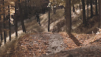
Photos of Mascouche Mountain Bike

Recent Trail Reports
| status | trail | date | condition | info | user |
|---|---|---|---|---|---|
| La traverse | Jun 11, 2026 @ 6:40pm (America/Toronto) Jun 11, 2026 | Ideal | CarrotExtract | ||
| Lien Maël-Maé | Jun 11, 2026 @ 6:40pm (America/Toronto) Jun 11, 2026 | Ideal | CarrotExtract | ||
| La Victor | Jun 11, 2026 @ 6:40pm (America/Toronto) Jun 11, 2026 | Variable | CarrotExtract | ||
| La Skate | Sep 2, 2025 @ 3:01pm Sep 2, 2025 | Ideal | ukTdae | ||
| Maëllo | Aug 6, 2025 @ 12:23pm Aug 6, 2025 | Dry | Shadbay | ||
| La Villemaire | Jul 2, 2025 @ 9:57am Jul 2, 2025 | Dry | 64NaKC | ||
| Parc à Chien | May 7, 2025 @ 9:16am May 7, 2025 | Variable | 64NaKC | ||
| La Crête Venteuse | Nov 4, 2024 @ 10:05am Nov 4, 2024 | Variable | bike701956 | ||
| L'escalier | Jun 26, 2024 @ 6:03am Jun 26, 2024 | Ideal | gOOmba756 | ||
| Belvédère | Jun 26, 2024 @ 6:03am Jun 26, 2024 | Ideal | gOOmba756 |
Activity Feed
| username | action | type | title | date |
|---|---|---|---|---|
| CarrotExtract | add | report | activity #96772468 | Jun 11, 2026 @ 5:35pm Jun 11, 2026 |
| CarrotExtract | add | report | activity #96772465 and 1 more | Jun 11, 2026 @ 5:35pm Jun 11, 2026 |
| Giobike73 | wishlist | region | activity #83316757 | Oct 31, 2025 @ 8:15am Oct 31, 2025 |
| Oferland | update | trail | activity #82323957 and 1 more | Oct 14, 2025 @ 5:21am Oct 14, 2025 |
| bobbywhiskey2 | ridden | trail | activity #81112372 and 1 more | Sep 25, 2025 @ 8:44pm Sep 25, 2025 |
Recent Comments
| username | type | title | comment | date |
|---|---|---|---|---|
| trail | Clean! plaisante à faire. beaucoup de trails... | Aug 5, 2025 @ 4:04pm Aug 5, 2025 | ||
| trail | Too many damn roots | May 15, 2024 @ 1:23pm May 15, 2024 | ||
| trail | Quelqu'un sait pourquoi cette trail ne match... | Jul 22, 2022 @ 10:24am Jul 22, 2022 | ||
| report | Arbre mort à abattre | Sep 21, 2021 @ 10:29am Sep 21, 2021 | ||
| trail | ???????????? | May 29, 2020 @ 6:48pm May 29, 2020 |
Local Badges
-

Epic Ride Climb 2k0 awarded -

Climbing 10k Badge8 awarded -

Climbing 100k Badge0 awarded -

Epic Ride Descent 2k0 awarded -

Descent 10k Badge8 awarded -

Descent 100k Badge0 awarded
Activity Type Stats
| activitytype | trails | distance | descent | descent distance | total vertical | rating | global rank | state rank | photos | reports | routes | ridelogs |
|---|---|---|---|---|---|---|---|---|---|---|---|---|
| Mountain Bike | 54 | 22 miles | 915 ft | 6 miles | 105 ft | #3,464 | #48 | 57 | 224 | 2 | 6,123 | |
| E-Bike | 46 | 18 miles | 794 ft | 5 miles | 105 ft | #4,396 | #41 | 203 | 105 | |||
| Hike | 56 | 23 miles | 919 ft | 6 miles | 112 ft | #5,993 | #51 | 219 | 291 | |||
| Trail Running | 56 | 23 miles | 919 ft | 6 miles | 112 ft | #5,548 | #45 | 219 | 823 | |||
| ATV/ORV/OHV | 1 | 1,007 ft | 13 ft | 295 ft | 30 ft | 8 | 6 | |||||
| Snowmobile | 1 | 2,018 ft | 85 ft | 3 ft | ||||||||
| Snowshoe | 24 | 6 miles | 243 ft | 2 miles | 95 ft | #983 | #41 | 1 | 81 | |||
| Nordic Ski | 3 | 3 miles | 105 ft | 1 mile | 79 ft | 34 |
Frequently Asked Questions About Mascouche
▼
What are the best places to ride in Mascouche?
Mascouche has 2 areas to explore for mountain biking. The top rated areas are:
▼
What are the highest rated mountain biking trails in Mascouche?
The highest rated mountain biking trails in Mascouche are:
- Diego (4.3/5)
- Ridge (4.2/5)
- Chez Brien (4.1/5)
- Maélie (4.1/5)
- Maëllo (4.1/5)
▼
What is the best time of the year to ride in Mascouche?
Based on ride log data, the most popular months to ride in Mascouche are:
- July (182 activities)
- May (173 activities)
- September (153 activities)
▼
Where can I park to ride in Mascouche?
There are 4 parking locations listed in Mascouche. The most popular parking spots are:
- P1 - Boul. de Mascouche et rue Lapointe
- P2 - Pavillon du Grand-Coteau (2510 boul. de Mascouche)
- Parking
- Parking
Activities
Trails
- By almostalx & contributors
- Admins: VQ, bigjay, StephaneMarceau, Canadmos, CCdeM, Gaetanlauzier
- #5396 - 12,711 views
- mascouche activity log | embed map of Mascouche mountain bike trails | mascouche mountain biking points of interest
Downloading of trail gps tracks in kml & gpx formats is enabled for Mascouche.
You must login to download files.