close
-
Layers w
- Weather Layers
- Pro
- Pro
- Pro
- Pro
- Pro
- Pro
- More Layers
- Pro
- Pro
- Pro
- Pro
-
Upgrade to

3D
Trail Conditions
- Unknown
- Snow Groomed
- Snow Packed
- Snow Covered
- Snow Cover Partial
- Freeze/thaw Cycle
- Icy
- Prevalent Mud
- Wet
- Variable
- Ideal
- Dry
- Very Dry
Trail Flow (Ridden Direction)
Trailforks scans users ridelogs to determine the most popular direction each trail is ridden. A good flowing trail network will have most trails flowing in a single direction according to their intension.
The colour categories are based on what percentage of riders are riding a trail in its intended direction.
The colour categories are based on what percentage of riders are riding a trail in its intended direction.
- > 96%
- > 90%
- > 80%
- > 70%
- > 50%
- < 50%
- bi-directional trail
- no data
Trail Last Ridden
Trailforks scans ridelogs to determine the last time a trail was ridden.
- < 2 days
- < 1 week
- < 2 weeks
- < 1 month
- < 6 months
- > 6 months
Trail Ridden Direction
The intended direction a trail should be ridden.
- Downhill Only
- Downhill Primary
- Both Directions
- Uphill Primary
- Uphill Only
- One Direction
Contribute Details
Colors indicate trail is missing specified detail.
- Description
- Photos
- Description & Photos
- Videos
Trail Popularity ?
Trailforks scans ridelogs to determine which trails are ridden the most in the last 9 months.
Trails are compared with nearby trails in the same city region with a possible 25 colour shades.
Think of this as a heatmap, more rides = more kinetic energy = warmer colors.
- most popular
- popular
- less popular
- not popular
ATV/ORV/OHV Filter
Max Vehicle Width
inches
US Cell Coverage
Legend

Radar Time
Activity Recordings
Trailforks uses anonymized public activity data.
?
Activity Recordings
Trailforks uses anonymized public activity data.
?
Personal Heatmap
▶
Activity Types
all
/
none
▶
Options
2
Date range
month
–
Winter Trails
Warning
A routing network for winter maps does not exist. Selecting trails using the winter trails layer has been disabled.
Missing Trails
Most Popular
Least Popular
Trails are colored based on popularity. The more popular a trail is, the more red. Less popular trails trend towards green.
Jump Magnitude Heatmap
Heatmap of where riders jump on trails. Zoom in to see individual jumps, click circles to view jump details.
BC Backroad Status
![map legend]()
Service Road Atlas is a free to use, community-driven service for viewing and creating reports on the numerous back-country service roads around B.C. and Alberta.

Slope Aspect
Direction the slope faces
Trails Deemphasized
Trails are shown in grey.
Only show trails with no bike usage.
Suggested Layers
Based on selected activity type
Save the current map location and zoom level as your default home location whenever this page is loaded.
Save
No description for Massa has been added yet!
Login or register to submit one.
This region uses the Uk/Euro style trail grading system.
Activities Click to view
- Mountain Bike
125 trails
- E-Bike
64 trails
- Gravel Bike
1 trails
- Adaptive Bike
0 trails
- Winter Fat Bike
0 trails
- Horse
25 trails
- Hike
121 trails
- Trail Running
121 trails
- Dirtbike/Moto
5 trails
Region Details
- 24
- 31
- 47
- 17
- 2
Region Status
Caution as of Jun 17, 2026Stats
- Avg Trail Rating
- Trails (view details)
- 123
- Trails Mountain Bike
- 125
- Trails E-Bike
- 64
- Trails Gravel Bike
- 1
- Trails Horse
- 25
- Trails Hike
- 121
- Trails Trail Running
- 121
- Trails Dirtbike/Moto
- 5
- Trails Observed Trials
- 1
- Trails ATV/ORV/OHV
- 4
- Total Distance
- 74 miles
- Total Descent
- 35,210 ft
- Total Vertical
- 3,233 ft
- Highest Trailhead
- 3,274 ft
- Reports
- 1,547
- Photos
- 212
- Ridden Counter
- 9,012
Sub Regions
-
Colline del Candia
- 1
- 2
-
Monte Pepe
- 1
-
Mt Belvedere
- 21
- 31
- 4
- 1
-
Mt Brugiana
- 6
- 8
- 12
- 1
-
Valle del Frigido
- 3
- 4
- 1
Popular Massa Mountain Biking Trails
• 100 ★ 4.8 • 807 ft • 0 ft • 193 •
Popular blue difficulty singletrack. This mountain bike primary trail can be used downhill primary. It features jump. On average it takes minutes to complete this trail.
• 95 ★ 4.0 • 1,302 ft • 0 ft • 164 •
Highly rated popular blue difficulty singletrack. This mountain bike primary trail can be used downhill primary. It features berm, drop and jump. On average it takes 1 minutes to complete this trail.
• 75 ★ 5.0 • 1,142 ft • 0 ft • 164 •
Popular blue difficulty singletrack. This multi-use trail can be used downhill only and has a moderate overall physical rating with a 0 ft blue climb. On average it takes 3 minutes to complete this trail.
• 95 ★ 4.5 • 2,264 ft • 0 ft • 151 •
Highly rated popular blue difficulty singletrack. This mountain bike primary trail can be used downhill only. Trail visibility is always easy to follow. On average it takes 4 minutes to complete this trail.
• 100 ★ 5.0 • 2,461 ft • 0 ft • 149 •
Popular blue difficulty singletrack. This mountain bike primary trail can be used downhill only and has a moderate overall physical rating. It features drop and jump. On average it takes 6 minutes to complete this trail.
• 95 ★ 4.0 • 863 ft • 0 ft • 137 •
Popular blue difficulty singletrack. This mountain bike primary trail can be used downhill only and has a moderate overall physical rating with a 0 ft blue climb. On average it takes minutes to complete this trail.
• 80 ★ 4.3 • 1 mile • 9 ft • 137 •
Highly rated popular blue difficulty singletrack. This mountain bike primary trail can be used downhill only and has a easy overall physical rating. On average it takes 12 minutes to complete this trail.
Massa Mountain Bike Routes
16 miles • 3,852 ft • 16 • Loop •
Traccia GPS della Social Ride del 1° Marzo 2025. Quando: 1 Marzo 2025 ⏰ Orario di ritrovo: 9:00 Orario...
6 miles • 2,316 ft • 3 • Point to Point •
La Via delle Fonti è un anello che unisce i Comuni di Massa e Montignoso, mettendo in comunicazioni...
107 miles • 17,623 ft • 8 • Point to Point •
La Via Vandelli, così chiamata in onore dell’abate Domenico Vandelli, è un’antica strada che collega...
★ 1.0 • 14 miles • 4,196 ft • 8 • Loop •
Enduro Loop of Monte Brugiana. Trails: 1. 2. 3. Specialissima ( + + + + Ciuffoluppo)
4 miles • 416 ft • 4 • Point to Point •
La Via delle Fonti è un anello che unisce i Comuni di Massa e Montignoso, mettendo in comunicazioni...
12 miles • 2,709 ft • 4 • Loop •
Cammino del Frigido: Bike Route #1 Massa - San Carlo - Tombara - Terre Turchine - Fiumetto - Pariana -...
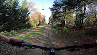
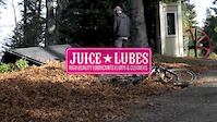
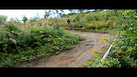
Photos of Massa Mountain Bike
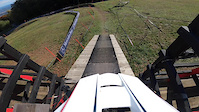
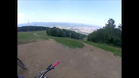
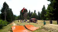
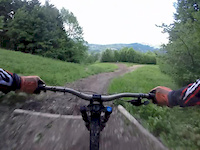
Videos of Massa Mountain Bike
trail: Maribor (Via delle Fonti)
4:29 |
9 |
Feb 19, 2025
trail: Maribor (Via delle Fonti)
3:51 |
71 |
Nov 5, 2020
trail: Maribor (Via delle Fonti)
0:52 |
274 |
Jun 8, 2019
trail: Maribor (Via delle Fonti)
3:12 |
41 |
May 20, 2019
trail: Maribor (Via delle Fonti)
2:22 |
38 |
Apr 30, 2019
trail: Maribor (Via delle Fonti)
3:23 |
1570 |
Dec 19, 2017
trail: Hazard
12:16 |
409 |
Mar 20, 2015
trail: Fly (DH Rosa) #2
0:43 |
281 |
May 31, 2014
Current Trail Warnings
| status | trail | date | condition | user | info |
|---|---|---|---|---|---|
| Fly (DH Rosa) #4 | Jun 17, 2026 @ 5:50pm (Europe/San_Marino) Jun 17, 2026 | Very Dry | mistik-mike | E-Bike Not really rideable - completely... |
Recent Trail Reports
| status | trail | date | condition | info | user |
|---|---|---|---|---|---|
| Fiumetto | Jun 17, 2026 @ 5:50pm (Europe/San_Marino) Jun 17, 2026 | Variable | mistik-mike | ||
| Via Volpara | Jun 17, 2026 @ 5:50pm (Europe/San_Marino) Jun 17, 2026 | Very Dry | mistik-mike | ||
| Maribor (Via delle Fonti) | Jun 17, 2026 @ 5:50pm (Europe/San_Marino) Jun 17, 2026 | Dry | mistik-mike | ||
| Costa Bonda (Via delle Fonti) | Jun 17, 2026 @ 5:50pm (Europe/San_Marino) Jun 17, 2026 | Very Dry | mistik-mike | ||
| Felix | Jun 17, 2026 @ 5:50pm (Europe/San_Marino) Jun 17, 2026 | Very Dry | mistik-mike | ||
| Fly (DH Rosa) #3 | Jun 17, 2026 @ 5:50pm (Europe/San_Marino) Jun 17, 2026 | Very Dry | mistik-mike | ||
| Fly (DH Rosa) #2 | Jun 17, 2026 @ 5:50pm (Europe/San_Marino) Jun 17, 2026 | Very Dry | mistik-mike | ||
| MrWho | Jun 17, 2026 @ 5:50pm (Europe/San_Marino) Jun 17, 2026 | Very Dry | mistik-mike | ||
| Fly (DH Rosa) #1 | Jun 17, 2026 @ 5:50pm (Europe/San_Marino) Jun 17, 2026 | Very Dry | mistik-mike | ||
| Dalmine | Jun 17, 2026 @ 5:50pm (Europe/San_Marino) Jun 17, 2026 | Very Dry | mistik-mike |
Activity Feed
| username | action | type | title | date |
|---|---|---|---|---|
| konstantinoskaraiskos | add | photo | activity #97971945 | Jun 28, 2026 @ 2:59am Jun 28, 2026 |
| JoeNuI5yN | wishlist | route | activity #97699519 | Jun 24, 2026 @ 8:27am Jun 24, 2026 |
| mistik-mike | vote | trail | activity #97566083 and 9 more | Jun 22, 2026 @ 9:10am Jun 22, 2026 |
| mistik-mike | add | report | activity #97217066 and 12 more | Jun 17, 2026 @ 4:39pm Jun 17, 2026 |
| peperoazxzJS | wishlist | trail | activity #96561273 | Jun 8, 2026 @ 1:33pm Jun 8, 2026 |
Recent Comments
| username | type | title | comment | date |
|---|---|---|---|---|
| trail | Very overgrown; no fun… | Dec 28, 2025 @ 11:24am Dec 28, 2025 | ||
| trail | Appena pulita, facile e scorrevole | Oct 17, 2025 @ 6:04am Oct 17, 2025 | ||
| report | Ciao, ad oggi tutto percorribile, un po' di... | Oct 10, 2025 @ 11:17pm Oct 10, 2025 | ||
| report | Ciao mi sai dire se i sentieri di monte... | Sep 27, 2025 @ 1:49pm Sep 27, 2025 | ||
| report | Ottimo lavoro 💪 | May 17, 2025 @ 4:15am May 17, 2025 |
Local Badges
-

Epic Ride Climb 2k481 awarded -

Climbing 10k Badge80 awarded -

Climbing 100k Badge18 awarded -

Epic Ride Descent 2k489 awarded -

Descent 10k Badge79 awarded -

Descent 100k Badge18 awarded
Activity Type Stats
| activitytype | trails | distance | descent | descent distance | total vertical | rating | global rank | state rank | photos | reports | routes | ridelogs |
|---|---|---|---|---|---|---|---|---|---|---|---|---|
| Mountain Bike | 125 | 74 miles | 34,944 ft | 41 miles | 3,235 ft | #1,362 | #35 | 202 | 1,543 | 24 | 11,686 | |
| E-Bike | 64 | 35 miles | 12,808 ft | 17 miles | 3,235 ft | #2,362 | #224 | 9 | 1,130 | 13 | 2,432 | |
| Gravel Bike | 1 | #217 | #108 | 1 | 3 | 67 | ||||||
| Horse | 25 | 16 miles | 4,744 ft | 7 miles | 2,700 ft | #771 | #20 | 171 | 1 | |||
| Hike | 121 | 74 miles | 34,275 ft | 41 miles | 3,235 ft | #2,282 | #76 | 1,503 | 4 | 503 | ||
| Trail Running | 121 | 74 miles | 34,275 ft | 41 miles | 3,235 ft | #1,866 | #57 | 1,503 | 4 | 27 | ||
| Dirtbike/Moto | 5 | 5 miles | 771 ft | 2 miles | 2,339 ft | #395 | #4 | 147 | 1 | |||
| Observed Trials | 1 | 1 mile | 33 ft | 958 ft | 489 ft | 2 | ||||||
| ATV/ORV/OHV | 4 | 2 miles | 233 ft | 2,841 ft | 1,102 ft | 147 |
Frequently Asked Questions About Massa
▼
What are the best places to ride in Massa?
Massa has 5 areas to explore for mountain biking. The top rated areas are:
▼
What are the highest rated mountain biking trails in Massa?
The highest rated mountain biking trails in Massa are:
- Dalmine (4.4/5)
- Fly (DH Rosa) #1 (4.3/5)
- Felix (4.3/5)
- MrWho (4.3/5)
- Zen (4.2/5)
▼
What is the best time of the year to ride in Massa?
Based on ride log data, the most popular months to ride in Massa are:
- May (48 activities)
- July (38 activities)
- August (36 activities)
▼
Where can I park to ride in Massa?
There are 8 parking locations listed in Massa. The most popular parking spots are: View all parking and trailhead locations on the map to plan your visit.
Activities
Trails
- By brenthillier
 NSMBA TRAILFORKS & contributors
 - Admins: DanielePracchia, WCT
- #3517 - 13,773 views
- massa activity log | embed map of Massa mountain bike trails | massa mountain biking points of interest
Downloading of trail gps tracks in kml & gpx formats is enabled for Massa.
You must login to download files.