close
-
Layers w
- Weather Layers
- Pro
- Pro
- Pro
- Pro
- Pro
- Pro
- More Layers
- Pro
- Pro
- Pro
- Pro
-
Upgrade to

3D
Trail Conditions
- Unknown
- Snow Groomed
- Snow Packed
- Snow Covered
- Snow Cover Partial
- Freeze/thaw Cycle
- Icy
- Prevalent Mud
- Wet
- Variable
- Ideal
- Dry
- Very Dry
Trail Flow (Ridden Direction)
Trailforks scans users ridelogs to determine the most popular direction each trail is ridden. A good flowing trail network will have most trails flowing in a single direction according to their intension.
The colour categories are based on what percentage of riders are riding a trail in its intended direction.
The colour categories are based on what percentage of riders are riding a trail in its intended direction.
- > 96%
- > 90%
- > 80%
- > 70%
- > 50%
- < 50%
- bi-directional trail
- no data
Trail Last Ridden
Trailforks scans ridelogs to determine the last time a trail was ridden.
- < 2 days
- < 1 week
- < 2 weeks
- < 1 month
- < 6 months
- > 6 months
Trail Ridden Direction
The intended direction a trail should be ridden.
- Downhill Only
- Downhill Primary
- Both Directions
- Uphill Primary
- Uphill Only
- One Direction
Contribute Details
Colors indicate trail is missing specified detail.
- Description
- Photos
- Description & Photos
- Videos
Trail Popularity ?
Trailforks scans ridelogs to determine which trails are ridden the most in the last 9 months.
Trails are compared with nearby trails in the same city region with a possible 25 colour shades.
Think of this as a heatmap, more rides = more kinetic energy = warmer colors.
- most popular
- popular
- less popular
- not popular
ATV/ORV/OHV Filter
Max Vehicle Width
inches
US Cell Coverage
Legend

Radar Time
Activity Recordings
Trailforks uses anonymized public activity data.
?
Activity Recordings
Trailforks uses anonymized public activity data.
?
Personal Heatmap
▶
Activity Types
all
/
none
▶
Options
2
Date range
month
–
Winter Trails
Warning
A routing network for winter maps does not exist. Selecting trails using the winter trails layer has been disabled.
Missing Trails
Most Popular
Least Popular
Trails are colored based on popularity. The more popular a trail is, the more red. Less popular trails trend towards green.
Jump Magnitude Heatmap
Heatmap of where riders jump on trails. Zoom in to see individual jumps, click circles to view jump details.
BC Backroad Status
![map legend]()
Service Road Atlas is a free to use, community-driven service for viewing and creating reports on the numerous back-country service roads around B.C. and Alberta.

Slope Aspect
Direction the slope faces
Trails Deemphasized
Trails are shown in grey.
Only show trails with no bike usage.
Suggested Layers
Based on selected activity type
Save the current map location and zoom level as your default home location whenever this page is loaded.
Save
No description for McKenzie County has been added yet!
Login or register to submit one.
Activities Click to view
- Mountain Bike
37 trails
- E-Bike
0 trails
- Horse
42 trails
- Hike
81 trails
- Trail Running
81 trails
- Dirtbike/Moto
0 trails
- ATV/ORV/OHV
0 trails
- Snowmobile
0 trails
- Snowshoe
1 trails
- Downhill Ski
0 trails
- Backcountry Ski
0 trails
- Nordic Ski
1 trails
Region Details
- 8
- 29
Stats
- Avg Trail Rating
- Trails (view details)
- 81
- Trails Mountain Bike
- 37
- Trails Horse
- 42
- Trails Hike
- 81
- Trails Trail Running
- 81
- Trails Snowshoe
- 1
- Trails Nordic Ski
- 1
- Total Distance
- 195 miles
- Total Descent
- 22,216 ft
- Total Vertical
- 904 ft
- Highest Trailhead
- 2,850 ft
- Reports
- 104
- Photos
- 132
- Ridden Counter
- 1,671
Articles
7 of the Best Bikepacking Trips Across the U.S.
Jul 11, 2025 from outsideonline.com
Load up your bike and disappear into America's wildest places on these incredible multi-day rides
Traveling on a Budget? These 10 U.S. National Parks Are the Most Affordable to Visit.
Jun 16, 2024 from outsideonline.com
Our parks expert has put together long weekend trips for as little as $204, with details on free entrance fees and campsites, and active...
Sub Regions
- Watford City (37)
Popular McKenzie County Mountain Biking Trails
• 95 ★ 4.4 • 1 mile • 161 ft • 165 •
Popular blue difficulty singletrack. This mountain bike primary trail can be used both directions. On average it takes 12 minutes to complete this trail.
• 75 ★ 4.0 • 2 miles • 547 ft • 156 •
Popular blue difficulty singletrack. This mountain bike primary trail can be used both directions. On average it takes 23 minutes to complete this trail.
• 100 ★ 4.0 • 1,019 ft • 13 ft • 152 •
Popular blue difficulty singletrack. This mountain bike primary trail can be used both directions. On average it takes 7 minutes to complete this trail.
• 90 ★ 4.0 • 3 miles • 434 ft • 151 •
Popular blue difficulty singletrack. This mountain bike primary trail can be used both directions. On average it takes 36 minutes to complete this trail.
• 90 ★ 4.0 • 1 mile • 77 ft • 141 •
Popular blue difficulty singletrack. This mountain bike primary trail can be used both directions. On average it takes 9 minutes to complete this trail.
• 85 ★ 4.4 • 5 miles • 603 ft • 138 •
Devils pass is a narrow ridge route that drops off over 150 feet on either side of the ridge. It is a short hike of the west end of Forest Service road 711. The closest campground is Camp to the east. This makes for a nice day hike to...
• 95 ★ 4.3 • 3 miles • 137 ft • 135 •
Popular blue difficulty singletrack. This mountain bike primary trail can be used both directions. On average it takes 19 minutes to complete this trail.
• 100 ★ 4.7 • 2 miles • 233 ft • 134 •
Highly rated popular blue difficulty singletrack. This mountain bike primary trail can be used both directions. On average it takes 17 minutes to complete this trail.
McKenzie County Mountain Bike Routes
28 miles • 2,750 ft • 8 •
This is Day 1 of Dakota Cyclery's "The Works" Shuttle MDH Ride.
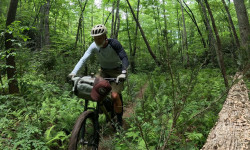
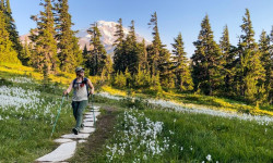
Photos of McKenzie County Mountain Bike
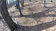
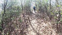
Videos of McKenzie County Mountain Bike
trail: Bennett Creek Trail
0:47 |
80 |
Dec 18, 2015
trail: Bennett Creek Trail
6:21 |
138 |
Dec 18, 2015
3:55 |
14 |
Mar 30, 2012

4:48 |
292 |
Feb 10, 2010
0:39 |
299 |
Sep 15, 2009

39:19 |
1558 |
Nov 3, 2020 , Watford City
Recent Trail Reports
| status | trail | date | condition | info | user |
|---|---|---|---|---|---|
| Summit Watford City | Sep 14, 2025 @ 5:41pm (America/Denver) Sep 14, 2025 | Unknown | kpeccles | ||
| Maah Daah Hey - From Roosevelt to Elkhorn Campground Watford City | Aug 4, 2025 @ 8:43am Aug 4, 2025 | Dry | Roadwarriorxo | ||
| Elkhorn Campground Road Watford City | Aug 4, 2025 @ 8:43am Aug 4, 2025 | Dry | Roadwarriorxo | ||
| Bennett Creek Trail Watford City | Jul 25, 2025 @ 11:37am Jul 25, 2025 | Ideal | Roadwarriorxo | ||
| Maah Daah Hey - Bennett to Road 823 Watford City | Jul 25, 2025 @ 11:37am Jul 25, 2025 | Ideal | Roadwarriorxo | ||
| Maah Daah Hey - Cottonwood to Bennett Watford City | Jul 25, 2025 @ 11:37am Jul 25, 2025 | Ideal | Roadwarriorxo | ||
| Cottonwood Watford City | Jul 25, 2025 @ 11:37am Jul 25, 2025 | Ideal | Roadwarriorxo | ||
| Long X Watford City | Jul 24, 2025 @ 10:18am Jul 24, 2025 | Variable | Roadwarriorxo | ||
| Maah Daah Hey - Long X to Summit Watford City | Jul 24, 2025 @ 10:18am Jul 24, 2025 | Variable | Roadwarriorxo | ||
| Maah Daah Hey - Summit to CCC Watford City | Apr 11, 2025 @ 3:23pm Apr 11, 2025 | Ideal | Bhoward12 |
National Scenic Trails & Official Routes
-
Maah Daah Hey Trail
- Mountain Bike
- Horse
- Hike
- Trail Running
- Snowshoe
Activity Feed
| username | action | type | title | date |
|---|---|---|---|---|
| RAbike11 | add | report | activity #97073649 and 2 more | Jun 15, 2026 @ 4:42pm Jun 15, 2026 |
| KrystakF9g0y | wishlist | trail | activity #96407598 | Jun 6, 2026 @ 2:43pm Jun 6, 2026 |
| LJ154320 | wishlist | region | activity #90103602 | Mar 7, 2026 @ 1:17am Mar 7, 2026 |
| liz-chrisman | comment | trail | activity #88332174 | Feb 4, 2026 @ 10:24am Feb 4, 2026 |
| Brian5BvIzl | ridden | trail | activity #88303303 and 2 more | Feb 3, 2026 @ 6:38pm Feb 3, 2026 |
Recent Comments
| username | type | title | comment | date |
|---|---|---|---|---|
| trail | Hi! We (IMBA) helped pass legislation in 2024... | Feb 4, 2026 @ 10:24am Feb 4, 2026 | ||
| trail | DO NOT RIDE THIS TRAIL! It is gone. | Sep 17, 2025 @ 7:04pm Sep 17, 2025 | ||
| report | X B Cc | Sep 1, 2025 @ 1:13pm Sep 1, 2025 | ||
| trail | Why the F is this an IMBA Epic they are the... | Jul 24, 2025 @ 4:52pm Jul 24, 2025 | ||
| trail | Attempted this trail today. The trail is... | Sep 13, 2024 @ 3:09pm Sep 13, 2024 |
Local Badges
-

10 Blue Trails53 awarded -

Epic Ride Climb 2k16 awarded -

Climbing 10k Badge4 awarded -

Climbing 100k Badge0 awarded -

Epic Ride Descent 2k15 awarded -

Descent 10k Badge4 awarded
Activity Type Stats
| activitytype | trails | distance | descent | descent distance | total vertical | rating | global rank | state rank | photos | reports | routes | ridelogs |
|---|---|---|---|---|---|---|---|---|---|---|---|---|
| Mountain Bike | 37 | 102 miles | 14,091 ft | 47 miles | 755 ft | 116 | 104 | 1 | 1,026 | |||
| Horse | 42 | 93 miles | 8,035 ft | 38 miles | 896 ft | 5 | 8 | |||||
| Hike | 81 | 195 miles | 22,215 ft | 85 miles | 906 ft | 16 | 104 | 431 | ||||
| Trail Running | 81 | 195 miles | 22,215 ft | 85 miles | 906 ft | 102 | 105 | |||||
| Snowshoe | 1 | 9 miles | 564 ft | 3 miles | 410 ft | 1 | ||||||
| Nordic Ski | 1 | 9 miles | 564 ft | 3 miles | 410 ft |
Frequently Asked Questions About McKenzie County
▼
What are the best places to ride in McKenzie County?
McKenzie County has 2 areas to explore for mountain biking.
▼
What are the highest rated mountain biking trails in McKenzie County?
The highest rated mountain biking trails in McKenzie County are:
- Maah Daah Hey - Summit to CCC (4.4/5)
- Maah Daah Hey - Cottonwood to Bennett (4.3/5)
- Maah Daah Hey - Magpie to Ice Cave (4.3/5)
- CCC (4.2/5)
- Maah Daah Hey - Little Missouri River to Magpie Rd. (4.2/5)
▼
What is the best time of the year to ride in McKenzie County?
Based on ride log data, the most popular months to ride in McKenzie County are:
- September (27 activities)
- July (14 activities)
- October (8 activities)
▼
What is the longest trail in McKenzie County?
The longest trail in McKenzie County is Maah Daah Hey - Ice Cave to Beicegel Creek Rd. at 10.4 miles. View all trails sorted by distance.
Activities
Trails
Points of Interest
- Oxbow Overlook Viewpoint
- Wind Canyon Overlook South Viewpoint
- Wind Canyon Overlook Central Viewpoint
- Wind Canyon Overlook North Viewpoint
- Cottonwood Campground Camping
- Roundup Horse Camp Camping
- Buck Hill Lookout Viewpoint
- Sperati Point Summit
- Juniper Campground Camping
- Devil's Pass Sight
- Blue Mountain (2,877 ft)
- Grassy Butte (2,769 ft)
- Teepee Butte (2,730 ft)
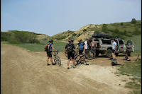
- By WillieJacobsz
 Trailforks SBP SWW & contributors
 - Admins: chuktA
- #48877 - 1,108 views
- mckenzie county activity log | embed map of McKenzie County mountain bike trails | mckenzie county mountain biking points of interest
Downloading of trail gps tracks in kml & gpx formats is enabled for McKenzie County.
You must login to download files.