close
-
Layers w
- Weather Layers
- Pro
- Pro
- Pro
- Pro
- Pro
- Pro
- More Layers
- Pro
- Pro
- Pro
- Pro
-
Upgrade to

3D
Trail Conditions
- Unknown
- Snow Groomed
- Snow Packed
- Snow Covered
- Snow Cover Partial
- Freeze/thaw Cycle
- Icy
- Prevalent Mud
- Wet
- Variable
- Ideal
- Dry
- Very Dry
Trail Flow (Ridden Direction)
Trailforks scans users ridelogs to determine the most popular direction each trail is ridden. A good flowing trail network will have most trails flowing in a single direction according to their intension.
The colour categories are based on what percentage of riders are riding a trail in its intended direction.
The colour categories are based on what percentage of riders are riding a trail in its intended direction.
- > 96%
- > 90%
- > 80%
- > 70%
- > 50%
- < 50%
- bi-directional trail
- no data
Trail Last Ridden
Trailforks scans ridelogs to determine the last time a trail was ridden.
- < 2 days
- < 1 week
- < 2 weeks
- < 1 month
- < 6 months
- > 6 months
Trail Ridden Direction
The intended direction a trail should be ridden.
- Downhill Only
- Downhill Primary
- Both Directions
- Uphill Primary
- Uphill Only
- One Direction
Contribute Details
Colors indicate trail is missing specified detail.
- Description
- Photos
- Description & Photos
- Videos
Trail Popularity ?
Trailforks scans ridelogs to determine which trails are ridden the most in the last 9 months.
Trails are compared with nearby trails in the same city region with a possible 25 colour shades.
Think of this as a heatmap, more rides = more kinetic energy = warmer colors.
- most popular
- popular
- less popular
- not popular
ATV/ORV/OHV Filter
Max Vehicle Width
inches
US Cell Coverage
Legend

Radar Time
Activity Recordings
Trailforks uses anonymized public activity data.
?
Activity Recordings
Trailforks uses anonymized public activity data.
?
Personal Heatmap
▶
Activity Types
all
/
none
▶
Options
2
Date range
month
–
Winter Trails
Warning
A routing network for winter maps does not exist. Selecting trails using the winter trails layer has been disabled.
Missing Trails
Most Popular
Least Popular
Trails are colored based on popularity. The more popular a trail is, the more red. Less popular trails trend towards green.
Jump Magnitude Heatmap
Heatmap of where riders jump on trails. Zoom in to see individual jumps, click circles to view jump details.
BC Backroad Status
![map legend]()
Service Road Atlas is a free to use, community-driven service for viewing and creating reports on the numerous back-country service roads around B.C. and Alberta.

Slope Aspect
Direction the slope faces
Trails Deemphasized
Trails are shown in grey.
Only show trails with no bike usage.
Suggested Layers
Based on selected activity type
Save the current map location and zoom level as your default home location whenever this page is loaded.
Save***PLEASE DO NOT RIDE FOR MINIMUM 24 HOURS AFTER RAINS***
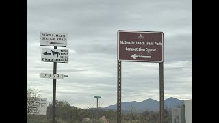
McKenzie Ranch Trails Park is a 1,700-acre
natural open space park located on the far east side of
Pima County and north of Marsh Station Road, at 12725
S. Red Hill Ranch Road.
The park is named for Asa McKenzie, a native of Virginia,
who established the ranch about 1860 at the age of 20.
McKenzie was the only settler on the Butterfield Trail
line between New Mexico and Tucson, and survived an
Indian attack that burned his ranch house to the ground.
The park is situated in the foothills of the southern Rincon
Mountains, and is located in a transition zone between
the Sonoran and Chihuahuan deserts. It occupies almost
three sections of land; the western and central sections
are mostly flat and have gently rolling terrain, with the
eastern section being more hilly with small canyons.
A 3.2 mile stretch of the Hohokam Trail runs east and
west across the park, and a 10-mile competition course
is located in the eastern section of the park consisting of
two loops for mountain bicyclists and runners.
The park’s trails are available from dawn to dusk 7 days
a week, and the competition course is available when it
isn’t occupied by a scheduled event. There are roughly 4
events per year, usually held on weekends.
Primary Trail Type: Cross-Country
eBikes Allowed:
No
Land Status: City Managed
 google parking directions
Links
Activities Click to view
- Mountain Bike
5 trails
- Horse
0 trails
- Hike
5 trails
- Trail Running
5 trails
Region Details
- 4
Region Status
Caution as of May 30, 2026Stats
- Avg Trail Rating
- Trails (view details)
- 4
- Trails Mountain Bike
- 5
- Trails Hike
- 5
- Trails Trail Running
- 5
- Total Distance
- 14 miles
- Total Descent
- 1,034 ft
- Total Vertical
- 384 ft
- Highest Trailhead
- 3,921 ft
- Reports
- 73
- Photos
- 43
- Ridden Counter
- 1,959
Popular McKenzie Ranch Mountain Biking Trails
• 100 ★ 3.8 • 7 miles • 494 ft • 668 •
Smooth and fast is the name of the game! 6.6mi loop of the McKenzie Ranch competitive race course. Please ride clockwise. It is the responsibility of all non-bike riders in all directions and riders traveling the opposite direction to...
• 75 ★ 4.3 • 3 miles • 281 ft • 579 •
A little more up means a lot more down! 3.3mi loop of the McKenzie Ranch competitive race course. Please access trail from and ride clockwise. Please pay attention when merging back onto the . It is the responsibility of all non-bike...
• 25 ★ 3.3 • 3 miles • 195 ft • 387 •
The connects from Agua Verde Rd on the west side of McKenzie Ranch to the competitive race course loops on the east side of McKenzie Ranch.
• 50 ★ 0.0 • 2,101 ft • 101 ft • 244 •
Use the to connect to the , or for a short 1.5mi kiddie loop.
McKenzie Ranch Mountain Bike Routes
★ 3.0 • 10 miles • 727 ft • 2 •
Pima County's first competitive mountain bike race course, fast and smooth. Ride both the and on the...
★ 3.4 • 23 miles • 1,464 ft • 11 •
Start at Gabe Zimmerman TH, ride to the McKenzie Ranch trails, complete the race course loop, and ride back.
★ 3.7 • 16 miles • 1,299 ft • 3 • Loop •
Nice, fast open desert lollipop loop on 100% singletrack. Avoids 4 miles of gravel road or pavement...
Photos of McKenzie Ranch Mountain Bike
Videos of McKenzie Ranch Mountain Bike
trail: Lozen Loop
16:25 |
880 |
Oct 4, 2020 , My City
Recent Trail Reports
| status | trail | date | condition | info | user |
|---|---|---|---|---|---|
| Daheste Loop | May 30, 2026 @ 9:14am (America/Phoenix) May 30, 2026 | Dry | Trailridersmn | ||
| Lozen Loop | May 30, 2026 @ 9:14am (America/Phoenix) May 30, 2026 | Dry | Trailridersmn | ||
| Hohokam Trail | Jan 18, 2026 @ 8:25am (America/Phoenix) Jan 18, 2026 | Dry | abi-ridefierce RMBA | ||
| Lozen Link | Dec 21, 2024 @ 10:30am Dec 21, 2024 | Dry | DingoBlue |
Activity Feed
| username | action | type | title | date |
|---|---|---|---|---|
| Absolute911tUMt0M | wishlist | trail | activity #96278801 | Jun 4, 2026 @ 11:37pm Jun 4, 2026 |
| Trailridersmn | add | report | activity #95976475 and 1 more | May 31, 2026 @ 2:05pm May 31, 2026 |
| keavymcminn | wishlist | route | activity #93286486 | Apr 24, 2026 @ 9:19am Apr 24, 2026 |
| deankherman | wishlist | route | activity #92604406 | Apr 14, 2026 @ 9:55am Apr 14, 2026 |
| rhythmdeficient | ridden | trail | activity #92230433 | Apr 8, 2026 @ 7:29pm Apr 8, 2026 |
Recent Comments
| username | type | title | comment | date |
|---|---|---|---|---|
| trail | Lozen Loop. Good trail. Pretty in a desolate... | Dec 13, 2025 @ 3:15pm Dec 13, 2025 | ||
| trail | There is parking on AZ state land trust 1/4... | Dec 2, 2025 @ 12:40pm Dec 2, 2025 | ||
| trail | Ridin nice after the rain we got. Nice and tacky | Sep 28, 2025 @ 12:55pm Sep 28, 2025 | ||
| trail | Rode Lozen, Daheste and Hohokam today for... | May 18, 2025 @ 7:19pm May 18, 2025 | ||
| trail | Do not park by RR trucks, I was warned by a... | Apr 8, 2025 @ 5:57pm Apr 8, 2025 |
Nearby Areas
| name | distance | ||||
|---|---|---|---|---|---|
| Colossal Cave Mountain Park | 11 | 4 | 1 | 3.5 km | |
| Rincon Valley | 4 | 3 | 5.6 km | ||
| Vail Vortex | 16 | 1 | 6.3 km | ||
| Saguaro National Park - Rincon Mountain District | 10 | 1 | 12.6 km | ||
| Fantasy Island | 12 | 11 | 14.9 km |
Activity Type Stats
| activitytype | trails | distance | descent | descent distance | total vertical | rating | global rank | state rank | photos | reports | routes | ridelogs |
|---|---|---|---|---|---|---|---|---|---|---|---|---|
| Mountain Bike | 5 | 14 miles | 1,033 ft | 6 miles | 384 ft | #6,717 | #2,562 | 43 | 73 | 7 | 2,535 | |
| Hike | 5 | 14 miles | 1,033 ft | 6 miles | 384 ft | #11,862 | #4,844 | 73 | 19 | |||
| Trail Running | 5 | 14 miles | 1,033 ft | 6 miles | 384 ft | #10,881 | #4,127 | 73 | 25 |
- By jeffgicklhorn
 & contributors
 - Admins: SDMB
- #22360 - 20,090 views
- mckenzie ranch activity log | embed map of McKenzie Ranch mountain bike trails | mckenzie ranch mountain biking points of interest
Downloading of trail gps tracks in kml & gpx formats is enabled for McKenzie Ranch.
You must login to download files.