close
-
Layers w
- Weather Layers
- Pro
- Pro
- Pro
- Pro
- Pro
- Pro
- More Layers
- Pro
- Pro
- Pro
- Pro
-
Upgrade to

3D
Trail Conditions
- Unknown
- Snow Groomed
- Snow Packed
- Snow Covered
- Snow Cover Partial
- Freeze/thaw Cycle
- Icy
- Prevalent Mud
- Wet
- Variable
- Ideal
- Dry
- Very Dry
Trail Flow (Ridden Direction)
Trailforks scans users ridelogs to determine the most popular direction each trail is ridden. A good flowing trail network will have most trails flowing in a single direction according to their intension.
The colour categories are based on what percentage of riders are riding a trail in its intended direction.
The colour categories are based on what percentage of riders are riding a trail in its intended direction.
- > 96%
- > 90%
- > 80%
- > 70%
- > 50%
- < 50%
- bi-directional trail
- no data
Trail Last Ridden
Trailforks scans ridelogs to determine the last time a trail was ridden.
- < 2 days
- < 1 week
- < 2 weeks
- < 1 month
- < 6 months
- > 6 months
Trail Ridden Direction
The intended direction a trail should be ridden.
- Downhill Only
- Downhill Primary
- Both Directions
- Uphill Primary
- Uphill Only
- One Direction
Contribute Details
Colors indicate trail is missing specified detail.
- Description
- Photos
- Description & Photos
- Videos
Trail Popularity ?
Trailforks scans ridelogs to determine which trails are ridden the most in the last 9 months.
Trails are compared with nearby trails in the same city region with a possible 25 colour shades.
Think of this as a heatmap, more rides = more kinetic energy = warmer colors.
- most popular
- popular
- less popular
- not popular
ATV/ORV/OHV Filter
Max Vehicle Width
inches
US Cell Coverage
Legend

Radar Time
Activity Recordings
Trailforks uses anonymized public activity data.
?
Activity Recordings
Trailforks uses anonymized public activity data.
?
Personal Heatmap
▶
Activity Types
all
/
none
▶
Options
2
Date range
month
–
Winter Trails
Warning
A routing network for winter maps does not exist. Selecting trails using the winter trails layer has been disabled.
Missing Trails
Most Popular
Least Popular
Trails are colored based on popularity. The more popular a trail is, the more red. Less popular trails trend towards green.
Jump Magnitude Heatmap
Heatmap of where riders jump on trails. Zoom in to see individual jumps, click circles to view jump details.
BC Backroad Status
![map legend]()
Service Road Atlas is a free to use, community-driven service for viewing and creating reports on the numerous back-country service roads around B.C. and Alberta.

Slope Aspect
Direction the slope faces
Trails Deemphasized
Trails are shown in grey.
Only show trails with no bike usage.
Suggested Layers
Based on selected activity type
Save the current map location and zoom level as your default home location whenever this page is loaded.
Save
No description for McKinney has been added yet!
Login or register to submit one.
Activities Click to view
- Mountain Bike
16 trails
- E-Bike
8 trails
- Gravel Bike
0 trails
- Winter Fat Bike
0 trails
- Hike
15 trails
- Trail Running
15 trails
Region Details
- 1
- 7
- 4
- 1
Region Status
Open as of 1 dayStats
- Avg Trail Rating
- Trails (view details)
- 13
- Trails Mountain Bike
- 17
- Trails E-Bike
- 8
- Trails Hike
- 15
- Trails Trail Running
- 15
- Total Distance
- 20 miles
- Total Descent Distance
- 7 miles
- Total Descent
- 1,098 ft
- Total Vertical
- 200 ft
- Highest Trailhead
- 705 ft
- Reports
- 2,292
- Photos
- 131
- Ridden Counter
- 3,429
Sub Regions
-
Erwin Park
- 1
-
Erwin Park Skill Park
- 1
-
Gray Branch Park
- 6
-
Sister Grove Park
- 4
Popular McKinney Mountain Biking Trails
• 40 ★ 0.0 • 4,183 ft • 42 ft • 21 •
Moderately popular green difficulty family friendly singletrack. This multi-use trail can be used both directions and has a easy overall physical rating with a 42 ft green climb. It features ladder bridge. Trail visibility is always easy to follow. On average it takes 5 minutes to complete this trail.
• 35 ★ 0.0 • 1 mile • 43 ft • 20 •
Less popular green difficulty singletrack. This multi-use trail can be used both directions and has a easy overall physical rating with a 43 ft green climb. Trail visibility is always easy to follow. On average it takes 10 minutes to complete this trail.
• 15 ★ 0.0 • 1 mile • 44 ft • 14 •
Less popular green difficulty singletrack. This multi-use trail can be used both directions. On average it takes 6 minutes to complete this trail.
• 30 ★ 0.0 • 4,154 ft • 25 ft • 7 •
Less popular green difficulty singletrack. This multi-use trail can be used both directions.
• 20 ★ 0.0 • 253 ft • 0 ft • 5 •
Less popular green difficulty singletrack. This multi-use trail can be used both directions.
• 10 ★ 0.0 • 377 ft • 0 ft • 3 •
Less popular green difficulty singletrack. This multi-use trail can be used both directions.
McKinney Mountain Bike Routes
★ 3.0 • 6 miles • 41 ft • 0 •
Gravel Route for when Erwin gets rained out and we cant use the trail due to our awesome Texas weather.
3 miles • 163 ft • 0 • Loop • Race •
The DFW Series Race Loop is used during weeknight mountain bike races and takes place on a closed course....
7 miles • 419 ft • 0 • Race •
This route is for the 70 mile and the 100 mile participants of the 2024 DORBA Judgment Day.
11 miles • 613 ft • 5 • Race •
This is the route for the 100 mile participants in the 2024 DORBA Judgment Day.
9 miles • 514 ft • 4 • Race •
This is the 70 mile route for the 2024 DORBA Judgment Day.
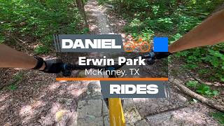
Videos of McKinney Mountain Bike
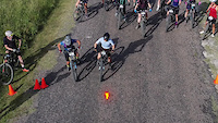
trail: Erwin Park
0:25 |
290 |
Jun 20, 2022

trail: Erwin Park
0:00 |
103 |
May 11, 2022
trail: Erwin Park
0:51 |
79 |
Apr 29, 2022
trail: Erwin Park
0:11 |
593 |
Feb 19, 2021

trail: Erwin Park
12:44 |
436 |
Dec 15, 2015
40:05 |
11 |
Jun 2, 2026

trail: Erwin Park
12:43 |
117 |
Jan 19, 2026 , McKinney

5:44 |
420 |
Oct 28, 2022
Current Trail Warnings
| status | trail | date | condition | user | info |
|---|---|---|---|---|---|
| Sister Loop | Jun 19, 2026 @ 11:48am (America/Chicago) 1 day | Prevalent Mud | BlakeW50 Trail Steward | ||
| Safari Loop | Jun 19, 2026 @ 11:48am (America/Chicago) 1 day | Prevalent Mud | BlakeW50 Trail Steward | ||
| Puppy Loop | Jun 19, 2026 @ 11:48am (America/Chicago) 1 day | Prevalent Mud | BlakeW50 Trail Steward |
Recent Trail Reports
Activity Feed
| username | action | type | title | date |
|---|---|---|---|---|
| chasethegnar | add | photo | activity #97361511 and 2 more | Jun 19, 2026 @ 7:23pm 20 hours |
| chasethegnar | ridden | trail | activity #97361456 | Jun 19, 2026 @ 7:22pm 20 hours |
| BlakeW50 | add | report | activity #97325470 and 4 more | Jun 19, 2026 @ 9:48am 1 day |
| scfeiock | add | report | activity #97311637 and 3 more | Jun 19, 2026 @ 6:10am 1 day |
| BlakeW50 | add | report | activity #97285697 and 9 more | Jun 18, 2026 @ 5:30pm 2 days |
Recent Comments
| username | type | title | comment | date |
|---|---|---|---|---|
| trail | Drop area off the ramp needs light... | Jan 13, 2026 @ 8:30pm Jan 13, 2026 | ||
| report | Cut and pasted from the FB chat cause im lazy:... | Nov 24, 2024 @ 7:05pm Nov 24, 2024 | ||
| report | The trail is okay. I rode a few times in the... | Nov 24, 2024 @ 5:35pm Nov 24, 2024 | ||
| report | Any idea when the trail will be dry enough?... | Nov 24, 2024 @ 8:58am Nov 24, 2024 | ||
| trail | Registration is now open for the 2022 DFW... | May 5, 2022 @ 7:32am May 5, 2022 |
Local Badges
-

Epic Mountain Bike Climb 2k0 awarded -

Climbing 10k Badge38 awarded -

Mountain Biking 100k Badge0 awarded -

Big Ride 30k1,089 awarded -

Epic Ride 50k383 awarded
Bike & Skill Parks
| name | type | city | rating |
|---|---|---|---|
| Badlands MX Park | skill park | McKinney |
Local Trail Supporters
- McKinney Parks Foundation
Activity Type Stats
| activitytype | trails | distance | descent | descent distance | total vertical | rating | global rank | state rank | photos | reports | routes | ridelogs |
|---|---|---|---|---|---|---|---|---|---|---|---|---|
| Mountain Bike | 16 | 20 miles | 1,099 ft | 7 miles | 200 ft | #3,152 | #1,083 | 135 | 2,425 | 6 | 18,931 | |
| E-Bike | 8 | 16 miles | 978 ft | 6 miles | 200 ft | #5,567 | #1,718 | 2,396 | 1 | 748 | ||
| Hike | 15 | 19 miles | 1,063 ft | 7 miles | 200 ft | #8,343 | #2,932 | 2,407 | 303 | |||
| Trail Running | 15 | 19 miles | 1,063 ft | 7 miles | 200 ft | #7,739 | #2,565 | 2,407 | 415 |
Frequently Asked Questions About McKinney
▼
What are the best places to ride in McKinney?
McKinney has 4 areas to explore for mountain biking. The top rated areas are:
▼
What are the highest rated mountain biking trails in McKinney?
The highest rated mountain biking trails in McKinney are:
- Safari Loop (4.3/5)
- Cutlass Supreme XC Loop (4.2/5)
- Sister Loop (4.2/5)
- Erwin Park (4.2/5)
- Lake Loop (4.2/5)
▼
What is the best time of the year to ride in McKinney?
Based on ride log data, the most popular months to ride in McKinney are:
- July (208 activities)
- September (173 activities)
- August (171 activities)
▼
Where can I park to ride in McKinney?
There are 3 parking locations listed in McKinney. The most popular parking spots are: View all parking and trailhead locations on the map to plan your visit.
Activities
- By brenthillier
 NSMBA TRAILFORKS & contributors
 - Admins: FWMBA, DORBA MAIN
- #3725 - 9,063 views
- mckinney activity log | embed map of McKinney mountain bike trails | mckinney mountain biking points of interest
Downloading of trail gps tracks in kml & gpx formats is enabled for McKinney.
You must login to download files.