close
-
Layers w
- Weather Layers
- Pro
- Pro
- Pro
- Pro
- Pro
- Pro
- More Layers
- Pro
- Pro
- Pro
- Pro
-
Upgrade to

3D
Trail Conditions
- Unknown
- Snow Groomed
- Snow Packed
- Snow Covered
- Snow Cover Partial
- Freeze/thaw Cycle
- Icy
- Prevalent Mud
- Wet
- Variable
- Ideal
- Dry
- Very Dry
Trail Flow (Ridden Direction)
Trailforks scans users ridelogs to determine the most popular direction each trail is ridden. A good flowing trail network will have most trails flowing in a single direction according to their intension.
The colour categories are based on what percentage of riders are riding a trail in its intended direction.
The colour categories are based on what percentage of riders are riding a trail in its intended direction.
- > 96%
- > 90%
- > 80%
- > 70%
- > 50%
- < 50%
- bi-directional trail
- no data
Trail Last Ridden
Trailforks scans ridelogs to determine the last time a trail was ridden.
- < 2 days
- < 1 week
- < 2 weeks
- < 1 month
- < 6 months
- > 6 months
Trail Ridden Direction
The intended direction a trail should be ridden.
- Downhill Only
- Downhill Primary
- Both Directions
- Uphill Primary
- Uphill Only
- One Direction
Contribute Details
Colors indicate trail is missing specified detail.
- Description
- Photos
- Description & Photos
- Videos
Trail Popularity ?
Trailforks scans ridelogs to determine which trails are ridden the most in the last 9 months.
Trails are compared with nearby trails in the same city region with a possible 25 colour shades.
Think of this as a heatmap, more rides = more kinetic energy = warmer colors.
- most popular
- popular
- less popular
- not popular
ATV/ORV/OHV Filter
Max Vehicle Width
inches
US Cell Coverage
Legend

Radar Time
Activity Recordings
Trailforks uses anonymized public activity data.
?
Activity Recordings
Trailforks uses anonymized public activity data.
?
Personal Heatmap
▶
Activity Types
all
/
none
▶
Options
2
Date range
month
–
Winter Trails
Warning
A routing network for winter maps does not exist. Selecting trails using the winter trails layer has been disabled.
Missing Trails
Most Popular
Least Popular
Trails are colored based on popularity. The more popular a trail is, the more red. Less popular trails trend towards green.
Jump Magnitude Heatmap
Heatmap of where riders jump on trails. Zoom in to see individual jumps, click circles to view jump details.
BC Backroad Status
![map legend]()
Service Road Atlas is a free to use, community-driven service for viewing and creating reports on the numerous back-country service roads around B.C. and Alberta.

Slope Aspect
Direction the slope faces
Trails Deemphasized
Trails are shown in grey.
Only show trails with no bike usage.
Suggested Layers
Based on selected activity type
Save the current map location and zoom level as your default home location whenever this page is loaded.
SaveJust 10 kilometres from the city, the 3150 ha McLeans Forest section of the Waimakariri River Regional Park is a valuable and unique natural recreational area where you can relax and enjoy a range of activities including picnicking, mountain biking, walking and running. It is also a recreation and leisure destination which includes golf, shooting, horse riding, vintage car steam & machinery clubs through to paintball and tank rides and Orana Wildlife Park. Nowhere else in NZ can you find a 'play' area like this.
The Forest:
Walking and mountain biking tracks may be closed from time to time due to forestry operations. Watch out for vehicles and deep water holes which are used for fire-fighting, and stay out of the forest during strong winds as trees or large branches may fall.
Fire danger:
Fire is a constant threat to this forest. The lighting of fires and smoking is strictly prohibited. If you see smoke or fire, call 111 immediately and leave the forest. Golf courses and other large open areas which have short green grass are safe places in a fire emergency.
Don't forget...
Mountain bike tracks are one-way only – watch for direction markers.
All paddocks and club areas are private and not available for public access except in emergencies.
Check the whiteboard at the start of the tracks for up-to-date safety information.
You can contact the rangers on 03 353 9725 at weekends or for Environment Canterbury Customer Services call 0800 EC INFO.
source: ECan - McLeans Forest Webpage
Primary Trail Type: Cross-Country
Land Status: Provincial Park
 google parking directions
 Access Info:
The main entrance to McLeans Forest is on McLeans Island Road, just before Orana Park if you are coming from Christchurch. There is also access along the stopbanks by foot or cycle from the intersection of Haul Road and McLeans Island Road.
Gate closing hours: Gates are now open at 7am and closed at 10pm - all year round.
Gate closing hours: Gates are now open at 7am and closed at 10pm - all year round.
Activities Click to view
- Mountain Bike
17 trails
- E-Bike
7 trails
- Hike
8 trails
- Trail Running
8 trails
Region Details
- 1
- 11
Region Status
Caution as of May 29, 2026Stats
- Avg Trail Rating
- Trails (view details)
- 13
- Trails Mountain Bike
- 17
- Trails E-Bike
- 7
- Trails Hike
- 8
- Trails Trail Running
- 8
- Trails Dirtbike/Moto
- 1
- Total Distance
- 31 miles
- Total Descent
- 415 ft
- Total Vertical
- 479 ft
- Highest Trailhead
- 499 ft
- Reports
- 195
- Photos
- 37
- Ridden Counter
- 2,813
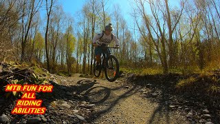
Popular McLeans Forest Mountain Biking Trails
• 85 ★ 3.9 • 6 miles • 237 ft • 739 •
This one way loop is ideal, easy riding for the whole family or for a quick blast through the forest.
• 85 ★ 4.0 • 3 miles • 108 ft • 692 •
Head under the bridge for an extra 5km's extending the ride into a figure of 8.
• 75 ★ 4.0 • 3,825 ft • 21 ft • 275 •
The offers alternative access to the Track. Has a mix of single track and gravel path.
• 65 ★ 4.0 • 1,708 ft • 12 ft • 221 •
Tresillian Loop Link Track - When one loop is not enough, this handy link trail bypasses the stopbank route for one more lap.
• 65 ★ 3.5 • 2,663 ft • 7 ft • 217 •
One way return single track along the Gordon Reid Track
• 65 ★ 3.5 • 1 mile • 22 ft • 190 •
Adds an extra 2km's with this little detour out towards the river from the track.
• 60 ★ 3.5 • 2,669 ft • 0 ft • 70 •
A track linking the Otukaikino Track to Darroch Street
• 50 ★ 4.0 • 4 miles • 160 ft • 48 •
The Willows, at the end of Thompsons Road, off Old West Coast Road in West Melton, has been developed specifically for non-motorised recreation activities. This development was driven by Environment Canterbury, along with the Selwyn...
Photos of McLeans Forest Mountain Bike
Videos of McLeans Forest Mountain Bike
youtuber
![THE WILLOWS feat. MC INDOE TRACK a family...]()
trail: McIndoe Track
13:32 |
852 |
Sep 16, 2021 , Christchurch
Recent Trail Reports
| status | trail | date | condition | info | user |
|---|---|---|---|---|---|
| River loop | May 30, 2026 @ 12:15pm (Pacific/Auckland) May 29, 2026 | Dry | PeteLompas | ||
| McIndoe Track | Mar 30, 2026 @ 2:34pm (Pacific/Auckland) Mar 29, 2026 | Dry | Cash1000 | ||
| Gordon Reid Return Track | Jan 24, 2026 @ 10:00am (Pacific/Auckland) Jan 23, 2026 | Variable | sparkynzl | ||
| Tresillian Loop Link Track | Jan 24, 2026 @ 10:00am (Pacific/Auckland) Jan 23, 2026 | Variable | sparkynzl | ||
| Gordon Reid Track | Jan 24, 2026 @ 10:00am (Pacific/Auckland) Jan 23, 2026 | Variable | sparkynzl | ||
| Coringa Loop | Nov 30, 2025 @ 9:30am (Pacific/Auckland) Nov 29, 2025 | Dry | Urn1e | ||
| Main Loop | Nov 30, 2025 @ 9:30am (Pacific/Auckland) Nov 29, 2025 | Ideal | Urn1e | ||
| Otukaikino Track (Darroch St Link) | Dec 21, 2024 @ 2:41pm Dec 21, 2024 | Ideal | sparkynzl | ||
| Otukaikino Track (Roto Kohatu - Clearwater) | Oct 29, 2023 @ 12:27pm Oct 29, 2023 | Ideal | sparkynzl |
Activity Feed
| username | action | type | title | date |
|---|---|---|---|---|
| PeteLompas | add | report | activity #95881535 | May 30, 2026 @ 1:11pm May 30, 2026 |
| thejazzcyclist | vote | trail | activity #94996686 | May 18, 2026 @ 1:19pm May 18, 2026 |
| rustybalboa | comment | trail | activity #93742979 | Apr 30, 2026 @ 4:48pm Apr 30, 2026 |
| Circel7hlTo | ridden | trail | activity #93325706 | Apr 24, 2026 @ 8:23pm Apr 24, 2026 |
| bobthesnowman | wishlist | trail | activity #93136030 | Apr 22, 2026 @ 2:41am Apr 22, 2026 |
Recent Comments
| username | type | title | comment | date |
|---|---|---|---|---|
| trail | Great little track , was a lot more fun than I... | Apr 30, 2026 @ 4:48pm Apr 30, 2026 | ||
| trail | Is it one runs parallel or should we split it? | Jul 9, 2025 @ 10:50pm Jul 9, 2025 | ||
| trail | Great little track.. | Nov 23, 2024 @ 4:30pm Nov 23, 2024 | ||
| report | Good condition. Starting get a bit over grown... | Dec 29, 2022 @ 10:42pm Dec 29, 2022 | ||
| trail | Flat and flowy | Jun 26, 2022 @ 1:26am Jun 26, 2022 |
Nearby Areas
| name | distance | ||||
|---|---|---|---|---|---|
| Waimakariri River Regional Park | 8 | 5.5 km | |||
| Crocodile XC MTB Park | 10 | 14 | 4 | 1 | 11.6 km |
| Bottle Lake Forest | 14 | 11.7 km | |||
| Christchurch Adventure Park | 7 | 16 | 11 | 11 | 13.2 km |
| Port Hills West | 5 | 4 | 2 | 13.3 km |
Activity Type Stats
| activitytype | trails | distance | descent | descent distance | total vertical | rating | global rank | state rank | photos | reports | routes | ridelogs |
|---|---|---|---|---|---|---|---|---|---|---|---|---|
| Mountain Bike | 17 | 19 miles | 279 ft | 3 miles | 404 ft | #2,729 | #74 | 37 | 195 | 7,128 | ||
| E-Bike | 7 | 5 miles | 30 ft | 1,798 ft | 151 ft | #2,453 | #66 | 164 | 301 | |||
| Hike | 8 | 9 miles | 171 ft | 2 miles | 404 ft | #4,348 | #79 | 172 | 26 | |||
| Trail Running | 8 | 9 miles | 171 ft | 2 miles | 404 ft | #3,466 | #65 | 172 | 259 | |||
| Dirtbike/Moto | 1 | 11 miles | 138 ft | 3 miles | 282 ft | 15 |
Frequently Asked Questions About McLeans Forest
▼
What are the highest rated mountain biking trails in McLeans Forest?
The highest rated mountain biking trails in McLeans Forest are:
- Coringa Loop (4/5)
- Sophora Loop (4/5)
- Gordon Reid Track (4/5)
- Tunnel and Trail Back to Carpark Link (4/5)
- Tresillian Loop Link Track (4/5)
▼
What is the best time of the year to ride in McLeans Forest?
Based on ride log data, the most popular months to ride in McLeans Forest are:
- January (45 activities)
- August (36 activities)
- October (34 activities)
▼
Where can I park to ride in McLeans Forest?
There are 2 parking locations listed in McLeans Forest. The most popular parking spots are:
▼
What is the longest trail in McLeans Forest?
The longest trail in McLeans Forest is Main Loop at 6.1 miles. View all trails sorted by distance.
Activities
- By YogiNZ & contributors
- Admins: MBA, rhino333, GC, DOT
- #8309 - 35,320 views
- mcleans forest activity log | embed map of McLeans Forest mountain bike trails | mcleans forest mountain biking points of interest
Downloading of trail gps tracks in kml & gpx formats is enabled for McLeans Forest.
You must login to download files.