close
-
Layers w
- Weather Layers
- Pro
- Pro
- Pro
- Pro
- Pro
- Pro
- More Layers
- Pro
- Pro
- Pro
- Pro
-
Upgrade to

3D
Trail Conditions
- Unknown
- Snow Groomed
- Snow Packed
- Snow Covered
- Snow Cover Partial
- Freeze/thaw Cycle
- Icy
- Prevalent Mud
- Wet
- Variable
- Ideal
- Dry
- Very Dry
Trail Flow (Ridden Direction)
Trailforks scans users ridelogs to determine the most popular direction each trail is ridden. A good flowing trail network will have most trails flowing in a single direction according to their intension.
The colour categories are based on what percentage of riders are riding a trail in its intended direction.
The colour categories are based on what percentage of riders are riding a trail in its intended direction.
- > 96%
- > 90%
- > 80%
- > 70%
- > 50%
- < 50%
- bi-directional trail
- no data
Trail Last Ridden
Trailforks scans ridelogs to determine the last time a trail was ridden.
- < 2 days
- < 1 week
- < 2 weeks
- < 1 month
- < 6 months
- > 6 months
Trail Ridden Direction
The intended direction a trail should be ridden.
- Downhill Only
- Downhill Primary
- Both Directions
- Uphill Primary
- Uphill Only
- One Direction
Contribute Details
Colors indicate trail is missing specified detail.
- Description
- Photos
- Description & Photos
- Videos
Trail Popularity ?
Trailforks scans ridelogs to determine which trails are ridden the most in the last 9 months.
Trails are compared with nearby trails in the same city region with a possible 25 colour shades.
Think of this as a heatmap, more rides = more kinetic energy = warmer colors.
- most popular
- popular
- less popular
- not popular
ATV/ORV/OHV Filter
Max Vehicle Width
inches
US Cell Coverage
Legend

Radar Time
Activity Recordings
Trailforks uses anonymized public activity data.
?
Activity Recordings
Trailforks uses anonymized public activity data.
?
Personal Heatmap
▶
Activity Types
all
/
none
▶
Options
2
Date range
month
–
Winter Trails
Warning
A routing network for winter maps does not exist. Selecting trails using the winter trails layer has been disabled.
Missing Trails
Most Popular
Least Popular
Trails are colored based on popularity. The more popular a trail is, the more red. Less popular trails trend towards green.
Jump Magnitude Heatmap
Heatmap of where riders jump on trails. Zoom in to see individual jumps, click circles to view jump details.
BC Backroad Status
![map legend]()
Service Road Atlas is a free to use, community-driven service for viewing and creating reports on the numerous back-country service roads around B.C. and Alberta.

Slope Aspect
Direction the slope faces
Trails Deemphasized
Trails are shown in grey.
Only show trails with no bike usage.
Suggested Layers
Based on selected activity type
Save the current map location and zoom level as your default home location whenever this page is loaded.
SaveArrondissement Mechelen:
Berlaar, Bonheiden, Bornem, Duffel, Heist-op-den-Berg, Lier, Mechelen, Nijlen, Putte, Puurs, Sint-Amands, Sint-Katelijne-Waver, Willebroek
Berlaar, Bonheiden, Bornem, Duffel, Heist-op-den-Berg, Lier, Mechelen, Nijlen, Putte, Puurs, Sint-Amands, Sint-Katelijne-Waver, Willebroek
This region uses the Uk/Euro style trail grading system.
Activities Click to view
- Mountain Bike
37 trails
- E-Bike
18 trails
- Adaptive Bike
0 trails
- Winter Fat Bike
0 trails
- Hike
38 trails
- Trail Running
38 trails
Region Details
- 10
- 21
- 4
- 2
Region Status
Caution as of Mar 20, 2026Stats
- Avg Trail Rating
- Trails (view details)
- 39
- Trails Mountain Bike
- 37
- Trails E-Bike
- 18
- Trails Hike
- 38
- Trails Trail Running
- 38
- Total Distance
- 18 miles
- Total Descent
- 715 ft
- Total Vertical
- 94 ft
- Highest Trailhead
- 94 ft
- Reports
- 68
- Photos
- 10
- Ridden Counter
- 1,007
Popular Mechelen Mountain Biking Trails
• 100 ★ 4.5 • 3,159 ft • 9 ft • 48 •
Popular green difficulty singletrack. This mountain bike primary trail can be used both directions. On average it takes 4 minutes to complete this trail.
• 90 ★ 0.0 • 2,329 ft • 5 ft • 47 •
Popular green difficulty singletrack. This mountain bike primary trail can be used both directions. On average it takes 1 minutes to complete this trail.
• 75 ★ 0.0 • 2,699 ft • 94 ft • 45 •
Part of the Bloso route in Bonheiden, short paved section halfway
• 85 ★ 3.0 • 3,235 ft • 108 ft • 42 •
Fun circuit, part of the Bloso route in Bonheiden
• 95 ★ 4.0 • 515 ft • 0 ft • 42 •
Popular green difficulty singletrack. This mountain bike primary trail can be used both directions. On average it takes minutes to complete this trail.
• 30 ★ 4.0 • 4,606 ft • 43 ft • 41 •
Part of the red Bloso route. Follow the red MTB signs
• 90 ★ 0.0 • 1,778 ft • 10 ft • 35 •
Easy singletrack with option to go down and up through a dry ditch 6 times.
• 85 ★ 4.0 • 1,417 ft • 2 ft • 35 •
Popular green difficulty singletrack. This mountain bike primary trail can be used both directions. On average it takes 2 minutes to complete this trail.
Mechelen Mountain Bike Routes
★ 3.5 • 14 miles • 412 ft • 0 • Loop •
MTB-route met ongeveer 40% offroad. Op het einde een technischer gedeelte, zeker wanneer het geregend...
★ 4.0 • 20 miles • 374 ft • 0 • Loop •
MTB-route met ongeveer 40% offroad. Grotendeels vlak. Start bij De Schalk, volg de groene driehoeken....
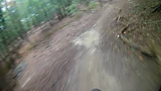
Videos of Mechelen Mountain Bike
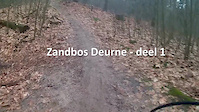
trail: Zandbos
12:47 |
185 |
Feb 22, 2017
trail: Muur van Battel
887 |
Jun 3, 2021 , Mechelen
trail: Kasteeldreef
0:35 |
86 |
Apr 28, 2009
Recent Trail Reports
| status | trail | date | condition | info | user |
|---|---|---|---|---|---|
| Mouriaubos | Jun 18, 2024 @ 4:56am Jun 18, 2024 | Wet | nokietje | ||
| Muur van Battel | Mar 26, 2024 @ 2:10pm Mar 26, 2024 | Wet | TerraWan | ||
| Singletrack Tussen Zenne en E19 | Sep 30, 2023 @ 7:58am Sep 30, 2023 | Ideal | bobopalmtree | ||
| klim Zenneberg vanuit ingang | Aug 26, 2023 @ 5:43am Aug 26, 2023 | Unknown | bobopalmtree | ||
| Bonheiden circuit | Nov 14, 2020 @ 11:58pm Nov 14, 2020 | Dry | mtbgeert | ||
| Single track Ruisbroek | Jun 21, 2020 @ 3:14pm Jun 21, 2020 | Variable | TerraWan | ||
| Zandbos | Dec 26, 2019 @ 3:29am Dec 26, 2019 | Ideal | PieterE |
Activity Feed
| username | action | type | title | date |
|---|---|---|---|---|
| doudou8jrFQo | wishlist | trail | activity #96942358 | Jun 14, 2026 @ 12:27am Jun 14, 2026 |
| Jos909 | wishlist | trail | activity #83230272 and 3 more | Oct 29, 2025 @ 1:16pm Oct 29, 2025 |
| gtdude | ridden | trail | activity #77052798 | Jul 30, 2025 @ 3:33pm Jul 30, 2025 |
| StijnjL9Dt8 | vote | trail | activity #70160124 | Apr 22, 2025 @ 11:54am Apr 22, 2025 |
| nokietje | add | report | activity #54330213 and 1 more | Jun 18, 2024 @ 10:59am Jun 18, 2024 |
Recent Comments
| username | type | title | comment | date |
|---|---|---|---|---|
| trail | Trees have been removed. | Oct 23, 2018 @ 12:09am Oct 23, 2018 | ||
| trail | Nice circuit, but quite a few fallen trees. | Oct 9, 2018 @ 3:59am Oct 9, 2018 |
Local Badges
-

Epic Mountain Bike Climb 2k1 awarded -

Climbing 10k Badge16 awarded -

Mountain Biking 100k Badge0 awarded -

Epic Ride Descent 2k1 awarded -

Descent 10k Badge16 awarded -

Descent 100k Badge0 awarded
Bike & Skill Parks
| name | type | city | rating |
|---|---|---|---|
| KRANK | skill park | Mechelen |
Activity Type Stats
| activitytype | trails | distance | descent | descent distance | total vertical | rating | global rank | state rank | photos | reports | routes | ridelogs |
|---|---|---|---|---|---|---|---|---|---|---|---|---|
| Mountain Bike | 37 | 14 miles | 591 ft | 5 miles | 95 ft | #3,403 | #27 | 5 | 68 | 3 | 9,692 | |
| E-Bike | 18 | 7 miles | 400 ft | 3 miles | 95 ft | #1,541 | #21 | 65 | 896 | |||
| Hike | 38 | 18 miles | 705 ft | 6 miles | 95 ft | #2,118 | #21 | 66 | 137 | |||
| Trail Running | 38 | 18 miles | 705 ft | 6 miles | 95 ft | #1,580 | #20 | 5 | 66 | 413 |
Frequently Asked Questions About Mechelen
▼
What are the highest rated mountain biking trails in Mechelen?
The highest rated mountain biking trails in Mechelen are:
- Muur van Battel (4.2/5)
- Trailtje Naast De Autostrade MTB (4.1/5)
- Eandisbos (4/5)
- Liezele s track (4/5)
- Liezele skill trail (4/5)
▼
What is the best time of the year to ride in Mechelen?
Based on ride log data, the most popular months to ride in Mechelen are:
- July (16 activities)
- August (15 activities)
- September (13 activities)
▼
Where can I park to ride in Mechelen?
Check the Mechelen trail map for trailhead and parking information. Community members regularly update access and parking details for trails in the area.
▼
What is the longest trail in Mechelen?
The longest trail in Mechelen is Single track Ruisbroek at 1.4 km. View all trails sorted by distance.
- By Jenstin
 TRAILFORKS & contributors
 - Admins: apply
- #24360 - 4,336 views
- mechelen activity log | embed map of Mechelen mountain bike trails |
Downloading of trail gps tracks in kml & gpx formats is enabled for Mechelen.
You must login to download files.