close
-
Layers w
- Weather Layers
- Pro
- Pro
- Pro
- Pro
- Pro
- Pro
- More Layers
- Pro
- Pro
- Pro
- Pro
-
Upgrade to

3D
Trail Conditions
- Unknown
- Snow Groomed
- Snow Packed
- Snow Covered
- Snow Cover Partial
- Freeze/thaw Cycle
- Icy
- Prevalent Mud
- Wet
- Variable
- Ideal
- Dry
- Very Dry
Trail Flow (Ridden Direction)
Trailforks scans users ridelogs to determine the most popular direction each trail is ridden. A good flowing trail network will have most trails flowing in a single direction according to their intension.
The colour categories are based on what percentage of riders are riding a trail in its intended direction.
The colour categories are based on what percentage of riders are riding a trail in its intended direction.
- > 96%
- > 90%
- > 80%
- > 70%
- > 50%
- < 50%
- bi-directional trail
- no data
Trail Last Ridden
Trailforks scans ridelogs to determine the last time a trail was ridden.
- < 2 days
- < 1 week
- < 2 weeks
- < 1 month
- < 6 months
- > 6 months
Trail Ridden Direction
The intended direction a trail should be ridden.
- Downhill Only
- Downhill Primary
- Both Directions
- Uphill Primary
- Uphill Only
- One Direction
Contribute Details
Colors indicate trail is missing specified detail.
- Description
- Photos
- Description & Photos
- Videos
Trail Popularity ?
Trailforks scans ridelogs to determine which trails are ridden the most in the last 9 months.
Trails are compared with nearby trails in the same city region with a possible 25 colour shades.
Think of this as a heatmap, more rides = more kinetic energy = warmer colors.
- most popular
- popular
- less popular
- not popular
ATV/ORV/OHV Filter
Max Vehicle Width
inches
US Cell Coverage
Legend

Radar Time
Activity Recordings
Trailforks uses anonymized public activity data.
?
Activity Recordings
Trailforks uses anonymized public activity data.
?
Personal Heatmap
▶
Activity Types
all
/
none
▶
Options
2
Date range
month
–
Winter Trails
Warning
A routing network for winter maps does not exist. Selecting trails using the winter trails layer has been disabled.
Missing Trails
Most Popular
Least Popular
Trails are colored based on popularity. The more popular a trail is, the more red. Less popular trails trend towards green.
Jump Magnitude Heatmap
Heatmap of where riders jump on trails. Zoom in to see individual jumps, click circles to view jump details.
BC Backroad Status
![map legend]()
Service Road Atlas is a free to use, community-driven service for viewing and creating reports on the numerous back-country service roads around B.C. and Alberta.

Slope Aspect
Direction the slope faces
Trails Deemphasized
Trails are shown in grey.
Only show trails with no bike usage.
Suggested Layers
Based on selected activity type
Save the current map location and zoom level as your default home location whenever this page is loaded.
Save
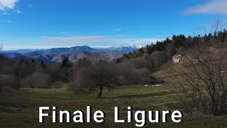
No description for Melogno has been added yet!
Login or register to submit one.
This region uses the Uk/Euro style trail grading system.
Activities Click to view
- Mountain Bike
14 trails
- E-Bike
9 trails
- Gravel Bike
0 trails
- Adaptive Bike
0 trails
- Winter Fat Bike
0 trails
- Hike
14 trails
- Trail Running
14 trails
Region Details
- 10
- 1
- 2
Region Status
Open as of Jun 10, 2026Stats
- Avg Trail Rating
- Trails (view details)
- 13
- Trails Mountain Bike
- 14
- Trails E-Bike
- 9
- Trails Horse
- 1
- Trails Hike
- 14
- Trails Trail Running
- 14
- Total Distance
- 21 miles
- Total Descent
- 3,316 ft
- Total Vertical
- 3,742 ft
- Highest Trailhead
- 4,528 ft
- Reports
- 445
- Photos
- 46
- Ridden Counter
- 16,328
Popular Melogno Mountain Biking Trails
• 50 ★ 4.4 • 4,777 ft • 5 ft • 604 •
Highly rated moderately popular blue difficulty singletrack. This mountain bike primary trail can be used downhill only with a 5 ft green climb. Trail visibility is always easy to follow. On average it takes 6 minutes to complete this trail.
• 15 ★ 2.5 • 394 ft • 3 ft • 77 •
Singletrack connection from Bondi to Xmen.
• 5 ★ 2.4 • 2,247 ft • 0 ft • 46 •
Veloce e scorrevole tutto tra pinete e faggete, facile e divertente Fast and flow all between pine and beech woods, easy and fun
Melogno Mountain Bike Routes
★ 4.3 • 13 miles • 2,234 ft • 7 • Point to Point •
Route connecting Roller Coaster Kill Bill 1 Madonna Della Guardia Pina Morta Pina Morta Lower Neanderthaler
13 miles • 2,231 ft • 7 • Point to Point •
Route connecting Roller Coaster Kill Bill 1 Madonna Della Guardia Pina Morta Pina Morta Lower Neanderthaler
22 miles • 2,423 ft • 7 • Shuttled •
Nice combination of trails from the Nato Base in Finale Ligure to make the most out of the shuttle altitude
★ 1.0 • 13 miles • 2,049 ft • 13 • Point to Point •
This is a good route for a morning ride, when you go up one time by shuttle from Pietra Ligure and want to...
Photos of Melogno Mountain Bike
Recent Trail Reports
| status | trail | date | condition | info | user |
|---|---|---|---|---|---|
| Isallo Exit | Jun 10, 2026 @ 4:28pm (Europe/Monaco) Jun 10, 2026 | Dry | arthurit | ||
| Isallo Extasy Access | Jun 7, 2026 @ 2:15am (Pacific/Midway) Jun 7, 2026 | Ideal | maximeroucheau | ||
| Melogno climb | Jun 7, 2026 @ 2:15am (Pacific/Midway) Jun 7, 2026 | Ideal | maximeroucheau | ||
| Catalano | May 31, 2026 @ 9:46am (Europe/Monaco) May 31, 2026 | Ideal | Pambry | ||
| le scalette a sinistra | May 29, 2026 @ 3:27pm (Europe/Monaco) May 29, 2026 | Ideal | aplced | ||
| Catalano-Colle Giustenice | May 29, 2026 @ 3:27pm (Europe/Monaco) May 29, 2026 | Ideal | aplced | ||
| Vigliazzi to Melogno Climb | May 17, 2026 @ 9:42am (Europe/Monaco) May 17, 2026 | Ideal | weridemtbskillscoaching | ||
| Verezzi Singletrack Access | May 1, 2026 @ 2:32pm (Europe/Rome) May 1, 2026 | Ideal | jjerry26 | ||
| Piambello climb | May 1, 2026 @ 10:44am (Europe/Monaco) May 1, 2026 | Ideal | arthurit | ||
| Bondi to Xmen Connector | Jan 26, 2026 @ 9:56am (Europe/Rome) Jan 26, 2026 | Ideal | Benni23186 |
Activity Feed
| username | action | type | title | date |
|---|---|---|---|---|
| whurr | wishlist | trail | activity #97414846 | Jun 20, 2026 @ 11:07am 16 hours |
| ottavya | ridden | trail | activity #97373000 | Jun 20, 2026 @ 1:45am 1 day |
| spezies8472 | wishlist | trail | activity #97104580 | Jun 16, 2026 @ 6:18am Jun 16, 2026 |
| HannesqH1jCO | ridden | trail | activity #96759498 | Jun 11, 2026 @ 1:48pm Jun 11, 2026 |
| Vjoliat | wishlist | trail | activity #96757133 | Jun 11, 2026 @ 12:59pm Jun 11, 2026 |
Recent Comments
| username | type | title | comment | date |
|---|---|---|---|---|
| trail | Bellissima strada tutta nel bosco fantastico.... | May 3, 2026 @ 11:59am May 3, 2026 | ||
| trail | Absolutely NOT recommended with ANY bike.... | Nov 21, 2025 @ 7:43am Nov 21, 2025 | ||
| trail | Hiking trail, don't bother with an e-bike. | Nov 3, 2025 @ 10:28am Nov 3, 2025 | ||
| trail | Percorso non adatto a mtb o e-bike, non... | Oct 18, 2025 @ 7:00am Oct 18, 2025 | ||
| trail | Do not go there, unless you really hate... | Oct 6, 2025 @ 4:25am Oct 6, 2025 |
Local Badges
-

Epic Mountain Bike Climb 2k75 awarded -

Climbing 10k Badge4 awarded -

Mountain Biking 100k Badge0 awarded -

Epic Ride Descent 2k75 awarded -

Descent 10k Badge6 awarded -

Descent 100k Badge0 awarded
Activity Type Stats
| activitytype | trails | distance | descent | descent distance | total vertical | rating | global rank | state rank | photos | reports | routes | ridelogs |
|---|---|---|---|---|---|---|---|---|---|---|---|---|
| Mountain Bike | 14 | 21 miles | 3,317 ft | 9 miles | 3,743 ft | #3,707 | #216 | 21 | 445 | 18 | 5,901 | |
| E-Bike | 9 | 16 miles | 3,287 ft | 8 miles | 3,307 ft | #2,173 | #211 | 25 | 427 | 11 | 1,453 | |
| Horse | 1 | 8 miles | 1,778 ft | 5 miles | 1,509 ft | 28 | 1 | |||||
| Hike | 14 | 21 miles | 3,317 ft | 9 miles | 3,743 ft | #6,642 | #351 | 442 | 1 | 79 | ||
| Trail Running | 14 | 21 miles | 3,317 ft | 9 miles | 3,743 ft | #6,106 | #330 | 442 | 1 | 15 |
Frequently Asked Questions About Melogno
▼
What are the highest rated mountain biking trails in Melogno?
The highest rated mountain biking trails in Melogno are:
- Colonello Din variante (4.2/5)
- Colonello Din seconda parte (4/5)
- Bondi to Xmen Connector (3.6/5)
▼
What is the best time of the year to ride in Melogno?
Based on ride log data, the most popular months to ride in Melogno are:
- October (62 activities)
- September (60 activities)
- April (34 activities)
▼
Where can I park to ride in Melogno?
Check the Melogno trail map for trailhead and parking information. Community members regularly update access and parking details for trails in the area.
▼
What is the longest trail in Melogno?
The longest trail in Melogno is Colonello Din variante at 1.5 km. View all trails sorted by distance.
Activities
Trails
Points of Interest
- By denitopia
 TRAILFORKS VTA & contributors
 - Admins: denitopia
- #11235 - 5,777 views
- melogno activity log | embed map of Melogno mountain bike trails | melogno mountain biking points of interest
Downloading of trail gps tracks in kml & gpx formats is enabled for Melogno.
You must login to download files.