close
-
Layers w
- Weather Layers
- Pro
- Pro
- Pro
- Pro
- Pro
- Pro
- More Layers
- Pro
- Pro
- Pro
- Pro
-
Upgrade to

3D
Trail Conditions
- Unknown
- Snow Groomed
- Snow Packed
- Snow Covered
- Snow Cover Partial
- Freeze/thaw Cycle
- Icy
- Prevalent Mud
- Wet
- Variable
- Ideal
- Dry
- Very Dry
Trail Flow (Ridden Direction)
Trailforks scans users ridelogs to determine the most popular direction each trail is ridden. A good flowing trail network will have most trails flowing in a single direction according to their intension.
The colour categories are based on what percentage of riders are riding a trail in its intended direction.
The colour categories are based on what percentage of riders are riding a trail in its intended direction.
- > 96%
- > 90%
- > 80%
- > 70%
- > 50%
- < 50%
- bi-directional trail
- no data
Trail Last Ridden
Trailforks scans ridelogs to determine the last time a trail was ridden.
- < 2 days
- < 1 week
- < 2 weeks
- < 1 month
- < 6 months
- > 6 months
Trail Ridden Direction
The intended direction a trail should be ridden.
- Downhill Only
- Downhill Primary
- Both Directions
- Uphill Primary
- Uphill Only
- One Direction
Contribute Details
Colors indicate trail is missing specified detail.
- Description
- Photos
- Description & Photos
- Videos
Trail Popularity ?
Trailforks scans ridelogs to determine which trails are ridden the most in the last 9 months.
Trails are compared with nearby trails in the same city region with a possible 25 colour shades.
Think of this as a heatmap, more rides = more kinetic energy = warmer colors.
- most popular
- popular
- less popular
- not popular
ATV/ORV/OHV Filter
Max Vehicle Width
inches
US Cell Coverage
Legend

Radar Time
Activity Recordings
Trailforks uses anonymized public activity data.
?
Activity Recordings
Trailforks uses anonymized public activity data.
?
Personal Heatmap
▶
Activity Types
all
/
none
▶
Options
2
Date range
month
–
Winter Trails
Warning
A routing network for winter maps does not exist. Selecting trails using the winter trails layer has been disabled.
Missing Trails
Most Popular
Least Popular
Trails are colored based on popularity. The more popular a trail is, the more red. Less popular trails trend towards green.
Jump Magnitude Heatmap
Heatmap of where riders jump on trails. Zoom in to see individual jumps, click circles to view jump details.
BC Backroad Status
![map legend]()
Service Road Atlas is a free to use, community-driven service for viewing and creating reports on the numerous back-country service roads around B.C. and Alberta.

Slope Aspect
Direction the slope faces
Trails Deemphasized
Trails are shown in grey.
Only show trails with no bike usage.
Suggested Layers
Based on selected activity type
Save the current map location and zoom level as your default home location whenever this page is loaded.
Save
No description for Melrose has been added yet!
Login or register to submit one.
Activities Click to view
- Mountain Bike
89 trails
- E-Bike
43 trails
- Gravel Bike
0 trails
- Adaptive Bike
0 trails
- Winter Fat Bike
0 trails
- Horse
3 trails
- Hike
65 trails
- Trail Running
65 trails
Region Details
- 20
- 1
- 10
- 29
- 16
Region Status
Open as of May 8, 2026Local Trail Association
Stats
- Avg Trail Rating
- Trails (view details)
- 78
- Trails Mountain Bike
- 93
- Trails E-Bike
- 43
- Trails Horse
- 3
- Trails Hike
- 65
- Trails Trail Running
- 65
- Trails ATV/ORV/OHV
- 1
- Total Distance
- 139 miles
- Total Descent
- 19,135 ft
- Total Vertical
- 2,667 ft
- Highest Trailhead
- 3,153 ft
- Reports
- 470
- Photos
- 148
- Ridden Counter
- 15,070
Sub Regions
-
Melrose Town Trails
- 1
- 4
- 13
- 12
-
Mount Remarkable National Park
- 6
-
Willowie Forest
- 4
- 4
Popular Melrose Mountain Biking Trails
• 90 ★ 4.6 • 4 miles • 385 ft • 522 •
If you only ride one trail in Melrose, make it ! Since the initial line was put in during 2008 this trail has been on a constant path of development since with many extension, realignments and changes. Featuring the spiral and the old...
• 100 ★ 3.4 • 728 ft • 0 ft • 477 •
Race your mates side by side on our dual slalom track. Great way to finish a day of riding with some head to head racing. Please pick a lane and stay in it!
• 90 ★ 2.8 • 1,745 ft • 0 ft • 474 •
An ancient walking trail that has been embellished by mountain bikers. Take a ride along the creek on this picturesque and cruisy trail keeping an eye out for the chooks, ducks, geese and pheasants that gave it it's name. There are...
• 95 ★ 4.2 • 3,248 ft • 30 ft • 443 •
A nice single track meander along the creek to access the southern side of the network. There are swimming holes along the way.
• 100 ★ 3.4 • 505 ft • 31 ft • 399 •
A short link trail joining the two saddles in the centre of the network.
• 100 ★ 3.0 • 3,256 ft • 33 ft • 394 •
Smooth link trail/path to the showgrounds and rail trail
• 60 ★ 4.0 • 1,783 ft • 74 ft • 353 •
Single track shared use access to the monument. UP only for bikes.
• 75 ★ 4.4 • 3,508 ft • 187 ft • 346 •
is the Highest track on the main mountain, reaching about 500m. marks the start of the Mini D downhill trail that starts at the start of 's downhill part and finishes at the bottom of . is a moderate trail that gets more difficult with...
Melrose Mountain Bike Routes
Remarkable Epic Trail Featured
★ 5.0 • 24 miles • 3,651 ft • 6 • Loop •
The Remarkable Epic Trail route is the premier South Australian backcountry experience and explores remote...
16 miles • 2,899 ft • 4 • Loop •
The shorter version of the Epic, featuring the descent! Add in extra trails in Willowie or head on back...
76 miles • 3,242 ft • 1 • Loop •
120 km Gravel Grind route ex Melrose First refreshment stop for food and water at the 50km: Julia's...
43 miles • 5,925 ft • 13 • Loop •
Just asking questions. 25 characters
38 miles • 5,330 ft • 17 • Loop •
Photos of Melrose Mountain Bike
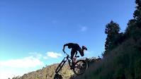
Videos of Melrose Mountain Bike

trail: Dodging Bullets
0:31 |
418 |
Jul 16, 2020
trail: Helrose
0:11 |
425 |
Jan 31, 2020

trail: Dodging Bullets
11:37 |
342 |
Apr 28, 2024 , Melrose
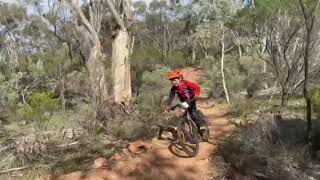
trail: E-Skid-Na
0:21 |
348 |
Nov 6, 2022 , Melrose

trail: Mad Mouse
0:37 |
530 |
Jul 25, 2021 , Melrose

trail: Dodging Bullets
8:46 |
1177 |
May 5, 2021 , Melrose

13:16 |
882 |
Mar 24, 2021

trail: Showgrounds Link
5:38 |
592 |
Mar 24, 2021 , Melrose
Recent Trail Reports
Activity Feed
| username | action | type | title | date |
|---|---|---|---|---|
| Moilove | wishlist | trail | activity #96715598 | Jun 10, 2026 @ 8:18pm Jun 10, 2026 |
| Frodododo | wishlist | trail | activity #95655451 | May 27, 2026 @ 12:46pm May 27, 2026 |
| hutchy53 | add | route | activity #95086861 | May 19, 2026 @ 9:15pm May 19, 2026 |
| Scott7SOPA2 | wishlist | route | activity #94674463 | May 14, 2026 @ 1:28am May 14, 2026 |
| j808 | checkin | trail | activity #94336367 | May 9, 2026 @ 7:11am May 9, 2026 |
Recent Comments
| username | type | title | comment | date |
|---|---|---|---|---|
| trail | Quite rocky and mostly uphill but we used it... | Oct 7, 2025 @ 4:51am Oct 7, 2025 | ||
| trail | There’s a nice hut up the top of the track... | Oct 7, 2025 @ 4:48am Oct 7, 2025 | ||
| trail | Edit: we used it as a way to Throwing Copper... | Oct 7, 2025 @ 4:41am Oct 7, 2025 | ||
| trail | Relatively narrow single track and mostly... | Oct 7, 2025 @ 4:34am Oct 7, 2025 | ||
| trail | Good quality long and straight stretch to... | Oct 6, 2025 @ 7:49pm Oct 6, 2025 |
Local Badges
-

10 Blue Trails207 awarded -

10 Black Trails136 awarded -

Epic Ride Climb 2k24 awarded -

Climbing 10k Badge26 awarded -

Climbing 100k Badge0 awarded -

Epic Ride Descent 2k27 awarded
Bike & Skill Parks
| name | type | city | rating |
|---|---|---|---|
| Melrose Caravan Park Pump Track/Skills Area | skill park | Melrose |
Activity Type Stats
| activitytype | trails | distance | descent | descent distance | total vertical | rating | global rank | state rank | photos | reports | routes | ridelogs |
|---|---|---|---|---|---|---|---|---|---|---|---|---|
| Mountain Bike | 89 | 130 miles | 17,106 ft | 63 miles | 2,198 ft | #972 | #53 | 147 | 470 | 17 | 5,513 | |
| E-Bike | 43 | 90 miles | 9,275 ft | 44 miles | 2,198 ft | #401 | #42 | 419 | 10 | 1,242 | ||
| Horse | 3 | 3,255 ft | 10 ft | 797 ft | 30 ft | #583 | #32 | 22 | ||||
| Hike | 65 | 87 miles | 9,249 ft | 43 miles | 2,667 ft | #1,519 | #48 | 385 | 392 | |||
| Trail Running | 65 | 87 miles | 9,249 ft | 43 miles | 2,667 ft | #1,226 | #39 | 386 | 159 | |||
| ATV/ORV/OHV | 1 | 21 |
Frequently Asked Questions About Melrose
▼
What are the best places to ride in Melrose?
Melrose has 4 areas to explore for mountain biking. The top rated areas are:
▼
What are the highest rated mountain biking trails in Melrose?
The highest rated mountain biking trails in Melrose are:
- Dodging Bullets (4.4/5)
- Orb Flow (4.4/5)
- Possum Magic (4.3/5)
- Home Run (4.2/5)
- Sleeper (4.2/5)
▼
What is the best time of the year to ride in Melrose?
Based on ride log data, the most popular months to ride in Melrose are:
- October (95 activities)
- July (78 activities)
- June (54 activities)
▼
Where can I park to ride in Melrose?
There are 6 parking locations listed in Melrose. The most popular parking spots are: View all parking and trailhead locations on the map to plan your visit.
Activities
Trails
Points of Interest
- Epic Trail Monument Trailhead Information
- Sugargum Dam Camp Camping
- Ali Lookout Viewpoint
- Hidden Camp Camping
- Sugar Gum Lookout Viewpoint
- Scarfes Hut Cabin
- Baroota Ruins Campground Camping
- Remarkable Epic Trail Start Trailhead Information
- Wilbur's watch Viewpoint
- Epic Trail Home Run Trailhead Information
- Mount Remarkable (962 m)
- Black Rock (835 m)
- Hogshead Hill (777 m)
- By canadaka
 Trailforks & contributors
 - Admins: Jake-Hannah, Addzz, NPSA, Coneofsilence, Bike Melrose
- #5062 - 35,071 views
- melrose activity log | embed map of Melrose mountain bike trails | melrose mountain biking points of interest
Downloading of trail gps tracks in kml & gpx formats is enabled for Melrose.
You must login to download files.