close
-
Layers w
- Weather Layers
- Pro
- Pro
- Pro
- Pro
- Pro
- Pro
- More Layers
- Pro
- Pro
- Pro
- Pro
-
Upgrade to

3D
Trail Conditions
- Unknown
- Snow Groomed
- Snow Packed
- Snow Covered
- Snow Cover Partial
- Freeze/thaw Cycle
- Icy
- Prevalent Mud
- Wet
- Variable
- Ideal
- Dry
- Very Dry
Trail Flow (Ridden Direction)
Trailforks scans users ridelogs to determine the most popular direction each trail is ridden. A good flowing trail network will have most trails flowing in a single direction according to their intension.
The colour categories are based on what percentage of riders are riding a trail in its intended direction.
The colour categories are based on what percentage of riders are riding a trail in its intended direction.
- > 96%
- > 90%
- > 80%
- > 70%
- > 50%
- < 50%
- bi-directional trail
- no data
Trail Last Ridden
Trailforks scans ridelogs to determine the last time a trail was ridden.
- < 2 days
- < 1 week
- < 2 weeks
- < 1 month
- < 6 months
- > 6 months
Trail Ridden Direction
The intended direction a trail should be ridden.
- Downhill Only
- Downhill Primary
- Both Directions
- Uphill Primary
- Uphill Only
- One Direction
Contribute Details
Colors indicate trail is missing specified detail.
- Description
- Photos
- Description & Photos
- Videos
Trail Popularity ?
Trailforks scans ridelogs to determine which trails are ridden the most in the last 9 months.
Trails are compared with nearby trails in the same city region with a possible 25 colour shades.
Think of this as a heatmap, more rides = more kinetic energy = warmer colors.
- most popular
- popular
- less popular
- not popular
ATV/ORV/OHV Filter
Max Vehicle Width
inches
US Cell Coverage
Legend

Radar Time
Activity Recordings
Trailforks uses anonymized public activity data.
?
Activity Recordings
Trailforks uses anonymized public activity data.
?
Personal Heatmap
▶
Activity Types
all
/
none
▶
Options
2
Date range
month
–
Winter Trails
Warning
A routing network for winter maps does not exist. Selecting trails using the winter trails layer has been disabled.
Missing Trails
Most Popular
Least Popular
Trails are colored based on popularity. The more popular a trail is, the more red. Less popular trails trend towards green.
Jump Magnitude Heatmap
Heatmap of where riders jump on trails. Zoom in to see individual jumps, click circles to view jump details.
BC Backroad Status
![map legend]()
Service Road Atlas is a free to use, community-driven service for viewing and creating reports on the numerous back-country service roads around B.C. and Alberta.

Slope Aspect
Direction the slope faces
Trails Deemphasized
Trails are shown in grey.
Only show trails with no bike usage.
Suggested Layers
Based on selected activity type
Save the current map location and zoom level as your default home location whenever this page is loaded.
SaveMachine-built trail system designed for advanced mountain bike riding. Rip around the berms, shred the downhill trails, and enjoy several technical structures, bridges, rock gardens (Mix Master), rutty sections, a jump section (Wynalda Loop), and a testy advanced trail (Sawtooth). Merrell footwear is our title sponsor and all trail segments are named after some of their most popular shoes Merrell Trail is the most popular trail system in the greater Grand Rapids area.
Primary Trail Type: Cross-Country
 google parking directions
 Activities Click to view
- Mountain Bike
23 trails
- Hike
23 trails
- Trail Running
23 trails
Region Details
- 3
- 3
- 9
- 2
Region Status
Open as of Jun 11, 2026Stats
- Avg Trail Rating
- Trails (view details)
- 17
- Trails Mountain Bike
- 23
- Trails Hike
- 23
- Trails Trail Running
- 23
- Total Distance
- 7 miles
- Total Descent Distance
- 2 miles
- Total Descent
- 604 ft
- Total Vertical
- 135 ft
- Highest Trailhead
- 939 ft
- Reports
- 3,104
- Photos
- 61
- Ridden Counter
- 12,207
Popular Merrell Trails Mountain Biking Trails
• 100 ★ 4.6 • 2 miles • 161 ft • 2,012 •
Features a roller coaster stretch with some of the most fun singletrack in the state. Fun to ride in either direction--up or down. Take advantage of the subtle jumps and drops buried into the topography for a fun ride.
• 65 ★ 5.0 • 3,140 ft • 86 ft • 1,737 •
Highly rated moderately popular blue difficulty singletrack. This multi-use trail can be used both directions and has a easy overall physical rating with a 86 ft green climb. On average it takes 16 minutes to complete this trail.
• 65 ★ 5.0 • 2,726 ft • 101 ft • 893 •
A technically challenging trail which is a different beast depending on which direction you ride it. In the yellow direction you maneuver a narrow elevated curvy bridge into a rutty section, crank up tight switchbacks and then fly off a...
• 75 ★ 5.0 • 3,586 ft • 129 ft • 866 •
Highly rated popular blue difficulty singletrack. This multi-use trail can be used both directions and has a easy overall physical rating with a 129 ft green climb. On average it takes 3 minutes to complete this trail.
• 50 ★ 4.4 • 223 ft • 5 ft • 700 •
Connects Loops to the / trailheads (red direction), allowing you to skip repeating MixMaster just to do another loop.
• 100 ★ 4.0 • 2,356 ft • 47 ft • 362 •
is a downhill only trail with exciting high speeds, berms, and fun table top jumps peppered throughout!
• 100 ★ 4.0 • 2 miles • 73 ft • 348 •
Popular blue difficulty singletrack. This multi-use trail can be used both directions and has a easy overall physical rating with a 73 ft green climb.
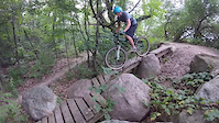
Photos of Merrell Trails Mountain Bike
Videos of Merrell Trails Mountain Bike
trail: Phaser
3:14 |
860 |
Aug 28, 2015

7:53 |
200 |
Jul 10, 2023

5:55 |
211 |
Dec 19, 2021
youtuber
![Looking To Send Our Meta Hardtails •...]()

26:01 |
321 |
Aug 30, 2021
youtuber
![No Rear Suspension? No Problem • Merrell...]()

26:01 |
222 |
Aug 3, 2021

trail: Wilderness
11:15 |
516 |
Jul 13, 2021 , Rockford

trail: Sawtooth
11:15 |
461 |
Jul 13, 2021 , Rockford

3:55 |
237 |
Jan 25, 2021
Recent Trail Reports
| status | trail | date | condition | info | user |
|---|---|---|---|---|---|
| Wynalda Flow Trail 3 | Jun 11, 2026 @ 7:02am (America/Detroit) Jun 11, 2026 | Ideal | MTB-Cowgirl | ||
| Wynalda Flow Trail 2 | Jun 11, 2026 @ 7:02am (America/Detroit) Jun 11, 2026 | Ideal | MTB-Cowgirl | ||
| Wynalda Flow Trail 1 | Jun 11, 2026 @ 7:02am (America/Detroit) Jun 11, 2026 | Ideal | MTB-Cowgirl | ||
| Carin Tech | Jun 4, 2026 @ 10:33am (America/Detroit) Jun 4, 2026 | Dry | rickplite | ||
| Nova | Jun 4, 2026 @ 10:33am (America/Detroit) Jun 4, 2026 | Dry | rickplite | ||
| Mix Master | Jun 4, 2026 @ 10:33am (America/Detroit) Jun 4, 2026 | Dry | rickplite | ||
| Wilderness Connector | Jun 4, 2026 @ 10:33am (America/Detroit) Jun 4, 2026 | Dry | rickplite | ||
| Siren | Jun 4, 2026 @ 10:33am (America/Detroit) Jun 4, 2026 | Dry | rickplite | ||
| Wynalda Return Trail | Jun 4, 2026 @ 10:33am (America/Detroit) Jun 4, 2026 | Dry | rickplite | ||
| Wilderness | Jun 4, 2026 @ 10:33am (America/Detroit) Jun 4, 2026 | Dry | rickplite |
Activity Feed
| username | action | type | title | date |
|---|---|---|---|---|
| MTB-Cowgirl | add | report | activity #96727431 and 2 more | Jun 11, 2026 @ 4:02am Jun 11, 2026 |
| campkarl | wishlist | trail | activity #96559651 | Jun 8, 2026 @ 1:03pm Jun 8, 2026 |
| rickplite | add | report | activity #96240113 and 9 more | Jun 4, 2026 @ 11:00am Jun 4, 2026 |
| microwaveric | add | report | activity #95926958 and 9 more | May 31, 2026 @ 4:48am May 31, 2026 |
| billy308 | add | report | activity #94817738 | May 16, 2026 @ 8:16am May 16, 2026 |
Recent Comments
| username | type | title | comment | date |
|---|---|---|---|---|
| report | Really fun big jumps | Oct 27, 2025 @ 3:32pm Oct 27, 2025 | ||
| trail | Living close to Merrell Trail, it ride it... | May 16, 2024 @ 6:14pm May 16, 2024 | ||
| trail | The black diamond rating on this trail is not... | May 16, 2024 @ 3:46pm May 16, 2024 | ||
| trail | The jumps are very small, beginner, and easy.... | Oct 26, 2022 @ 6:40am Oct 26, 2022 | ||
| trail | 2022 change was legendary | Sep 16, 2022 @ 7:43pm Sep 16, 2022 |
Nearby Areas
| name | distance | ||||
|---|---|---|---|---|---|
| Rogue River Park | 5 | 2 km | |||
| Luton Park | 9 | 7 | 3.7 km | ||
| Donald J. Lamoreaux Park | 4.8 km | ||||
| Cannon Township | 5.1 km | ||||
| Cannon Township Trails | 1 | 5.1 km |
Bike & Skill Parks
| name | type | city | rating |
|---|---|---|---|
| Rock City BMX | skill park | Rockford |
Activity Type Stats
| activitytype | trails | distance | descent | descent distance | total vertical | rating | global rank | state rank | photos | reports | routes | ridelogs |
|---|---|---|---|---|---|---|---|---|---|---|---|---|
| Mountain Bike | 23 | 7 miles | 604 ft | 2 miles | 135 ft | #969 | #356 | 62 | 3,099 | 2 | 14,049 | |
| Hike | 23 | 7 miles | 604 ft | 2 miles | 135 ft | #10,150 | #3,975 | 3,101 | 88 | |||
| Trail Running | 23 | 7 miles | 604 ft | 2 miles | 135 ft | #9,190 | #3,296 | 3,101 | 1 | 81 |
Frequently Asked Questions About Merrell Trails
▼
What are the highest rated mountain biking trails in Merrell Trails?
The highest rated mountain biking trails in Merrell Trails are:
- Phaser (4.6/5)
- Siren (4.6/5)
- Sawtooth (4.6/5)
- Wilderness (4.4/5)
- Wilderness Connector (4.1/5)
▼
What is the best time of the year to ride in Merrell Trails?
Based on ride log data, the most popular months to ride in Merrell Trails are:
- July (71 activities)
- August (66 activities)
- June (55 activities)
▼
Where can I park to ride in Merrell Trails?
There are 2 parking locations listed in Merrell Trails. The most popular parking spots are:
▼
What is the longest trail in Merrell Trails?
The longest trail in Merrell Trails is Wilderness at 1.5 miles. View all trails sorted by distance.
Activities
Trails
Points of Interest
- By brenthillier
 NSMBA TRAILFORKS & contributors
 - Admins: WMMBA
- #8665 - 24,863 views
- merrell trails activity log | embed map of Merrell Trails mountain bike trails | merrell trails mountain biking points of interest
Downloading of trail gps tracks in kml & gpx formats is enabled for Merrell Trails.
You must login to download files.