close
-
Layers w
- Weather Layers
- Pro
- Pro
- Pro
- Pro
- Pro
- Pro
- More Layers
- Pro
- Pro
- Pro
- Pro
-
Upgrade to

3D
Trail Conditions
- Unknown
- Snow Groomed
- Snow Packed
- Snow Covered
- Snow Cover Partial
- Freeze/thaw Cycle
- Icy
- Prevalent Mud
- Wet
- Variable
- Ideal
- Dry
- Very Dry
Trail Flow (Ridden Direction)
Trailforks scans users ridelogs to determine the most popular direction each trail is ridden. A good flowing trail network will have most trails flowing in a single direction according to their intension.
The colour categories are based on what percentage of riders are riding a trail in its intended direction.
The colour categories are based on what percentage of riders are riding a trail in its intended direction.
- > 96%
- > 90%
- > 80%
- > 70%
- > 50%
- < 50%
- bi-directional trail
- no data
Trail Last Ridden
Trailforks scans ridelogs to determine the last time a trail was ridden.
- < 2 days
- < 1 week
- < 2 weeks
- < 1 month
- < 6 months
- > 6 months
Trail Ridden Direction
The intended direction a trail should be ridden.
- Downhill Only
- Downhill Primary
- Both Directions
- Uphill Primary
- Uphill Only
- One Direction
Contribute Details
Colors indicate trail is missing specified detail.
- Description
- Photos
- Description & Photos
- Videos
Trail Popularity ?
Trailforks scans ridelogs to determine which trails are ridden the most in the last 9 months.
Trails are compared with nearby trails in the same city region with a possible 25 colour shades.
Think of this as a heatmap, more rides = more kinetic energy = warmer colors.
- most popular
- popular
- less popular
- not popular
ATV/ORV/OHV Filter
Max Vehicle Width
inches
US Cell Coverage
Legend

Radar Time
Activity Recordings
Trailforks uses anonymized public activity data.
?
Activity Recordings
Trailforks uses anonymized public activity data.
?
Personal Heatmap
▶
Activity Types
all
/
none
▶
Options
2
Date range
month
–
Winter Trails
Warning
A routing network for winter maps does not exist. Selecting trails using the winter trails layer has been disabled.
Missing Trails
Most Popular
Least Popular
Trails are colored based on popularity. The more popular a trail is, the more red. Less popular trails trend towards green.
Jump Magnitude Heatmap
Heatmap of where riders jump on trails. Zoom in to see individual jumps, click circles to view jump details.
BC Backroad Status
![map legend]()
Service Road Atlas is a free to use, community-driven service for viewing and creating reports on the numerous back-country service roads around B.C. and Alberta.

Slope Aspect
Direction the slope faces
Trails Deemphasized
Trails are shown in grey.
Only show trails with no bike usage.
Suggested Layers
Based on selected activity type
Save the current map location and zoom level as your default home location whenever this page is loaded.
Save
No description for Merrimack has been added yet!
Login or register to submit one.
Activities Click to view
- Mountain Bike
103 trails
- E-Bike
73 trails
- Gravel Bike
0 trails
- Adaptive Bike
0 trails
- Hike
92 trails
- Trail Running
92 trails
- Snowshoe
5 trails
- Nordic Ski
5 trails
Region Details
- 9
- 35
- 54
- 4
Region Status
Open as of 1 dayStats
- Avg Trail Rating
- Trails (view details)
- 102
- Trails Mountain Bike
- 103
- Trails E-Bike
- 73
- Trails Hike
- 92
- Trails Trail Running
- 92
- Trails Snowshoe
- 5
- Trails Nordic Ski
- 5
- Total Distance
- 49 miles
- Total Descent
- 5,821 ft
- Total Vertical
- 348 ft
- Highest Trailhead
- 499 ft
- Reports
- 747
- Photos
- 108
- Ridden Counter
- 23,948
Sub Regions
-
Grater Woods
- 13
- 24
- 1
-
Horse Hill Nature Preserve
- 5
- 15
- 3
-
Wasserman Conservation Area
- 12
- 6
-
Wildcat Falls Conservation Area
- 4
- 1
Popular Merrimack Mountain Biking Trails
• 100 ★ 2.0 • 2,138 ft • 75 ft • 824 •
Flat, easy doubletrack connector that connects the parking lot to the trail, and passes by Blodget Hill Summit trail in the process.
• 100 ★ 4.0 • 3,732 ft • 169 ft • 648 •
Instead of heading straight up Blodgett Hill, try this instead. The Bypass takes you on a nice, windy, somewhat technical singletrack offshoot climb that is longer and more fun.
• 85 ★ 4.0 • 1 mile • 70 ft • 619 •
is one of the more fun trails at Horse Hill. As the name implies, it's a twisty run over roling terrain, though west to east is definitely the DH direction. As a climb, is more difficult, though not incredibly so. There are a few minor...
• 95 ★ 5.0 • 2,298 ft • 66 ft • 588 •
Outer Ledges trail piggybacks off of Ledges trail, and is a really fun, twisty piece of trail with some technical rocks and fun switchbacks. While not very long, the trail can be challenging depending on skill level, and if you choose...
• 90 ★ 4.5 • 1 mile • 37 ft • 542 •
Like most of the trails out at Grater, is full of twists and turns. Definitely one of the easiest trails out here though, with not much as far as climbs or technical features.
• 90 ★ 4.3 • 1,730 ft • 29 ft • 497 •
Ledges trail is also sometimes called Inner Ledges trail, due to the fact that Outer Ledges trail piggybacks off of it. Definitely a fun, short little DH with one steeper rocky section that could be intimidating, depending on skill...
• 75 ★ 4.8 • 2 miles • 279 ft • 473 •
Yet another fun, twisty trail out at Grater! Capped at both ends with windy singletrack through a tight brushy forest with a lot of punchy ups and downs, and a good amount of tech. The middle of the trail opens up to wider switchbacks...
• 90 ★ 5.0 • 1,325 ft • 5 ft • 469 •
Popular black diamond difficulty singletrack. This mountain bike primary trail can be used downhill primary. On average it takes 1 minutes to complete this trail.
Merrimack Mountain Bike Routes
4 miles • 241 ft • 2 • Loop •
A quick ride on the west trails near Horse Hill Nature Preserve.
10 miles • 1,322 ft • 8 •
Skip the doubletrack trails and get right to it. Climb to via , , Milipede, , and then descend via ,
28 miles • 1,886 ft • 23 • Loop •
For the endurance junkies. Hits up almost everything at Horse Hill, Wasserman, and Grater.
6 miles • 461 ft • 5 • Point to Point •
This route is meant to be a rather quick one that focuses on the twists and turns while working through...
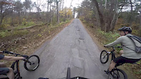
Photos of Merrimack Mountain Bike
Videos of Merrimack Mountain Bike
trail: Grater Woods Trail
2:02 |
10827 |
Nov 12, 2016
trail: Loop
8:02 |
149 |
Dec 5, 2015
trail: Loop
8:22 |
236 |
Nov 13, 2015
trail: Rocky
4:05 |
272 |
Jul 13, 2014
trail: Rocky
0:49 |
243 |
Jun 25, 2014

trail: Quarry
5:29 |
240 |
Apr 9, 2014

trail: Skyline
6:35 |
67947 |
Nov 7, 2013

trail: Rocky
9:27 |
172 |
Jul 26, 2013
Recent Trail Reports
| status | trail | date | condition | info | user |
|---|---|---|---|---|---|
| Dark Matter | Jun 17, 2026 @ 5:56pm (America/New_York) 1 day | Dry | TQ-6288 | ||
| Northside | May 25, 2026 @ 2:56pm (America/New_York) May 25, 2026 | Variable | SCoves12 | ||
| Plumber Trail | May 25, 2026 @ 2:56pm (America/New_York) May 25, 2026 | Dry | SCoves12 | ||
| Horse Hill Bypass | May 25, 2026 @ 2:56pm (America/New_York) May 25, 2026 | Variable | SCoves12 | ||
| Outer Ledges | May 25, 2026 @ 2:56pm (America/New_York) May 25, 2026 | Dry | SCoves12 | ||
| Blodgett Hill Summit | May 25, 2026 @ 2:56pm (America/New_York) May 25, 2026 | Variable | SCoves12 | ||
| Loop Trail Connector | May 25, 2026 @ 2:56pm (America/New_York) May 25, 2026 | Variable | SCoves12 | ||
| School Loop Trail | May 20, 2026 @ 5:53pm (America/New_York) May 20, 2026 | Dry | SCoves12 | ||
| Eagle | May 20, 2026 @ 5:53pm (America/New_York) May 20, 2026 | Dry | SCoves12 | ||
| Brickyard | May 20, 2026 @ 5:53pm (America/New_York) May 20, 2026 | Dry | SCoves12 |
Activity Feed
| username | action | type | title | date |
|---|---|---|---|---|
| TQ-6288 | add | report | activity #97211054 | Jun 17, 2026 @ 2:56pm 1 day |
| TQ-6288 | ridden | trail | activity #97210936 | Jun 17, 2026 @ 2:54pm 1 day |
| KylerW | wishlist | region | activity #97129257 | Jun 16, 2026 @ 12:03pm 2 days |
| JustinNbZWeP | wishlist | trail | activity #96768752 and 2 more | Jun 11, 2026 @ 4:38pm Jun 11, 2026 |
| greenmachinelt | vote | trail | activity #96097879 and 8 more | Jun 2, 2026 @ 11:17am Jun 2, 2026 |
Recent Comments
| username | type | title | comment | date |
|---|---|---|---|---|
| trail | Mellow fun flowy riding, except for a bridge... | May 19, 2026 @ 8:29am May 19, 2026 | ||
| trail | Awesome descent with lots of fun little jumps... | Aug 6, 2025 @ 6:16pm Aug 6, 2025 | ||
| trail | Absolutely great trail, short but a highlight... | Aug 6, 2025 @ 6:15pm Aug 6, 2025 | ||
| trail | Fun for green, wish it were longer | Aug 6, 2025 @ 6:14pm Aug 6, 2025 | ||
| trail | Great tech trail, some fun sections | Aug 6, 2025 @ 6:13pm Aug 6, 2025 |
Local Badges
-

10 Green Trails329 awarded -

10 Blue Trails434 awarded -

Epic Ride Climb 2k1 awarded -

Climbing 10k Badge53 awarded -

Climbing 100k Badge1 awarded -

Epic Ride Descent 2k2 awarded
Activity Type Stats
| activitytype | trails | distance | descent | descent distance | total vertical | rating | global rank | state rank | photos | reports | routes | ridelogs |
|---|---|---|---|---|---|---|---|---|---|---|---|---|
| Mountain Bike | 103 | 49 miles | 5,820 ft | 19 miles | 348 ft | #982 | #388 | 105 | 747 | 7 | 16,500 | |
| E-Bike | 73 | 39 miles | 4,944 ft | 16 miles | 325 ft | #3,013 | #1,116 | 663 | 1 | 588 | ||
| Hike | 92 | 40 miles | 5,144 ft | 16 miles | 348 ft | #4,259 | #1,497 | 739 | 1 | 2,052 | ||
| Trail Running | 92 | 40 miles | 5,144 ft | 16 miles | 348 ft | #4,185 | #1,275 | 739 | 296 | |||
| Snowshoe | 5 | 3 miles | 223 ft | 1 mile | 69 ft | #1,001 | #494 | 8 | 78 | |||
| Nordic Ski | 5 | 3 miles | 223 ft | 1 mile | 69 ft | #1,726 | #888 | 8 | 25 |
Frequently Asked Questions About Merrimack
▼
What are the best places to ride in Merrimack?
Merrimack has 4 areas to explore for mountain biking. The top rated areas are:
▼
What are the highest rated mountain biking trails in Merrimack?
The highest rated mountain biking trails in Merrimack are:
- Outer Ledges (4.4/5)
- Skyline (4.3/5)
- QBP Trail (4.1/5)
- Plumber Trail (4.1/5)
- Fat Cat Trail (4.1/5)
▼
What is the best time of the year to ride in Merrimack?
Based on ride log data, the most popular months to ride in Merrimack are:
- May (299 activities)
- June (291 activities)
- July (275 activities)
▼
Where can I park to ride in Merrimack?
There are 7 parking locations listed in Merrimack. The most popular parking spots are:
- Parking
- Grater Road Parking
- Wasserman Conservation Area parking
- Grater Woods Main Parking
- Beebe Lane Parking
Activities
Trails
Points of Interest
- By StephaneMarceau
 TRAILFORKS & contributors
 - Admins: SNH NEMBA, SNH NEMBA
- #16795 - 5,873 views
- merrimack activity log | embed map of Merrimack mountain bike trails | merrimack mountain biking points of interest polygons
Downloading of trail gps tracks in kml & gpx formats is enabled for Merrimack.
You must login to download files.