close
-
Layers w
- Weather Layers
- Pro
- Pro
- Pro
- Pro
- Pro
- Pro
- More Layers
- Pro
- Pro
- Pro
- Pro
-
Upgrade to

3D
Trail Conditions
- Unknown
- Snow Groomed
- Snow Packed
- Snow Covered
- Snow Cover Partial
- Freeze/thaw Cycle
- Icy
- Prevalent Mud
- Wet
- Variable
- Ideal
- Dry
- Very Dry
Trail Flow (Ridden Direction)
Trailforks scans users ridelogs to determine the most popular direction each trail is ridden. A good flowing trail network will have most trails flowing in a single direction according to their intension.
The colour categories are based on what percentage of riders are riding a trail in its intended direction.
The colour categories are based on what percentage of riders are riding a trail in its intended direction.
- > 96%
- > 90%
- > 80%
- > 70%
- > 50%
- < 50%
- bi-directional trail
- no data
Trail Last Ridden
Trailforks scans ridelogs to determine the last time a trail was ridden.
- < 2 days
- < 1 week
- < 2 weeks
- < 1 month
- < 6 months
- > 6 months
Trail Ridden Direction
The intended direction a trail should be ridden.
- Downhill Only
- Downhill Primary
- Both Directions
- Uphill Primary
- Uphill Only
- One Direction
Contribute Details
Colors indicate trail is missing specified detail.
- Description
- Photos
- Description & Photos
- Videos
Trail Popularity ?
Trailforks scans ridelogs to determine which trails are ridden the most in the last 9 months.
Trails are compared with nearby trails in the same city region with a possible 25 colour shades.
Think of this as a heatmap, more rides = more kinetic energy = warmer colors.
- most popular
- popular
- less popular
- not popular
ATV/ORV/OHV Filter
Max Vehicle Width
inches
US Cell Coverage
Legend

Radar Time
Activity Recordings
Trailforks uses anonymized public activity data.
?
Activity Recordings
Trailforks uses anonymized public activity data.
?
Personal Heatmap
▶
Activity Types
all
/
none
▶
Options
2
Date range
month
–
Winter Trails
Warning
A routing network for winter maps does not exist. Selecting trails using the winter trails layer has been disabled.
Missing Trails
Most Popular
Least Popular
Trails are colored based on popularity. The more popular a trail is, the more red. Less popular trails trend towards green.
Jump Magnitude Heatmap
Heatmap of where riders jump on trails. Zoom in to see individual jumps, click circles to view jump details.
BC Backroad Status
![map legend]()
Service Road Atlas is a free to use, community-driven service for viewing and creating reports on the numerous back-country service roads around B.C. and Alberta.

Slope Aspect
Direction the slope faces
Trails Deemphasized
Trails are shown in grey.
Only show trails with no bike usage.
Suggested Layers
Based on selected activity type
Save the current map location and zoom level as your default home location whenever this page is loaded.
Save
No description for Mervelier has been added yet!
Login or register to submit one.
This region uses the Uk/Euro style trail grading system.
Activities Click to view
- Mountain Bike
8 trails
- E-Bike
3 trails
- Hike
3 trails
- Trail Running
3 trails
Region Details
- 3
- 1
- 3
- 1
Region Status
Caution as of Nov 15, 2025Stats
- Avg Trail Rating
- Trails (view details)
- 8
- Trails Mountain Bike
- 8
- Trails E-Bike
- 3
- Trails Hike
- 3
- Trails Trail Running
- 3
- Total Distance
- 10 miles
- Total Descent Distance
- 5 miles
- Total Descent
- 5,133 ft
- Total Vertical
- 1,337 ft
- Highest Trailhead
- 3,279 ft
- Reports
- 91
- Photos
- 20
- Ridden Counter
- 929
Sub Regions
-
Mervelier
- 1
- 3
- 1
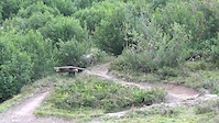
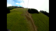
Popular Mervelier Mountain Biking Trails
• 80 ★ 4.9 • 1 mile • 74 ft • 145 •
Highly rated popular red difficulty singletrack. This mountain bike primary trail can be used downhill only. It features berm, drop, jump and gap jump. Trail visibility is always easy to follow. On average it takes 30 minutes to complete this trail.
• 35 ★ 4.9 • 4,301 ft • 0 ft • 112 •
Highly rated less popular red difficulty singletrack. This mountain bike primary trail can be used downhill only. It features berm and jump. Trail visibility is always easy to follow. On average it takes 11 minutes to complete this trail.
• 45 ★ 4.7 • 2,772 ft • 0 ft • 109 •
Highly rated moderately popular red difficulty singletrack. This mountain bike primary trail can be used downhill only with a 0 ft green climb. It features berm. Trail visibility is always easy to follow. On average it takes 11 minutes to complete this trail.
• 25 ★ 5.0 • 1,854 ft • 0 ft • 64 •
Less popular black difficulty wilderness trail. This mountain bike primary trail can be used downhill only. Trail visibility is always easy to follow. On average it takes 25 minutes to complete this trail.
• 15 ★ 4.5 • 1 mile • 33 ft • 61 •
Highly rated less popular black difficulty singletrack. This mountain bike primary trail can be used downhill only. It features berm, drop, jump and rock garden. Trail visibility is always easy to follow. On average it takes 24 minutes to complete this trail.
• 90 ★ 0.0 • 974 ft • 0 ft • 25 • • hike
Popular blue difficulty singletrack. This hike primary trail.
Mervelier Mountain Bike Routes
Photos of Mervelier Mountain Bike
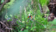
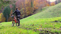
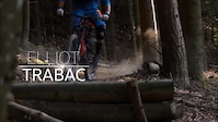
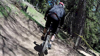
Videos of Mervelier Mountain Bike
trail: Le Tchaitelat
0:15 |
316 |
Feb 14, 2022
trail: La Chère Bien
0:47 |
585 |
Nov 16, 2020
trail: Le Tchaitelat
2:14 |
677 |
Apr 3, 2020
trail: Guy
0:30 |
375 |
Jun 28, 2015
trail: Guy
3:12 |
331 |
Dec 2, 2014
trail: Guy
0:32 |
1104 |
Aug 8, 2014
trail: Guy
0:15 |
161 |
Jun 3, 2014

trail: Guy
2:12 |
473 |
Feb 15, 2013
Recent Trail Reports
| status | trail | date | condition | info | user |
|---|---|---|---|---|---|
| La Chère Bien | Nov 15, 2025 @ 9:48pm (Europe/Zurich) Nov 15, 2025 | Unknown | colinski2244 | ||
| Delirium | Nov 13, 2025 @ 12:30pm (Europe/Zurich) Nov 13, 2025 | Unknown | Pietho | ||
| Le Tchaitelat | May 1, 2025 @ 2:10pm May 1, 2025 | Ideal | trailpapst TRAILFORKS | ||
| Guy | May 1, 2025 @ 2:10pm May 1, 2025 | Ideal | trailpapst TRAILFORKS | ||
| Simsalabim | Jan 25, 2025 @ 7:29am Jan 25, 2025 | Dry | necatr | ||
| Access Guy | Apr 13, 2024 @ 1:42am Apr 13, 2024 | Ideal | dabu22 | ||
| Uphill Grandmont | Apr 13, 2024 @ 1:42am Apr 13, 2024 | Ideal | dabu22 | ||
| Uphill South | Apr 13, 2024 @ 1:42am Apr 13, 2024 | Ideal | dabu22 |
Activity Feed
| username | action | type | title | date |
|---|---|---|---|---|
| JOSHARVEY21 | wishlist | trail | activity #96791865 | Jun 12, 2026 @ 3:11am Jun 12, 2026 |
| Gabester1989 | vote | trail | activity #95519729 | May 25, 2026 @ 1:38pm May 25, 2026 |
| Gabester1989 | ridden | trail | activity #95519725 | May 25, 2026 @ 1:38pm May 25, 2026 |
| Vera01 | ridden | trail | activity #95436717 | May 24, 2026 @ 12:37pm May 24, 2026 |
| shikane | wishlist | trail | activity #95183998 and 6 more | May 21, 2026 @ 10:12am May 21, 2026 |
Recent Comments
| username | type | title | comment | date |
|---|---|---|---|---|
| trail | insanely nice trail. kudos to the builder! | Jun 21, 2025 @ 12:17pm Jun 21, 2025 | ||
| trail | Super trail, in top condition. Totally at and... | May 1, 2025 @ 11:21am May 1, 2025 | ||
| trail | Super trail, in top condition. Thanks to the... | May 1, 2025 @ 11:20am May 1, 2025 | ||
| trail | Mega trail, jetzt gerade recht schlammig | Apr 30, 2024 @ 11:14pm Apr 30, 2024 | ||
| trail | "THE" trail of mervelier. It's a real double... | Oct 10, 2023 @ 3:40am Oct 10, 2023 |
Bike & Skill Parks
| name | type | city | rating |
|---|---|---|---|
| Bike Park Juride | skill park | Mervelier |
Activity Type Stats
| activitytype | trails | distance | descent | descent distance | total vertical | rating | global rank | state rank | photos | reports | routes | ridelogs |
|---|---|---|---|---|---|---|---|---|---|---|---|---|
| Mountain Bike | 8 | 10 miles | 5,131 ft | 5 miles | 1,339 ft | #2,909 | #39 | 20 | 91 | 1 | 693 | |
| E-Bike | 3 | 5 miles | 184 ft | 3,983 ft | 1,161 ft | #3,805 | #152 | 49 | 53 | |||
| Hike | 3 | 5 miles | 184 ft | 3,983 ft | 1,161 ft | #6,040 | #153 | 52 | 32 | |||
| Trail Running | 3 | 5 miles | 184 ft | 3,983 ft | 1,161 ft | #5,547 | #135 | 52 |
Frequently Asked Questions About Mervelier
▼
What are the best places to ride in Mervelier?
Mervelier has 1 areas to explore for mountain biking. The top rated areas are:
▼
What are the highest rated mountain biking trails in Mervelier?
The highest rated mountain biking trails in Mervelier are:
- Le Tchaitelat (4.6/5)
- Simsalabim (4.5/5)
- Guy (4.4/5)
- La Chère Bien (4.2/5)
- Delirium (4.2/5)
▼
What is the best time of the year to ride in Mervelier?
Based on ride log data, the most popular months to ride in Mervelier are:
- April (5 activities)
- June (4 activities)
- May (4 activities)
▼
Where can I park to ride in Mervelier?
There are 1 parking locations listed in Mervelier. The most popular parking spots are:
- By cgiffordmiears
 & contributors
 - Admins: apply
- #19637 - 7,673 views
- mervelier activity log | embed map of Mervelier mountain bike trails | mervelier mountain biking points of interest
Downloading of trail gps tracks in kml & gpx formats is enabled for Mervelier.
You must login to download files.