close
-
Layers w
- Weather Layers
- Pro
- Pro
- Pro
- Pro
- Pro
- Pro
- More Layers
- Pro
- Pro
- Pro
- Pro
-
Upgrade to

3D
Trail Conditions
- Unknown
- Snow Groomed
- Snow Packed
- Snow Covered
- Snow Cover Partial
- Freeze/thaw Cycle
- Icy
- Prevalent Mud
- Wet
- Variable
- Ideal
- Dry
- Very Dry
Trail Flow (Ridden Direction)
Trailforks scans users ridelogs to determine the most popular direction each trail is ridden. A good flowing trail network will have most trails flowing in a single direction according to their intension.
The colour categories are based on what percentage of riders are riding a trail in its intended direction.
The colour categories are based on what percentage of riders are riding a trail in its intended direction.
- > 96%
- > 90%
- > 80%
- > 70%
- > 50%
- < 50%
- bi-directional trail
- no data
Trail Last Ridden
Trailforks scans ridelogs to determine the last time a trail was ridden.
- < 2 days
- < 1 week
- < 2 weeks
- < 1 month
- < 6 months
- > 6 months
Trail Ridden Direction
The intended direction a trail should be ridden.
- Downhill Only
- Downhill Primary
- Both Directions
- Uphill Primary
- Uphill Only
- One Direction
Contribute Details
Colors indicate trail is missing specified detail.
- Description
- Photos
- Description & Photos
- Videos
Trail Popularity ?
Trailforks scans ridelogs to determine which trails are ridden the most in the last 9 months.
Trails are compared with nearby trails in the same city region with a possible 25 colour shades.
Think of this as a heatmap, more rides = more kinetic energy = warmer colors.
- most popular
- popular
- less popular
- not popular
ATV/ORV/OHV Filter
Max Vehicle Width
inches
US Cell Coverage
Legend

Radar Time
Activity Recordings
Trailforks uses anonymized public activity data.
?
Activity Recordings
Trailforks uses anonymized public activity data.
?
Personal Heatmap
▶
Activity Types
all
/
none
▶
Options
2
Date range
month
–
Winter Trails
Warning
A routing network for winter maps does not exist. Selecting trails using the winter trails layer has been disabled.
Missing Trails
Most Popular
Least Popular
Trails are colored based on popularity. The more popular a trail is, the more red. Less popular trails trend towards green.
Jump Magnitude Heatmap
Heatmap of where riders jump on trails. Zoom in to see individual jumps, click circles to view jump details.
BC Backroad Status
![map legend]()
Service Road Atlas is a free to use, community-driven service for viewing and creating reports on the numerous back-country service roads around B.C. and Alberta.

Slope Aspect
Direction the slope faces
Trails Deemphasized
Trails are shown in grey.
Only show trails with no bike usage.
Suggested Layers
Based on selected activity type
Save the current map location and zoom level as your default home location whenever this page is loaded.
Save
No description for Meyers has been added yet!
Login or register to submit one.
Activities Click to view
- Mountain Bike
117 trails
- E-Bike
33 trails
- Gravel Bike
1 trails
- Adaptive Bike
0 trails
- Horse
86 trails
- Hike
122 trails
- Trail Running
122 trails
Region Details
- 18
- 4
- 41
- 19
- 9
- 3
Region Status
Closed as of Jun 8, 2026Stats
- Avg Trail Rating
- Trails (view details)
- 97
- Trails Mountain Bike
- 117
- Trails E-Bike
- 33
- Trails Gravel Bike
- 1
- Trails Winter Fat Bike
- 1
- Trails Horse
- 86
- Trails Hike
- 122
- Trails Trail Running
- 122
- Total Distance
- 91 miles
- Total Descent
- 13,905 ft
- Total Vertical
- 2,718 ft
- Highest Trailhead
- 8,988 ft
- Reports
- 606
- Photos
- 354
- Ridden Counter
- 14,033
Sub Regions
-
Angora Ridge
- 1
- 3
- 1
- 2
-
Gunmount
- 10
-
Meiss Country
- 6
- 8
- 1
-
Meyers Urban Trails
- 4
- 28
- 10
-
Washoe Meadows State Park
- 2
Popular Meyers Mountain Biking Trails
• 100 ★ 4.7 • 4 miles • 32 ft • 977 •
This is a quintessential Tahoe trail--rocky, periodically technical, and remote. The trail gets its name from the adjacent residential community and parallels a branch of the Upper Truckee River through mature pine forest except for a...
• 20 ★ 3.7 • 2 miles • 563 ft • 874 •
This section of the TRT winds through Big Meadow and then climbs steeply to meet the head. Not very technical aside from a couple of short step sections that are easier to push than ride up.
• 90 ★ 3.6 • 2,434 ft • 251 ft • 830 •
Short but very technical section of the TRT connecting CA 89 to Big Meadow. Tough ride down, and better pushed than ridden up.
• 90 ★ 3.8 • 2 miles • 587 ft • 800 •
This trail was completed in August 2017 and still a bit raw in places. It was funded by the Tahoe Area Mountain Biking Association and built in partnership with the US Forest Service and many volunteers. The trail sits on a rocky...
• 100 ★ 4.4 • 2 miles • 0 ft • 776 •
Trail completed in September 2017 by the Tahoe Area Mountain Biking Association in partnership with the US Forest Service. The trail connects the Gun Mount Trail and neighborborhood by North Upper Truckee to the top of Angora Ridge. It...
• 95 ★ 4.0 • 1 mile • 62 ft • 593 •
The upper section of the Angora Ridge Trail parallels Road to the east and ends at the Angora Lakes parking lot. This narrow trail has no sustained climbing and great views of Lake Valley to the east. However, the trail navigates...
• 100 ★ 5.0 • 2 miles • 113 ft • 466 •
Popular white difficulty family friendly paved path. This multi-use trail can be used both directions and has a easy overall physical rating with a 113 ft green climb. Trail visibility is always easy to follow. On average it takes 7 minutes to complete this trail.
Meyers Mountain Bike Routes
TAMBA: Paradise Loop Featured
★ 4.0 • 11 miles • 816 ft • 15 • Loop •
The Paradise Loop is a fun new intermediate loop for the Tahoe Mountain Bike Festival. It is 11 miles long...
★ 2.5 • 25 miles • 4,292 ft • 17 • Loop •
Tracing the TAMBA Triple Crown with an opt-out of Mr. Toads. Brings you around Freel Meadows and down...
★ 3.2 • 25 miles • 4,762 ft • 25 • Loop •
The Tahoe Mountain Bike Festival’s signature ride starts with a “Triple Crown Ride” covering 30+...
9 miles • 1,506 ft • 4 • Loop •
Nice challenging fire road climb followed by downhill sections on some Tahoe classics. Loop originally...
34 miles • 5,128 ft • 16 • Loop •
The Tahoe Mountain Bike Festival’s signature ride starts with a “Triple Crown Ride” covering 30+...
Photos of Meyers Mountain Bike
Videos of Meyers Mountain Bike
trail: Lily Lake Trail
3:14 |
25 |
Feb 2, 2024

trail: Mule Deer Connector Trail
4:43 |
8 |
Feb 15, 2022
trail: Dardanelles Trail
2:21 |
51 |
Aug 28, 2025 , Meyers
youtuber
![Hawley Grade / South Lake Tahoe, CA / MTB]()
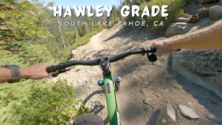
trail: Hawley Grade Trail
6:36 |
83 |
Aug 21, 2025 , Meyers
youtuber
![Clark / South Lake Tahoe, CA / MTB]()
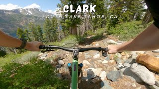
trail: Clark Trail
5:21 |
106 |
Jul 13, 2025 , Meyers
youtuber
![Christmas Valley Trail (2021) / Meyers | South...]()
trail: Hawley Grade Trail
23:07 |
54 |
Nov 20, 2021 , Meyers
youtuber
![Christmas Valley Trail (2022) / Lake Tahoe / MTB]()
trail: Christmas Valley Trail
19:35 |
94 |
Sep 22, 2022 , Meyers
youtuber
![Christmas Valley Trail / Lake Tahoe, CA / MTB]()
trail: Christmas Valley Trail
13:28 |
81 |
Aug 29, 2023 , Meyers
Recent Trail Reports
Activity Feed
| username | action | type | title | date |
|---|---|---|---|---|
| nate36coats | wishlist | route | activity #97578902 | Jun 22, 2026 @ 12:30pm 13 hours |
| jctahoemtb | ridden | route | activity #97550746 | Jun 22, 2026 @ 3:11am 22 hours |
| chadrcox | vote | route | activity #97541086 | Jun 21, 2026 @ 8:49pm 1 day |
| CarriexfEf33 | rsvp | event | activity #97486274 | Jun 21, 2026 @ 8:11am 2 days |
| paulengr9pec | wishlist | route | activity #97483327 | Jun 21, 2026 @ 7:36am 2 days |
Recent Comments
| username | type | title | comment | date |
|---|---|---|---|---|
| trail | I rode this in the downhill direction. In my... | May 25, 2026 @ 9:57pm May 25, 2026 | ||
| trail | Good gradual climb. Ran into a stump on the... | May 7, 2026 @ 2:55pm May 7, 2026 | ||
| trail | E-bikes, all classes, are prohibited above the... | Mar 17, 2026 @ 12:42pm Mar 17, 2026 | ||
| trail | Really well done, but definitely never ending... | Oct 8, 2025 @ 10:48pm Oct 8, 2025 | ||
| trail | Having ridden many Tahoe trails over the past... | Oct 8, 2025 @ 10:46pm Oct 8, 2025 |
Local Badges
-

Completionist0 awarded -

10 Blue Trails42 awarded -

10 Green Trails66 awarded -

Epic Mountain Bike Climb 2k10 awarded -

Climbing 10k Badge9 awarded -

Mountain Biking 100k Badge0 awarded
Activity Type Stats
| activitytype | trails | distance | descent | descent distance | total vertical | rating | global rank | state rank | photos | reports | routes | ridelogs |
|---|---|---|---|---|---|---|---|---|---|---|---|---|
| Mountain Bike | 117 | 76 miles | 10,636 ft | 30 miles | 2,201 ft | #1,548 | #581 | 328 | 606 | 16 | 6,545 | |
| E-Bike | 33 | 11 miles | 1,463 ft | 5 miles | 2,510 ft | #4,964 | #1,555 | 9 | 428 | 3 | 550 | |
| Gravel Bike | 1 | #701 | #1,210 | 1 | 1 | 14 | ||||||
| Winter Fat Bike | 1 | #866 | #473 | 2 | 2 | |||||||
| Horse | 86 | 63 miles | 11,444 ft | 32 miles | 2,720 ft | #831 | #599 | 327 | ||||
| Hike | 122 | 91 miles | 13,904 ft | 38 miles | 2,720 ft | #1,389 | #636 | 15 | 606 | 25 | 2,141 | |
| Trail Running | 122 | 91 miles | 13,904 ft | 38 miles | 2,720 ft | #1,859 | #615 | 1 | 606 | 12 | 1,075 |
Frequently Asked Questions About Meyers
▼
What are the best places to ride in Meyers?
Meyers has 5 areas to explore for mountain biking. The top rated areas are:
▼
What are the highest rated mountain biking trails in Meyers?
The highest rated mountain biking trails in Meyers are:
- Christmas Valley Trail (4.6/5)
- Lily Lake Trail (4.5/5)
- Christmas Valley Trail Advanced Alternate 3 (Sunday Slabs) (4.2/5)
- Angora Lake Trail (4.2/5)
- Mule Deer Connector Trail (4.2/5)
▼
What is the best time of the year to ride in Meyers?
Based on ride log data, the most popular months to ride in Meyers are:
- July (148 activities)
- June (127 activities)
- August (69 activities)
▼
Where can I park to ride in Meyers?
There are 5 parking locations listed in Meyers. The most popular parking spots are:
- Christmas Valley Trail Parking
- Big Meadows Parking
- Hawley Grade Lower Parking
- Angora Lake Parking
- Parking
Activities
Trails
- By pedrodelmonte
 & contributors
 - Admins: TheAngryTomato
- #23075 - 6,076 views
- meyers activity log | embed map of Meyers mountain bike trails | meyers mountain biking points of interest
Downloading of trail gps tracks in kml & gpx formats is enabled for Meyers.
You must login to download files.