close
-
Layers w
- Weather Layers
- Pro
- Pro
- Pro
- Pro
- Pro
- Pro
- More Layers
- Pro
- Pro
- Pro
- Pro
-
Upgrade to

3D
Trail Conditions
- Unknown
- Snow Groomed
- Snow Packed
- Snow Covered
- Snow Cover Partial
- Freeze/thaw Cycle
- Icy
- Prevalent Mud
- Wet
- Variable
- Ideal
- Dry
- Very Dry
Trail Flow (Ridden Direction)
Trailforks scans users ridelogs to determine the most popular direction each trail is ridden. A good flowing trail network will have most trails flowing in a single direction according to their intension.
The colour categories are based on what percentage of riders are riding a trail in its intended direction.
The colour categories are based on what percentage of riders are riding a trail in its intended direction.
- > 96%
- > 90%
- > 80%
- > 70%
- > 50%
- < 50%
- bi-directional trail
- no data
Trail Last Ridden
Trailforks scans ridelogs to determine the last time a trail was ridden.
- < 2 days
- < 1 week
- < 2 weeks
- < 1 month
- < 6 months
- > 6 months
Trail Ridden Direction
The intended direction a trail should be ridden.
- Downhill Only
- Downhill Primary
- Both Directions
- Uphill Primary
- Uphill Only
- One Direction
Contribute Details
Colors indicate trail is missing specified detail.
- Description
- Photos
- Description & Photos
- Videos
Trail Popularity ?
Trailforks scans ridelogs to determine which trails are ridden the most in the last 9 months.
Trails are compared with nearby trails in the same city region with a possible 25 colour shades.
Think of this as a heatmap, more rides = more kinetic energy = warmer colors.
- most popular
- popular
- less popular
- not popular
ATV/ORV/OHV Filter
Max Vehicle Width
inches
US Cell Coverage
Legend

Radar Time
Activity Recordings
Trailforks uses anonymized public activity data.
?
Activity Recordings
Trailforks uses anonymized public activity data.
?
Personal Heatmap
▶
Activity Types
all
/
none
▶
Options
2
Date range
month
–
Winter Trails
Warning
A routing network for winter maps does not exist. Selecting trails using the winter trails layer has been disabled.
Missing Trails
Most Popular
Least Popular
Trails are colored based on popularity. The more popular a trail is, the more red. Less popular trails trend towards green.
Jump Magnitude Heatmap
Heatmap of where riders jump on trails. Zoom in to see individual jumps, click circles to view jump details.
BC Backroad Status
![map legend]()
Service Road Atlas is a free to use, community-driven service for viewing and creating reports on the numerous back-country service roads around B.C. and Alberta.

Slope Aspect
Direction the slope faces
Trails Deemphasized
Trails are shown in grey.
Only show trails with no bike usage.
Suggested Layers
Based on selected activity type
Save the current map location and zoom level as your default home location whenever this page is loaded.
Save
No description for Midlands Region has been added yet!
Login or register to submit one.
This region uses the Uk/Euro style trail grading system.
Region Details
- 39
- 1
- 37
- 7
- 8
Stats
- Avg Trail Rating
- Trails (view details)
- 100
- Trails Mountain Bike
- 139
- Trails E-Bike
- 70
- Trails Horse
- 3
- Trails Hike
- 65
- Trails Trail Running
- 65
- Total Distance
- 68 miles
- Total Descent
- 12,423 ft
- Total Vertical
- 1,510 ft
- Highest Trailhead
- 1,722 ft
- Reports
- 588
- Photos
- 51
- Ridden Counter
- 6,988
Sub Regions
- Offaly (117)
- Tullamore (26)
- Wicklow (1)
- Slieve Blooms (97)
- Tullamore (26)
- Westmeath (26)
- Ballymanus (23)
- Mullaghmeen Forest (22)
- Ballymanus (23)
Popular Midlands Region Mountain Biking Trails
• 95 ★ 4.0 • 2,703 ft • 8 ft • 212 •
Popular blue difficulty singletrack. This mountain bike primary trail can be used downhill only. It features berm. On average it takes 2 minutes to complete this trail.
• 80 ★ 5.0 • 863 ft • 0 ft • 207 •
Popular blue difficulty singletrack. This mountain bike primary trail can be used downhill primary. On average it takes minutes to complete this trail.
• 90 ★ 4.0 • 4,544 ft • 7 ft • 205 •
Popular blue difficulty singletrack. This mountain bike primary trail can be used downhill only and has a moderate overall physical rating. On average it takes 5 minutes to complete this trail.
• 80 ★ 5.0 • 2 miles • 237 ft • 197 •
Popular red difficulty singletrack. This mountain bike primary trail can be used one direction with a 237 ft blue climb. Trail visibility is always easy to follow. On average it takes 25 minutes to complete this trail.
• 70 ★ 5.0 • 3,455 ft • 32 ft • 177 •
Popular red difficulty singletrack. This mountain bike primary trail can be used downhill only and has a moderate overall physical rating. Trail visibility is always easy to follow. On average it takes 3 minutes to complete this trail.
• 60 ★ 4.0 • 1,496 ft • 37 ft • 172 •
Moderately popular red difficulty singletrack. This mountain bike primary trail can be used downhill only and has a moderate overall physical rating with a 37 ft blue climb. Trail visibility is always easy to follow. On average it takes 1 minutes to complete this trail.
• 55 ★ 4.0 • 2 miles • 193 ft • 157 •
Moderately popular red difficulty singletrack. This mountain bike primary trail can be used downhill only. It features berm, jump and rock garden. Trail visibility is always easy to follow. On average it takes 6 minutes to complete this trail.
• 40 ★ 4.0 • 3,307 ft • 3 ft • 137 •
Moderately popular blue difficulty singletrack. This mountain bike primary trail can be used one direction. It features berm and jump. Trail visibility is always easy to follow. On average it takes 2 minutes to complete this trail.
Midlands Region Mountain Bike Routes
25 miles • 3,669 ft • 13 • Loop •
This is a proposed MTB route in the Slieve Blooms to connect the Kinnitty trails with the Baunreagh...
7 miles • 742 ft • 7 • Loop •
Time: 1:30 - 2 hours This blue grade trail is graded moderate, with numerous difficult sections along the...
19 miles • 2,373 ft • 6 • Loop •
This is a network of purpose-built singletrack trails and forest roads that are designed for use by...
24 miles • 3,108 ft • 12 • Loop •
To be tested, some parts might be unrideable
5 miles • 821 ft • 15 • Loop •
Long loop on Offaly/Kinnitty trailcenter, climb is on access road with a small section of trail on the top.
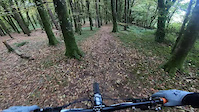
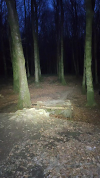
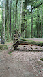
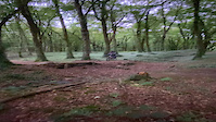
Photos of Midlands Region Mountain Bike
Videos of Midlands Region Mountain Bike
trail: Pinned or Rimmed
0:14 |
65 |
Feb 8, 2023
trail: Pinned or Rimmed
0:11 |
39 |
Jul 22, 2022

trail: Pinned or Rimmed
0:16 |
30 |
Jul 22, 2022
trail: Chewy Louie
0:16 |
172 |
Jul 22, 2022
trail: Pinned or Rimmed
0:05 |
|
Jul 21, 2022
trail: DH1
3:35 |
492 |
Jun 5, 2013
Recent Trail Reports
Activity Feed
| username | action | type | title | date |
|---|---|---|---|---|
| SebastianElY5mm | ridden | trail | activity #91962968 and 2 more | Apr 5, 2026 @ 3:14am Apr 5, 2026 |
| BenTtL8gK | ridden | trail | activity #89828148 | Mar 2, 2026 @ 12:28am Mar 2, 2026 |
| AdrianPluskota | vote | trail | activity #88627075 | Feb 9, 2026 @ 8:06am Feb 9, 2026 |
| MikeWS7KP5 | ridden | route | activity #85312471 | Dec 10, 2025 @ 7:15am Dec 10, 2025 |
| Galoompie | add | report | activity #84903360 | Nov 29, 2025 @ 7:26am Nov 29, 2025 |
Recent Comments
| username | type | title | comment | date |
|---|---|---|---|---|
| report | Not anymore. Trees down | Sep 7, 2025 @ 12:50pm Sep 7, 2025 | ||
| trail | Its not doubletrack this is a black trail... | Mar 9, 2023 @ 7:44am Mar 9, 2023 | ||
| trail | Tricky enough trail with a few rocky descends... | Jul 27, 2022 @ 12:47pm Jul 27, 2022 | ||
| trail | Great trail with some interesting but easy... | Jul 25, 2022 @ 12:55pm Jul 25, 2022 | ||
| report | I miss the gap jump! | Oct 22, 2021 @ 4:58am Oct 22, 2021 |
Local Badges
-

Big Ride 30k94 awarded -

Descent 10k Badge7 awarded -
Descent 10k Badge0 awarded -

Descent 100k Badge0 awarded -
Descent 100k Badge0 awarded -

Epic Ride 50k39 awarded
Local Mountain Biking Directory
-
Mbw TullamoreBike Shop
Local Trail Supporters
- Coillte
Activity Type Stats
| activitytype | trails | distance | descent | descent distance | total vertical | rating | global rank | state rank | photos | reports | routes | ridelogs |
|---|---|---|---|---|---|---|---|---|---|---|---|---|
| Mountain Bike | 138 | 65 miles | 12,290 ft | 37 miles | 1,276 ft | 49 | 595 | 8 | 5,837 | |||
| E-Bike | 70 | 26 miles | 5,305 ft | 15 miles | 1,276 ft | 578 | 4 | 460 | ||||
| Horse | 3 | 3 miles | 617 ft | 3 miles | 443 ft | |||||||
| Hike | 65 | 40 miles | 5,358 ft | 20 miles | 1,509 ft | 2 | 572 | 173 | ||||
| Trail Running | 65 | 40 miles | 5,358 ft | 20 miles | 1,509 ft | 572 | 111 |
Activities
- By brenthillier
 NSMBA TRAILFORKS & contributors
 - Admins: elyari
- #8100 - 2,862 views
- midlands region activity log | embed map of Midlands Region mountain bike trails | midlands region mountain biking points of interest
Downloading of trail gps tracks in kml & gpx formats is enabled for Midlands Region.
You must login to download files.