close
-
Layers w
- Weather Layers
- Pro
- Pro
- Pro
- Pro
- Pro
- Pro
- More Layers
- Pro
- Pro
- Pro
- Pro
-
Upgrade to

3D
Trail Conditions
- Unknown
- Snow Groomed
- Snow Packed
- Snow Covered
- Snow Cover Partial
- Freeze/thaw Cycle
- Icy
- Prevalent Mud
- Wet
- Variable
- Ideal
- Dry
- Very Dry
Trail Flow (Ridden Direction)
Trailforks scans users ridelogs to determine the most popular direction each trail is ridden. A good flowing trail network will have most trails flowing in a single direction according to their intension.
The colour categories are based on what percentage of riders are riding a trail in its intended direction.
The colour categories are based on what percentage of riders are riding a trail in its intended direction.
- > 96%
- > 90%
- > 80%
- > 70%
- > 50%
- < 50%
- bi-directional trail
- no data
Trail Last Ridden
Trailforks scans ridelogs to determine the last time a trail was ridden.
- < 2 days
- < 1 week
- < 2 weeks
- < 1 month
- < 6 months
- > 6 months
Trail Ridden Direction
The intended direction a trail should be ridden.
- Downhill Only
- Downhill Primary
- Both Directions
- Uphill Primary
- Uphill Only
- One Direction
Contribute Details
Colors indicate trail is missing specified detail.
- Description
- Photos
- Description & Photos
- Videos
Trail Popularity ?
Trailforks scans ridelogs to determine which trails are ridden the most in the last 9 months.
Trails are compared with nearby trails in the same city region with a possible 25 colour shades.
Think of this as a heatmap, more rides = more kinetic energy = warmer colors.
- most popular
- popular
- less popular
- not popular
ATV/ORV/OHV Filter
Max Vehicle Width
inches
US Cell Coverage
Legend

Radar Time
Activity Recordings
Trailforks uses anonymized public activity data.
?
Activity Recordings
Trailforks uses anonymized public activity data.
?
Personal Heatmap
▶
Activity Types
all
/
none
▶
Options
2
Date range
month
–
Winter Trails
Warning
A routing network for winter maps does not exist. Selecting trails using the winter trails layer has been disabled.
Missing Trails
Most Popular
Least Popular
Trails are colored based on popularity. The more popular a trail is, the more red. Less popular trails trend towards green.
Jump Magnitude Heatmap
Heatmap of where riders jump on trails. Zoom in to see individual jumps, click circles to view jump details.
BC Backroad Status
![map legend]()
Service Road Atlas is a free to use, community-driven service for viewing and creating reports on the numerous back-country service roads around B.C. and Alberta.

Slope Aspect
Direction the slope faces
Trails Deemphasized
Trails are shown in grey.
Only show trails with no bike usage.
Suggested Layers
Based on selected activity type
Save the current map location and zoom level as your default home location whenever this page is loaded.
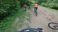
SaveMill Mountain is a mountain just outside of downtown in Roanoke, VA that includes a wide-range of hiking and mountain biking trails. Many of the original trails are "old-school" multi-use mountain bike trails, but recent trail expansion has included building a number of mountain-bike-optimized trails, including a "downhill hub" with green, blue, and black jump lines.
Primary Trail Type: Cross-Country
eBikes Allowed:
Yes
Land Status: City Managed
 google parking directions
IMBA Ride Center

Virginia's Blue Ridge
Activities Click to view
- Mountain Bike
28 trails
- E-Bike
24 trails
- Hike
35 trails
- Trail Running
35 trails
Region Details
- 5
- 8
- 14
- 1
Region Status
Caution as of 2 daysStats
- Avg Trail Rating
- Trails (view details)
- 37
- Trails Mountain Bike
- 29
- Trails E-Bike
- 24
- Trails Gravel Bike
- 7
- Trails Adaptive Bike
- 1
- Trails Horse
- 1
- Trails Hike
- 35
- Trails Trail Running
- 35
- Total Distance
- 37 miles
- Total Descent Distance
- 17 miles
- Total Descent
- 5,323 ft
- Total Vertical
- 1,282 ft
- Highest Trailhead
- 2,177 ft
- Reports
- 400
- Photos
- 26
- Ridden Counter
- 4,562
Popular Mill Mountain Mountain Biking Trails
• 100 ★ 3.4 • 3,009 ft • 239 ft • 349 •
is a multi-directional singletrack trail on Mill Mountain. It features a number of natural flat and bermed turns as it switchbacks down (or up) the mountain. It is an intermediate trail, with natural trail features (roots and rocks)...
• 75 ★ 4.2 • 2 miles • 92 ft • 322 •
is a singletrack trail that descends from the "big bikes" on Mill Mountain Parkway to the "old road." It can be ridden in either direction, and features some high-speed bench cut sections (when descending) and several areas with loose...
• 85 ★ 4.0 • 1,470 ft • 82 ft • 300 •
The -Woodthrush connector is a fun, flowy singletrack trail that connects the Parking area with Lower Woodthrush. Note: The trail surface is primarily clay, so holds moisture after a rain.
• 70 ★ 4.0 • 2 miles • 349 ft • 283 •
Woodthrush is a singletrack trail that traverses across Mill Mountain. It is bi-directional and often used as a connector to access other trails.
• 90 ★ 4.0 • 2,064 ft • 0 ft • 281 •
is a technical intermediate trail that has numerous natural rock features to navigate along a narrow bench cut. It can be ridden in either direction.
• 85 ★ 5.0 • 1,716 ft • 120 ft • 281 •
is an intermediate singletrack trail connecting to the 4-way intersection across from the "Big Bikes" on the Mill Mountain Parkway. It is primarily benchcut trail with natural roots and rocks.
• 95 ★ 4.3 • 4,478 ft • 144 ft • 236 •
is a fun "lollipop" trail loop that is most often ridden in the clockwise direction. It features a fun descent with natural rock and root features, then a climb back up to the start.
• 70 ★ 5.0 • 3,789 ft • 46 ft • 227 •
is a fun singletrack trail that traverses the side of Mill Mountain from the "old road" across towards (to continue climbing up the mountain) or the Sherwood Forest neighborhood.
Mill Mountain Mountain Bike Routes
7 miles • 1,467 ft • 6 • Race •
The course starts at the Riverland Road parking lot at the base of the mountain. Cruise up the gravel road...
7 miles • 1,286 ft • 8 • Race •
DISCO IS BACK! Wednesday night disco will have 2 nights may 13th and may 27th
Videos of Mill Mountain Mountain Bike
trail: Wood Thrush
0:21 |
180 |
Jul 29, 2022
trail: Monument
5:10 |
322 |
Jul 10, 2016
trail: Monument
2:52 |
173 |
Oct 20, 2013
trail: Monument
4:30 |
140 |
Oct 20, 2013
Current Trail Warnings
| status | trail | date | condition | user | info |
|---|---|---|---|---|---|
| Yellow Jacket | Jun 20, 2026 @ 3:11pm (America/New_York) 2 days | Unknown | bikespoke95 | ||
| Wood Thrush | Jun 14, 2026 @ 12:36pm (America/New_York) Jun 14, 2026 | Ideal | NGinipro | Large tree down across trail, blocking... |
Recent Trail Reports
| status | trail | date | condition | info | user |
|---|---|---|---|---|---|
| Star/ Woods Thrush Connector | Jun 4, 2026 @ 10:53am (America/New_York) Jun 4, 2026 | Variable | abi-ridefierce RMBA | ||
| Ridgeline | May 27, 2026 @ 8:18am (America/New_York) May 27, 2026 | Wet | mtennant78 | ||
| Revercomb Way | May 25, 2026 @ 9:50am (America/New_York) May 25, 2026 | Wet | abi-ridefierce RMBA | ||
| Happy Camper | May 25, 2026 @ 9:49am (America/New_York) May 25, 2026 | Wet | abi-ridefierce RMBA | ||
| Bloodroot | May 7, 2026 @ 4:54pm (America/Kentucky/Monticello) May 7, 2026 | Ideal | abi-ridefierce RMBA | ||
| Stoke City | May 7, 2026 @ 4:54pm (America/Kentucky/Monticello) May 7, 2026 | Dry | abi-ridefierce RMBA | ||
| 611 | May 7, 2026 @ 4:54pm (America/Kentucky/Monticello) May 7, 2026 | Ideal | abi-ridefierce RMBA | ||
| Titmouse | May 7, 2026 @ 4:54pm (America/Kentucky/Monticello) May 7, 2026 | Ideal | abi-ridefierce RMBA | ||
| Fern Park Trail | Apr 28, 2026 @ 2:56pm (America/Kentucky/Monticello) Apr 28, 2026 | Ideal | abi-ridefierce RMBA | ||
| Tinker Creek Greenway | Apr 20, 2026 @ 12:38am (America/New_York) Apr 19, 2026 | Unknown | MaxwellAMooney |
Activity Feed
| username | action | type | title | date |
|---|---|---|---|---|
| bikespoke95 | add | report | activity #97421283 | Jun 20, 2026 @ 12:11pm 2 days |
| Pkovo1 | ridden | route | activity #97173189 | Jun 17, 2026 @ 4:17am Jun 17, 2026 |
| NGinipro | add | report | activity #96979017 | Jun 14, 2026 @ 9:39am Jun 14, 2026 |
| Wesfishes | wishlist | route | activity #96889111 | Jun 13, 2026 @ 9:44am Jun 13, 2026 |
| nicholas9219 | ridden | trail | activity #96740842 and 3 more | Jun 11, 2026 @ 8:51am Jun 11, 2026 |
Recent Comments
| username | type | title | comment | date |
|---|---|---|---|---|
| report | Tree cleared | Jun 3, 2026 @ 9:14am Jun 3, 2026 | ||
| trail | Jumps mostly flow reasonably well. High speed... | Mar 12, 2026 @ 9:55am Mar 12, 2026 | ||
| trail | Not really a jump trail, more of a scaled down... | Mar 12, 2026 @ 9:50am Mar 12, 2026 |
Nearby Areas
| name | distance | ||||
|---|---|---|---|---|---|
| Morningside Park | 1 | 1 | 1.2 km | ||
| Wasena Park | 2.1 km | ||||
| Murray Run | 7 | 2.6 km | |||
| Explore Park Trail System | 7 | 10 | 1 | 4.7 km | |
| Read Mountain | 3 | 1 | 6.8 km |
Local Badges
-

Completionist0 awarded
Activity Type Stats
| activitytype | trails | distance | descent | descent distance | total vertical | rating | global rank | state rank | photos | reports | routes | ridelogs |
|---|---|---|---|---|---|---|---|---|---|---|---|---|
| Mountain Bike | 28 | 30 miles | 3,802 ft | 13 miles | 843 ft | #2,838 | #983 | 24 | 400 | 3 | 10,642 | |
| E-Bike | 24 | 24 miles | 2,822 ft | 10 miles | 843 ft | #4,311 | #1,210 | 389 | 1 | 1,010 | ||
| Gravel Bike | 7 | 13 miles | 554 ft | 4 miles | 843 ft | #1,534 | #822 | 21 | 96 | |||
| Adaptive Bike | 1 | 7 miles | 138 ft | 2 miles | 85 ft | #1,537 | #822 | 6 | ||||
| Horse | 1 | 4 miles | 682 ft | 2 miles | 407 ft | 71 | ||||||
| Hike | 35 | 35 miles | 4,606 ft | 15 miles | 1,283 ft | #5,357 | #1,926 | 2 | 398 | 348 | ||
| Trail Running | 35 | 35 miles | 4,606 ft | 15 miles | 1,283 ft | #4,773 | #1,394 | 398 | 758 |
Frequently Asked Questions About Mill Mountain
▼
What are the highest rated mountain biking trails in Mill Mountain?
The highest rated mountain biking trails in Mill Mountain are:
- Riser Trail (4.2/5)
- Big Sunny Trail (4.2/5)
- Virginia Pine (4.2/5)
- Wood Thrush (4.2/5)
- Monument (4.2/5)
▼
What is the best time of the year to ride in Mill Mountain?
Based on ride log data, the most popular months to ride in Mill Mountain are:
- October (80 activities)
- July (80 activities)
- August (78 activities)
▼
Where can I park to ride in Mill Mountain?
▼
What is the longest trail in Mill Mountain?
The longest trail in Mill Mountain is Roanoke River Greenway at 6.6 miles. View all trails sorted by distance.
Activities
Trails
Points of Interest
- By brenthillier
 NSMBA TRAILFORKS & contributors
 - Admins: apply
- #16062 - 6,569 views
- mill mountain activity log | embed map of Mill Mountain mountain bike trails | mill mountain mountain biking points of interest
Downloading of trail gps tracks in kml & gpx formats is enabled for Mill Mountain.
You must login to download files.