close
-
Layers w
- Weather Layers
- Pro
- Pro
- Pro
- Pro
- Pro
- Pro
- More Layers
- Pro
- Pro
- Pro
- Pro
-
Upgrade to

3D
Trail Conditions
- Unknown
- Snow Groomed
- Snow Packed
- Snow Covered
- Snow Cover Partial
- Freeze/thaw Cycle
- Icy
- Prevalent Mud
- Wet
- Variable
- Ideal
- Dry
- Very Dry
Trail Flow (Ridden Direction)
Trailforks scans users ridelogs to determine the most popular direction each trail is ridden. A good flowing trail network will have most trails flowing in a single direction according to their intension.
The colour categories are based on what percentage of riders are riding a trail in its intended direction.
The colour categories are based on what percentage of riders are riding a trail in its intended direction.
- > 96%
- > 90%
- > 80%
- > 70%
- > 50%
- < 50%
- bi-directional trail
- no data
Trail Last Ridden
Trailforks scans ridelogs to determine the last time a trail was ridden.
- < 2 days
- < 1 week
- < 2 weeks
- < 1 month
- < 6 months
- > 6 months
Trail Ridden Direction
The intended direction a trail should be ridden.
- Downhill Only
- Downhill Primary
- Both Directions
- Uphill Primary
- Uphill Only
- One Direction
Contribute Details
Colors indicate trail is missing specified detail.
- Description
- Photos
- Description & Photos
- Videos
Trail Popularity ?
Trailforks scans ridelogs to determine which trails are ridden the most in the last 9 months.
Trails are compared with nearby trails in the same city region with a possible 25 colour shades.
Think of this as a heatmap, more rides = more kinetic energy = warmer colors.
- most popular
- popular
- less popular
- not popular
ATV/ORV/OHV Filter
Max Vehicle Width
inches
US Cell Coverage
Legend

Radar Time
Activity Recordings
Trailforks uses anonymized public activity data.
?
Activity Recordings
Trailforks uses anonymized public activity data.
?
Personal Heatmap
▶
Activity Types
all
/
none
▶
Options
2
Date range
month
–
Winter Trails
Warning
A routing network for winter maps does not exist. Selecting trails using the winter trails layer has been disabled.
Missing Trails
Most Popular
Least Popular
Trails are colored based on popularity. The more popular a trail is, the more red. Less popular trails trend towards green.
Jump Magnitude Heatmap
Heatmap of where riders jump on trails. Zoom in to see individual jumps, click circles to view jump details.
BC Backroad Status
![map legend]()
Service Road Atlas is a free to use, community-driven service for viewing and creating reports on the numerous back-country service roads around B.C. and Alberta.

Slope Aspect
Direction the slope faces
Trails Deemphasized
Trails are shown in grey.
Only show trails with no bike usage.
Suggested Layers
Based on selected activity type
Save the current map location and zoom level as your default home location whenever this page is loaded.
Save
No description for Millbury has been added yet!
Login or register to submit one.
Activities Click to view
- Mountain Bike
81 trails
- E-Bike
81 trails
- Gravel Bike
1 trails
- Adaptive Bike
1 trails
- Winter Fat Bike
1 trails
- Horse
30 trails
- Hike
81 trails
- Trail Running
81 trails
- Snowshoe
74 trails
- Nordic Ski
43 trails
Region Details
- 23
- 15
- 43
Region Status
Open as of Jun 5, 2026Stats
- Avg Trail Rating
- Trails (view details)
- 81
- Trails Mountain Bike
- 81
- Trails E-Bike
- 81
- Trails Gravel Bike
- 1
- Trails Adaptive Bike
- 1
- Trails Winter Fat Bike
- 1
- Trails Horse
- 30
- Trails Hike
- 81
- Trails Trail Running
- 81
- Trails Snowshoe
- 74
- Trails Nordic Ski
- 43
- Total Distance
- 33 miles
- Total Descent Distance
- 10 miles
- Total Descent
- 2,534 ft
- Total Vertical
- 406 ft
- Highest Trailhead
- 758 ft
- Reports
- 228
- Photos
- 94
- Ridden Counter
- 7,027
Sub Regions
-
Brierly Conservation Area
- 1
-
Butler Farm
- 2
- 3
-
Clearview Conservation Area
- 9
-
Rayburn Trails @ Colton Road Conservation Area
- 2
- 23
-
Stowe Meadows
- 9
- 1
Popular Millbury Mountain Biking Trails
• 100 ★ 4.5 • 3 miles • 271 ft • 456 •
Built in the days of 26" wheels and narrow bars. Around every corner there's a corner.
• 100 ★ 4.4 • 3,051 ft • 27 ft • 377 •
Popular blue difficulty singletrack. This multi-use trail can be used downhill primary and has a moderate overall physical rating with a 27 ft blue climb. On average it takes 4 minutes to complete this trail.
• 90 ★ 4.8 • 1 mile • 92 ft • 337 •
Popular blue difficulty singletrack. This multi-use trail can be used downhill primary and has a moderate overall physical rating with a 92 ft blue climb. On average it takes 13 minutes to complete this trail.
• 95 ★ 4.4 • 1,102 ft • 24 ft • 315 •
Popular blue difficulty singletrack. This multi-use trail can be used both directions and has a moderate overall physical rating with a 24 ft blue climb. Trail visibility is always easy to follow. On average it takes 2 minutes to complete this trail.
• 100 ★ 4.2 • 4,232 ft • 14 ft • 289 •
Some challenging maneuvers over rocks and bridges but in general a fun, winding trail.
• 90 ★ 0.0 • 860 ft • 5 ft • 216 •
Fun singletrack. Twisty and turny with a lot of small root and rock obstacles. Great Trail
• 85 ★ 0.0 • 4,442 ft • 75 ft • 190 •
Popular blue difficulty singletrack. This multi-use trail can be used both directions and has a moderate overall physical rating with a 75 ft blue climb. On average it takes 9 minutes to complete this trail.
Millbury Mountain Bike Routes
Rayburn Reloaded! Featured
10 miles • 669 ft • 0 •
Rayburn Reloaded is a 10 mile intermediate route comprised of trails chosen specifically for e-mtb, long...
3 miles • 162 ft • 26 • Loop •
the novice for the 2026 Spring Social event
5 miles • 382 ft • 5 •
Nice 5 mile ride starts near Martha Deering and finishes up with They in Rayburn Trails, ending with a...
3,816 ft • 62 ft • 0 • Loop •
Fast flowy meets a bit of technical with some light climbing.
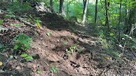
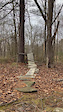
Photos of Millbury Mountain Bike
Videos of Millbury Mountain Bike
trail: Side Wiper!
0:14 |
28 |
Sep 12, 2025
trail: Psych Ward
0:06 |
55 |
Jan 5, 2025
Current Trail Warnings
| status | trail | date | condition | user | info |
|---|---|---|---|---|---|
| Dearnolm Track | Jun 5, 2026 @ 9:31am (America/New_York) Jun 5, 2026 | Ideal | Wangmauler | (this was on 05/03/2026) Southern half is... |
Recent Trail Reports
| status | trail | date | condition | info | user |
|---|---|---|---|---|---|
| Hey Moe! | Jun 5, 2026 @ 1:30pm (America/New_York) Jun 5, 2026 | Ideal | Wangmauler | ||
| Upper Powerline Access Trail | May 7, 2026 @ 1:51pm (America/New_York) May 7, 2026 | Dry | brucerioux WACH NEMBA | ||
| Soitenly Trail | May 7, 2026 @ 1:51pm (America/New_York) May 7, 2026 | Ideal | brucerioux WACH NEMBA | ||
| The Stooges | May 7, 2026 @ 1:51pm (America/New_York) May 7, 2026 | Ideal | brucerioux WACH NEMBA | ||
| Old Common Road Connector | May 5, 2026 @ 2:05pm (America/New_York) May 5, 2026 | Ideal | brucerioux WACH NEMBA | ||
| Solar gully | May 5, 2026 @ 2:04pm (America/New_York) May 5, 2026 | Ideal | brucerioux WACH NEMBA | ||
| Chestnut Trail | May 5, 2026 @ 9:59am (America/New_York) May 5, 2026 | Ideal | brucerioux WACH NEMBA | ||
| Ferngully | May 5, 2026 @ 9:59am (America/New_York) May 5, 2026 | Ideal | brucerioux WACH NEMBA | ||
| Bottom Round | May 3, 2026 @ 9:41am (America/New_York) May 3, 2026 | Ideal | RabbiOfRhythms BVNEMBA CSP | ||
| Barrel Trail | May 3, 2026 @ 9:41am (America/New_York) May 3, 2026 | Ideal | RabbiOfRhythms BVNEMBA CSP |
Activity Feed
| username | action | type | title | date |
|---|---|---|---|---|
| aamcgee | wishlist | region | activity #96822813 | Jun 12, 2026 @ 12:49pm Jun 12, 2026 |
| vpetithw | wishlist | region | activity #96660161 | Jun 10, 2026 @ 2:34am Jun 10, 2026 |
| Wangmauler | add | report | activity #96306936 | Jun 5, 2026 @ 10:30am Jun 5, 2026 |
| Wangmauler | add | report | activity #96291350 | Jun 5, 2026 @ 6:34am Jun 5, 2026 |
| MatthewaJuxxj | wishlist | region | activity #95995381 | May 31, 2026 @ 7:39pm May 31, 2026 |
Recent Comments
| username | type | title | comment | date |
|---|---|---|---|---|
| report | Thank you Russ!! | Nov 28, 2025 @ 3:56pm Nov 28, 2025 | ||
| trail | Advanced-beginner trail, due so some slightly... | Nov 25, 2025 @ 2:53pm Nov 25, 2025 | ||
| trail | The expanded version of this trail seems to... | Nov 25, 2025 @ 2:52pm Nov 25, 2025 | ||
| trail | Man made features need to be rebuilt. | Jun 26, 2025 @ 9:18am Jun 26, 2025 | ||
| trail | Great trail to ride but the woods portion... | Mar 12, 2025 @ 2:35pm Mar 12, 2025 |
Local Badges
-

10 Blue Trails129 awarded -

Epic Ride Climb 2k0 awarded -

Climbing 10k Badge3 awarded -

Climbing 100k Badge1 awarded -

Epic Ride Descent 2k0 awarded -

Descent 10k Badge3 awarded
Bike & Skill Parks
| name | type | city | rating |
|---|---|---|---|
| Brierly Pond Pump Track & Skills area | skill park | Millbury |
Activity Type Stats
| activitytype | trails | distance | descent | descent distance | total vertical | rating | global rank | state rank | photos | reports | routes | ridelogs |
|---|---|---|---|---|---|---|---|---|---|---|---|---|
| Mountain Bike | 81 | 33 miles | 2,533 ft | 10 miles | 407 ft | #2,736 | #978 | 75 | 225 | 7 | 3,694 | |
| E-Bike | 81 | 33 miles | 2,533 ft | 10 miles | 407 ft | #3,215 | #1,159 | 168 | 3 | 81 | ||
| Gravel Bike | 1 | #644 | #1,167 | 2 | 1 | |||||||
| Adaptive Bike | 1 | #575 | #1,861 | 1 | ||||||||
| Winter Fat Bike | 1 | #383 | #1,156 | 8 | 5 | 2 | ||||||
| Horse | 30 | 5 miles | 525 ft | 2 miles | 308 ft | #2,285 | #1,263 | 1 | 41 | 2 | ||
| Hike | 81 | 33 miles | 2,533 ft | 10 miles | 407 ft | #2,870 | #1,069 | 12 | 226 | 2 | 324 | |
| Trail Running | 81 | 33 miles | 2,533 ft | 10 miles | 407 ft | #4,572 | #1,416 | 226 | 2 | 84 | ||
| Snowshoe | 74 | 26 miles | 2,277 ft | 8 miles | 354 ft | #582 | #222 | 87 | 7 | |||
| Nordic Ski | 43 | 16 miles | 1,427 ft | 5 miles | 318 ft | #899 | #365 | 39 | 8 |
Frequently Asked Questions About Millbury
▼
What are the best places to ride in Millbury?
Millbury has 5 areas to explore for mountain biking. The top rated areas are:
▼
What are the highest rated mountain biking trails in Millbury?
The highest rated mountain biking trails in Millbury are:
- The Stooges (4.3/5)
- Nyuk Nyuk Nyuk Trail (4.3/5)
- Side Wiper! (4.1/5)
- Surprise (4.1/5)
- Bojangles (4.1/5)
▼
What is the best time of the year to ride in Millbury?
Based on ride log data, the most popular months to ride in Millbury are:
- June (80 activities)
- July (71 activities)
- May (70 activities)
▼
Where can I park to ride in Millbury?
There are 11 parking locations listed in Millbury. The most popular parking spots are: View all parking and trailhead locations on the map to plan your visit.
Activities
Trails
Points of Interest
- By WillieJacobsz
 Trailforks SBP SWW & contributors
 - Admins: BVNEMBA Region, BVNEMBA Admins, MNTC
- #23222 - 3,879 views
- millbury activity log | embed map of Millbury mountain bike trails | millbury mountain biking points of interest polygons
Downloading of trail gps tracks in kml & gpx formats is enabled for Millbury.
You must login to download files.