close
-
Layers w
- Weather Layers
- Pro
- Pro
- Pro
- Pro
- Pro
- Pro
- More Layers
- Pro
- Pro
- Pro
- Pro
-
Upgrade to

3D
Trail Conditions
- Unknown
- Snow Groomed
- Snow Packed
- Snow Covered
- Snow Cover Partial
- Freeze/thaw Cycle
- Icy
- Prevalent Mud
- Wet
- Variable
- Ideal
- Dry
- Very Dry
Trail Flow (Ridden Direction)
Trailforks scans users ridelogs to determine the most popular direction each trail is ridden. A good flowing trail network will have most trails flowing in a single direction according to their intension.
The colour categories are based on what percentage of riders are riding a trail in its intended direction.
The colour categories are based on what percentage of riders are riding a trail in its intended direction.
- > 96%
- > 90%
- > 80%
- > 70%
- > 50%
- < 50%
- bi-directional trail
- no data
Trail Last Ridden
Trailforks scans ridelogs to determine the last time a trail was ridden.
- < 2 days
- < 1 week
- < 2 weeks
- < 1 month
- < 6 months
- > 6 months
Trail Ridden Direction
The intended direction a trail should be ridden.
- Downhill Only
- Downhill Primary
- Both Directions
- Uphill Primary
- Uphill Only
- One Direction
Contribute Details
Colors indicate trail is missing specified detail.
- Description
- Photos
- Description & Photos
- Videos
Trail Popularity ?
Trailforks scans ridelogs to determine which trails are ridden the most in the last 9 months.
Trails are compared with nearby trails in the same city region with a possible 25 colour shades.
Think of this as a heatmap, more rides = more kinetic energy = warmer colors.
- most popular
- popular
- less popular
- not popular
ATV/ORV/OHV Filter
Max Vehicle Width
inches
US Cell Coverage
Legend

Radar Time
Activity Recordings
Trailforks uses anonymized public activity data.
?
Activity Recordings
Trailforks uses anonymized public activity data.
?
Personal Heatmap
▶
Activity Types
all
/
none
▶
Options
2
Date range
month
–
Winter Trails
Warning
A routing network for winter maps does not exist. Selecting trails using the winter trails layer has been disabled.
Missing Trails
Most Popular
Least Popular
Trails are colored based on popularity. The more popular a trail is, the more red. Less popular trails trend towards green.
Jump Magnitude Heatmap
Heatmap of where riders jump on trails. Zoom in to see individual jumps, click circles to view jump details.
BC Backroad Status
![map legend]()
Service Road Atlas is a free to use, community-driven service for viewing and creating reports on the numerous back-country service roads around B.C. and Alberta.

Slope Aspect
Direction the slope faces
Trails Deemphasized
Trails are shown in grey.
Only show trails with no bike usage.
Suggested Layers
Based on selected activity type
Save the current map location and zoom level as your default home location whenever this page is loaded.
Save
No description for Mills River has been added yet!
Login or register to submit one.
Activities Click to view
- Mountain Bike
37 trails
- Gravel Bike
13 trails
- Horse
18 trails
- Hike
40 trails
- Trail Running
40 trails
Region Details
- 13
- 2
- 15
- 7
Region Status
Caution as of 2 daysStats
- Avg Trail Rating
- Trails (view details)
- 40
- Trails Mountain Bike
- 37
- Trails Gravel Bike
- 13
- Trails Horse
- 18
- Trails Hike
- 40
- Trails Trail Running
- 40
- Total Distance
- 112 miles
- Total Descent
- 17,721 ft
- Total Vertical
- 2,765 ft
- Highest Trailhead
- 4,969 ft
- Reports
- 1,137
- Photos
- 302
- Ridden Counter
- 27,548
Sub Regions
-
Fiddlehead Farm & Forest
-
North Mills River
- 2
- 11
- 4
-
South Mills River
- 4
- 3
Popular Mills River Mountain Biking Trails
• 100 ★ 4.2 • 2 miles • 507 ft • 2,745 •
Once was an old road bed, turned trail.
• 95 ★ 4.2 • 1 mile • 4 ft • 2,245 •
A Great downhill trail with multiple drops and rock armored sections.
• 95 ★ 4.8 • 1 mile • 133 ft • 2,034 •
Gradual descent that builds speed until it spits you out at high speed just past the Mills River Reservoir
• 100 ★ 4.7 • 3 miles • 169 ft • 1,888 •
Ridgeline descent above mills river. Rutted out gullies have made the trail more technical with exposed rocks and several small drops. Very rocky and fast on the first two descents. The third descent is fast, but more flowy since it's...
• 95 ★ 4.5 • 1 mile • 0 ft • 1,793 •
Fast and flow. This trail is on the smother side of Pisgah. Plenty of speed to be caught with minimal gnar. This route weaves in and out of open grass fields and woods before dipping down for two smaller creek crossings that can get you...
• 90 ★ 3.9 • 1 mile • 0 ft • 1,549 •
The section from Wash Creek Trail to where intersects with was rerouted in 2015 to aid in the erosion prevention and make more sustainable trails.
• 90 ★ 3.6 • 3,996 ft • 28 ft • 1,242 •
Popular green difficulty family friendly singletrack. This multi-use trail can be used both directions and has a easy overall physical rating with a 28 ft green climb. Trail visibility is always easy to follow. On average it takes 4 minutes to complete this trail.
• 90 ★ 2.5 • 1,519 ft • 5 ft • 1,038 •
Popular blue difficulty singletrack. This multi-use trail can be used both directions. On average it takes 1 minutes to complete this trail.
Mills River Mountain Bike Routes
★ 4.7 • 10 miles • 1,329 ft • 11 • Loop •
This route takes you through the Spencer Upper, Fletcher Upper & Fletcher Lower downhill sections....
★ 5.0 • 12 miles • 1,530 ft • 6 • Loop •
Typical North River Mills Blue loop. - Spencer Gap (Upper) - Spencer Branch (Upper) - Spencer Gap (Lower)...
★ 5.0 • 13 miles • 1,921 ft • 2 • Loop •
This is one of our favorite routes for Laurel Mountain and Pilot Rock that are featured in Freehub...
★ 3.0 • 13 miles • 1,709 ft • 19 • Loop •
Climb is hard but enjoyable & something to brag about if you clean it all the way.. Spencer Branch...
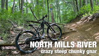
Photos of Mills River Mountain Bike
Videos of Mills River Mountain Bike
trail: Henderson Reservoir Road
0:44 |
12 |
Jul 23, 2024
trail: Trace Ridge Trail (Upper)
0:14 |
25 |
Nov 10, 2022
trail: Big Creek Trail
0:15 |
1122 |
Jan 11, 2016
trail: Squirrel Gap
6:36 |
1102 |
Jan 9, 2012
13:56 |
27 |
May 4, 2025

trail: Wash Creek Road
2:54 |
62 |
May 4, 2025 , Mills River
trail: Laurel Mountain
4:47 |
770 |
Dec 21, 2011

trail: Trace Ridge Trail
7:34 |
218 |
Apr 19, 2024 , Mills River
Current Trail Warnings
| status | trail | date | condition | user | info |
|---|---|---|---|---|---|
| Riverside | Jun 21, 2026 @ 8:40pm (America/New_York) 2 days | Unknown | Z675R | trees down, some crossings unclear,... | |
| Cantrell Creek Trail | Jun 8, 2026 @ 7:19pm (America/New_York) Jun 8, 2026 | Ideal | epicbruce | Once again, trees down Cantrell in... | |
| Squirrel Gap | Jun 8, 2026 @ 7:19pm (America/New_York) Jun 8, 2026 | Ideal | epicbruce | Once again, trees down Cantrell in... |
Recent Trail Reports
Activity Feed
| username | action | type | title | date |
|---|---|---|---|---|
| Conco-berry | wishlist | route | activity #97619962 | Jun 23, 2026 @ 5:38am 16 hours |
| CaraRouAXp | ridden | trail | activity #97566428 and 1 more | Jun 22, 2026 @ 9:16am 2 days |
| CaraRouAXp | ridden | trail | activity #97566413 | Jun 22, 2026 @ 9:15am 2 days |
| Z675R | add | report | activity #97534124 | Jun 21, 2026 @ 5:40pm 2 days |
| EdYGxy7a | wishlist | route | activity #97504936 | Jun 21, 2026 @ 11:28am 2 days |
Recent Comments
| username | type | title | comment | date |
|---|---|---|---|---|
| trail | nice | Dec 13, 2025 @ 2:15pm Dec 13, 2025 | ||
| report | . | Nov 10, 2025 @ 3:20pm Nov 10, 2025 | ||
| report | 🎙️🎚️ | Nov 10, 2025 @ 3:16pm Nov 10, 2025 | ||
| report | Ann f. Axes xxxzszxzk i S sc | Nov 10, 2025 @ 3:08pm Nov 10, 2025 | ||
| report | Cocoz | Nov 10, 2025 @ 2:58pm Nov 10, 2025 |
Local Badges
-

Completionist - Life Time0 awarded -

Big Ride 30k2,185 awarded -

Epic Ride 50k624 awarded -

Top 10 Trails0 awarded -
Top 10 Trails4 awarded -

Completionist 20220 awarded
Bike & Skill Parks
| name | type | city | rating |
|---|---|---|---|
| Fiddlehead Farm & Forest | bike park | Mills River |
Activity Type Stats
| activitytype | trails | distance | descent | descent distance | total vertical | rating | global rank | state rank | photos | reports | routes | ridelogs |
|---|---|---|---|---|---|---|---|---|---|---|---|---|
| Mountain Bike | 37 | 109 miles | 16,611 ft | 49 miles | 2,766 ft | #1,129 | #436 | 294 | 1,134 | 53 | 23,200 | |
| Gravel Bike | 13 | 41 miles | 2,795 ft | 11 miles | 1,680 ft | #350 | #949 | 95 | 74 | |||
| Horse | 18 | 27 miles | 5,410 ft | 15 miles | 2,543 ft | #1,411 | #841 | 353 | 1 | |||
| Hike | 40 | 112 miles | 17,720 ft | 52 miles | 2,766 ft | #2,349 | #938 | 7 | 1,136 | 2 | 1,544 | |
| Trail Running | 40 | 112 miles | 17,720 ft | 52 miles | 2,766 ft | #1,975 | #640 | 1,136 | 1 | 267 |
Frequently Asked Questions About Mills River
▼
What are the best places to ride in Mills River?
Mills River has 3 areas to explore for mountain biking. The top rated areas are:
▼
What are the highest rated mountain biking trails in Mills River?
The highest rated mountain biking trails in Mills River are:
- Fletcher Creek (Lower) (4.6/5)
- Trace Ridge Trail (4.4/5)
- Big Creek Trail (4.4/5)
- Fletcher Creek (Upper) (4.4/5)
- Spencer Branch (Upper) (4.1/5)
▼
What is the best time of the year to ride in Mills River?
Based on ride log data, the most popular months to ride in Mills River are:
- July (193 activities)
- June (192 activities)
- September (157 activities)
▼
Where can I park to ride in Mills River?
There are 12 parking locations listed in Mills River. The most popular parking spots are:
- Wash Creek Road - Parking
- North Mills River Picnic Area
- Laurel/Pilot Parking
- Pilot Cove - Slate Rock Parking
- Parking
Activities
Trails
- By blowmyfuse
 & contributors
 - Admins: apply
- #9382 - 17,979 views
- mills river activity log | embed map of Mills River mountain bike trails | mills river mountain biking points of interest
Downloading of trail gps tracks in kml & gpx formats is enabled for Mills River.
You must login to download files.