close
-
Layers w
- Weather Layers
- Pro
- Pro
- Pro
- Pro
- Pro
- Pro
- More Layers
- Pro
- Pro
- Pro
- Pro
-
Upgrade to

3D
Trail Conditions
- Unknown
- Snow Groomed
- Snow Packed
- Snow Covered
- Snow Cover Partial
- Freeze/thaw Cycle
- Icy
- Prevalent Mud
- Wet
- Variable
- Ideal
- Dry
- Very Dry
Trail Flow (Ridden Direction)
Trailforks scans users ridelogs to determine the most popular direction each trail is ridden. A good flowing trail network will have most trails flowing in a single direction according to their intension.
The colour categories are based on what percentage of riders are riding a trail in its intended direction.
The colour categories are based on what percentage of riders are riding a trail in its intended direction.
- > 96%
- > 90%
- > 80%
- > 70%
- > 50%
- < 50%
- bi-directional trail
- no data
Trail Last Ridden
Trailforks scans ridelogs to determine the last time a trail was ridden.
- < 2 days
- < 1 week
- < 2 weeks
- < 1 month
- < 6 months
- > 6 months
Trail Ridden Direction
The intended direction a trail should be ridden.
- Downhill Only
- Downhill Primary
- Both Directions
- Uphill Primary
- Uphill Only
- One Direction
Contribute Details
Colors indicate trail is missing specified detail.
- Description
- Photos
- Description & Photos
- Videos
Trail Popularity ?
Trailforks scans ridelogs to determine which trails are ridden the most in the last 9 months.
Trails are compared with nearby trails in the same city region with a possible 25 colour shades.
Think of this as a heatmap, more rides = more kinetic energy = warmer colors.
- most popular
- popular
- less popular
- not popular
ATV/ORV/OHV Filter
Max Vehicle Width
inches
US Cell Coverage
Legend

Radar Time
Activity Recordings
Trailforks uses anonymized public activity data.
?
Activity Recordings
Trailforks uses anonymized public activity data.
?
Personal Heatmap
▶
Activity Types
all
/
none
▶
Options
2
Date range
month
–
Winter Trails
Warning
A routing network for winter maps does not exist. Selecting trails using the winter trails layer has been disabled.
Missing Trails
Most Popular
Least Popular
Trails are colored based on popularity. The more popular a trail is, the more red. Less popular trails trend towards green.
Jump Magnitude Heatmap
Heatmap of where riders jump on trails. Zoom in to see individual jumps, click circles to view jump details.
BC Backroad Status
![map legend]()
Service Road Atlas is a free to use, community-driven service for viewing and creating reports on the numerous back-country service roads around B.C. and Alberta.

Slope Aspect
Direction the slope faces
Trails Deemphasized
Trails are shown in grey.
Only show trails with no bike usage.
Suggested Layers
Based on selected activity type
Save the current map location and zoom level as your default home location whenever this page is loaded.
Save
No description for Miltenberg has been added yet!
Login or register to submit one.
This region uses the Uk/Euro style trail grading system.
Activities Click to view
- Mountain Bike
11 trails
- E-Bike
11 trails
- Winter Fat Bike
0 trails
- Hike
8 trails
- Trail Running
8 trails
Region Details
- 7
- 3
- 1
Region Status
Caution as of Jun 22, 2026Stats
- Avg Trail Rating
- Trails (view details)
- 11
- Trails Mountain Bike
- 11
- Trails E-Bike
- 11
- Trails Hike
- 8
- Trails Trail Running
- 8
- Total Distance
- 4 miles
- Total Descent Distance
- 3 miles
- Total Descent
- 2,453 ft
- Total Vertical
- 891 ft
- Highest Trailhead
- 1,522 ft
- Reports
- 176
- Photos
- 4
- Ridden Counter
- 1,823
Popular Miltenberg Mountain Biking Trails
• 100 ★ 4.5 • 3,911 ft • 0 ft • 241 •
Highly rated popular green difficulty singletrack. This multi-use trail can be used downhill only. On average it takes 6 minutes to complete this trail.
• 95 ★ 4.6 • 3,816 ft • 0 ft • 241 •
Highly rated popular blue difficulty singletrack. This mountain bike primary trail can be used downhill only. On average it takes 9 minutes to complete this trail.
• 55 ★ 3.4 • 2,772 ft • 0 ft • 182 •
Moderately popular green difficulty singletrack. This multi-use trail can be used downhill primary. On average it takes 4 minutes to complete this trail.
• 85 ★ 4.9 • 1,024 ft • 0 ft • 171 •
Highly rated popular blue difficulty singletrack. This mountain bike primary trail can be used downhill only. It features berm, drop, jump, rock face and rock garden. Trail visibility is always easy to follow. On average it takes 1 minutes to complete this trail.
• 75 ★ 4.9 • 1,453 ft • 0 ft • 171 •
Highly rated popular red difficulty singletrack. This mountain bike primary trail can be used downhill only. It features berm, drop, jump, rock face, rock garden and skinny. Trail visibility is always easy to follow. On average it takes 3 minutes to complete this trail.
• 65 ★ 2.6 • 928 ft • 0 ft • 139 •
Moderately popular green difficulty singletrack. This mountain bike primary trail can be used downhill primary. On average it takes 2 minutes to complete this trail.
• 45 ★ 4.0 • 1,148 ft • 0 ft • 109 •
Moderately popular green difficulty singletrack. This multi-use trail can be used uphill primary and has a easy overall physical rating with a 0 ft green climb. Trail visibility is always easy to follow. On average it takes 1 minutes to complete this trail.
• 30 ★ 3.0 • 702 ft • 0 ft • 64 •
Less popular blue difficulty singletrack. This multi-use trail can be used both directions. Trail visibility is sometimes hard to follow. On average it takes minutes to complete this trail.
Miltenberg Mountain Bike Routes
★ 5.0 • 16 miles • 2,911 ft • 0 •
Erste ausgeschilderte Mountainbikestrecke Mil1 in Miltenberg / Main. Start und Ziel sind jeweils der...
★ 5.0 • 15 miles • 2,126 ft • 1 • Loop •
MTB Loop BÜ1 Länge 26 km, Hm: 620 m Hier ist für jeden Mountain-Biker was dabei. Für Abwechslung...
21 miles • 3,374 ft • 0 •
Die abwechslungsreiche Strecke in Collenberg verläuft in 2 Schleifen durch Wälder und Wiesentäler. Die...
Videos of Miltenberg Mountain Bike
youtuber
![MILTENBERG MIL1 zurück in Kanada! / Tobis...]()
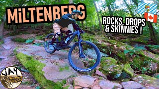
trail: Quellentrail
18:14 |
153 |
Oct 11, 2024 , Miltenberg
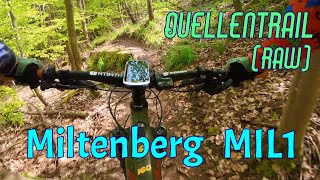
trail: Quellentrail
5:09 |
82 |
Jun 8, 2024 , Miltenberg
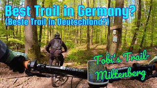
trail: Tobis Trail
4:19 |
138 |
Jun 8, 2024 , Miltenberg
youtuber
![MILTENBERG MIL1 Rundstrecke: Kanada-Vibes! /...]()
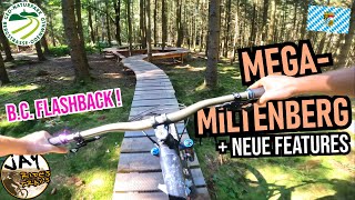
trail: Quellentrail
13:41 |
184 |
Jan 30, 2024 , Miltenberg
Current Trail Warnings
| status | trail | date | condition | user | info |
|---|---|---|---|---|---|
| Keltensteig Part 2 | Jun 22, 2026 @ 9:01am (Europe/Berlin) Jun 22, 2026 | Variable | HAL2000 | Durch Forstarbeiten sind Teile vom Trail... |
Recent Trail Reports
| status | trail | date | condition | info | user |
|---|---|---|---|---|---|
| Akazien Trail | Jun 22, 2026 @ 9:05am (Europe/Berlin) Jun 22, 2026 | Dry | HAL2000 | ||
| Quellentrail | Jun 22, 2026 @ 9:03am (Europe/Berlin) Jun 22, 2026 | Dry | HAL2000 | ||
| Keltensteig Part 1 | Jun 22, 2026 @ 9:01am (Europe/Berlin) Jun 22, 2026 | Dry | HAL2000 | ||
| Jägersteig | Jun 22, 2026 @ 8:57am (Europe/Berlin) Jun 21, 2026 | Ideal | HAL2000 | ||
| Teutonenschneise | Jun 22, 2026 @ 8:55am (Europe/Berlin) Jun 21, 2026 | Ideal | HAL2000 | ||
| Tobis Trail | Jun 22, 2026 @ 8:55am (Europe/Berlin) Jun 21, 2026 | Ideal | HAL2000 | ||
| Felsenmeer | May 30, 2025 @ 12:05pm May 30, 2025 | Ideal | squeezen | ||
| Felsenmeer 2 | May 24, 2023 @ 2:21am May 24, 2023 | Variable | Promyk | ||
| Niebelungensteig | May 8, 2022 @ 10:15pm May 8, 2022 | Variable | HAL2000 |
Activity Feed
| username | action | type | title | date |
|---|---|---|---|---|
| HAL2000 | add | report | activity #97546034 and 6 more | Jun 21, 2026 @ 11:55pm Jun 21, 2026 |
| Megaise | ridden | trail | activity #95885631 | May 30, 2026 @ 2:03pm May 30, 2026 |
| felixbernhard | wishlist | trail | activity #95379183 | May 23, 2026 @ 10:07pm May 23, 2026 |
| MichaeltoAau5 | ridden | trail | activity #95108747 and 4 more | May 20, 2026 @ 8:09am May 20, 2026 |
| nornof | wishlist | route | activity #94088461 | May 5, 2026 @ 7:23am May 5, 2026 |
Local Badges
-

Epic Mountain Bike Climb 2k17 awarded -

Climbing 10k Badge5 awarded -

Mountain Biking 100k Badge1 awarded -

Epic Ride Descent 2k17 awarded -

Descent 10k Badge5 awarded -

Descent 100k Badge1 awarded
Activity Type Stats
| activitytype | trails | distance | descent | descent distance | total vertical | rating | global rank | state rank | photos | reports | routes | ridelogs |
|---|---|---|---|---|---|---|---|---|---|---|---|---|
| Mountain Bike | 11 | 4 miles | 2,454 ft | 3 miles | 892 ft | #8,051 | #364 | 4 | 176 | 3 | 1,834 | |
| E-Bike | 11 | 4 miles | 2,454 ft | 3 miles | 892 ft | #5,905 | #227 | 174 | 2 | 186 | ||
| Hike | 8 | 3 miles | 1,411 ft | 2 miles | 892 ft | #10,111 | #245 | 163 | 102 | |||
| Trail Running | 8 | 3 miles | 1,411 ft | 2 miles | 892 ft | #9,737 | #248 | 163 | 9 |
Frequently Asked Questions About Miltenberg
▼
What are the highest rated mountain biking trails in Miltenberg?
The highest rated mountain biking trails in Miltenberg are:
- Keltensteig Part 2 (4.5/5)
- Keltensteig Part 1 (4.5/5)
- Quellentrail (4.4/5)
- Tobis Trail (4.3/5)
- Teutonenschneise (4/5)
▼
What is the best time of the year to ride in Miltenberg?
Based on ride log data, the most popular months to ride in Miltenberg are:
- April (21 activities)
- May (18 activities)
- August (15 activities)
▼
Where can I park to ride in Miltenberg?
There are 1 parking locations listed in Miltenberg. The most popular parking spots are:
▼
What is the longest trail in Miltenberg?
The longest trail in Miltenberg is Tobis Trail at 1.2 km. View all trails sorted by distance.
Activities
- By endurophili & contributors
- Admins: larry81541
- #25831 - 3,135 views
- miltenberg activity log | embed map of Miltenberg mountain bike trails | miltenberg mountain biking points of interest
Downloading of trail gps tracks in kml & gpx formats is enabled for Miltenberg.
You must login to download files.