close
-
Layers w
- Weather Layers
- Pro
- Pro
- Pro
- Pro
- Pro
- Pro
- More Layers
- Pro
- Pro
- Pro
- Pro
-
Upgrade to

3D
Trail Conditions
- Unknown
- Snow Groomed
- Snow Packed
- Snow Covered
- Snow Cover Partial
- Freeze/thaw Cycle
- Icy
- Prevalent Mud
- Wet
- Variable
- Ideal
- Dry
- Very Dry
Trail Flow (Ridden Direction)
Trailforks scans users ridelogs to determine the most popular direction each trail is ridden. A good flowing trail network will have most trails flowing in a single direction according to their intension.
The colour categories are based on what percentage of riders are riding a trail in its intended direction.
The colour categories are based on what percentage of riders are riding a trail in its intended direction.
- > 96%
- > 90%
- > 80%
- > 70%
- > 50%
- < 50%
- bi-directional trail
- no data
Trail Last Ridden
Trailforks scans ridelogs to determine the last time a trail was ridden.
- < 2 days
- < 1 week
- < 2 weeks
- < 1 month
- < 6 months
- > 6 months
Trail Ridden Direction
The intended direction a trail should be ridden.
- Downhill Only
- Downhill Primary
- Both Directions
- Uphill Primary
- Uphill Only
- One Direction
Contribute Details
Colors indicate trail is missing specified detail.
- Description
- Photos
- Description & Photos
- Videos
Trail Popularity ?
Trailforks scans ridelogs to determine which trails are ridden the most in the last 9 months.
Trails are compared with nearby trails in the same city region with a possible 25 colour shades.
Think of this as a heatmap, more rides = more kinetic energy = warmer colors.
- most popular
- popular
- less popular
- not popular
ATV/ORV/OHV Filter
Max Vehicle Width
inches
US Cell Coverage
Legend

Radar Time
Activity Recordings
Trailforks uses anonymized public activity data.
?
Activity Recordings
Trailforks uses anonymized public activity data.
?
Personal Heatmap
▶
Activity Types
all
/
none
▶
Options
2
Date range
month
–
Winter Trails
Warning
A routing network for winter maps does not exist. Selecting trails using the winter trails layer has been disabled.
Missing Trails
Most Popular
Least Popular
Trails are colored based on popularity. The more popular a trail is, the more red. Less popular trails trend towards green.
Jump Magnitude Heatmap
Heatmap of where riders jump on trails. Zoom in to see individual jumps, click circles to view jump details.
BC Backroad Status
![map legend]()
Service Road Atlas is a free to use, community-driven service for viewing and creating reports on the numerous back-country service roads around B.C. and Alberta.

Slope Aspect
Direction the slope faces
Trails Deemphasized
Trails are shown in grey.
Only show trails with no bike usage.
Suggested Layers
Based on selected activity type
Save the current map location and zoom level as your default home location whenever this page is loaded.
Save
No description for Milton has been added yet!
Login or register to submit one.
Activities Click to view
- Mountain Bike
231 trails
- Gravel Bike
6 trails
- Adaptive Bike
2 trails
- Winter Fat Bike
4 trails
- Horse
13 trails
- Hike
284 trails
- Trail Running
272 trails
- Snowshoe
160 trails
- Downhill Ski
17 trails
- Nordic Ski
47 trails
Region Details
- 21
- 4
- 72
- 76
- 39
- 9
Region Status
Open as of Jun 15, 2026Stats
- Avg Trail Rating
- Trails (view details)
- 290
- Trails Mountain Bike
- 233
- Trails E-Bike
- 2
- Trails Gravel Bike
- 6
- Trails Adaptive Bike
- 2
- Trails Winter Fat Bike
- 4
- Trails Horse
- 13
- Trails Hike
- 284
- Trails Trail Running
- 272
- Trails Snowshoe
- 160
- Trails Downhill Ski
- 17
- Trails Backcountry Ski
- 2
- Trails Nordic Ski
- 47
- Total Distance
- 128 miles
- Total Descent
- 10,256 ft
- Total Vertical
- 448 ft
- Highest Trailhead
- 1,194 ft
- Reports
- 11,085
- Photos
- 1,955
- Ridden Counter
- 125,845
Sub Regions
-
Area 8 Conservation Area
- 2
- 1
-
Halton Region Agreement Forest (HAFTA Trails)
- 23
- 27
- 13
- 2
-
Halton Region Forest - Conley Tract
- 1
-
Hilton Falls Conservation Area
- 7
- 14
- 5
- 2
-
Kelso
- 1
- 18
- 24
- 9
- 2
-
Mountsberg Conservation Area
- 1
- 14
Popular Milton Mountain Biking Trails
• 100 ★ 4.2 • 1,293 ft • 3 ft • 1,931 •
Highly rated popular blue difficulty singletrack. This mountain bike primary trail can be used both directions and has a moderate overall physical rating with a 3 ft black diamond climb. It features berm, roller coaster and skinny. On average it takes 1 minutes to complete this trail.
• 100 ★ 4.2 • 1 mile • 218 ft • 1,855 •
A much longer and more fun replacement for Xtreeme Bypass. Twisting and turning through the trees, speed makes this one a blast.
• 90 ★ 3.9 • 1,532 ft • 24 ft • 1,784 •
Short section of trail that connects west end ( side trail and digger downhill trails) to the east end (summit lookout and summit lookout trails). This trail has a minor slope with one short section of rocks towards the west end of the...
• 95 ★ 4.2 • 2,260 ft • 65 ft • 1,757 •
Highly rated popular blue difficulty singletrack. This mountain bike primary trail can be used both directions. On average it takes 3 minutes to complete this trail.
• 100 ★ 2.9 • 1,096 ft • 11 ft • 1,733 •
Popular green difficulty dirt/gravel road. This mountain bike primary trail can be used both directions and has a easy overall physical rating. On average it takes 1 minutes to complete this trail.
• 100 ★ 3.7 • 2,728 ft • 48 ft • 1,719 •
This is a fun section with a few log drops, a nice jump off a short ramp. Watch for the on your left half way around. There is wooden ramp over a wet area that you can get air on while landing on a small rock garden. Best traveled from...
• 90 ★ 4.5 • 1 mile • 65 ft • 1,695 •
A great feature trail inside the Kelso trail network, the X-treme trail is a feature packed black diamond gem that includes rock drops, skinnies, ladder bridges, berms, drops, and more. Technical skill is required to navigate through...
Milton Mountain Bike Routes
Agreement Forest Easy Featured
★ 5.0 • 10 miles • 261 ft • 20 • Loop •
EASIER ROUTE FOR FIRST RIDE AT AGREEMENT FOREST
2019/20 HAFTA FAT BIKE LOOP Featured
10 miles • 367 ft • 37 • Loop •
HAFTA's 2019/20 WINTER LOOP (AF only)
★ 5.0 • 11 miles • 352 ft • 16 • Loop •
This is HAFTA's Winter Loop for the 2025/26. This year, HAFTA was granted permission by Hilton Falls to...
★ 5.0 • 4 miles • 396 ft • 9 • Loop •
Course #1 for the 2024 Kelso MTb Race Series - Novice and Intermediate
★ 5.0 • 7 miles • 268 ft • 17 • Loop •
VOILA THE 2018/19 HAFTA WINTER FAT BIKE LOOP WITH AS AN OPTION - ENJOY
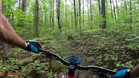
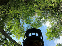
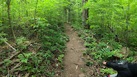
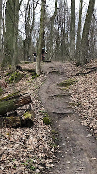
Photos of Milton Mountain Bike
Videos of Milton Mountain Bike
trail: The Boundary Trail B
0:13 |
59 |
Jan 24, 2024
trail: Down 'n' Dirty
3:17 |
|
Jan 20, 2024
trail: Hidden Gem
4:16 |
78 |
Jun 5, 2021
trail: Digger Downhill
0:11 |
1159 |
Feb 12, 2021
trail: Ugly Up
0:10 |
953 |
May 29, 2020
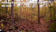
trail: No Dab
2:05 |
203 |
Oct 5, 2019
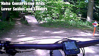
trail: Snakes and Ladders
0:23 |
1102 |
Jun 8, 2019
trail: Disco Inferno
3:26 |
549 |
Aug 15, 2018
Current Trail Warnings
| status | trail | date | condition | user | info |
|---|---|---|---|---|---|
| Lakeshore Lookout Trail | Jun 15, 2026 @ 1:23pm (America/Toronto) Jun 15, 2026 | Unknown | ahegarty | Closed signs at both ends | |
| Deer Run | Jun 13, 2026 @ 12:55pm (America/Toronto) Jun 13, 2026 | Unknown | jack7272 | ||
| Rogue Trail | Jun 3, 2026 @ 6:18pm (America/Toronto) Jun 3, 2026 | Unknown | bmkcbrxx |
Recent Trail Reports
| status | trail | date | condition | info | user |
|---|---|---|---|---|---|
| Bat Boxes | Jun 15, 2026 @ 7:08pm (America/Toronto) Jun 15, 2026 | Ideal | aldo321 | ||
| Burnt Out Car | Jun 15, 2026 @ 7:08pm (America/Toronto) Jun 15, 2026 | Ideal | aldo321 | ||
| Ranchy Rocks | Jun 15, 2026 @ 7:08pm (America/Toronto) Jun 15, 2026 | Ideal | aldo321 | ||
| Robertson Tract Access Road | Jun 15, 2026 @ 7:08pm (America/Toronto) Jun 15, 2026 | Ideal | aldo321 | ||
| Currie Mahon Access Road | Jun 15, 2026 @ 7:08pm (America/Toronto) Jun 15, 2026 | Ideal | aldo321 | ||
| The Den | Jun 12, 2026 @ 2:17pm (America/Toronto) Jun 12, 2026 | Variable | jbirchy HAFTA | ||
| Lac Trail | Jun 4, 2026 @ 10:05pm (America/Toronto) Jun 4, 2026 | Ideal | jack7272 | ||
| Roller Coaster | Jun 4, 2026 @ 10:02pm (America/Toronto) Jun 4, 2026 | Ideal | jack7272 | ||
| Darryl's Alley | Jun 3, 2026 @ 6:18pm (America/Toronto) Jun 3, 2026 | Dry | bmkcbrxx | ||
| Rough Trade | Jun 3, 2026 @ 6:18pm (America/Toronto) Jun 3, 2026 | Ideal | bmkcbrxx |
Activity Feed
| username | action | type | title | date |
|---|---|---|---|---|
| aldo321 | wishlist | trail | activity #97159244 and 15 more | Jun 16, 2026 @ 8:13pm 3 days |
| aldo321 | wishlist | trail | activity #97158988 and 15 more | Jun 16, 2026 @ 8:08pm 3 days |
| Nick102B | vote | trail | activity #97122960 and 3 more | Jun 16, 2026 @ 10:48am Jun 16, 2026 |
| campover | wishlist | route | activity #97109323 | Jun 16, 2026 @ 7:38am Jun 16, 2026 |
| aldo321 | add | report | activity #97085021 and 4 more | Jun 15, 2026 @ 8:23pm Jun 15, 2026 |
Recent Comments
| username | type | title | comment | date |
|---|---|---|---|---|
| report | Cleared the Pines with no power tools | Aug 26, 2025 @ 7:06pm Aug 26, 2025 | ||
| report | Edit: top section is open, lower closed. | Jul 25, 2025 @ 9:36am Jul 25, 2025 | ||
| report | DN | Jun 3, 2025 @ 9:13am Jun 3, 2025 | ||
| trail | The trail flows better if you run it reverse. | Jun 2, 2025 @ 5:00am Jun 2, 2025 | ||
| report | Cleared and pruned. | May 31, 2025 @ 4:19pm May 31, 2025 |
Local Badges
-

Top 10 Trails128 awarded -

Descent 100k Badge2 awarded -

Big Ride 30k2,900 awarded -

Epic Ride 50k1,591 awarded -

Completionist2 awarded -
Completionist0 awarded
Activity Type Stats
| activitytype | trails | distance | descent | descent distance | total vertical | rating | global rank | state rank | photos | reports | routes | ridelogs |
|---|---|---|---|---|---|---|---|---|---|---|---|---|
| Mountain Bike | 231 | 90 miles | 6,260 ft | 32 miles | 387 ft | #78 | #5 | 1,801 | 11,095 | 94 | 54,051 | |
| E-Bike | 2 | 1 mile | 33 ft | 1,506 ft | 26 ft | 7,788 | 1 | 461 | ||||
| Gravel Bike | 6 | #310 | #43 | 297 | 97 | |||||||
| Adaptive Bike | 2 | #256 | #71 | 1 | 5 | |||||||
| Winter Fat Bike | 4 | #180 | #65 | 9 | 11 | 5 | 34 | |||||
| Horse | 13 | 7 miles | 325 ft | 3 miles | 197 ft | #1,263 | #21 | 2,836 | 5 | |||
| Hike | 284 | 123 miles | 8,743 ft | 44 miles | 449 ft | #645 | #17 | 134 | 10,954 | 5 | 4,459 | |
| Trail Running | 272 | 117 miles | 8,491 ft | 41 miles | 449 ft | #798 | #13 | 8 | 10,880 | 18 | 1,219 | |
| Snowshoe | 160 | 70 miles | 4,498 ft | 24 miles | 449 ft | #130 | #12 | 2,878 | 8 | 143 | ||
| Downhill Ski | 17 | 2 miles | 1,332 ft | 2 miles | 269 ft | #197 | #6 | 8 | 629 | |||
| Backcountry Ski | 2 | 1 mile | 49 ft | 2,910 ft | 85 ft | 18 | 6 | 6 | ||||
| Nordic Ski | 47 | 23 miles | 1,506 ft | 8 miles | 341 ft | #488 | #27 | 450 | 1 | 284 |
Frequently Asked Questions About Milton
▼
What are the best places to ride in Milton?
Milton has 11 areas to explore for mountain biking. The top rated areas are:
▼
What are the highest rated mountain biking trails in Milton?
The highest rated mountain biking trails in Milton are:
- Ugly Up (4.5/5)
- Down 'n' Dirty (4.4/5)
- X-treem Trail (4.4/5)
- Snakes and Ladders (4.4/5)
- I Will Allow It (4.4/5)
▼
What is the best time of the year to ride in Milton?
Based on ride log data, the most popular months to ride in Milton are:
- July (1,249 activities)
- June (1,124 activities)
- August (1,089 activities)
▼
Where can I park to ride in Milton?
There are 18 parking locations listed in Milton. The most popular parking spots are:
- Summit $ Parking
- 4th line parking area
- Currie Track Trail Parking
- 10th side road parking area
- Kelso Main Gate Parking
Activities
Trails
- By brenthillier
 NSMBA TRAILFORKS & contributors
 - Admins: apply
- #4036 - 48,998 views
- milton activity log | embed map of Milton mountain bike trails | milton mountain biking points of interest polygons
Downloading of trail gps tracks in kml & gpx formats is enabled for Milton.
You must login to download files.