close
-
Layers w
- Weather Layers
- Pro
- Pro
- Pro
- Pro
- Pro
- Pro
- More Layers
- Pro
- Pro
- Pro
- Pro
-
Upgrade to

3D
Trail Conditions
- Unknown
- Snow Groomed
- Snow Packed
- Snow Covered
- Snow Cover Partial
- Freeze/thaw Cycle
- Icy
- Prevalent Mud
- Wet
- Variable
- Ideal
- Dry
- Very Dry
Trail Flow (Ridden Direction)
Trailforks scans users ridelogs to determine the most popular direction each trail is ridden. A good flowing trail network will have most trails flowing in a single direction according to their intension.
The colour categories are based on what percentage of riders are riding a trail in its intended direction.
The colour categories are based on what percentage of riders are riding a trail in its intended direction.
- > 96%
- > 90%
- > 80%
- > 70%
- > 50%
- < 50%
- bi-directional trail
- no data
Trail Last Ridden
Trailforks scans ridelogs to determine the last time a trail was ridden.
- < 2 days
- < 1 week
- < 2 weeks
- < 1 month
- < 6 months
- > 6 months
Trail Ridden Direction
The intended direction a trail should be ridden.
- Downhill Only
- Downhill Primary
- Both Directions
- Uphill Primary
- Uphill Only
- One Direction
Contribute Details
Colors indicate trail is missing specified detail.
- Description
- Photos
- Description & Photos
- Videos
Trail Popularity ?
Trailforks scans ridelogs to determine which trails are ridden the most in the last 9 months.
Trails are compared with nearby trails in the same city region with a possible 25 colour shades.
Think of this as a heatmap, more rides = more kinetic energy = warmer colors.
- most popular
- popular
- less popular
- not popular
ATV/ORV/OHV Filter
Max Vehicle Width
inches
US Cell Coverage
Legend

Radar Time
Activity Recordings
Trailforks uses anonymized public activity data.
?
Activity Recordings
Trailforks uses anonymized public activity data.
?
Personal Heatmap
▶
Activity Types
all
/
none
▶
Options
2
Date range
month
–
Winter Trails
Warning
A routing network for winter maps does not exist. Selecting trails using the winter trails layer has been disabled.
Missing Trails
Most Popular
Least Popular
Trails are colored based on popularity. The more popular a trail is, the more red. Less popular trails trend towards green.
Jump Magnitude Heatmap
Heatmap of where riders jump on trails. Zoom in to see individual jumps, click circles to view jump details.
BC Backroad Status
![map legend]()
Service Road Atlas is a free to use, community-driven service for viewing and creating reports on the numerous back-country service roads around B.C. and Alberta.

Slope Aspect
Direction the slope faces
Trails Deemphasized
Trails are shown in grey.
Only show trails with no bike usage.
Suggested Layers
Based on selected activity type
Save the current map location and zoom level as your default home location whenever this page is loaded.
SaveMinnetonka is a suburban city in Hennepin County, Minnesota, United States, eight miles (13 km) west of Minneapolis. The population was 49,734 at the 2010 census. The name comes from the Dakota Sioux 'mni tanka', meaning "great water". The city is the home of Cargill, the country's largest privately owned company, and UnitedHealth Group, the state's largest publicly owned company.
source: Wikipedia
Activities Click to view
- Mountain Bike
28 trails
- E-Bike
23 trails
- Adaptive Bike
0 trails
- Horse
0 trails
- Hike
35 trails
- Trail Running
35 trails
- Dirtbike/Moto
0 trails
- Observed Trials
0 trails
- ATV/ORV/OHV
0 trails
- Snowmobile
0 trails
- Snowshoe
0 trails
- Downhill Ski
0 trails
- Backcountry Ski
0 trails
- Nordic Ski
0 trails
Region Details
- 23
- 5
Region Status
Open as of Jan 15, 2026Stats
- Avg Trail Rating
- Trails (view details)
- 35
- Trails Mountain Bike
- 29
- Trails E-Bike
- 23
- Trails Hike
- 35
- Trails Trail Running
- 35
- Total Distance
- 38 miles
- Total Descent Distance
- 12 miles
- Total Descent
- 1,323 ft
- Total Vertical
- 227 ft
- Highest Trailhead
- 1,046 ft
- Reports
- 50
- Photos
- 2
- Ridden Counter
- 1,792
Sub Regions
-
Big Willow Park
- 9
- 3
-
Bredesen Park
- 1
-
Byrant Luke Regional Park
- 3
-
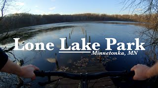
Lone Lake Park
- 3
- 2
-
Purgatory Park
- 2
-
Staring Lake Park
- 5
Popular Minnetonka Mountain Biking Trails
• 100 ★ 4.2 • 4 miles • 415 ft • 438 •
trail system monitored by MORC and Minnetonka MTB Advocates
• 100 ★ 3.7 • 4,117 ft • 59 ft • 431 •
Popular green difficulty singletrack. This multi-use trail can be used both directions. On average it takes 4 minutes to complete this trail.
• 90 ★ 4.0 • 1,211 ft • 6 ft • 158 •
Popular white difficulty paved path. This multi-use trail can be used both directions. On average it takes 2 minutes to complete this trail.
• 95 ★ 5.0 • 5 miles • 5 ft • 122 •
Three Rivers Park Multi Use Pathway Connecting Hopkins to Minneapolis https://www.threeriversparks.org/location/cedar-lake-regional-trail
• 85 ★ 0.0 • 2 miles • 120 ft • 63 •
Popular white difficulty paved path. This multi-use trail can be used both directions. On average it takes 10 minutes to complete this trail.
• 75 ★ 0.0 • 1,519 ft • 0 ft • 57 •
Popular white difficulty paved path. This multi-use trail can be used both directions. On average it takes minutes to complete this trail.
• 60 ★ 0.0 • 2 miles • 17 ft • 33 •
Moderately popular white difficulty paved path. This multi-use trail can be used both directions. On average it takes 7 minutes to complete this trail.
• 55 ★ 0.0 • 4,288 ft • 39 ft • 30 •
Moderately popular white difficulty paved path. This multi-use trail can be used both directions. On average it takes 3 minutes to complete this trail.
Photos of Minnetonka Mountain Bike
Videos of Minnetonka Mountain Bike
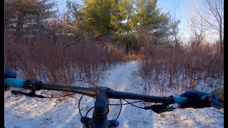
trail: Lone Lake Long Loop
15:00 |
195 |
Dec 14, 2023 , Minnetonka
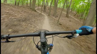
trail: Lone Lake Long Loop
15:43 |
306 |
Sep 7, 2023 , Minnetonka

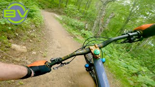
6:47 |
660 |
Sep 1, 2022
youtuber
![Is this the best flow trail in the cities? I...]()
10:08 |
282 |
Jun 9, 2022
9:23 |
623 |
Dec 10, 2020
Recent Trail Reports
| status | trail | date | condition | info | user |
|---|---|---|---|---|---|
| Lone Lake Long Loop | Sep 2, 2025 @ 9:18am Sep 2, 2025 | Unknown | Mwfox952 | ||
| South Cedar Lake Trail | Jun 5, 2025 @ 5:38pm Jun 5, 2025 | Ideal | plmn777 | ||
| Lone Lake Short Loop | May 4, 2025 @ 2:17pm May 4, 2025 | Dry | breichow | ||
| South Leg | Aug 19, 2024 @ 6:22am Aug 19, 2024 | Unknown | WillieJacobsz Trailforks | ||
| Big Hill Lake Trail | Aug 19, 2024 @ 6:22am Aug 19, 2024 | Unknown | WillieJacobsz Trailforks | ||
| Purgatory Park Trail | Aug 28, 2023 @ 12:26am Aug 28, 2023 | Ideal | hremmert |
Activity Feed
| username | action | type | title | date |
|---|---|---|---|---|
| littlejerry7 | ridden | trail | activity #96107011 | Jun 2, 2026 @ 1:37pm Jun 2, 2026 |
| littlejerry7 | wishlist | trail | activity #91769208 | Apr 2, 2026 @ 10:07am Apr 2, 2026 |
| EmmasuiHSc | ridden | trail | activity #79665062 | Sep 4, 2025 @ 9:08pm Sep 4, 2025 |
| Mwfox952 | add | report | activity #79492941 | Sep 2, 2025 @ 9:18am Sep 2, 2025 |
| JestonkWnAMR | ridden | trail | activity #77416798 | Aug 4, 2025 @ 3:28pm Aug 4, 2025 |
Recent Comments
| username | type | title | comment | date |
|---|---|---|---|---|
| trail | Pleasantly surprised by this new trail. It... | Nov 30, 2021 @ 8:08am Nov 30, 2021 | ||
| trail | One way! Decent beginner flow trail with... | May 13, 2021 @ 3:00pm May 13, 2021 |
Local Badges
-

Epic Mountain Bike Climb 2k0 awarded -

Climbing 10k Badge18 awarded -

Mountain Biking 100k Badge0 awarded -

Epic Ride Descent 2k0 awarded -

Descent 10k Badge18 awarded -

Descent 100k Badge0 awarded
Activity Type Stats
| activitytype | trails | distance | descent | descent distance | total vertical | rating | global rank | state rank | photos | reports | routes | ridelogs |
|---|---|---|---|---|---|---|---|---|---|---|---|---|
| Mountain Bike | 28 | 34 miles | 1,204 ft | 11 miles | 226 ft | #6,117 | #2,067 | 2 | 50 | 9,493 | ||
| E-Bike | 23 | 26 miles | 823 ft | 9 miles | 223 ft | #4,872 | #1,537 | 37 | 193 | |||
| Hike | 35 | 37 miles | 1,306 ft | 12 miles | 226 ft | #6,181 | #2,170 | 50 | 456 | |||
| Trail Running | 35 | 37 miles | 1,306 ft | 12 miles | 226 ft | #5,778 | #1,838 | 50 | 169 |
Frequently Asked Questions About Minnetonka
▼
What are the best places to ride in Minnetonka?
Minnetonka has 6 areas to explore for mountain biking. The top rated areas are:
▼
What are the highest rated mountain biking trails in Minnetonka?
The highest rated mountain biking trails in Minnetonka are:
- South Cedar Lake Trail (4.1/5)
- Big Hill Lake Trail (4.1/5)
- Lone Lake Long Loop (4.1/5)
- South Leg (4/5)
- Lone Lake Short Loop (3.9/5)
▼
What is the best time of the year to ride in Minnetonka?
Based on ride log data, the most popular months to ride in Minnetonka are:
- October (40 activities)
- July (35 activities)
- June (32 activities)
▼
Where can I park to ride in Minnetonka?
Activities
- By captainbringdown
 & contributors
 - Admins: apply
- #42673 - 1,590 views
- minnetonka activity log | embed map of Minnetonka mountain bike trails | minnetonka mountain biking points of interest
Downloading of trail gps tracks in kml & gpx formats is enabled for Minnetonka.
You must login to download files.