close
-
Layers w
- Weather Layers
- Pro
- Pro
- Pro
- Pro
- Pro
- Pro
- More Layers
- Pro
- Pro
- Pro
- Pro
-
Upgrade to

3D
Trail Conditions
- Unknown
- Snow Groomed
- Snow Packed
- Snow Covered
- Snow Cover Partial
- Freeze/thaw Cycle
- Icy
- Prevalent Mud
- Wet
- Variable
- Ideal
- Dry
- Very Dry
Trail Flow (Ridden Direction)
Trailforks scans users ridelogs to determine the most popular direction each trail is ridden. A good flowing trail network will have most trails flowing in a single direction according to their intension.
The colour categories are based on what percentage of riders are riding a trail in its intended direction.
The colour categories are based on what percentage of riders are riding a trail in its intended direction.
- > 96%
- > 90%
- > 80%
- > 70%
- > 50%
- < 50%
- bi-directional trail
- no data
Trail Last Ridden
Trailforks scans ridelogs to determine the last time a trail was ridden.
- < 2 days
- < 1 week
- < 2 weeks
- < 1 month
- < 6 months
- > 6 months
Trail Ridden Direction
The intended direction a trail should be ridden.
- Downhill Only
- Downhill Primary
- Both Directions
- Uphill Primary
- Uphill Only
- One Direction
Contribute Details
Colors indicate trail is missing specified detail.
- Description
- Photos
- Description & Photos
- Videos
Trail Popularity ?
Trailforks scans ridelogs to determine which trails are ridden the most in the last 9 months.
Trails are compared with nearby trails in the same city region with a possible 25 colour shades.
Think of this as a heatmap, more rides = more kinetic energy = warmer colors.
- most popular
- popular
- less popular
- not popular
ATV/ORV/OHV Filter
Max Vehicle Width
inches
US Cell Coverage
Legend

Radar Time
Activity Recordings
Trailforks uses anonymized public activity data.
?
Activity Recordings
Trailforks uses anonymized public activity data.
?
Personal Heatmap
▶
Activity Types
all
/
none
▶
Options
2
Date range
month
–
Winter Trails
Warning
A routing network for winter maps does not exist. Selecting trails using the winter trails layer has been disabled.
Missing Trails
Most Popular
Least Popular
Trails are colored based on popularity. The more popular a trail is, the more red. Less popular trails trend towards green.
Jump Magnitude Heatmap
Heatmap of where riders jump on trails. Zoom in to see individual jumps, click circles to view jump details.
BC Backroad Status
![map legend]()
Service Road Atlas is a free to use, community-driven service for viewing and creating reports on the numerous back-country service roads around B.C. and Alberta.

Slope Aspect
Direction the slope faces
Trails Deemphasized
Trails are shown in grey.
Only show trails with no bike usage.
Suggested Layers
Based on selected activity type
Save the current map location and zoom level as your default home location whenever this page is loaded.
Save
No description for Minocqua has been added yet!
Login or register to submit one.
Activities Click to view
- Mountain Bike
16 trails
- E-Bike
15 trails
- Adaptive Bike
2 trails
- Winter Fat Bike
5 trails
- Horse
0 trails
- Hike
15 trails
- Trail Running
15 trails
- Dirtbike/Moto
0 trails
- Observed Trials
0 trails
- ATV/ORV/OHV
0 trails
- Snowmobile
0 trails
- Snowshoe
0 trails
- Downhill Ski
0 trails
- Backcountry Ski
0 trails
- Nordic Ski
34 trails
Region Details
- 1
- 7
- 7
- 1
Region Status
Open as of May 11, 2026Stats
- Trails (view details)
- 51
- Trails Mountain Bike
- 16
- Trails E-Bike
- 15
- Trails Gravel Bike
- 1
- Trails Adaptive Bike
- 2
- Trails Winter Fat Bike
- 5
- Trails Hike
- 15
- Trails Trail Running
- 15
- Trails Nordic Ski
- 34
- Total Distance
- 66 miles
- Total Descent Distance
- 24 miles
- Total Descent
- 2,511 ft
- Total Vertical
- 234 ft
- Highest Trailhead
- 1,723 ft
- Reports
- 120
- Photos
- 5
- Ridden Counter
- 1,559
Sub Regions
-
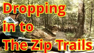
LAMBO Zip Trail
- 6
- 8
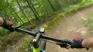
Popular Minocqua Mountain Biking Trails
• 50 ★ 5.0 • 2 miles • 140 ft • 172 •
FREE and open to the public. Groomed for winter fat-biking. About 3.35 miles long. Fun fast and accessible for all riders. Developed with support from the Northwoods Zip Line, The town of Minocqua, and the Wisconsin DNR.
• 75 ★ 5.0 • 2,549 ft • 3 ft • 170 •
Fastest of the ZIP trails! Drop your seat post and let'r rip!
• 65 ★ 0.0 • 1,811 ft • 0 ft • 165 •
Several optional features with a fun drop, kicker, and table at the bottom
• 40 ★ 5.0 • 1,552 ft • 3 ft • 147 •
Moderately popular green difficulty singletrack. This multi-use trail can be used one direction and has a easy overall physical rating with a 3 ft green climb. It features bridge. Trail visibility is always easy to follow. On average it takes 2 minutes to complete this trail.
• 100 ★ 0.0 • 994 ft • 3 ft • 112 •
Intermediate to difficult gravity trail. Drops and small jumps, all rollable or avoidable if needed.
Photos of Minocqua Mountain Bike
Videos of Minocqua Mountain Bike


Recent Trail Reports
| status | trail | date | condition | info | user |
|---|---|---|---|---|---|
| Over | Aug 17, 2025 @ 12:48pm Aug 17, 2025 | Ideal | Rassierm | ||
| Under | Aug 17, 2025 @ 12:48pm Aug 17, 2025 | Ideal | Rassierm | ||
| Mis-Fire | Aug 17, 2025 @ 12:48pm Aug 17, 2025 | Ideal | Rassierm | ||
| Reload | Aug 17, 2025 @ 12:48pm Aug 17, 2025 | Ideal | Rassierm | ||
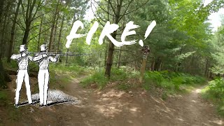
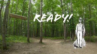
| Ready | Aug 17, 2025 @ 12:48pm Aug 17, 2025 | Ideal | Rassierm | ||
| Gem Trail | Aug 17, 2025 @ 12:48pm Aug 17, 2025 | Ideal | Rassierm | ||
| Double Barrel w | Dec 14, 2024 @ 2:06pm Dec 14, 2024 | Unknown | PerrySmith LAMBO | ||
| Big Blue Ox | Dec 14, 2024 @ 2:06pm Dec 14, 2024 | Ideal | PerrySmith LAMBO | ||
| ZipTrails | Nov 21, 2023 @ 4:56pm Nov 21, 2023 | Ideal | Rassierm | ||
| Aim | Nov 21, 2023 @ 4:56pm Nov 21, 2023 | Ideal | Rassierm |
Activity Feed
| username | action | type | title | date |
|---|---|---|---|---|
| JessVHn93h | wishlist | region | activity #97125242 | Jun 16, 2026 @ 11:14am Jun 16, 2026 |
| SterlingFBhn2D | ridden | trail | activity #95326924 | May 23, 2026 @ 9:25am May 23, 2026 |
| n49IID | wishlist | region | activity #93487631 | Apr 26, 2026 @ 4:33pm Apr 26, 2026 |
| rjheld3 | wishlist | region | activity #84779189 | Nov 26, 2025 @ 8:16pm Nov 26, 2025 |
| weberkaitlinbs | ridden | trail | activity #81838003 and 3 more | Oct 6, 2025 @ 12:43pm Oct 6, 2025 |
Recent Comments
| username | type | title | comment | date |
|---|---|---|---|---|
| trail | Very fun trail! Good for intermediate riders... | Jul 5, 2024 @ 6:40am Jul 5, 2024 | ||
| trail | Fun, flowy, and fast. Some good features and... | Jun 15, 2020 @ 4:59am Jun 15, 2020 | ||
| trail | Awesome fun. Very well maintained and fast. | Jun 14, 2020 @ 10:25am Jun 14, 2020 |
Local Badges
-

Epic Ride Descent 2k0 awarded -

Descent 10k Badge3 awarded -

Descent 100k Badge0 awarded -

Epic Mountain Bike Climb 2k0 awarded -

Climbing 10k Badge1 awarded -

Mountain Biking 100k Badge0 awarded
Activity Type Stats
| activitytype | trails | distance | descent | descent distance | total vertical | rating | global rank | state rank | photos | reports | routes | ridelogs |
|---|---|---|---|---|---|---|---|---|---|---|---|---|
| Mountain Bike | 16 | 26 miles | 797 ft | 10 miles | 190 ft | #11,415 | #3,487 | 5 | 112 | 1,623 | ||
| E-Bike | 15 | 26 miles | 741 ft | 10 miles | 190 ft | #5,041 | #1,572 | 107 | 80 | |||
| Gravel Bike | 1 | 2,037 ft | 3 ft | 410 ft | 30 ft | 2 | ||||||
| Adaptive Bike | 2 | 20 miles | 259 ft | 9 miles | 174 ft | #368 | #1,702 | 26 | ||||
| Winter Fat Bike | 5 | 3 miles | 194 ft | 4,199 ft | 69 ft | #371 | #1,143 | 8 | ||||
| Hike | 15 | 28 miles | 886 ft | 11 miles | 190 ft | #7,816 | #2,758 | 112 | 54 | |||
| Trail Running | 15 | 28 miles | 886 ft | 11 miles | 190 ft | #7,391 | #2,444 | 112 | 9 | |||
| Nordic Ski | 34 | 38 miles | 1,529 ft | 13 miles | 174 ft | #564 | #182 | 8 | 219 |
Frequently Asked Questions About Minocqua
▼
What are the best places to ride in Minocqua?
Minocqua has 3 areas to explore for mountain biking. The top rated areas are:
▼
What are the highest rated mountain biking trails in Minocqua?
The highest rated mountain biking trails in Minocqua are:
- Gem Trail (4.3/5)
- Reload (4.2/5)
- Aim (4.2/5)
- Ready (4.1/5)
- Big Blue Ox (4.1/5)
▼
What is the best time of the year to ride in Minocqua?
Based on ride log data, the most popular months to ride in Minocqua are:
- July (16 activities)
- September (7 activities)
- August (5 activities)
▼
Where can I park to ride in Minocqua?
There are 4 parking locations listed in Minocqua. The most popular parking spots are: View all parking and trailhead locations on the map to plan your visit.
Activities
Trails
Points of Interest
- By LAMBORiders LAMBO & contributors
- Admins: LAMBO
- #33295 - 3,062 views
- minocqua activity log | embed map of Minocqua mountain bike trails | minocqua mountain biking points of interest
Downloading of trail gps tracks in kml & gpx formats is enabled for Minocqua.
You must login to download files.