close
-
Layers w
- Weather Layers
- Pro
- Pro
- Pro
- Pro
- Pro
- Pro
- More Layers
- Pro
- Pro
- Pro
- Pro
-
Upgrade to

3D
Trail Conditions
- Unknown
- Snow Groomed
- Snow Packed
- Snow Covered
- Snow Cover Partial
- Freeze/thaw Cycle
- Icy
- Prevalent Mud
- Wet
- Variable
- Ideal
- Dry
- Very Dry
Trail Flow (Ridden Direction)
Trailforks scans users ridelogs to determine the most popular direction each trail is ridden. A good flowing trail network will have most trails flowing in a single direction according to their intension.
The colour categories are based on what percentage of riders are riding a trail in its intended direction.
The colour categories are based on what percentage of riders are riding a trail in its intended direction.
- > 96%
- > 90%
- > 80%
- > 70%
- > 50%
- < 50%
- bi-directional trail
- no data
Trail Last Ridden
Trailforks scans ridelogs to determine the last time a trail was ridden.
- < 2 days
- < 1 week
- < 2 weeks
- < 1 month
- < 6 months
- > 6 months
Trail Ridden Direction
The intended direction a trail should be ridden.
- Downhill Only
- Downhill Primary
- Both Directions
- Uphill Primary
- Uphill Only
- One Direction
Contribute Details
Colors indicate trail is missing specified detail.
- Description
- Photos
- Description & Photos
- Videos
Trail Popularity ?
Trailforks scans ridelogs to determine which trails are ridden the most in the last 9 months.
Trails are compared with nearby trails in the same city region with a possible 25 colour shades.
Think of this as a heatmap, more rides = more kinetic energy = warmer colors.
- most popular
- popular
- less popular
- not popular
ATV/ORV/OHV Filter
Max Vehicle Width
inches
US Cell Coverage
Legend

Radar Time
Activity Recordings
Trailforks uses anonymized public activity data.
?
Activity Recordings
Trailforks uses anonymized public activity data.
?
Personal Heatmap
▶
Activity Types
all
/
none
▶
Options
2
Date range
month
–
Winter Trails
Warning
A routing network for winter maps does not exist. Selecting trails using the winter trails layer has been disabled.
Missing Trails
Most Popular
Least Popular
Trails are colored based on popularity. The more popular a trail is, the more red. Less popular trails trend towards green.
Jump Magnitude Heatmap
Heatmap of where riders jump on trails. Zoom in to see individual jumps, click circles to view jump details.
BC Backroad Status
![map legend]()
Service Road Atlas is a free to use, community-driven service for viewing and creating reports on the numerous back-country service roads around B.C. and Alberta.

Slope Aspect
Direction the slope faces
Trails Deemphasized
Trails are shown in grey.
Only show trails with no bike usage.
Suggested Layers
Based on selected activity type
Save the current map location and zoom level as your default home location whenever this page is loaded.
Save
No description for Minooka Park has been added yet!
Login or register to submit one.
 google parking directions
Primary Trail Type: Cross-Country
Land Status: County Park
Land Manager: Waukesha County Parks
google parking directionsLinks
Activities Click to view
- Mountain Bike
4 trails
- E-Bike
4 trails
- Hike
0 trails
- Trail Running
0 trails
Region Details
- 2
- 2
Region Status
Open as of 3 hoursStats
- Avg Trail Rating
- Trails (view details)
- 4
- Trails Mountain Bike
- 4
- Trails E-Bike
- 4
- Total Distance
- 6 miles
- Total Descent Distance
- 2 miles
- Total Descent
- 376 ft
- Total Vertical
- 110 ft
- Highest Trailhead
- 1,060 ft
- Reports
- 204
- Photos
- 46
- Ridden Counter
- 1,493
Popular Minooka Park Mountain Biking Trails
• 45 ★ 0.0 • 358 ft • 0 ft • 179 •
Moderately popular green difficulty singletrack. This mountain bike primary trail can be used one direction and has a easy overall physical rating with a 0 ft green climb. On average it takes 5 minutes to complete this trail.
• 75 ★ 3.0 • 154 ft • 0 ft • 170 •
Starts with some larger rounded boulders while simultaneously threading between two trees. Continues with a short easy section before more rock gardens; these rocks are more technical than the easy-to-roll-through gardens on . Has a...
Minooka Park Mountain Bike Routes
• 20 miles • 1,304 ft • 7 •
• 16 miles • 955 ft • 12 •
• 30 miles • 353 ft • 2 •
• 11 miles • 687 ft • 10 •
• 11 miles • 671 ft • 8 •
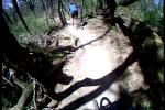
Photos of Minooka Park Mountain Bike


Recent Trail Reports
| status | trail | date | condition | info | user |
|---|---|---|---|---|---|
| Green Bailout | Jun 20, 2026 @ 1:59pm (America/Chicago) 9 hours | Ideal | Jon-Mc | ||
| Link | Jun 20, 2026 @ 1:59pm (America/Chicago) 9 hours | Ideal | Jon-Mc | ||
| Green Loop | Jun 20, 2026 @ 1:59pm (America/Chicago) 9 hours | Ideal | Jon-Mc | ||
| Blue Loop | Jun 20, 2026 @ 1:59pm (America/Chicago) 9 hours | Ideal | Jon-Mc | ||
| Chunky Goblin | Jun 13, 2026 @ 4:44pm (America/Chicago) Jun 13, 2026 | Ideal | Jon-Mc |
Activity Feed
| username | action | type | title | date |
|---|---|---|---|---|
| Jon-Mc | add | report | activity #97445838 and 3 more | Jun 20, 2026 @ 5:42pm 3 hours |
| Jon-Mc | add | report | activity #96938189 and 3 more | Jun 13, 2026 @ 9:26pm Jun 13, 2026 |
| Ria224 | wishlist | region | activity #93410274 | Apr 25, 2026 @ 7:56pm Apr 25, 2026 |
| lojones5 | add | report | activity #92260005 and 2 more | Apr 9, 2026 @ 9:43am Apr 9, 2026 |
| ssstraub | update | region | activity #86675835 | Jan 4, 2026 @ 6:53pm Jan 4, 2026 |
Recent Comments
| username | type | title | comment | date |
|---|---|---|---|---|
| trail | Good trail. Occasional rock garden and tech... | Oct 9, 2021 @ 2:10pm Oct 9, 2021 |
Nearby Areas
| name | distance | ||||
|---|---|---|---|---|---|
| Meadow View Bike Park | 1 | 1 | 7.9 km | ||
| Kegel Alpha | 2 | 1 | 8.9 km | ||
| Hoyt Park | 9.9 km | ||||
| Oak Hill | 3 | 5 | 11 km | ||
| Kettle Moraine SF - Lapham Peak Unit | 1 | 11.3 km |
Local Mountain Biking Directory
-
CyclesmithBike Shop
Activity Type Stats
| activitytype | trails | distance | descent | descent distance | total vertical | rating | global rank | state rank | photos | reports | routes | ridelogs |
|---|---|---|---|---|---|---|---|---|---|---|---|---|
| Mountain Bike | 4 | 6 miles | 377 ft | 2 miles | 112 ft | #6,920 | #2,639 | 46 | 191 | 1 | 6,091 | |
| E-Bike | 4 | 6 miles | 377 ft | 2 miles | 112 ft | #7,914 | #2,402 | 154 | 109 |
- By brenthillier
 NSMBA TRAILFORKS & contributors
 - Admins: METRO
- #7436 - 12,640 views
- minooka park activity log | embed map of Minooka Park mountain bike trails | minooka park mountain biking points of interest
Downloading of trail gps tracks in kml & gpx formats is enabled for Minooka Park.
You must login to download files.