close
-
Layers w
- Weather Layers
- Pro
- Pro
- Pro
- Pro
- Pro
- Pro
- More Layers
- Pro
- Pro
- Pro
- Pro
-
Upgrade to

3D
Trail Conditions
- Unknown
- Snow Groomed
- Snow Packed
- Snow Covered
- Snow Cover Partial
- Freeze/thaw Cycle
- Icy
- Prevalent Mud
- Wet
- Variable
- Ideal
- Dry
- Very Dry
Trail Flow (Ridden Direction)
Trailforks scans users ridelogs to determine the most popular direction each trail is ridden. A good flowing trail network will have most trails flowing in a single direction according to their intension.
The colour categories are based on what percentage of riders are riding a trail in its intended direction.
The colour categories are based on what percentage of riders are riding a trail in its intended direction.
- > 96%
- > 90%
- > 80%
- > 70%
- > 50%
- < 50%
- bi-directional trail
- no data
Trail Last Ridden
Trailforks scans ridelogs to determine the last time a trail was ridden.
- < 2 days
- < 1 week
- < 2 weeks
- < 1 month
- < 6 months
- > 6 months
Trail Ridden Direction
The intended direction a trail should be ridden.
- Downhill Only
- Downhill Primary
- Both Directions
- Uphill Primary
- Uphill Only
- One Direction
Contribute Details
Colors indicate trail is missing specified detail.
- Description
- Photos
- Description & Photos
- Videos
Trail Popularity ?
Trailforks scans ridelogs to determine which trails are ridden the most in the last 9 months.
Trails are compared with nearby trails in the same city region with a possible 25 colour shades.
Think of this as a heatmap, more rides = more kinetic energy = warmer colors.
- most popular
- popular
- less popular
- not popular
ATV/ORV/OHV Filter
Max Vehicle Width
inches
US Cell Coverage
Legend

Radar Time
Activity Recordings
Trailforks uses anonymized public activity data.
?
Activity Recordings
Trailforks uses anonymized public activity data.
?
Personal Heatmap
▶
Activity Types
all
/
none
▶
Options
2
Date range
month
–
Winter Trails
Warning
A routing network for winter maps does not exist. Selecting trails using the winter trails layer has been disabled.
Missing Trails
Most Popular
Least Popular
Trails are colored based on popularity. The more popular a trail is, the more red. Less popular trails trend towards green.
Jump Magnitude Heatmap
Heatmap of where riders jump on trails. Zoom in to see individual jumps, click circles to view jump details.
BC Backroad Status
![map legend]()
Service Road Atlas is a free to use, community-driven service for viewing and creating reports on the numerous back-country service roads around B.C. and Alberta.

Slope Aspect
Direction the slope faces
Trails Deemphasized
Trails are shown in grey.
Only show trails with no bike usage.
Suggested Layers
Based on selected activity type
Save the current map location and zoom level as your default home location whenever this page is loaded.
Save
No description for Mississauga has been added yet!
Login or register to submit one.
Activities Click to view
- Mountain Bike
192 trails
- E-Bike
58 trails
- Gravel Bike
1 trails
- Adaptive Bike
0 trails
- Winter Fat Bike
0 trails
- Hike
177 trails
- Trail Running
175 trails
- Snowshoe
17 trails
- Nordic Ski
13 trails
Region Details
- 63
- 16
- 52
- 39
- 15
- 7
Region Status
Caution as of Jun 5, 2026Stats
- Avg Trail Rating
- Trails (view details)
- 193
- Trails Mountain Bike
- 192
- Trails E-Bike
- 58
- Trails Gravel Bike
- 1
- Trails Hike
- 177
- Trails Trail Running
- 175
- Trails Snowshoe
- 17
- Trails Nordic Ski
- 13
- Total Distance
- 96 miles
- Total Descent
- 3,420 ft
- Total Vertical
- 439 ft
- Highest Trailhead
- 686 ft
- Reports
- 1,343
- Photos
- 2,057
- Ridden Counter
- 12,750
Sub Regions
-
Credit Meadows Park
-
Erindale Park
- 11
- 10
- 5
- 2
-
Jim Tovey Lakeview Conservation Area
-
Mary Fix Park
- 2
-
Meadowvale Conservation Area
- 6
- 3
- 1
-
Meadowvale Woods North Park
- 3
- 1
-
Rattray Marsh
- 1
- 5
-
Riverwood
- 10
- 15
- 7
- 4
-
Sawmill Creek
- 5
-
Windrush Woods Park
- 2
- 1
- 2
Popular Mississauga Mountain Biking Trails
• 100 ★ 5.0 • 643 ft • 0 ft • 261 •
A swift single-track downhill with a moderate decline. Difficulty based on off-camber and root sections.
• 100 ★ 4.0 • 758 ft • 0 ft • 259 •
Dirt pathway connecting the with the Culham trail. Has some optional little jumps on the sides.
• 95 ★ 4.0 • 2,618 ft • 25 ft • 219 •
Scenic route off of the mainline Culham Trail through part of the Riverwood Conservatory.
• 100 ★ 4.8 • 1,512 ft • 0 ft • 210 •
Fun singletrack line cut out of the side of the hill. Best ridden from east to west (Towards the 403, starting on the Burnhamthorpe side). Trail has a few small drops and a jump at the end.
• 100 ★ 5.0 • 2,274 ft • 34 ft • 203 •
Loop around the old Zaichuk property thats now owned by the City of Mississauga as part of the Riverwood Conservation Area. One of the best loops in the around, great for sessioning.
• 100 ★ 4.5 • 400 ft • 0 ft • 192 •
Loose gravel / dirt ascent connecting the Culham Trail to the Zaichuk property.
• 95 ★ 5.0 • 1 mile • 103 ft • 180 •
This part of the Culham trail network features a large incline taking users from Hewick Meadows up to Credit Pointe Drive. The trail continues underneath Eglinton Road and ends next to the Grain Mills on Barbertown Road in Streetsville.
• 80 ★ 5.0 • 1 mile • 12 ft • 178 •
Popular white difficulty mixed. This mountain bike primary trail can be used both directions. On average it takes 7 minutes to complete this trail.
Mississauga Mountain Bike Routes
★ 5.0 • 1,309 ft • 1 • Loop •
Beginner friendly, single track loop using the start of into Inner Zaichuk and back onto the end of...
★ 5.0 • 4,629 ft • 31 ft • 2 • Loop •
The top loop in Riverwood along the 403. Great for sessioning.
8 miles • 440 ft • 17 • Point to Point •
Starting out at Riverwood at the Westborough entrance heading through the trail network and then crossing...
★ 5.0 • 6 miles • 101 ft • 0 • Loop •
A beautiful round-trip along the trails around South and Central Meadowvale - starting off at Windwood...
10 miles • 707 ft • 13 • Out & Back •
Park at UTM and Ride into Erindale park and out to Streetsville then back again and up along the ridge...
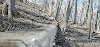
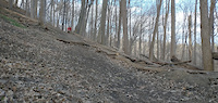
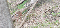
Photos of Mississauga Mountain Bike
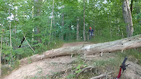
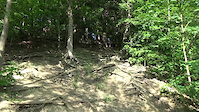
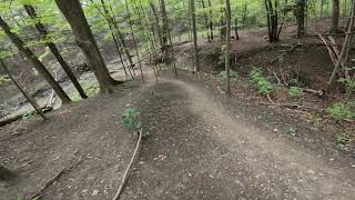
Videos of Mississauga Mountain Bike
trail: Remastered
0:18 |
82 |
Jul 17, 2022
trail: Remastered
0:07 |
76 |
Jul 17, 2022
0:35 |
19 |
Jul 17, 2022
0:12 |
75 |
Jul 17, 2022
trail: Chute to Kill
0:15 |
123 |
Jul 16, 2022
trail: Pipehill
0:29 |
142 |
Oct 20, 2021

trail: Spinning Out
0:48 |
52 |
Oct 12, 2021
trail: Cut Short
0:28 |
283 |
Oct 2, 2021 , Mississauga
Current Trail Warnings
| status | trail | date | condition | user | info |
|---|---|---|---|---|---|
| Swift Thistle | Jun 5, 2026 @ 5:59pm (America/Toronto) Jun 5, 2026 | Dry | YurieqkmR0 | trail is pretty much gone for the most... |
Recent Trail Reports
| status | trail | date | condition | info | user |
|---|---|---|---|---|---|
| Salmon Run | Jun 5, 2026 @ 6:08pm (America/Toronto) Jun 5, 2026 | Unknown | YurieqkmR0 | ||
| Spin to Win | May 31, 2026 @ 3:27pm (America/Toronto) May 31, 2026 | Variable | MCGiorgi | ||
| Inner Zaichuk | May 26, 2026 @ 6:53pm (America/Toronto) May 26, 2026 | Icy | ShredMogul | ||
| Burnhamthorpe Trail | May 19, 2026 @ 1:34pm (America/Toronto) May 19, 2026 | Dry | extremumadventura | ||
| Queensway Trail | May 19, 2026 @ 1:33pm (America/Toronto) May 19, 2026 | Variable | extremumadventura | ||
| Little Etobicoke Creek South | May 19, 2026 @ 1:32pm (America/Toronto) May 19, 2026 | Unknown | extremumadventura | ||
| Derailment | May 17, 2026 @ 3:12pm (America/Toronto) May 17, 2026 | Dry | YurieqkmR0 | ||
| Pipe Run | May 8, 2026 @ 2:35am (America/Toronto) May 7, 2026 | Unknown | BrunoHD | ||
| Pine Roller Coaster | Apr 25, 2026 @ 2:58pm (America/Toronto) Apr 25, 2026 | Variable | BrunoHD | ||
| Pipehill | Apr 25, 2026 @ 2:07pm (America/Toronto) Apr 25, 2026 | Variable | BrunoHD |
Activity Feed
| username | action | type | title | date |
|---|---|---|---|---|
| YurieqkmR0 | add | report | activity #96323255 and 1 more | Jun 5, 2026 @ 2:59pm Jun 5, 2026 |
| SYSSMouse | add | trail | activity #96076435 | Jun 2, 2026 @ 5:23am Jun 2, 2026 |
| SYSSMouse | add | region | activity #96076420 | Jun 2, 2026 @ 5:22am Jun 2, 2026 |
| MCGiorgi | add | report | activity #95968069 | May 31, 2026 @ 12:28pm May 31, 2026 |
| MCGiorgi | add | report | activity #95672252 | May 27, 2026 @ 5:13pm May 27, 2026 |
Recent Comments
| username | type | title | comment | date |
|---|---|---|---|---|
| report | Trail not real* | Mar 26, 2026 @ 6:21am Mar 26, 2026 | ||
| trail | Just FYI it appears the city doesn't want any... | Nov 5, 2025 @ 6:20am Nov 5, 2025 | ||
| trail | Overgrown completely. Can't see the entrance. | Oct 25, 2025 @ 1:04pm Oct 25, 2025 | ||
| trail | Doesn't exist anymore. Overgrown. Can't find... | Oct 25, 2025 @ 12:51pm Oct 25, 2025 | ||
| trail | Needs a lot of maintenance. Completely... | Oct 5, 2025 @ 10:39am Oct 5, 2025 |
Local Badges
-

Epic Ride Climb 2k3 awarded -

Climbing 10k Badge34 awarded -

Climbing 100k Badge0 awarded -

Epic Ride Descent 2k2 awarded -

Descent 10k Badge34 awarded -

Descent 100k Badge0 awarded
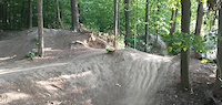
Bike & Skill Parks
| name | type | city | rating |
|---|---|---|---|
| Ellis Leuschner Challenge Park | skill park | Mississauga | |
| Clarkson Dirt Jump Park | skill park | Mississauga | |
| Windrush Woods Dirt Jump Bike Park | skill park | Mississauga | |
| Iceland Skatepark | skill park | Mississauga |
Activity Type Stats
| activitytype | trails | distance | descent | descent distance | total vertical | rating | global rank | state rank | photos | reports | routes | ridelogs |
|---|---|---|---|---|---|---|---|---|---|---|---|---|
| Mountain Bike | 192 | 96 miles | 3,402 ft | 33 miles | 440 ft | #743 | #23 | 1,070 | 1,342 | 6 | 13,816 | |
| E-Bike | 58 | 44 miles | 1,683 ft | 18 miles | 413 ft | #2,253 | #49 | 8 | 976 | 271 | ||
| Gravel Bike | 1 | #303 | #42 | 3 | 1 | 115 | ||||||
| Hike | 177 | 94 miles | 3,304 ft | 32 miles | 440 ft | #389 | #5 | 979 | 1,308 | 1 | 623 | |
| Trail Running | 175 | 93 miles | 3,274 ft | 32 miles | 440 ft | #401 | #6 | 1,304 | 1 | 1,965 | ||
| Snowshoe | 17 | 6 miles | 151 ft | 2 miles | 344 ft | #613 | #65 | 14 | 6 | |||
| Nordic Ski | 13 | 7 miles | 207 ft | 3 miles | 344 ft | #638 | #41 | 9 | 29 |
Frequently Asked Questions About Mississauga
▼
What are the best places to ride in Mississauga?
Mississauga has 10 areas to explore for mountain biking. The top rated areas are:
▼
What are the highest rated mountain biking trails in Mississauga?
The highest rated mountain biking trails in Mississauga are:
- UTM Nature Trail (4.4/5)
- Pipehill (4.4/5)
- Snapping Turtle DH (4.3/5)
- Zaichuk Loop (4.3/5)
- Chappell Creek Run (4.3/5)
▼
What is the best time of the year to ride in Mississauga?
Based on ride log data, the most popular months to ride in Mississauga are:
- July (313 activities)
- June (268 activities)
- May (232 activities)
▼
Where can I park to ride in Mississauga?
Activities
Trails
- By brenthillier
 NSMBA TRAILFORKS & contributors
 - Admins: MMBA
- #3376 - 29,948 views
- mississauga activity log | embed map of Mississauga mountain bike trails | mississauga mountain biking points of interest
Downloading of trail gps tracks in kml & gpx formats is enabled for Mississauga.
You must login to download files.