close
-
Layers w
- Weather Layers
- Pro
- Pro
- Pro
- Pro
- Pro
- Pro
- More Layers
- Pro
- Pro
- Pro
- Pro
-
Upgrade to

3D
Trail Conditions
- Unknown
- Snow Groomed
- Snow Packed
- Snow Covered
- Snow Cover Partial
- Freeze/thaw Cycle
- Icy
- Prevalent Mud
- Wet
- Variable
- Ideal
- Dry
- Very Dry
Trail Flow (Ridden Direction)
Trailforks scans users ridelogs to determine the most popular direction each trail is ridden. A good flowing trail network will have most trails flowing in a single direction according to their intension.
The colour categories are based on what percentage of riders are riding a trail in its intended direction.
The colour categories are based on what percentage of riders are riding a trail in its intended direction.
- > 96%
- > 90%
- > 80%
- > 70%
- > 50%
- < 50%
- bi-directional trail
- no data
Trail Last Ridden
Trailforks scans ridelogs to determine the last time a trail was ridden.
- < 2 days
- < 1 week
- < 2 weeks
- < 1 month
- < 6 months
- > 6 months
Trail Ridden Direction
The intended direction a trail should be ridden.
- Downhill Only
- Downhill Primary
- Both Directions
- Uphill Primary
- Uphill Only
- One Direction
Contribute Details
Colors indicate trail is missing specified detail.
- Description
- Photos
- Description & Photos
- Videos
Trail Popularity ?
Trailforks scans ridelogs to determine which trails are ridden the most in the last 9 months.
Trails are compared with nearby trails in the same city region with a possible 25 colour shades.
Think of this as a heatmap, more rides = more kinetic energy = warmer colors.
- most popular
- popular
- less popular
- not popular
ATV/ORV/OHV Filter
Max Vehicle Width
inches
US Cell Coverage
Legend

Radar Time
Activity Recordings
Trailforks uses anonymized public activity data.
?
Activity Recordings
Trailforks uses anonymized public activity data.
?
Personal Heatmap
▶
Activity Types
all
/
none
▶
Options
2
Date range
month
–
Winter Trails
Warning
A routing network for winter maps does not exist. Selecting trails using the winter trails layer has been disabled.
Missing Trails
Most Popular
Least Popular
Trails are colored based on popularity. The more popular a trail is, the more red. Less popular trails trend towards green.
Jump Magnitude Heatmap
Heatmap of where riders jump on trails. Zoom in to see individual jumps, click circles to view jump details.
BC Backroad Status
![map legend]()
Service Road Atlas is a free to use, community-driven service for viewing and creating reports on the numerous back-country service roads around B.C. and Alberta.

Slope Aspect
Direction the slope faces
Trails Deemphasized
Trails are shown in grey.
Only show trails with no bike usage.
Suggested Layers
Based on selected activity type
Save the current map location and zoom level as your default home location whenever this page is loaded.
SavePopular Trail Networks
view all areas »
No description for Mississippi has been added yet!
Login or register to submit one.
Region Details
- 86
- 2
- 124
- 143
- 12
- 1
Stats
- Avg Trail Rating
- Trails (view details)
- 410
- Trails Mountain Bike
- 369
- Trails E-Bike
- 117
- Trails Gravel Bike
- 20
- Trails Adaptive Bike
- 26
- Trails Winter Fat Bike
- 7
- Trails Horse
- 43
- Trails Hike
- 374
- Trails Trail Running
- 374
- Total Distance
- 647 miles
- Total Descent
- 34,999 ft
- Total Vertical
- 685 ft
- Highest Trailhead
- 686 ft
- Reports
- 1,799
- Photos
- 454
- Ridden Counter
- 15,103
Sub Regions
- Central Mississippi Region (84)
- Chocktaw County (21)
- Lauderdale County (49)
- Oktibbeha County (6)
- Coastal Mississippi Region (63)
- George County (1)
- Hancock County (4)
- Harrison County (37)
- Jackson County (21)
- Pearl River County (7)
- Stone County (1)
- North Mississippi Region (67)
- Alcorn County (6)
- Desoto County (15)
- Lafayette County (18)
- Lee County (6)
- Pontotoc County (13)
- Tate County (7)
- Tishomingo County (2)
- South Mississippi Region (75)
- Clarke County (15)
- Forrest County (25)
- Franklin County (5)
- Lincoln County (14)
- Scott County (15)
- Wilkinson County (0)
- Tri-County Region Mississippi (71)
- Hinds County (19)
- Madison County (22)
- Rankin County (30)
Popular Mississippi Mountain Biking Trails
• 85 ★ 4.6 • 3 miles • 195 ft • 187 •
The "OG" is the heart of the original 6 mile trail that was carefully and lovingly laid out on a relatively small plot of land. The terrain is mostly hard packed. There are several short and punchy hills designed to get your heart rate up.
• 90 ★ 4.0 • 1,001 ft • 19 ft • 164 •
Wide, smooth road/trail leading into the trail system from the trail head. At the south end heading away from the , go left for a short and fairly beginner friendly ride or go right for everything else!
• 90 ★ 3.0 • 1 mile • 58 ft • 140 •
New to mountain biking? This is your place to start! A fun, flowy trail that is relatively flat. It's also a good place to begin honing skills like jumps, pumps, and cornering.
• 60 ★ 3.0 • 3,586 ft • 35 ft • 139 •
Moderately popular green difficulty singletrack. This mountain bike primary trail can be used one direction and has a easy overall physical rating with a 35 ft green climb. It features berm, jump and wallride. On average it takes 3 minutes to complete this trail.
• 70 ★ 3.7 • 417 ft • 0 ft • 139 •
Fast section of trail with a wooden berm boosting you across the pond dam (think flashing arrows on Mario Kart). Watch out for cross traffic as you exit the pond dam.
• 65 ★ 4.5 • 4,327 ft • 67 ft • 131 •
Moderately popular green difficulty singletrack. This multi-use trail can be used one direction and has a easy overall physical rating with a 67 ft blue climb. Trail visibility is always easy to follow. On average it takes 6 minutes to complete this trail.
• 80 ★ 3.7 • 2 miles • 108 ft • 132 •
Popular blue difficulty singletrack. This mountain bike primary trail can be used both directions. It features berm and rock garden. On average it takes 7 minutes to complete this trail.
• 100 ★ 3.7 • 574 ft • 0 ft • 120 •
is a double black diamond trail that begins with a very steep drop-in followed by an aggressive jump, a shark fin, a small drop, big berm and finally a very large drop at the end. Expert riders only should ride this trail. Pre-ride,...
Mississippi Mountain Bike Routes
A51 Figure Eight Featured
3 miles • 356 ft • 6 • Loop •
Fun figure eight route that brings you past Outpost Alfa several times then spits you out at the trailhead.
8 miles • 622 ft • 4 • Loop •
The Area51 XC Race track is approximately 9 miles in length The route begins at the yellow gate located on...
10 miles • 743 ft • 5 • Loop •
FKA, The Northside Trail - Follow the red blazes (spray-painted on the trees) to connect many of the...
★ 4.0 • 6 miles • 510 ft • 3 • Loop •
Voyager Loop (including temp trail) as of 10/10/22
24 miles • 1,737 ft • 7 • Loop •
Moderately difficult course throughout the Noxubee Hills Trail System in Ackerman, MS. This course...
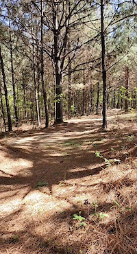
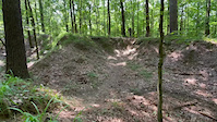
Photos of Mississippi Mountain Bike
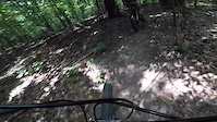
Videos of Mississippi Mountain Bike
trail: The OG
0:07 |
86 |
Apr 3, 2022
trail: Berm Loop
0:11 |
92 |
Jul 5, 2021
trail: Gemini
2:37 |
297 |
Jul 5, 2021

trail: Spash Down
0:55 |
359 |
Jul 5, 2021
0:11 |
94 |
Jul 4, 2021
trail: Berm Loop
0:16 |
53 |
Jul 4, 2021

trail: Bayou Point
0:11 |
113 |
Jul 4, 2021
trail: The OG
3:30 |
752 |
Nov 17, 2011
Activity Feed
| username | action | type | title | date |
|---|---|---|---|---|
| barlowman | wishlist | trail | activity #96982410 and 2 more | Jun 14, 2026 @ 10:12am Jun 14, 2026 |
| Kwdawg | add | report | activity #96952367 and 3 more | Jun 14, 2026 @ 3:56am Jun 14, 2026 |
| Kwdawg | add | report | activity #96952127 | Jun 14, 2026 @ 3:53am Jun 14, 2026 |
| Ryanlhoover2 | add | report | activity #96684273 | Jun 10, 2026 @ 10:57am Jun 10, 2026 |
| Kevin1uqbYv | add | report | activity #96666070 and 2 more | Jun 10, 2026 @ 5:31am Jun 10, 2026 |
Recent Comments
| username | type | title | comment | date |
|---|---|---|---|---|
| report | Yes it was a mess, the whole area looks like a... | Jun 1, 2026 @ 6:27pm Jun 1, 2026 | ||
| report | Not rideable, many trees blocking the trail. | May 9, 2026 @ 8:33pm May 9, 2026 | ||
| report | treedown | Apr 3, 2026 @ 12:25pm Apr 3, 2026 | ||
| trail | Tried to ride through these trails today, but... | Nov 15, 2025 @ 1:39pm Nov 15, 2025 | ||
| trail | Fun trail. Need to keep focused to follow but... | Oct 10, 2025 @ 9:02am Oct 10, 2025 |
Local Badges
-

Area 51 Mile Club36 awarded -

Descent 10k Badge3 awarded -

Epic Ride Descent 2k0 awarded -
Epic Ride Descent 2k0 awarded -
Descent 10k Badge2 awarded -
Descent 10k Badge1 awarded
Bike & Skill Parks
| name | type | city | rating |
|---|---|---|---|
| Red Creek Off-Road | skill park | Saucier | |
| Barnyard Mud Boggers | skill park | Fulton | |
| Dirty Deeds MX | skill park | Meridian | |
| MX886 | skill park | Pontotoc | |
| Veterans MX Park | skill park | Fulton |
Activity Type Stats
| activitytype | trails | distance | descent | descent distance | total vertical | rating | global rank | state rank | photos | reports | routes | ridelogs |
|---|---|---|---|---|---|---|---|---|---|---|---|---|
| Mountain Bike | 369 | 578 miles | 28,993 ft | 219 miles | 686 ft | #59 | 420 | 1,777 | 35 | 34,607 | ||
| E-Bike | 117 | 129 miles | 6,407 ft | 47 miles | 594 ft | #58 | 5 | 1,400 | 3 | 1,241 | ||
| Gravel Bike | 20 | 61 miles | 1,611 ft | 20 miles | 597 ft | #53 | 21 | 3 | 332 | |||
| Adaptive Bike | 26 | 105 miles | 2,057 ft | 39 miles | 469 ft | #50 | 23 | 6 | ||||
| Winter Fat Bike | 7 | 13 miles | 620 ft | 5 miles | 387 ft | #55 | 78 | |||||
| Horse | 43 | 134 miles | 7,090 ft | 50 miles | 512 ft | #46 | 2 | 446 | 377 | |||
| Hike | 374 | 617 miles | 30,932 ft | 234 miles | 686 ft | #58 | 26 | 1,766 | 5 | 1,668 | ||
| Trail Running | 374 | 617 miles | 30,932 ft | 234 miles | 686 ft | #58 | 1 | 1,768 | 6 | 1,118 |
Activities
Trails
Points of Interest
- E2 - [Emergency Evacuation Point] Other
- E15 - [Emergency Evacuation Point] Other
- E14 - [Emergency Evacuation Point] Other
- E13 - [Emergency Evacuation Point] Other
- E12 - [Emergency Evacuation Point] Other
- E11 - [Emergency Evacuation Point] Other
- E10 - [Emergency Evacuation Point] Other
- E9 - [Emergency Evacuation Point] Other
- E8 - [Emergency Evacuation Point] Other
- E7 - [Emergency Evacuation Point] Other
- By canadaka
 Trailforks & contributors
 - Admins: Map Team, IMBA, chuktA, msmcfate, WillieJacobsz, PlumbBobM, ReckitRolley, colinreuter, SORBA
- #3221 - 15,787 views
- mississippi activity log | embed map of Mississippi mountain bike trails | mississippi mountain biking points of interest polygons
Downloading of trail gps tracks in kml & gpx formats is enabled for Mississippi.
You must login to download files.