close
-
Layers w
- Weather Layers
- Pro
- Pro
- Pro
- Pro
- Pro
- Pro
- More Layers
- Pro
- Pro
- Pro
- Pro
-
Upgrade to

3D
Trail Conditions
- Unknown
- Snow Groomed
- Snow Packed
- Snow Covered
- Snow Cover Partial
- Freeze/thaw Cycle
- Icy
- Prevalent Mud
- Wet
- Variable
- Ideal
- Dry
- Very Dry
Trail Flow (Ridden Direction)
Trailforks scans users ridelogs to determine the most popular direction each trail is ridden. A good flowing trail network will have most trails flowing in a single direction according to their intension.
The colour categories are based on what percentage of riders are riding a trail in its intended direction.
The colour categories are based on what percentage of riders are riding a trail in its intended direction.
- > 96%
- > 90%
- > 80%
- > 70%
- > 50%
- < 50%
- bi-directional trail
- no data
Trail Last Ridden
Trailforks scans ridelogs to determine the last time a trail was ridden.
- < 2 days
- < 1 week
- < 2 weeks
- < 1 month
- < 6 months
- > 6 months
Trail Ridden Direction
The intended direction a trail should be ridden.
- Downhill Only
- Downhill Primary
- Both Directions
- Uphill Primary
- Uphill Only
- One Direction
Contribute Details
Colors indicate trail is missing specified detail.
- Description
- Photos
- Description & Photos
- Videos
Trail Popularity ?
Trailforks scans ridelogs to determine which trails are ridden the most in the last 9 months.
Trails are compared with nearby trails in the same city region with a possible 25 colour shades.
Think of this as a heatmap, more rides = more kinetic energy = warmer colors.
- most popular
- popular
- less popular
- not popular
ATV/ORV/OHV Filter
Max Vehicle Width
inches
US Cell Coverage
Legend

Radar Time
Activity Recordings
Trailforks uses anonymized public activity data.
?
Activity Recordings
Trailforks uses anonymized public activity data.
?
Personal Heatmap
▶
Activity Types
all
/
none
▶
Options
2
Date range
month
–
Winter Trails
Warning
A routing network for winter maps does not exist. Selecting trails using the winter trails layer has been disabled.
Missing Trails
Most Popular
Least Popular
Trails are colored based on popularity. The more popular a trail is, the more red. Less popular trails trend towards green.
Jump Magnitude Heatmap
Heatmap of where riders jump on trails. Zoom in to see individual jumps, click circles to view jump details.
BC Backroad Status
![map legend]()
Service Road Atlas is a free to use, community-driven service for viewing and creating reports on the numerous back-country service roads around B.C. and Alberta.

Slope Aspect
Direction the slope faces
Trails Deemphasized
Trails are shown in grey.
Only show trails with no bike usage.
Suggested Layers
Based on selected activity type
Save the current map location and zoom level as your default home location whenever this page is loaded.
SavePopular Trail Networks
view all areas »
No description for Missoula has been added yet!
Login or register to submit one.
Region Supporters & Maintainers
![]()
MTB MissoulaMaintainer
Activities Click to view
- Mountain Bike
441 trails
- E-Bike
74 trails
- Gravel Bike
1 trails
- Adaptive Bike
1 trails
- Winter Fat Bike
0 trails
- Horse
222 trails
- Hike
551 trails
- Trail Running
550 trails
- Dirtbike/Moto
63 trails
- ATV/ORV/OHV
34 trails
- Snowmobile
4 trails
- Snowshoe
228 trails
- Downhill Ski
61 trails
- Backcountry Ski
55 trails
- Nordic Ski
47 trails
Region Details
- 103
- 20
- 152
- 126
- 31
- 2
Region Status
Open as of Jun 17, 2026Stats
- Avg Trail Rating
- Trails (view details)
- 640
- Trails Mountain Bike
- 441
- Trails E-Bike
- 74
- Trails Gravel Bike
- 1
- Trails Adaptive Bike
- 1
- Trails Horse
- 222
- Trails Hike
- 551
- Trails Trail Running
- 550
- Trails Dirtbike/Moto
- 63
- Trails ATV/ORV/OHV
- 34
- Trails Snowmobile
- 4
- Trails Snowshoe
- 228
- Trails Downhill Ski
- 61
- Trails Backcountry Ski
- 55
- Trails Nordic Ski
- 47
- Total Distance
- 1,120 miles
- Total Descent
- 182,608 ft
- Total Vertical
- 9,361 ft
- Highest Trailhead
- 9,365 ft
- Reports
- 7,823
- Photos
- 1,048
- Ridden Counter
- 97,297
Sub Regions
-
Blue Mountain
- 14
- 28
- 9
-
Dean Stone
- 5
- 5
-
Frenchtown
- 1
-
Lolo Pass
- 3
- 6
- 3
-
Marshall Mountain
- 7
- 10
- 3
- 1
-
Montana Snowbowl
- 4
- 4
- 3
-
National Bison Range
-
Ninemile
- 2
- 5
- 3
-
Pattee Canyon
- 31
- 17
- 4
-
Petty Mountain
- 4
- 2
- 1
-
South Hills
- 17
- 6
-
The Rattlesnake
- 4
- 52
- 28
- 6
-
Twin Creeks
- 4
- 8
Popular Missoula Mountain Biking Trails
• 100 ★ 4.1 • 1 mile • 0 ft • 1,261 •
is by far the preferred trail to return to the main Rattlesnake trail head. It's a super fun, fast, and flowy trail when descending, but WATCH OUT there are a lot of other trail users due to its close proximity to the trail head. It is...
• 85 ★ 4.2 • 3 miles • 207 ft • 1,176 •
Super fun trail with a couple very fast sections, some tiny drops, a little pedaling, and a recently rerouted flow trail ending. Follows the =https://www.trailforks.com/trails/ -25567/] L L[/L]]. This side dries out before the spring...
• 95 ★ 4.1 • 1 mile • 120 ft • 1,048 •
One of the newer trails in the Mount Jumbo area. Smooth and flowing through open fields.
• 100 ★ 4.9 • 1 mile • 14 ft • 979 •
1.5 miles of berms, rollers, and intermediate jumps. Everything is rollable, so this trail is fun for everyone. Halfway down, there's a jump line alternate with 6 proper tabletops, each with a short and a long lip. There's also an...
• 95 ★ 3.6 • 3 miles • 975 ft • 902 •
The easiest way to climb up to all the main Rattlesnake trails. This is a mix of single and double track trail and is really a mix of blue and green terrain. Not really recommended for descending as there is a lot up uphill traffic....
• 100 ★ 3.8 • 1,650 ft • 2 ft • 884 •
Steep and narrow descent through a series of sharp committing switchbacks.
• 100 ★ 4.3 • 1,289 ft • 0 ft • 854 •
Steep and fast descent linking the upper mountain trails to the lower mountain. It starts with a couple of moderate switchbacks then shoots into the trees and turns downhill. After a quick right the trail drops steeply down a short...
• 95 ★ 2.0 • 3,448 ft • 314 ft • 756 •
The trail connects the North Jumbo to the beginning of the trail. It starts as a moderate climb passing through small trees. After passing though an "S" curve the enters a mature forest and is drops gradually before beginning a long...
Missoula Mountain Bike Routes
MTBM - Classic Sheep Mountain Loop Featured
★ 3.6 • 25 miles • 4,731 ft • 3 • Loop •
Missoula's premier backcountry classic ride! This is the typical way most people ride the Sheep Mountain...
★ 3.8 • 16 miles • 1,571 ft • 8 • Loop •
The classic Missoula ride around Mount Sentinel. The route is typically ridden clockwise to end on the MoZ...
★ 5.0 • 15 miles • 2,783 ft • 6 • Loop •
A loop from the that climbs a combination of pavement, singletrack, and gravel roads up to the , and...
★ 5.0 • 4 miles • 76 ft • 1 •
This is one of our favorite routes in Missoula and is featured in Freehub Magazine's Montana Photo Book:...
★ 4.0 • 8 miles • 1,466 ft • 14 • Loop •
A chill afternoon loop with a flowy descent down and a more technical descent down trail.
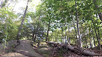
Photos of Missoula Mountain Bike
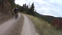
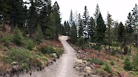
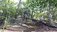
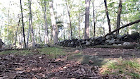
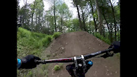
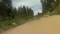
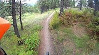
Videos of Missoula Mountain Bike
0:17 |
247 |
Oct 1, 2018
0:25 |
417 |
Oct 1, 2018
trail: Blue Mountain Main Corridor
0:06 |
172 |
Sep 30, 2017
trail: Blue Mountain Main Corridor
0:08 |
72 |
Sep 30, 2017
trail: Blue Mountain Main Corridor
0:05 |
65 |
Sep 30, 2017
trail: Blue Mountain Main Corridor
0:58 |
196 |
May 30, 2017
trail: Fenceline
16:35 |
645 |
Jun 21, 2015
trail: Crazy Canyon
2:04 |
417 |
Sep 23, 2014
Current Trail Warnings
| status | trail | date | condition | user | info |
|---|---|---|---|---|---|
| Sheep Mountain | Jun 11, 2026 @ 8:19am (America/Denver) Jun 11, 2026 | Ideal | tlilly89 | cleared all trees up to Blue Point. snow... | |
| Marshall Woods | May 21, 2026 @ 10:50pm (America/Denver) May 21, 2026 | Unknown | Cambrose | Lots of downed trees |
Recent Trail Reports
| status | trail | date | condition | info | user |
|---|---|---|---|---|---|
| Moto Line | Jun 17, 2026 @ 12:03pm (America/Creston) Jun 17, 2026 | Dry | johncc | ||
| Orchard | Jun 17, 2026 @ 12:03pm (America/Creston) Jun 17, 2026 | Dry | johncc | ||
| 6.01 - Moto Trail | Jun 17, 2026 @ 12:03pm (America/Creston) Jun 17, 2026 | Dry | johncc | ||
| Spring Gulch Doubletrack | Jun 15, 2026 @ 12:29pm (America/Denver) Jun 15, 2026 | Ideal | aaronrbaldwin TRAILFORKS | ||
| Petty Mountain Trail | Jun 13, 2026 @ 6:22pm (America/Denver) Jun 13, 2026 | Ideal | aaronrbaldwin TRAILFORKS | ||
| Petty Pasture Trail | Jun 13, 2026 @ 11:41am (America/Denver) Jun 13, 2026 | Ideal | aaronrbaldwin TRAILFORKS | ||
| Contour | Jun 11, 2026 @ 5:41pm (America/Denver) Jun 11, 2026 | Ideal | aaronrbaldwin TRAILFORKS | ||
| Wallman East | Jun 11, 2026 @ 5:41pm (America/Denver) Jun 11, 2026 | Ideal | aaronrbaldwin TRAILFORKS | ||
| Wallman East | Jun 11, 2026 @ 5:41pm (America/Denver) Jun 11, 2026 | Ideal | aaronrbaldwin TRAILFORKS | ||
| Wallman West | Jun 11, 2026 @ 5:41pm (America/Denver) Jun 11, 2026 | Ideal | aaronrbaldwin TRAILFORKS |
Activity Feed
| username | action | type | title | date |
|---|---|---|---|---|
| sEthanol | wishlist | route | activity #97421427 | Jun 20, 2026 @ 12:13pm 8 mins |
| enpmIm | ridden | trail | activity #97366229 | Jun 19, 2026 @ 9:55pm 14 hours |
| Luke6l5SdH | wishlist | route | activity #97320754 | Jun 19, 2026 @ 8:43am 1 day |
| seabring | wishlist | region | activity #97311230 | Jun 19, 2026 @ 6:02am 1 day |
| johncc | add | report | activity #97224305 and 2 more | Jun 17, 2026 @ 6:41pm 3 days |
Recent Comments
| username | type | title | comment | date |
|---|---|---|---|---|
| trail | Nice route to the top with no real grunts. | May 28, 2026 @ 1:06pm May 28, 2026 | ||
| trail | Good trail to find “moto washboards “. As... | May 28, 2026 @ 1:03pm May 28, 2026 | ||
| trail | Fallen trees make it impassable as of this date. | May 28, 2026 @ 12:59pm May 28, 2026 | ||
| trail | Tried to make this work going up and come back... | May 27, 2026 @ 2:43pm May 27, 2026 | ||
| trail | Down tree city, careful descending | May 3, 2026 @ 4:17pm May 3, 2026 |
Local Badges
-

Completionist0 awarded -

Epic Ride 50k3,180 awarded -

Top 10 Trails0 awarded -
Completionist0 awarded -
Completionist1 awarded -
Completionist0 awarded
Bike & Skill Parks
| name | type | city | rating |
|---|---|---|---|
| Syringa Skills Park | skill park | Missoula |
Upcoming Local Events
Activity Type Stats
| activitytype | trails | distance | descent | descent distance | total vertical | rating | global rank | state rank | photos | reports | routes | ridelogs |
|---|---|---|---|---|---|---|---|---|---|---|---|---|
| Mountain Bike | 441 | 923 miles | 141,506 ft | 357 miles | 8,238 ft | #66 | #25 | 995 | 7,697 | 85 | 102,285 | |
| E-Bike | 74 | 348 miles | 37,923 ft | 119 miles | 4,380 ft | #270 | #677 | 3 | 6,479 | 2 | 1,117 | |
| Gravel Bike | 1 | #39 | #722 | 3 | 22 | 2 | 703 | |||||
| Adaptive Bike | 1 | #229 | #1,536 | 1 | 6 | |||||||
| Horse | 222 | 522 miles | 86,736 ft | 202 miles | 5,069 ft | #13 | #309 | 1,372 | 3 | 4 | ||
| Hike | 551 | 1,043 miles | 149,147 ft | 375 miles | 6,424 ft | #15 | #23 | 36 | 7,631 | 20 | 14,650 | |
| Trail Running | 550 | 1,043 miles | 149,091 ft | 374 miles | 6,424 ft | #21 | #20 | 9 | 7,632 | 21 | 22,079 | |
| Dirtbike/Moto | 63 | 328 miles | 45,007 ft | 135 miles | 4,380 ft | #46 | #27 | 938 | 70 | |||
| ATV/ORV/OHV | 34 | 270 miles | 26,982 ft | 102 miles | 4,380 ft | #11 | #8 | 862 | 5 | |||
| Snowmobile | 4 | 79 miles | 8,219 ft | 43 miles | 2,913 ft | #37 | #27 | 83 | 1 | |||
| Snowshoe | 228 | 467 miles | 76,781 ft | 185 miles | 6,250 ft | #9 | #5 | 722 | 3 | 78 | ||
| Downhill Ski | 61 | 23 miles | 24,875 ft | 22 miles | 2,500 ft | #196 | #78 | 1 | 82 | 2,014 | ||
| Backcountry Ski | 55 | 171 miles | 33,983 ft | 71 miles | 6,115 ft | #50 | #12 | 226 | 1,981 | |||
| Nordic Ski | 47 | 189 miles | 19,098 ft | 67 miles | 3,346 ft | #60 | #15 | 1 | 433 | 2 | 4,190 |
Frequently Asked Questions About Missoula
▼
What are the best places to ride in Missoula?
Missoula has 19 areas to explore for mountain biking. The top rated areas are:
▼
What are the highest rated mountain biking trails in Missoula?
The highest rated mountain biking trails in Missoula are:
- Hello, Kitty (4.6/5)
- Björn Again (4.5/5)
- Sheep Mountain (4.5/5)
- Moose (4.5/5)
- Carlton Ridge (4.5/5)
▼
What is the best time of the year to ride in Missoula?
Based on ride log data, the most popular months to ride in Missoula are:
- July (1,645 activities)
- June (1,260 activities)
- May (1,194 activities)
▼
Where can I park to ride in Missoula?
There are 86 parking locations listed in Missoula. The most popular parking spots are:
- Rattlesnake Trailhead
- Rattlesnake Overflow Parking
- Parking
- Mount Jumbo Saddle Trailhead
- Duncan Trailhead
Activities
- Missoula Mountain Biking Trails
- Missoula E-Biking Trails
- Missoula Horseback Trails
- Missoula Hiking Trails
- Missoula Trail Running Trails
- Missoula Dirtbiking Trails
- Missoula ATVing/Offroading Trails
- Missoula Snowshoeing Trails
- Missoula Skiing Trails
- Missoula Backcountry Skiing Trails
- Missoula Nordic Skiing Trails
Trails
Points of Interest
- By durza11 & contributors
- Admins: MMBC, aaronrbaldwin
- #5489 - 82,749 views
- missoula activity log | embed map of Missoula mountain bike trails | missoula mountain biking points of interest polygons
Downloading of trail gps tracks in kml & gpx formats is enabled for Missoula.
You must login to download files.