close
-
Layers w
- Weather Layers
- Pro
- Pro
- Pro
- Pro
- Pro
- Pro
- More Layers
- Pro
- Pro
- Pro
- Pro
-
Upgrade to

3D
Trail Conditions
- Unknown
- Snow Groomed
- Snow Packed
- Snow Covered
- Snow Cover Partial
- Freeze/thaw Cycle
- Icy
- Prevalent Mud
- Wet
- Variable
- Ideal
- Dry
- Very Dry
Trail Flow (Ridden Direction)
Trailforks scans users ridelogs to determine the most popular direction each trail is ridden. A good flowing trail network will have most trails flowing in a single direction according to their intension.
The colour categories are based on what percentage of riders are riding a trail in its intended direction.
The colour categories are based on what percentage of riders are riding a trail in its intended direction.
- > 96%
- > 90%
- > 80%
- > 70%
- > 50%
- < 50%
- bi-directional trail
- no data
Trail Last Ridden
Trailforks scans ridelogs to determine the last time a trail was ridden.
- < 2 days
- < 1 week
- < 2 weeks
- < 1 month
- < 6 months
- > 6 months
Trail Ridden Direction
The intended direction a trail should be ridden.
- Downhill Only
- Downhill Primary
- Both Directions
- Uphill Primary
- Uphill Only
- One Direction
Contribute Details
Colors indicate trail is missing specified detail.
- Description
- Photos
- Description & Photos
- Videos
Trail Popularity ?
Trailforks scans ridelogs to determine which trails are ridden the most in the last 9 months.
Trails are compared with nearby trails in the same city region with a possible 25 colour shades.
Think of this as a heatmap, more rides = more kinetic energy = warmer colors.
- most popular
- popular
- less popular
- not popular
ATV/ORV/OHV Filter
Max Vehicle Width
inches
US Cell Coverage
Legend

Radar Time
Activity Recordings
Trailforks uses anonymized public activity data.
?
Activity Recordings
Trailforks uses anonymized public activity data.
?
Personal Heatmap
▶
Activity Types
all
/
none
▶
Options
2
Date range
month
–
Winter Trails
Warning
A routing network for winter maps does not exist. Selecting trails using the winter trails layer has been disabled.
Missing Trails
Most Popular
Least Popular
Trails are colored based on popularity. The more popular a trail is, the more red. Less popular trails trend towards green.
Jump Magnitude Heatmap
Heatmap of where riders jump on trails. Zoom in to see individual jumps, click circles to view jump details.
BC Backroad Status
![map legend]()
Service Road Atlas is a free to use, community-driven service for viewing and creating reports on the numerous back-country service roads around B.C. and Alberta.

Slope Aspect
Direction the slope faces
Trails Deemphasized
Trails are shown in grey.
Only show trails with no bike usage.
Suggested Layers
Based on selected activity type
Save the current map location and zoom level as your default home location whenever this page is loaded.
SavePopular Trail Networks
view all areas »
No description for Missouri has been added yet!
Login or register to submit one.
Region Details
- 192
- 103
- 341
- 449
- 123
- 20
Stats
- Avg Trail Rating
- Trails (view details)
- 1,763
- Trails Mountain Bike
- 1,252
- Trails E-Bike
- 592
- Trails Gravel Bike
- 21
- Trails Horse
- 187
- Trails Hike
- 1,609
- Trails Trail Running
- 1,596
- Trails Dirtbike/Moto
- 10
- Trails ATV/ORV/OHV
- 1
- Trails Snowshoe
- 19
- Trails Downhill Ski
- 28
- Trails Nordic Ski
- 9
- Total Distance
- 2,536 miles
- Total Descent
- 221,620 ft
- Total Vertical
- 1,425 ft
- Highest Trailhead
- 1,768 ft
- Reports
- 7,658
- Photos
- 2,056
- Ridden Counter
- 126,559
Articles
The Ozark Trail: A Guide to Hiking Missouri's Mountains
Mar 31, 2022 from backpacker.com
This hidden gem of a thru-hike shows off all the Ozarks have to offer.

Richie Rude and Kate Lawrence Clinch Victories at BME Series Opener in Ironton, MO
May 3, 2021 from pinkbike.com
The Big Mountain Enduro season kicked off this week at a new venue in Ironton, Missouri.
Sub Regions
- Central Missouri (161)
- Benton County (20)
- Boone County (69)
- Camden County (0)
- Cole County (7)
- Lafayette County (3)
- Pettis County (1)
- Randolph County (1)
- Eastern Missouri (28)
- Saint Louis County (14)
- Saint Charles County (7)
- St. Francois County (1)
- Kansas City Metro (MO) (359)
- Cass County (27)
- Clay County (69)
- Jackson County (272)
- Platte County (23)
- Ray County (2)
- Lake Ozark (0)
- Mark Twain National Forest (3)
- Mark Twain National Forest - Houston Rolla District (12)
- Northern Region - MO (103)
- Buchanan County (103)
- Northwest Missouri (0)
- Southeast Missouri (81)
- Crawford County (13)
- Iron County (1)
- Perry County (4)
- St Francois County (9)
- Southwest Missouri (274)
- Barry County (0)
- Cedar County (5)
- Cristian County (9)
- Dallas County (0)
- Greene County (92)
- Jasper County (44)
- Laclede County (5)
- McDonald County (31)
- Newton County (20)
- Polk County (2)
- Stone County (34)
- Taney County (47)
Popular Missouri Mountain Biking Trails
• 80 ★ 3.7 • 4 miles • 421 ft • 737 •
Popular blue difficulty singletrack. This mountain bike primary trail can be used both directions and has a moderate overall physical rating with a 421 ft blue climb. It features jump. On average it takes 20 minutes to complete this trail.
• 85 ★ 4.8 • 3 miles • 230 ft • 631 •
Highly rated popular blue difficulty singletrack. This mountain bike primary trail can be used both directions and has a moderate overall physical rating with a 230 ft blue climb. It features berm, drop, jump and rock garden. On average it takes 28 minutes to complete this trail.
• 60 ★ 4.5 • 4 miles • 289 ft • 567 •
The western half of the Trail is now complete and can be accessed from the . Switchbacking you up through, under and around spectacular rock formations weaves in and out of multiple hollows and eventually leads you back to the pavement....
• 95 ★ 4.9 • 4 miles • 210 ft • 507 •
The trail mostly twists around the hillside up and down short climbs and descents. Plenty of roots throughout the trail. This is a really good beginner or first trail ride since there isn't much climbing if you stick to the main loop...
• 90 ★ 5.0 • 2 miles • 83 ft • 453 •
Trail west of road connecting 87th st and Oldham Rd with flowy fun singletrack.
• 100 ★ 5.0 • 403 ft • 5 ft • 452 •
Popular blue difficulty singletrack. This mountain bike primary trail can be used both directions. On average it takes 1 minutes to complete this trail.
• 50 ★ 4.5 • 2 miles • 276 ft • 482 •
Bluff View is the newest addition to the St. Louis county network of trails. This 5 mile round-trip singletrack trail was built in 2012 by GORC and Americorps volunteers. The Bluff View trail features some rocky outcroppings, sustained...
• 100 ★ 4.6 • 11 miles • 615 ft • 479 •
Highly rated popular blue difficulty singletrack. This mountain bike primary trail can be used both directions and has a moderate overall physical rating with a 615 ft blue climb. On average it takes 1 hour10 minutes to complete this trail.
Missouri Mountain Bike Routes
★ 4.0 • 26 miles • 2,442 ft • 2 • Loop •
This is the complete loop that makes up the . The section of Ozark Trail now uses 12 miles of the western...
★ 3.0 • 5 miles • 357 ft • 3 • Loop •
Once around the trail including both lollipops.
★ 4.0 • 50 miles • 2,969 ft • 12 • Out & Back •
Also known as the St. Charles County Epic, this ride uses the Katy and s to access 3 popular area trail...
★ 4.5 • 8 miles • 942 ft • 15 • Point to Point •
This is the complete bittersweet "loop." It's mainly in the culverts below neighborhoods. You'll find some...
★ 1.0 • 20 miles • 1,625 ft • 3 • Out & Back •
Out and back on from the Mound. Max singletrack with probably minimum doubletrack.
★ 4.5 • 7 miles • 355 ft • 15 • Loop •
Welcome to Landahl, on of KC's finest and oldest trail systems! With over 20 miles of trail, there's no...
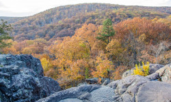
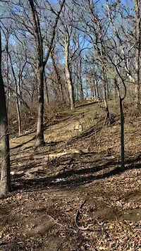
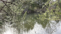
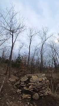
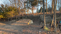
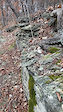
Photos of Missouri Mountain Bike
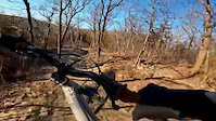
Videos of Missouri Mountain Bike
trail: Highline Express
0:11 |
22 |
Mar 26, 2026
trail: Legends Loop
0:31 |
15 |
Mar 20, 2026
trail: Flowride
0:37 |
24 |
Feb 25, 2026

trail: Highline Express
0:52 |
23 |
Feb 25, 2026
trail: Senderella
0:08 |
80 |
Mar 4, 2025
trail: Senderella
0:14 |
65 |
Dec 30, 2024
trail: Legends Loop
0:26 |
27 |
May 3, 2024

trail: Jack's Loop
20:55 |
44 |
Mar 12, 2024
National Scenic Trails & Official Routes
-
Ozark Trail
- Mountain Bike
- Horse
- Hike
- Trail Running
Activity Feed
| username | action | type | title | date |
|---|---|---|---|---|
| MarkYMtoYv | wishlist | region | activity #97185108 | Jun 17, 2026 @ 8:17am 9 hours |
| xxdiffxx | comment | trail | activity #97129966 | Jun 16, 2026 @ 12:12pm 1 day |
| ksilvey10 | add | trail | activity #97128822 and 7 more | Jun 16, 2026 @ 11:57am 1 day |
| johnhuebbe | wishlist | route | activity #97123856 | Jun 16, 2026 @ 10:58am 1 day |
| johnhuebbe | ridden | route | activity #97123807 | Jun 16, 2026 @ 10:57am 1 day |
Recent Comments
| username | type | title | comment | date |
|---|---|---|---|---|
| trail | This is a great trail even after coming from a... | Jun 16, 2026 @ 12:12pm 1 day | ||
| trail | Rode CW. Fairly challenging trail with several... | Jun 12, 2026 @ 8:15am Jun 12, 2026 | ||
| trail | As of 5/2/26, there are 2 to 3 spots that have... | May 6, 2026 @ 5:48am May 6, 2026 | ||
| trail | This is a steep rocky road. A serious grunt... | May 5, 2026 @ 2:31pm May 5, 2026 | ||
| trail | I much prefer the nearby Eleanor trail. This... | Mar 30, 2026 @ 1:14pm Mar 30, 2026 |
Local Badges
-

10 Green Trails46 awarded -

Top 10 Trails1 awarded -

Epic Ride Climb 2k7 awarded -
Epic Ride Climb 2k33 awarded -

Climbing 10k Badge122 awarded -
Climbing 10k Badge3 awarded
Bike & Skill Parks
| name | type | city | rating |
|---|---|---|---|
| Shepherd Mountain Bike Park | bike park | Ironton | |
| Howler Bike Park | bike park | Branson | |
| Hidden Valley Ski Area | bike park | Eureka | |
| Raytown BMX Asphalt Pumptrack | skill park | Kansas City, MO | |
| Challenge Trax | skill park | Warrensburg |
Upcoming Local Events
Activity Type Stats
| activitytype | trails | distance | descent | descent distance | total vertical | rating | global rank | state rank | photos | reports | routes | ridelogs |
|---|---|---|---|---|---|---|---|---|---|---|---|---|
| Mountain Bike | 1,250 | 1,874 miles | 146,581 ft | 700 miles | 1,276 ft | #42 | 1,944 | 7,652 | 134 | 213,731 | ||
| E-Bike | 592 | 600 miles | 41,936 ft | 224 miles | 1,204 ft | #39 | 18 | 5,827 | 43 | 13,552 | ||
| Gravel Bike | 21 | 81 miles | 3,970 ft | 36 miles | 778 ft | #42 | 1 | 245 | 3 | 2,882 | ||
| Horse | 187 | 563 miles | 57,730 ft | 232 miles | 1,401 ft | #31 | 1 | 2,663 | 1 | 70 | ||
| Hike | 1,609 | 2,485 miles | 203,215 ft | 949 miles | 1,424 ft | #39 | 55 | 7,503 | 10 | 9,951 | ||
| Trail Running | 1,596 | 2,476 miles | 201,542 ft | 945 miles | 1,424 ft | #40 | 6 | 7,501 | 12 | 7,919 | ||
| Dirtbike/Moto | 10 | 4 miles | 371 ft | 4,826 ft | 253 ft | #45 | 1,386 | 52 | ||||
| ATV/ORV/OHV | 1 | 4,203 ft | 600 ft | #45 | 1,386 | 33 | ||||||
| Snowshoe | 19 | 23 miles | 1,759 ft | 8 miles | 427 ft | #45 | 64 | 2 | ||||
| Downhill Ski | 28 | 4 miles | 2,093 ft | 4 miles | 486 ft | #36 | 322 | |||||
| Nordic Ski | 9 | 7 miles | 797 ft | 3 miles | 249 ft | #45 | 55 | 60 |
Activities
Trails
Points of Interest
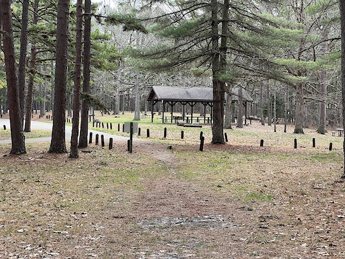
- Shelter Cabin
- Trail Center Information
- Waterfall Sight
- Current River Cave Spring Sight
- The Hayes Home Sight
- [shelter] Antimi Shelter Trailhead Other
- Trailhead Other
- Sitting Tree Viewpoint
- Picnic Shelter Cabin
- Weston Bend Campground Camping
- Buford Mountain (1,742 ft)
- Lead Hill (1,736 ft)
- Keyger Mountain (1,667 ft)
- By canadaka
 Trailforks & contributors
 - Admins: Map Team, IMBA, chuktA, msmcfate, WillieJacobsz, PlumbBobM, ReckitRolley, colinreuter
- #3196 - 35,460 views
- missouri activity log | embed map of Missouri mountain bike trails | missouri mountain biking points of interest polygons
Downloading of trail gps tracks in kml & gpx formats is enabled for Missouri.
You must login to download files.