close
-
Layers w
- Weather Layers
- Pro
- Pro
- Pro
- Pro
- Pro
- Pro
- More Layers
- Pro
- Pro
- Pro
- Pro
-
Upgrade to

3D
Trail Conditions
- Unknown
- Snow Groomed
- Snow Packed
- Snow Covered
- Snow Cover Partial
- Freeze/thaw Cycle
- Icy
- Prevalent Mud
- Wet
- Variable
- Ideal
- Dry
- Very Dry
Trail Flow (Ridden Direction)
Trailforks scans users ridelogs to determine the most popular direction each trail is ridden. A good flowing trail network will have most trails flowing in a single direction according to their intension.
The colour categories are based on what percentage of riders are riding a trail in its intended direction.
The colour categories are based on what percentage of riders are riding a trail in its intended direction.
- > 96%
- > 90%
- > 80%
- > 70%
- > 50%
- < 50%
- bi-directional trail
- no data
Trail Last Ridden
Trailforks scans ridelogs to determine the last time a trail was ridden.
- < 2 days
- < 1 week
- < 2 weeks
- < 1 month
- < 6 months
- > 6 months
Trail Ridden Direction
The intended direction a trail should be ridden.
- Downhill Only
- Downhill Primary
- Both Directions
- Uphill Primary
- Uphill Only
- One Direction
Contribute Details
Colors indicate trail is missing specified detail.
- Description
- Photos
- Description & Photos
- Videos
Trail Popularity ?
Trailforks scans ridelogs to determine which trails are ridden the most in the last 9 months.
Trails are compared with nearby trails in the same city region with a possible 25 colour shades.
Think of this as a heatmap, more rides = more kinetic energy = warmer colors.
- most popular
- popular
- less popular
- not popular
ATV/ORV/OHV Filter
Max Vehicle Width
inches
US Cell Coverage
Legend

Radar Time
Activity Recordings
Trailforks uses anonymized public activity data.
?
Activity Recordings
Trailforks uses anonymized public activity data.
?
Personal Heatmap
▶
Activity Types
all
/
none
▶
Options
2
Date range
month
–
Winter Trails
Warning
A routing network for winter maps does not exist. Selecting trails using the winter trails layer has been disabled.
Missing Trails
Most Popular
Least Popular
Trails are colored based on popularity. The more popular a trail is, the more red. Less popular trails trend towards green.
Jump Magnitude Heatmap
Heatmap of where riders jump on trails. Zoom in to see individual jumps, click circles to view jump details.
BC Backroad Status
![map legend]()
Service Road Atlas is a free to use, community-driven service for viewing and creating reports on the numerous back-country service roads around B.C. and Alberta.

Slope Aspect
Direction the slope faces
Trails Deemphasized
Trails are shown in grey.
Only show trails with no bike usage.
Suggested Layers
Based on selected activity type
Save the current map location and zoom level as your default home location whenever this page is loaded.
Save
No description for Mitchell Brook has been added yet!
Login or register to submit one.
Primary Trail Type: Cross-Country
Land Status: Private Property
Land Manager: Parsons Investments Limited
Activities Click to view
- Mountain Bike
22 trails
- E-Bike
8 trails
- Hike
22 trails
- Trail Running
22 trails
- Snowshoe
17 trails
Region Details
- 1
- 3
- 14
Region Status
Open as of Feb 23, 2026Stats
- Avg Trail Rating
- Trails (view details)
- 18
- Trails Mountain Bike
- 22
- Trails E-Bike
- 8
- Trails Winter Fat Bike
- 1
- Trails Hike
- 22
- Trails Trail Running
- 22
- Trails Dirtbike/Moto
- 1
- Trails ATV/ORV/OHV
- 1
- Trails Snowshoe
- 17
- Total Distance
- 8 miles
- Total Descent
- 1,004 ft
- Total Vertical
- 420 ft
- Highest Trailhead
- 465 ft
- Reports
- 81
- Photos
- 5
- Ridden Counter
- 599
Popular Mitchell Brook Mountain Biking Trails
• 50 ★ 3.8 • 3,232 ft • 18 ft • 134 •
The lovely P2 side of - very flowy and fun, somewhat more physical than the main Gorge section.
• 85 ★ 4.5 • 1 mile • 65 ft • 78 •
Popular blue difficulty singletrack. This mountain bike primary trail. On average it takes 16 minutes to complete this trail.
• 65 ★ 5.0 • 1,526 ft • 14 ft • 72 •
Moderately popular blue difficulty singletrack. This mountain bike primary trail. On average it takes 2 minutes to complete this trail.
• 55 ★ 3.4 • 1,634 ft • 129 ft • 66 •
A new link that extends the best parts of Phase2. Built with the intention to be ridden downhill this will provide lots of speed, flow and fun!
• 75 ★ 0.0 • 2,589 ft • 80 ft • 41 •
Popular blue difficulty singletrack. This mountain bike primary trail.
• 75 ★ 0.0 • 292 ft • 0 ft • 39 •
Popular blue difficulty singletrack. This mountain bike primary trail can be used both directions.
• 60 ★ 0.0 • 581 ft • 29 ft • 36 •
Moderately popular green difficulty singletrack. This mountain bike primary trail can be used both directions. On average it takes minutes to complete this trail.
Videos of Mitchell Brook Mountain Bike
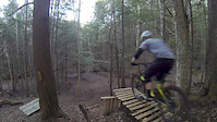
trail: Endorphin
2:54 |
6659 |
Dec 13, 2015
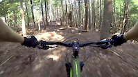
trail: Lower Phase 2 - Main
0:22 |
9156 |
Aug 30, 2015
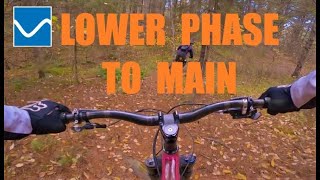
trail: Lower Phase 2 - Main
4:56 |
392 |
Nov 10, 2021 , Kentville
Recent Trail Reports
| status | trail | date | condition | info | user |
|---|---|---|---|---|---|
| Roller B LINE | Oct 14, 2025 @ 5:32pm (America/Halifax) Oct 14, 2025 | Ideal | brock-mcdougall | ||
| Visiting Mitchell | Oct 7, 2025 @ 5:33pm (America/Halifax) Oct 7, 2025 | Dry | brock-mcdougall | ||
| LP2 to Endorphin | Oct 7, 2025 @ 5:33pm (America/Halifax) Oct 7, 2025 | Dry | brock-mcdougall | ||
| Lower Phase 2 - Main | Oct 7, 2025 @ 5:33pm (America/Halifax) Oct 7, 2025 | Dry | brock-mcdougall | ||
| Texaco | Oct 7, 2025 @ 5:33pm (America/Halifax) Oct 7, 2025 | Very Dry | brock-mcdougall | ||
| The Unknown | Jul 13, 2025 @ 11:06am Jul 13, 2025 | Ideal | vwcabrio82 Gore Trails | ||
| Upper Phase 2 | May 29, 2024 @ 3:22pm May 29, 2024 | Ideal | ValDalle | ||
| Holy Roller | May 10, 2024 @ 9:58am May 10, 2024 | Ideal | benlalonde | ||
| Twister | May 10, 2024 @ 9:58am May 10, 2024 | Ideal | benlalonde | ||
| Other Exit | May 10, 2024 @ 9:58am May 10, 2024 | Wet | benlalonde |
Activity Feed
| username | action | type | title | date |
|---|---|---|---|---|
| Hearnzo | update | trail | activity #97315341 and 1 more | Jun 19, 2026 @ 7:19am Jun 19, 2026 |
| cs2100 | ridden | trail | activity #96770039 and 3 more | Jun 11, 2026 @ 4:58pm Jun 11, 2026 |
| Hearnzo | add | trail | activity #96553433 | Jun 8, 2026 @ 11:28am Jun 8, 2026 |
| Hearnzo | add | trail | activity #96227101 and 1 more | Jun 4, 2026 @ 7:46am Jun 4, 2026 |
| Hearnzo | update | trail | activity #95177533 | May 21, 2026 @ 8:33am May 21, 2026 |
Recent Comments
| username | type | title | comment | date |
|---|---|---|---|---|
| trail | Power line trail cleared by machines leaving... | Jul 1, 2018 @ 2:40pm Jul 1, 2018 | ||
| trail | Power line trail cleared by machines leaving... | Jul 1, 2018 @ 2:37pm Jul 1, 2018 | ||
| trail | Spent a solid 20 min walking through grass to... | Jul 1, 2018 @ 2:31pm Jul 1, 2018 | ||
| trail | ATV trail plain and simple. Initially along... | Jul 1, 2018 @ 2:26pm Jul 1, 2018 |
Nearby Areas
| name | distance | ||||
|---|---|---|---|---|---|
| The Gorge | 11 | 17 | 6 | 1 | 1.1 km |
| Bird Sanctuary | 12 | 12 | 1.2 km | ||
| Sand Pit | 2 | 1.2 km | |||
| The Dump | 1 | 1.9 km | |||
| Miner's Marsh | 2.4 km |
Activity Type Stats
| activitytype | trails | distance | descent | descent distance | total vertical | rating | global rank | state rank | photos | reports | routes | ridelogs |
|---|---|---|---|---|---|---|---|---|---|---|---|---|
| Mountain Bike | 22 | 8 miles | 1,004 ft | 3 miles | 420 ft | #11,406 | #45 | 5 | 81 | 420 | ||
| E-Bike | 8 | 2 miles | 236 ft | 1 mile | 177 ft | #9,672 | #27 | 73 | 36 | |||
| Winter Fat Bike | 1 | 1 | ||||||||||
| Hike | 22 | 8 miles | 1,004 ft | 3 miles | 420 ft | #12,790 | #60 | 78 | 38 | |||
| Trail Running | 22 | 8 miles | 1,004 ft | 3 miles | 420 ft | #11,878 | #48 | 78 | 7 | |||
| Dirtbike/Moto | 1 | 34 | 1 | |||||||||
| ATV/ORV/OHV | 1 | 34 | ||||||||||
| Snowshoe | 17 | 7 miles | 1,001 ft | 3 miles | 420 ft | #1,407 | #46 | 18 | 4 |
Frequently Asked Questions About Mitchell Brook
▼
What are the highest rated mountain biking trails in Mitchell Brook?
The highest rated mountain biking trails in Mitchell Brook are:
- Lower Endorphin (4.1/5)
- The Unknown (4.1/5)
- Endorphin (3.9/5)
- Lower Phase 2 - Main (3.9/5)
- Nothing Special (3.8/5)
▼
Where can I park to ride in Mitchell Brook?
Check the Mitchell Brook trail map for trailhead and parking information. Community members regularly update access and parking details for trails in the area.
▼
What is the longest trail in Mitchell Brook?
The longest trail in Mitchell Brook is The Unknown at 2.4 km. View all trails sorted by distance.
▼
What are the best & highest rated hiking trails in Mitchell Brook?
The best hiking trails in Mitchell Brook are: View all hiking trails sorted by popularity score.
Activities
- By bent6543
 TRAILFORKS & contributors
 - Admins: AVMBA
- #60978 - 1,325 views
- mitchell brook activity log | embed map of Mitchell Brook mountain bike trails |
Downloading of trail gps tracks in kml & gpx formats is enabled for Mitchell Brook.
You must login to download files.