close
-
Layers w
- Weather Layers
- Pro
- Pro
- Pro
- Pro
- Pro
- Pro
- More Layers
- Pro
- Pro
- Pro
- Pro
-
Upgrade to

3D
Trail Conditions
- Unknown
- Snow Groomed
- Snow Packed
- Snow Covered
- Snow Cover Partial
- Freeze/thaw Cycle
- Icy
- Prevalent Mud
- Wet
- Variable
- Ideal
- Dry
- Very Dry
Trail Flow (Ridden Direction)
Trailforks scans users ridelogs to determine the most popular direction each trail is ridden. A good flowing trail network will have most trails flowing in a single direction according to their intension.
The colour categories are based on what percentage of riders are riding a trail in its intended direction.
The colour categories are based on what percentage of riders are riding a trail in its intended direction.
- > 96%
- > 90%
- > 80%
- > 70%
- > 50%
- < 50%
- bi-directional trail
- no data
Trail Last Ridden
Trailforks scans ridelogs to determine the last time a trail was ridden.
- < 2 days
- < 1 week
- < 2 weeks
- < 1 month
- < 6 months
- > 6 months
Trail Ridden Direction
The intended direction a trail should be ridden.
- Downhill Only
- Downhill Primary
- Both Directions
- Uphill Primary
- Uphill Only
- One Direction
Contribute Details
Colors indicate trail is missing specified detail.
- Description
- Photos
- Description & Photos
- Videos
Trail Popularity ?
Trailforks scans ridelogs to determine which trails are ridden the most in the last 9 months.
Trails are compared with nearby trails in the same city region with a possible 25 colour shades.
Think of this as a heatmap, more rides = more kinetic energy = warmer colors.
- most popular
- popular
- less popular
- not popular
ATV/ORV/OHV Filter
Max Vehicle Width
inches
US Cell Coverage
Legend

Radar Time
Activity Recordings
Trailforks uses anonymized public activity data.
?
Activity Recordings
Trailforks uses anonymized public activity data.
?
Personal Heatmap
▶
Activity Types
all
/
none
▶
Options
2
Date range
month
–
Winter Trails
Warning
A routing network for winter maps does not exist. Selecting trails using the winter trails layer has been disabled.
Missing Trails
Most Popular
Least Popular
Trails are colored based on popularity. The more popular a trail is, the more red. Less popular trails trend towards green.
Jump Magnitude Heatmap
Heatmap of where riders jump on trails. Zoom in to see individual jumps, click circles to view jump details.
BC Backroad Status
![map legend]()
Service Road Atlas is a free to use, community-driven service for viewing and creating reports on the numerous back-country service roads around B.C. and Alberta.

Slope Aspect
Direction the slope faces
Trails Deemphasized
Trails are shown in grey.
Only show trails with no bike usage.
Suggested Layers
Based on selected activity type
Save the current map location and zoom level as your default home location whenever this page is loaded.
Save
No description for Modena has been added yet!
Login or register to submit one.
This region uses the Uk/Euro style trail grading system.
Activities Click to view
- Mountain Bike
363 trails
- E-Bike
281 trails
- Horse
6 trails
- Hike
272 trails
- Trail Running
274 trails
Region Details
- 45
- 7
- 68
- 139
- 2
Stats
- Avg Trail Rating
- Trails (view details)
- 327
- Trails Mountain Bike
- 363
- Trails E-Bike
- 281
- Trails Gravel Bike
- 6
- Trails Adaptive Bike
- 5
- Trails Horse
- 6
- Trails Hike
- 272
- Trails Trail Running
- 274
- Trails Dirtbike/Moto
- 1
- Total Distance
- 384 miles
- Total Descent
- 144,469 ft
- Total Vertical
- 6,969 ft
- Highest Trailhead
- 7,074 ft
- Reports
- 1,821
- Photos
- 316
- Ridden Counter
- 10,592
Sub Regions
- Castelvetro (5)
- Faeto (5)
- Fanano (74)
- Lama Mocogno (99)
- Modena (14)
- Montecreto (14)
- Montese (16)
- Monzone (10)
- Palagano (19)
- Pavullo Nel Frignano (18)
- Piandelagotti (17)
- Pievepelago (3)
- Sant'Annapelago (0)
- Riolunato (3)
- Sassuolo (38)
- Montegibbio (15)
- Porn Valley (14)
- Serramazzoni (2)
- Sestola (19)
Popular Modena Mountain Biking Trails
• 100 ★ 4.0 • 4,813 ft • 74 ft • 204 •
Highly rated popular blue difficulty singletrack. This mountain bike primary trail can be used downhill primary and has a easy overall physical rating. It features roller coaster. On average it takes 8 minutes to complete this trail.
• 80 ★ 3.7 • 2,661 ft • 0 ft • 173 •
Popular blue difficulty singletrack. This mountain bike primary trail can be used downhill only. It features berm. On average it takes 5 minutes to complete this trail.
• 95 ★ 4.7 • 3,540 ft • 0 ft • 173 •
Highly rated popular red difficulty singletrack. This mountain bike primary trail can be used downhill only. On average it takes 6 minutes to complete this trail.
• 85 ★ 4.2 • 4,344 ft • 11 ft • 164 •
Highly rated popular blue difficulty singletrack. This mountain bike primary trail can be used downhill only. It features berm, jump and skinny. On average it takes 7 minutes to complete this trail.
• 95 ★ 4.5 • 4 miles • 41 ft • 162 •
Highly rated popular red difficulty singletrack. This mountain bike primary trail and has a moderate overall physical rating. It features berm, rock face and rock garden. On average it takes 54 minutes to complete this trail.
• 100 ★ 4.0 • 4,741 ft • 4 ft • 129 •
Popular red difficulty singletrack. This mountain bike primary trail and has a moderate overall physical rating. It features rock face and rock garden. On average it takes 6 minutes to complete this trail.
• 60 ★ 5.0 • 5 miles • 727 ft • 127 •
Moderately popular blue difficulty singletrack. This mountain bike primary trail can be used downhill primary and has a moderate overall physical rating. On average it takes 1 hour6 minutes to complete this trail.
Modena Mountain Bike Routes
★ 4.0 • 7 miles • 1,321 ft • 2 • Loop •
Anello intorno alle Piane di Mocogno, comprende monte Campidello. Le Lezze e il Prato delle Canale.
20 miles • 3,979 ft • 2 • Loop •
MTB 3 La Gotica è un percorso con salite panoramiche che renderanno la tua pedalata ancora più...
1 mile • 326 ft • 1 • Loop •
TB 1 Scuola In un contesto sicuro e divertente, potrai affrontare salite, discese e curve imparando a...
★ 5.0 • 22 miles • 3,656 ft • 2 • Loop •
Giro abbastanza lungo ed in certi tratti impegnativo. Passa dal famoso Ponte Diavolo.
14 miles • 2,626 ft • 1 • Loop •
MTB 4 Immergiti nella natura incontaminata dell'Appennino, ammira le suggestive doline e goditi i panorami...
★ 4.0 • 5 miles • 977 ft • 4 • Loop •
Anello dalle Piane a Borra e ritorno sulla Via Vandelli
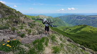
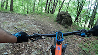
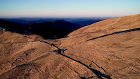
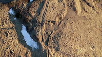
Photos of Modena Mountain Bike
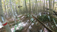
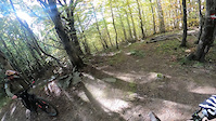
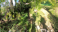
Videos of Modena Mountain Bike
4:04 |
2 |
Jun 1, 2026
trail: Mirandola
5:07 |
13 |
Oct 12, 2025
trail: Flow Line
4:49 |
19 |
Oct 11, 2025
trail: Poggio
5:34 |
21 |
Oct 11, 2025
trail: Wild stones
0:32 |
5 |
Sep 20, 2025

trail: Cà Palazza
6:44 |
35 |
Jun 19, 2023
0:50 |
74 |
Apr 7, 2020
0:00 |
132 |
Apr 7, 2020
Current Trail Warnings
| status | trail | date | condition | user | info |
|---|---|---|---|---|---|
| The Queen Fanano | Jun 1, 2026 @ 11:27am (Europe/Rome) Jun 1, 2026 | Dry | Davide-89 | Alberi caduti in più punti. |
Recent Trail Reports
Activity Feed
| username | action | type | title | date |
|---|---|---|---|---|
| andreazucchini | add | route | activity #97171568 | Jun 17, 2026 @ 3:32am 17 hours |
| EnricoGenerali | vote | trail | activity #97166833 and 5 more | Jun 17, 2026 @ 12:32am 20 hours |
| lcastellini9 | add | report | activity #96941769 | Jun 14, 2026 @ 12:07am Jun 14, 2026 |
| trailbrigo | wishlist | trail | activity #96887372 | Jun 13, 2026 @ 9:28am Jun 13, 2026 |
| GabGad | add | report | activity #96858981 and 1 more | Jun 13, 2026 @ 3:27am Jun 13, 2026 |
Recent Comments
| username | type | title | comment | date |
|---|---|---|---|---|
| report | Some sections wet. Lot of leaves on the path,... | May 12, 2026 @ 11:39pm May 12, 2026 | ||
| trail | Solchi e linee sporche... | Mar 10, 2026 @ 11:12am Mar 10, 2026 | ||
| trail | Tutto ok .. a parte le foglie... | Mar 10, 2026 @ 11:06am Mar 10, 2026 | ||
| trail | Totalmente distrutto nella parte finale con... | Mar 10, 2026 @ 11:01am Mar 10, 2026 | ||
| trail | Bel trail livello S2/S3 con tratti vertical e... | Sep 14, 2025 @ 10:44am Sep 14, 2025 |
Local Badges
-

Climbing 10k Badge33 awarded -
Climbing 10k Badge5 awarded -
Climbing 10k Badge2 awarded -

Mountain Biking 100k Badge2 awarded -

Epic Mountain Bike Climb 2k27 awarded -
Epic Mountain Bike Climb 2k4 awarded
Bike & Skill Parks
| name | type | city | rating |
|---|---|---|---|
| Crossdromo Campogalliano | skill park | Modena | |
| Savignano | skill park | Castelvetro | |
| Serramazzoni | skill park | Castelvetro | |
| Crossdromo Carpi | skill park | San Martino (MO) | |
| Bike Republic Montecreto | skill park | Montecreto |
Activity Type Stats
| activitytype | trails | distance | descent | descent distance | total vertical | rating | global rank | state rank | photos | reports | routes | ridelogs |
|---|---|---|---|---|---|---|---|---|---|---|---|---|
| Mountain Bike | 363 | 382 miles | 143,018 ft | 203 miles | 6,969 ft | 300 | 1,821 | 45 | 29,262 | |||
| E-Bike | 281 | 257 miles | 85,554 ft | 136 miles | 5,719 ft | 1 | 1,649 | 34 | 3,400 | |||
| Gravel Bike | 6 | 5 | 4 | 356 | ||||||||
| Adaptive Bike | 4 | 3 | ||||||||||
| Horse | 6 | 10 miles | 1,673 ft | 4 miles | 3,058 ft | 94 | ||||||
| Hike | 272 | 270 miles | 104,183 ft | 145 miles | 5,459 ft | 1,747 | 16 | 1,695 | ||||
| Trail Running | 274 | 299 miles | 104,098 ft | 152 miles | 5,784 ft | 1,748 | 15 | 549 | ||||
| Dirtbike/Moto | 1 | 1 mile | 308 ft | 4,288 ft | 295 ft | 127 | 13 |
Frequently Asked Questions About Modena
▼
What are the best places to ride in Modena?
Modena has 5 areas to explore for mountain biking. The top rated areas are:
▼
What are the highest rated mountain biking trails in Modena?
The highest rated mountain biking trails in Modena are:
- Duca degli Abruzzi - Lago Pratignano (4.4/5)
- War Line (4.4/5)
- CAI 417 (4.4/5)
- 425 (4.3/5)
- Piffero (4.3/5)
▼
What is the best time of the year to ride in Modena?
Based on ride log data, the most popular months to ride in Modena are:
- August (230 activities)
- July (158 activities)
- June (124 activities)
▼
What is the longest trail in Modena?
The longest trail in Modena is Modena-Vignola at 28.6 km. View all trails sorted by distance.
Activities
Trails
Points of Interest
- Bivacco La Pilaccia Cabin
- Monte Cavalbianco Viewpoint
- Villa Pace Cabin
- Camping Piane di Mocogno
- Punto Panoramico Viewpoint
- Punto Panoramico Viewpoint
- Punto Panoramico Viewpoint
- Madonna di Montemezzano Viewpoint
- Bivacco Villa Rosella Cabin
- Serra dei Baichetti Viewpoint
- Monte Cimone (2,157 m)
- Monte Cimoncino (2,100 m)
- Monte Lagoni (1,940 m)
- By denitopia
 TRAILFORKS VTA & contributors
 - Admins: denitopia, marcoangeletti, cemoorelife
- #11674 - 6,043 views
- modena activity log | embed map of Modena mountain bike trails | modena mountain biking points of interest polygons
Downloading of trail gps tracks in kml & gpx formats is enabled for Modena.
You must login to download files.