close
-
Layers w
- Weather Layers
- Pro
- Pro
- Pro
- Pro
- Pro
- Pro
- More Layers
- Pro
- Pro
- Pro
- Pro
-
Upgrade to

3D
Trail Conditions
- Unknown
- Snow Groomed
- Snow Packed
- Snow Covered
- Snow Cover Partial
- Freeze/thaw Cycle
- Icy
- Prevalent Mud
- Wet
- Variable
- Ideal
- Dry
- Very Dry
Trail Flow (Ridden Direction)
Trailforks scans users ridelogs to determine the most popular direction each trail is ridden. A good flowing trail network will have most trails flowing in a single direction according to their intension.
The colour categories are based on what percentage of riders are riding a trail in its intended direction.
The colour categories are based on what percentage of riders are riding a trail in its intended direction.
- > 96%
- > 90%
- > 80%
- > 70%
- > 50%
- < 50%
- bi-directional trail
- no data
Trail Last Ridden
Trailforks scans ridelogs to determine the last time a trail was ridden.
- < 2 days
- < 1 week
- < 2 weeks
- < 1 month
- < 6 months
- > 6 months
Trail Ridden Direction
The intended direction a trail should be ridden.
- Downhill Only
- Downhill Primary
- Both Directions
- Uphill Primary
- Uphill Only
- One Direction
Contribute Details
Colors indicate trail is missing specified detail.
- Description
- Photos
- Description & Photos
- Videos
Trail Popularity ?
Trailforks scans ridelogs to determine which trails are ridden the most in the last 9 months.
Trails are compared with nearby trails in the same city region with a possible 25 colour shades.
Think of this as a heatmap, more rides = more kinetic energy = warmer colors.
- most popular
- popular
- less popular
- not popular
ATV/ORV/OHV Filter
Max Vehicle Width
inches
US Cell Coverage
Legend

Radar Time
Activity Recordings
Trailforks uses anonymized public activity data.
?
Activity Recordings
Trailforks uses anonymized public activity data.
?
Personal Heatmap
▶
Activity Types
all
/
none
▶
Options
2
Date range
month
–
Winter Trails
Warning
A routing network for winter maps does not exist. Selecting trails using the winter trails layer has been disabled.
Missing Trails
Most Popular
Least Popular
Trails are colored based on popularity. The more popular a trail is, the more red. Less popular trails trend towards green.
Jump Magnitude Heatmap
Heatmap of where riders jump on trails. Zoom in to see individual jumps, click circles to view jump details.
BC Backroad Status
![map legend]()
Service Road Atlas is a free to use, community-driven service for viewing and creating reports on the numerous back-country service roads around B.C. and Alberta.

Slope Aspect
Direction the slope faces
Trails Deemphasized
Trails are shown in grey.
Only show trails with no bike usage.
Suggested Layers
Based on selected activity type
Save the current map location and zoom level as your default home location whenever this page is loaded.
Save
No description for Monchique has been added yet!
Login or register to submit one.
This region uses the Uk/Euro style trail grading system.
Activities Click to view
- Mountain Bike
16 trails
- E-Bike
7 trails
- Gravel Bike
0 trails
- Adaptive Bike
0 trails
- Hike
16 trails
- Trail Running
15 trails
Region Details
- 1
- 2
- 9
- 3
- 1
Region Status
Caution as of Feb 12, 2026Stats
- Avg Trail Rating
- Trails (view details)
- 16
- Trails Mountain Bike
- 16
- Trails E-Bike
- 7
- Trails Hike
- 16
- Trails Trail Running
- 15
- Total Distance
- 12 miles
- Total Descent
- 8,760 ft
- Total Vertical
- 2,595 ft
- Highest Trailhead
- 2,923 ft
- Reports
- 137
- Photos
- 91
- Ridden Counter
- 273
Popular Monchique Mountain Biking Trails
• 95 ★ 4.7 • 1,644 ft • 7 ft • 49 •
Popular green difficulty singletrack. This multi-use trail can be used downhill primary. It features jump. On average it takes 2 minutes to complete this trail.
• 85 ★ 4.0 • 3,038 ft • 0 ft • 41 •
Popular blue difficulty singletrack. This mountain bike primary trail can be used downhill primary. It features jump. On average it takes 7 minutes to complete this trail.
• 5 ★ 4.7 • 1 mile • 20 ft • 36 •
Less popular red difficulty singletrack. This mountain bike primary trail can be used downhill only. On average it takes 1 hour24 minutes to complete this trail.
• 65 ★ 2.0 • 3,602 ft • 3 ft • 33 •
Similar to . Singletrack with heaps of tricky granite boulders to trial on them
• 5 ★ 3.7 • 1 mile • 0 ft • 20 •
The First is part is not a built trail, just warming up. You can look forward to some gnarly rockgardens and huge gaps. A Downhill bike and a complete skill set is recommended. Be aware, after heavy rain the track can be very washed out!
• 90 ★ 3.2 • 1,578 ft • 0 ft • 18 •
Popular blue difficulty singletrack. This multi-use trail can be used downhill primary. It features jump. On average it takes 3 minutes to complete this trail.
• 100 ★ 4.0 • 2,123 ft • 3 ft • 18 •
Popular blue difficulty singletrack. This multi-use trail can be used downhill primary and has a moderate overall physical rating with a 3 ft blue climb. Trail visibility is always easy to follow.
Monchique Mountain Bike Routes
26 miles • 5,207 ft • 11 • Loop •
La zona de Marmelete es una de las pocas zonas del Algarve bien cartografiada en Trailforks, junto a Fonte...
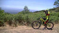
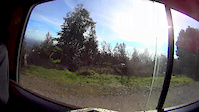
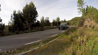
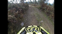
Videos of Monchique Mountain Bike

trail: Running Dog
6:38 |
378 |
Jun 16, 2016
trail: Running Dog
6:39 |
1318 |
Jul 16, 2015
trail: Running Dog
2:13 |
164 |
Feb 24, 2015
3:20 |
171 |
Jan 22, 2015
3:59 |
515 |
Dec 31, 2014
trail: Running Dog
5:04 |
273 |
Jun 8, 2014
3:42 |
472 |
May 12, 2014
6:19 |
137 |
May 12, 2014
Recent Trail Reports
| status | trail | date | condition | info | user |
|---|---|---|---|---|---|
| Evolution | Jan 27, 2026 @ 8:52pm (Europe/Lisbon) Jan 27, 2026 | Ideal | Niekn09fM5 | ||
| Turbinas Connection II | Feb 3, 2025 @ 3:13pm Feb 3, 2025 | Ideal | timbarnes | ||
| Gralhos | Feb 3, 2025 @ 3:06pm Feb 3, 2025 | Ideal | timbarnes | ||
| Turbinas | Nov 10, 2024 @ 9:50am Nov 10, 2024 | Ideal | Mixlouco | ||
| The View | Nov 4, 2024 @ 10:26am Nov 4, 2024 | Unknown | Mahturbs | ||
| Turbinas Connection I | Apr 26, 2023 @ 9:18am Apr 26, 2023 | Dry | Shirsi |
Activity Feed
| username | action | type | title | date |
|---|---|---|---|---|
| RicardoaZwMkK | vote | trail | activity #96690779 | Jun 10, 2026 @ 12:43pm Jun 10, 2026 |
| DomDemeul | wishlist | region | activity #89687472 | Feb 28, 2026 @ 6:22am Feb 28, 2026 |
| Niekn09fM5 | add | report | activity #87906974 | Jan 27, 2026 @ 12:52pm Jan 27, 2026 |
| frostie3000 | wishlist | trail | activity #84598466 | Nov 23, 2025 @ 7:17am Nov 23, 2025 |
| gregb82 | wishlist | trail | activity #83234063 | Oct 29, 2025 @ 2:29pm Oct 29, 2025 |
Recent Comments
| username | type | title | comment | date |
|---|---|---|---|---|
| trail | Nice section, flowy easy blue | Mar 16, 2025 @ 1:31pm Mar 16, 2025 | ||
| trail | The actual start is from the watchtower above... | Mar 16, 2025 @ 9:01am Mar 16, 2025 | ||
| trail | Today we cleaned the trail, unfortunately... | Oct 8, 2023 @ 7:43am Oct 8, 2023 | ||
| trail | Same as report from March 5th 2022, main trail... | Feb 25, 2023 @ 1:39pm Feb 25, 2023 | ||
| trail | Trail is being fixed, but not ready yet! | Dec 2, 2022 @ 11:27pm Dec 2, 2022 |
Local Badges
-

Epic Mountain Bike Climb 2k100 awarded -

Climbing 10k Badge13 awarded -

Mountain Biking 100k Badge2 awarded -

Epic Ride Descent 2k100 awarded -

Descent 10k Badge13 awarded -

Descent 100k Badge2 awarded
Activity Type Stats
| activitytype | trails | distance | descent | descent distance | total vertical | rating | global rank | state rank | photos | reports | routes | ridelogs |
|---|---|---|---|---|---|---|---|---|---|---|---|---|
| Mountain Bike | 16 | 12 miles | 8,760 ft | 10 miles | 2,595 ft | #2,476 | #16 | 91 | 137 | 1 | 2,440 | |
| E-Bike | 7 | 3 miles | 1,007 ft | 2 miles | 1,089 ft | #1,826 | #21 | 129 | 1 | 87 | ||
| Hike | 16 | 12 miles | 8,760 ft | 10 miles | 2,595 ft | #2,420 | #10 | 138 | 262 | |||
| Trail Running | 15 | 11 miles | 8,757 ft | 10 miles | 1,939 ft | #2,002 | #9 | 138 | 2 |
Frequently Asked Questions About Monchique
▼
What are the highest rated mountain biking trails in Monchique?
The highest rated mountain biking trails in Monchique are:
- Foia DH (4.2/5)
- Turbinas (4.1/5)
- Evolution (4/5)
- Running Dog (3.9/5)
- Turbinas Connection II (3.4/5)
▼
What is the best time of the year to ride in Monchique?
Based on ride log data, the most popular months to ride in Monchique are:
- November (26 activities)
- April (19 activities)
- June (18 activities)
▼
Where can I park to ride in Monchique?
Check the Monchique trail map for trailhead and parking information. Community members regularly update access and parking details for trails in the area.
▼
What is the longest trail in Monchique?
The longest trail in Monchique is Foia DH at 1.3 miles. View all trails sorted by distance.
Activities
Trails
Points of Interest
- By lightlives
 & contributors
 - Admins: elyari, AMG, marcossantamaria, krasty1002
- #17532 - 11,982 views
- monchique activity log | embed map of Monchique mountain bike trails | monchique mountain biking points of interest
Downloading of trail gps tracks in kml & gpx formats is enabled for Monchique.
You must login to download files.