close
-
Layers w
- Weather Layers
- Pro
- Pro
- Pro
- Pro
- Pro
- Pro
- More Layers
- Pro
- Pro
- Pro
- Pro
-
Upgrade to

3D
Trail Conditions
- Unknown
- Snow Groomed
- Snow Packed
- Snow Covered
- Snow Cover Partial
- Freeze/thaw Cycle
- Icy
- Prevalent Mud
- Wet
- Variable
- Ideal
- Dry
- Very Dry
Trail Flow (Ridden Direction)
Trailforks scans users ridelogs to determine the most popular direction each trail is ridden. A good flowing trail network will have most trails flowing in a single direction according to their intension.
The colour categories are based on what percentage of riders are riding a trail in its intended direction.
The colour categories are based on what percentage of riders are riding a trail in its intended direction.
- > 96%
- > 90%
- > 80%
- > 70%
- > 50%
- < 50%
- bi-directional trail
- no data
Trail Last Ridden
Trailforks scans ridelogs to determine the last time a trail was ridden.
- < 2 days
- < 1 week
- < 2 weeks
- < 1 month
- < 6 months
- > 6 months
Trail Ridden Direction
The intended direction a trail should be ridden.
- Downhill Only
- Downhill Primary
- Both Directions
- Uphill Primary
- Uphill Only
- One Direction
Contribute Details
Colors indicate trail is missing specified detail.
- Description
- Photos
- Description & Photos
- Videos
Trail Popularity ?
Trailforks scans ridelogs to determine which trails are ridden the most in the last 9 months.
Trails are compared with nearby trails in the same city region with a possible 25 colour shades.
Think of this as a heatmap, more rides = more kinetic energy = warmer colors.
- most popular
- popular
- less popular
- not popular
ATV/ORV/OHV Filter
Max Vehicle Width
inches
US Cell Coverage
Legend

Radar Time
Activity Recordings
Trailforks uses anonymized public activity data.
?
Activity Recordings
Trailforks uses anonymized public activity data.
?
Personal Heatmap
▶
Activity Types
all
/
none
▶
Options
2
Date range
month
–
Winter Trails
Warning
A routing network for winter maps does not exist. Selecting trails using the winter trails layer has been disabled.
Missing Trails
Most Popular
Least Popular
Trails are colored based on popularity. The more popular a trail is, the more red. Less popular trails trend towards green.
Jump Magnitude Heatmap
Heatmap of where riders jump on trails. Zoom in to see individual jumps, click circles to view jump details.
BC Backroad Status
![map legend]()
Service Road Atlas is a free to use, community-driven service for viewing and creating reports on the numerous back-country service roads around B.C. and Alberta.

Slope Aspect
Direction the slope faces
Trails Deemphasized
Trails are shown in grey.
Only show trails with no bike usage.
Suggested Layers
Based on selected activity type
Save the current map location and zoom level as your default home location whenever this page is loaded.
Save
No description for Moneglia has been added yet!
Login or register to submit one.
This region uses the Uk/Euro style trail grading system.
Activities Click to view
- Mountain Bike
29 trails
- E-Bike
12 trails
- Gravel Bike
0 trails
- Adaptive Bike
0 trails
- Hike
29 trails
- Trail Running
29 trails
Region Details
- 6
- 2
- 12
Region Status
Caution as of Jun 12, 2026Stats
- Avg Trail Rating
- Trails (view details)
- 23
- Trails Mountain Bike
- 29
- Trails E-Bike
- 12
- Trails Horse
- 2
- Trails Hike
- 29
- Trails Trail Running
- 29
- Trails Dirtbike/Moto
- 1
- Total Distance
- 26 miles
- Total Descent
- 12,589 ft
- Total Vertical
- 2,056 ft
- Highest Trailhead
- 2,092 ft
- Reports
- 244
- Photos
- 74
- Ridden Counter
- 1,327
Sub Regions
-
Tigullio - Levante Ligure
- 2
- 10
Popular Moneglia Mountain Biking Trails
• 100 ★ 4.7 • 4 miles • 385 ft • 181 •
Bel sentiero che attraverso il monte incisa dalla località tagliamento. Si percorre il primo tratto degli altri sentieri e poi si continua dritto finchè non ci si ricongiunge sul pezzo finale che scende a Deiva o Moneglia. Il sentiero...
• 70 ★ 4.8 • 4,114 ft • 6 ft • 108 •
Sentiero molto bello e tecnico, terreno roccioso e ripido soprattutto all'inizio. Presenti salti e drop lungo il percorso.
• 75 ★ 4.0 • 2 miles • 592 ft • 35 •
Sentiero che riporta dal valico di mola a Vasca per poi raggiungere, unendosi agli altri sentieri, alla frazione Baracchino.
• 60 ★ 1.4 • 2 miles • 276 ft • 31 •
Bel sentiero AM. Dalla Località Tagliamento fino a Lemeglio. Si fa tutta la cresta del monte Incisa per poi scendere su Lemeglio.
• 65 ★ 3.0 • 2 miles • 370 ft • 31 •
Sentiero single track tra i più belli della zona ma per gli amanti del genere. Tutto sali e scendi con passaggi trialistici, vista e panorama mozzafiato. La vegetazione è abbastanza intensa e si consigli vivamente maniche lunghe e...
• 90 ★ 3.0 • 1 mile • 10 ft • 26 •
ottimo sentiero che consente di raggiungere la frazione sottostante e il Santuario delle Grazie
• 5 ★ 2.8 • 4,081 ft • 48 ft • 16 •
Sentiero veloce che porta dalla località di Littorno fino a Moneglia arrivando al torrente.
Moneglia Mountain Bike Routes
15 miles • 2,371 ft • 3 • Loop •
Bellissimo giro Enduro/Freeride da Moneglia a Deiva, per rientrare a Moneglia si può prendere il treno,...
17 miles • 3,391 ft • 3 • Loop •
Bel giro Enduro/Freeride ad anello che parte da Framura. Tocca i sentieri , , e Deiva
7 miles • 1,307 ft • 1 •
A small route near Bracco. Drawn by hand, let's see how it goes.
5 miles • 769 ft • 1 •
A small round near Bracco, created with Trailforks. Let's see how it goes!
10 miles • 2,290 ft • 4 •
This is a route which a draw with trailforks. I hope it works out!
11 miles • 2,369 ft • 0 • Point to Point •
Bellissimo giro che parte da Moneglia e percorre tutto l'altopiano del Monte Incisa fino alla località di...
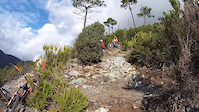
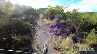
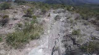
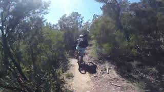
Photos of Moneglia Mountain Bike
Videos of Moneglia Mountain Bike
trail: FuMaRupe
0:25 |
15 |
Apr 15, 2025
trail: FuMaRupe
7:29 |
37 |
Nov 29, 2025 , moneglia
trail: FuMaRupe
5:12 |
204 |
May 2, 2023 , moneglia
trail: Tagliamento Deiva
17:46 |
485 |
May 2, 2023 , moneglia

trail: FuMaRupe
8:24 |
254 |
Dec 26, 2022 , moneglia
trail: Tagliamento Deiva
18:31 |
245 |
Dec 15, 2022 , moneglia
Recent Trail Reports
| status | trail | date | condition | info | user |
|---|---|---|---|---|---|
| Bracco Vasca | Jun 13, 2026 @ 8:56am (Europe/Rome) Jun 12, 2026 | Dry | mmax70 | ||
| Tritone | May 31, 2026 @ 9:24am (Europe/Rome) May 31, 2026 | Ideal | Stefanosurf68 | ||
| Accesso ai trail di Riva | May 31, 2026 @ 9:24am (Europe/Rome) May 31, 2026 | Ideal | Stefanosurf68 | ||
| Connection to Cadelazzino Climb | May 31, 2026 @ 7:43am (Europe/Monaco) May 30, 2026 | Ideal | fabioapnea | ||
| Costa - Foce Del Prato | Jun 1, 2026 @ 10:55am (Europe/Monaco) Jun 1, 2026 | Ideal | Garru | ||
| FuMaRupe | May 21, 2026 @ 11:45am (Europe/Rome) May 21, 2026 | Ideal | alexmetaam | ||
| Tagliamento Deiva | Apr 29, 2026 @ 10:54am (Europe/Rome) Apr 29, 2026 | Very Dry | alexmetaam | ||
| Riva-Moneglia | Aug 31, 2025 @ 9:00am Aug 31, 2025 | Dry | DeCif | ||
| Littorno Moneglia | Aug 29, 2025 @ 5:46am Aug 29, 2025 | Ideal | giulio010890 | ||
| Lemeglio Littorno | Aug 29, 2025 @ 5:43am Aug 29, 2025 | Variable | giulio010890 |
Activity Feed
| username | action | type | title | date |
|---|---|---|---|---|
| Max5hVnEN | ridden | trail | activity #97307475 | Jun 19, 2026 @ 4:27am 14 hours |
| mmax70 | add | report | activity #97028986 | Jun 15, 2026 @ 2:20am Jun 15, 2026 |
| Stefano4MnkxZ | ridden | trail | activity #96591944 | Jun 9, 2026 @ 2:10am Jun 9, 2026 |
| Stefanosurf68 | add | report | activity #96137993 and 1 more | Jun 2, 2026 @ 11:34pm Jun 2, 2026 |
| fabioapnea | add | report | activity #96100846 | Jun 2, 2026 @ 11:58am Jun 2, 2026 |
Recent Comments
| username | type | title | comment | date |
|---|---|---|---|---|
| trail | Molto bello, veloce e panoramico. Tutto su... | Feb 21, 2026 @ 12:04pm Feb 21, 2026 | ||
| report | Non fatevi scoraggiare dal primissimo pezzo... | Aug 29, 2025 @ 3:38am Aug 29, 2025 | ||
| trail | Praticamente abbandonato, peccato era uno dei... | Jul 20, 2025 @ 10:31am Jul 20, 2025 | ||
| trail | Il sentiero è spettacolare, dopo le panchine... | Mar 26, 2025 @ 2:33pm Mar 26, 2025 | ||
| report | Ottimo stato | May 11, 2024 @ 10:13am May 11, 2024 |
Local Badges
-

Epic Ride Climb 2k81 awarded -

Climbing 10k Badge19 awarded -

Climbing 100k Badge2 awarded -

Epic Ride Descent 2k88 awarded -

Descent 10k Badge19 awarded -

Descent 100k Badge2 awarded
Activity Type Stats
| activitytype | trails | distance | descent | descent distance | total vertical | rating | global rank | state rank | photos | reports | routes | ridelogs |
|---|---|---|---|---|---|---|---|---|---|---|---|---|
| Mountain Bike | 29 | 26 miles | 12,589 ft | 16 miles | 2,057 ft | #4,961 | #358 | 43 | 244 | 9 | 975 | |
| E-Bike | 12 | 3 miles | 1,115 ft | 2 miles | 974 ft | #782 | #95 | 31 | 171 | 166 | ||
| Horse | 2 | 1 mile | 256 ft | 3,091 ft | 295 ft | 19 | ||||||
| Hike | 29 | 26 miles | 12,589 ft | 16 miles | 2,057 ft | #6,265 | #314 | 244 | 62 | |||
| Trail Running | 29 | 26 miles | 12,589 ft | 16 miles | 2,057 ft | #5,718 | #299 | 244 | 22 | |||
| Dirtbike/Moto | 1 | 1 mile | 190 ft | 2,661 ft | 135 ft | 19 |
Frequently Asked Questions About Moneglia
▼
What are the best places to ride in Moneglia?
Moneglia has 1 areas to explore for mountain biking. The top rated areas are:
▼
What are the highest rated mountain biking trails in Moneglia?
The highest rated mountain biking trails in Moneglia are:
- FuMaRupe (4.5/5)
- Tagliamento Deiva (4.4/5)
- Incisa Variante 1 (4.1/5)
- Incisa variante 3 (4.1/5)
- Il Casarza (4.1/5)
▼
What is the best time of the year to ride in Moneglia?
Based on ride log data, the most popular months to ride in Moneglia are:
- July (6 activities)
- September (5 activities)
- October (4 activities)
▼
Where can I park to ride in Moneglia?
Check the Moneglia trail map for trailhead and parking information. Community members regularly update access and parking details for trails in the area.
Activities
Trails
- By j8lud & contributors
- Admins: denitopia, linomak
- #19332 - 4,266 views
- moneglia activity log | embed map of Moneglia mountain bike trails | moneglia mountain biking points of interest
Downloading of trail gps tracks in kml & gpx formats is enabled for Moneglia.
You must login to download files.