close
-
Layers w
- Weather Layers
- Pro
- Pro
- Pro
- Pro
- Pro
- Pro
- More Layers
- Pro
- Pro
- Pro
- Pro
-
Upgrade to

3D
Trail Conditions
- Unknown
- Snow Groomed
- Snow Packed
- Snow Covered
- Snow Cover Partial
- Freeze/thaw Cycle
- Icy
- Prevalent Mud
- Wet
- Variable
- Ideal
- Dry
- Very Dry
Trail Flow (Ridden Direction)
Trailforks scans users ridelogs to determine the most popular direction each trail is ridden. A good flowing trail network will have most trails flowing in a single direction according to their intension.
The colour categories are based on what percentage of riders are riding a trail in its intended direction.
The colour categories are based on what percentage of riders are riding a trail in its intended direction.
- > 96%
- > 90%
- > 80%
- > 70%
- > 50%
- < 50%
- bi-directional trail
- no data
Trail Last Ridden
Trailforks scans ridelogs to determine the last time a trail was ridden.
- < 2 days
- < 1 week
- < 2 weeks
- < 1 month
- < 6 months
- > 6 months
Trail Ridden Direction
The intended direction a trail should be ridden.
- Downhill Only
- Downhill Primary
- Both Directions
- Uphill Primary
- Uphill Only
- One Direction
Contribute Details
Colors indicate trail is missing specified detail.
- Description
- Photos
- Description & Photos
- Videos
Trail Popularity ?
Trailforks scans ridelogs to determine which trails are ridden the most in the last 9 months.
Trails are compared with nearby trails in the same city region with a possible 25 colour shades.
Think of this as a heatmap, more rides = more kinetic energy = warmer colors.
- most popular
- popular
- less popular
- not popular
ATV/ORV/OHV Filter
Max Vehicle Width
inches
US Cell Coverage
Legend

Radar Time
Activity Recordings
Trailforks uses anonymized public activity data.
?
Activity Recordings
Trailforks uses anonymized public activity data.
?
Personal Heatmap
▶
Activity Types
all
/
none
▶
Options
2
Date range
month
–
Winter Trails
Warning
A routing network for winter maps does not exist. Selecting trails using the winter trails layer has been disabled.
Missing Trails
Most Popular
Least Popular
Trails are colored based on popularity. The more popular a trail is, the more red. Less popular trails trend towards green.
Jump Magnitude Heatmap
Heatmap of where riders jump on trails. Zoom in to see individual jumps, click circles to view jump details.
BC Backroad Status
![map legend]()
Service Road Atlas is a free to use, community-driven service for viewing and creating reports on the numerous back-country service roads around B.C. and Alberta.

Slope Aspect
Direction the slope faces
Trails Deemphasized
Trails are shown in grey.
Only show trails with no bike usage.
Suggested Layers
Based on selected activity type
Save the current map location and zoom level as your default home location whenever this page is loaded.
SavePopular Trail Networks
view all areas »
No description for Mono County has been added yet!
Login or register to submit one.
Activities Click to view
- Mountain Bike
163 trails
- E-Bike
74 trails
- Horse
149 trails
- Hike
312 trails
- Trail Running
308 trails
- Dirtbike/Moto
18 trails
- ATV/ORV/OHV
12 trails
- Snowshoe
9 trails
- Downhill Ski
216 trails
- Backcountry Ski
3 trails
- Nordic Ski
8 trails
Region Details
- 40
- 10
- 24
- 46
- 20
- 12
- 8
Stats
- Avg Trail Rating
- Trails (view details)
- 574
- Trails Mountain Bike
- 163
- Trails E-Bike
- 74
- Trails Horse
- 149
- Trails Hike
- 312
- Trails Trail Running
- 308
- Trails Dirtbike/Moto
- 18
- Trails ATV/ORV/OHV
- 12
- Trails Snowmobile
- 1
- Trails Snowshoe
- 9
- Trails Downhill Ski
- 223
- Trails Backcountry Ski
- 4
- Trails Nordic Ski
- 8
- Total Distance
- 1,041 miles
- Total Descent
- 225,445 ft
- Total Vertical
- 9,128 ft
- Highest Trailhead
- 13,082 ft
- Reports
- 1,128
- Photos
- 620
- Ridden Counter
- 122,381
Articles
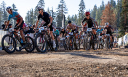
Mammoth PedalPalooza Returns August 16th
Aug 11, 2025 from pinkbike.com
XC racing returns to the slopes of Mammoth Mountain on a fully redesigned course.
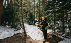
Trails Update: Mammoth Bike Park Goes Off the Top
Jul 3, 2025 from pinkbike.com
The trail crew has put in an incredible amount of effort to make the summit accessible and continues to work on expanding the terrain as snow...
Mammoth Mountain Bike Park Opening Day Trail Update
May 20, 2025 from pinkbike.com
The lifts start turning this Friday with four trails ready to rock.
Mammoth Mountain Bike Park to Open May 23rd
May 7, 2025 from pinkbike.com
Bike park season is starting early this year!
Sub Regions
- Bridgeport (17)
- Twin Lakes (6)
- Chalfant Valley (1)
- June Lake (5)
- Lee Vining (3)
- Mammoth Lakes (118)
- Walker (15)
- Mill Canyon (13)
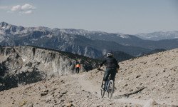
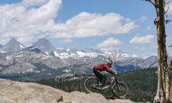
Popular Mono County Mountain Biking Trails
• 100 ★ 4.3 • 5 miles • 18 ft • 1,583 •
Known as the family . Zig zags across the pumice fields at the top. Some of the turns are lined with pavers. There a few rock gardens along this trail, but everything is very mellow and family friendly. At the bottom, turn left on to go...
• 50 ★ 4.4 • 705 ft • 0 ft • 1,382 •
The trail starts with a massive step up into the woods. There are a few jumps and a technical section before a long, steep ladder drops you back out of the woods.
• 100 ★ 4.5 • 4,167 ft • 0 ft • 1,361 •
Fun downhill trail with an optional log ride and wall ride. Nothing too technical.
• 95 ★ 3.9 • 2,418 ft • 0 ft • 1,287 •
Popular black diamond difficulty singletrack. This mountain bike primary trail can be used downhill only. On average it takes 2 minutes to complete this trail.
• 50 ★ 4.6 • 1,329 ft • 0 ft • 1,228 •
Highly rated moderately popular black diamond difficulty singletrack. This mountain bike primary trail can be used downhill only. Adaptive MTB rating: amtb green. On average it takes 1 minutes to complete this trail.
• 95 ★ 4.7 • 1,568 ft • 0 ft • 1,007 •
The part of that goes to Chair 2. A fast jump line with very good .
• 95 ★ 3.9 • 1,577 ft • 4 ft • 990 •
Popular blue difficulty singletrack. This mountain bike primary trail can be used downhill only. On average it takes 1 minutes to complete this trail.
• 100 ★ 4.5 • 1,230 ft • 0 ft • 979 •
Highly rated popular blue difficulty singletrack. This mountain bike primary trail can be used downhill only. On average it takes 1 minutes to complete this trail.
Mono County Mountain Bike Routes
★ 3.7 • 28 miles • 1,325 ft • 0 • Loop •
This is a common Loop for local Gravel Grinder and Spring and Fall Mountain Bike riding loop also used for...
★ 5.0 • 9 miles • 1,334 ft • 1 •
From mary lake to mammoth rocky trail
5 miles • 1,734 ft • 2 • Out & Back •
Wild backcountry out and back. is a HARD pedal up but a rip roarin descent. is even steeper and more...
★ 5.0 • 14 miles • 2,503 ft • 0 • Loop •
Sustained High Sierra scenery with big views, aspen groves, and lots of year-round creeks. This route is a...
1 mile • 3 • Shuttled •
My favorite trail combo at the Mammoth Bike Park
★ 5.0 • 3 miles • 93 ft • 11 • Point to Point •
There are routes that more exciting but this is a good warm up. Adaptive Info: There are three spots right...
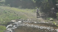
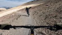
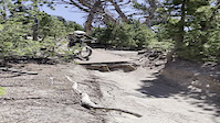
Photos of Mono County Mountain Bike
Videos of Mono County Mountain Bike
trail: Lost Cannon Trail
0:03 |
8 |
May 27, 2026
trail: Chain Smoke
0:09 |
54 |
Sep 18, 2024
0:06 |
93 |
Nov 21, 2022
trail: Shock Treatment
0:04 |
|
Jul 23, 2021
0:10 |
83 |
Jan 4, 2021
trail: Chain Smoke
4:14 |
140 |
Sep 28, 2020
trail: Shotgun
2:49 |
89 |
Sep 28, 2020
trail: Velocity DH
0:17 |
78 |
Sep 18, 2020
Recent Trail Reports
Activity Feed
| username | action | type | title | date |
|---|---|---|---|---|
| RedMisty | add | report | activity #97353840 | Jun 19, 2026 @ 4:52pm 1 day |
| RedMisty | add | report | activity #97353490 and 1 more | Jun 19, 2026 @ 4:45pm 1 day |
| trailforks | add | video | activity #97295323 | Jun 18, 2026 @ 9:00pm 2 days |
| chrismcnamara | like | report | activity #97254684 | Jun 18, 2026 @ 8:39am 3 days |
| RedMisty | add | report | activity #97254623 | Jun 18, 2026 @ 8:38am 3 days |
Recent Comments
| username | type | title | comment | date |
|---|---|---|---|---|
| trail | One of my least favorite trials that I’ve... | Jun 15, 2026 @ 9:36pm Jun 15, 2026 | ||
| trail | Great trail. | Jun 15, 2026 @ 6:05am Jun 15, 2026 | ||
| trail | great trail. bedded in and killer switchbacks | Jun 13, 2026 @ 4:30pm Jun 13, 2026 | ||
| report | No snow on trail. | Jun 13, 2026 @ 12:32pm Jun 13, 2026 | ||
| trail | Rode today June 12, ‘26. Only one mound of... | Jun 12, 2026 @ 2:51pm Jun 12, 2026 |
Local Badges
-

Climbing 10k Badge0 awarded -

Epic Mountain Bike Climb 2k0 awarded -

Epic Ride 50k8 awarded -

Big Ride 30k21 awarded -

Mountain Biking 100k Badge0 awarded -

Descent 100k Badge0 awarded
Bike & Skill Parks
| name | type | city | rating |
|---|---|---|---|
| Mammoth Mountain Bike Park | bike park | Mammoth Lakes | |
| Mammoth Mountain Ski Resort | bike park | Mammoth Lakes | |
| June Mountain Ski Area | bike park | June Lake | |
| Mammoth Motocross | skill park | Mammoth Lakes |
Local Products
Local Trail Supporters
- Town of Mammoth Lakes
![Mammoth Lakes Anesthesiologists]()
![Sierra Meadows ranch]()
Activity Type Stats
| activitytype | trails | distance | descent | descent distance | total vertical | rating | global rank | state rank | photos | reports | routes | ridelogs |
|---|---|---|---|---|---|---|---|---|---|---|---|---|
| Mountain Bike | 163 | 280 miles | 52,139 ft | 123 miles | 7,116 ft | 591 | 1,081 | 42 | 27,149 | |||
| E-Bike | 74 | 142 miles | 20,272 ft | 53 miles | 6,509 ft | 981 | 16 | 2,715 | ||||
| Horse | 149 | 513 miles | 88,875 ft | 211 miles | 8,369 ft | 335 | 4 | |||||
| Hike | 312 | 891 miles | 145,033 ft | 343 miles | 9,127 ft | 24 | 991 | 100 | 8,562 | |||
| Trail Running | 308 | 888 miles | 144,170 ft | 341 miles | 9,127 ft | 3 | 989 | 100 | 1,201 | |||
| Dirtbike/Moto | 18 | 52 miles | 6,211 ft | 19 miles | 5,564 ft | 307 | 1 | 32 | ||||
| ATV/ORV/OHV | 12 | 34 miles | 4,137 ft | 13 miles | 5,564 ft | 303 | 1 | 22 | ||||
| Snowmobile | 1 | 1 mile | 23 ft | 1,102 ft | 282 ft | 33 | 1 | 2 | ||||
| Snowshoe | 9 | 8 miles | 558 ft | 4 miles | 1,040 ft | 34 | 2 | 102 | ||||
| Downhill Ski | 216 | 73 miles | 53,068 ft | 63 miles | 3,396 ft | 37 | 11,379 | |||||
| Backcountry Ski | 3 | 9 miles | 2,844 ft | 3 miles | 3,343 ft | 34 | 1,664 | |||||
| Nordic Ski | 8 | 7 miles | 489 ft | 3 miles | 361 ft | 34 | 1 | 1,294 |
Frequently Asked Questions About Mono County
▼
What are the best places to ride in Mono County?
Mono County has 20 areas to explore for mountain biking. The top rated areas are:
▼
What are the highest rated mountain biking trails in Mono County?
The highest rated mountain biking trails in Mono County are:
- Follow Me (4.6/5)
- Shock Treatment (4.6/5)
- Twilight Zone (4.4/5)
- Flow (4.4/5)
- Smooth Operator (4.4/5)
▼
What is the best time of the year to ride in Mono County?
Based on ride log data, the most popular months to ride in Mono County are:
- July (480 activities)
- August (407 activities)
- June (174 activities)
▼
What is the longest trail in Mono County?
The longest trail in Mono County is Horse & Cattle Creek Canyon at 6.3 miles. View all trails sorted by distance.
Activities
- Mono County Mountain Biking Trails
- Mono County E-Biking Trails
- Mono County Horseback Trails
- Mono County Hiking Trails
- Mono County Trail Running Trails
- Mono County Dirtbiking Trails
- Mono County ATVing/Offroading Trails
- Mono County Snowshoeing Trails
- Mono County Skiing Trails
- Mono County Nordic Skiing Trails
Trails
- By brenthillier
 NSMBA TRAILFORKS & contributors
 - Admins: jpmcghee, sanfret, brianpetry, TheAngryTomato
- #7919 - 5,977 views
- mono county activity log | embed map of Mono County mountain bike trails | mono county mountain biking points of interest polygons
Downloading of trail gps tracks in kml & gpx formats is enabled for Mono County.
You must login to download files.