close
-
Layers w
- Weather Layers
- Pro
- Pro
- Pro
- Pro
- Pro
- Pro
- More Layers
- Pro
- Pro
- Pro
- Pro
-
Upgrade to

3D
Trail Conditions
- Unknown
- Snow Groomed
- Snow Packed
- Snow Covered
- Snow Cover Partial
- Freeze/thaw Cycle
- Icy
- Prevalent Mud
- Wet
- Variable
- Ideal
- Dry
- Very Dry
Trail Flow (Ridden Direction)
Trailforks scans users ridelogs to determine the most popular direction each trail is ridden. A good flowing trail network will have most trails flowing in a single direction according to their intension.
The colour categories are based on what percentage of riders are riding a trail in its intended direction.
The colour categories are based on what percentage of riders are riding a trail in its intended direction.
- > 96%
- > 90%
- > 80%
- > 70%
- > 50%
- < 50%
- bi-directional trail
- no data
Trail Last Ridden
Trailforks scans ridelogs to determine the last time a trail was ridden.
- < 2 days
- < 1 week
- < 2 weeks
- < 1 month
- < 6 months
- > 6 months
Trail Ridden Direction
The intended direction a trail should be ridden.
- Downhill Only
- Downhill Primary
- Both Directions
- Uphill Primary
- Uphill Only
- One Direction
Contribute Details
Colors indicate trail is missing specified detail.
- Description
- Photos
- Description & Photos
- Videos
Trail Popularity ?
Trailforks scans ridelogs to determine which trails are ridden the most in the last 9 months.
Trails are compared with nearby trails in the same city region with a possible 25 colour shades.
Think of this as a heatmap, more rides = more kinetic energy = warmer colors.
- most popular
- popular
- less popular
- not popular
ATV/ORV/OHV Filter
Max Vehicle Width
inches
US Cell Coverage
Legend

Radar Time
Activity Recordings
Trailforks uses anonymized public activity data.
?
Activity Recordings
Trailforks uses anonymized public activity data.
?
Personal Heatmap
▶
Activity Types
all
/
none
▶
Options
2
Date range
month
–
Winter Trails
Warning
A routing network for winter maps does not exist. Selecting trails using the winter trails layer has been disabled.
Missing Trails
Most Popular
Least Popular
Trails are colored based on popularity. The more popular a trail is, the more red. Less popular trails trend towards green.
Jump Magnitude Heatmap
Heatmap of where riders jump on trails. Zoom in to see individual jumps, click circles to view jump details.
BC Backroad Status
![map legend]()
Service Road Atlas is a free to use, community-driven service for viewing and creating reports on the numerous back-country service roads around B.C. and Alberta.

Slope Aspect
Direction the slope faces
Trails Deemphasized
Trails are shown in grey.
Only show trails with no bike usage.
Suggested Layers
Based on selected activity type
Save the current map location and zoom level as your default home location whenever this page is loaded.
Save
No description for Monsanto has been added yet!
Login or register to submit one.
 google parking directions
Primary Trail Type: Cross-Country
Land Status: City Managed
google parking directionsThis region uses the Uk/Euro style trail grading system.
Activities Click to view
- Mountain Bike
48 trails
- E-Bike
31 trails
- Hike
40 trails
- Trail Running
41 trails
Region Details
- 1
- 3
- 20
- 21
- 3
Region Status
Caution as of Jun 14, 2026Local Trail Association
Stats
- Avg Trail Rating
- Trails (view details)
- 48
- Trails Mountain Bike
- 49
- Trails E-Bike
- 31
- Trails Hike
- 40
- Trails Trail Running
- 41
- Total Distance
- 14 miles
- Total Descent
- 5,019 ft
- Total Vertical
- 597 ft
- Highest Trailhead
- 679 ft
- Reports
- 2,471
- Photos
- 100
- Ridden Counter
- 10,700
Popular Monsanto Mountain Biking Trails
• 85 ★ 4.6 • 3,998 ft • 42 ft • 357 •
Highly rated popular blue difficulty singletrack. This mountain bike primary trail can be used downhill primary and has a moderate overall physical rating with a 42 ft blue climb. It features drop and gap jump. On average it takes 6 minutes to complete this trail.
• 75 ★ 4.5 • 2,723 ft • 9 ft • 342 •
Highly rated popular green difficulty singletrack. This mountain bike primary trail can be used downhill primary. It features jump. On average it takes 3 minutes to complete this trail.
• 95 ★ 5.0 • 1,654 ft • 0 ft • 321 •
Highly rated popular blue difficulty singletrack. This multi-use trail can be used downhill only and has a moderate overall physical rating. It features berm, drop and jump. Trail visibility is always easy to follow. On average it takes 5 minutes to complete this trail.
• 95 ★ 4.8 • 477 ft • 0 ft • 268 •
Popular blue difficulty singletrack. This mountain bike primary trail can be used downhill only and has a easy overall physical rating. It features berm, bridge and drop. Trail visibility is always easy to follow. On average it takes minutes to complete this trail.
• 50 ★ 4.4 • 1,784 ft • 4 ft • 264 •
Moderately popular green difficulty singletrack. This mountain bike primary trail can be used both directions. On average it takes 2 minutes to complete this trail.
• 70 ★ 2.0 • 2,867 ft • 37 ft • 261 •
Popular white difficulty family friendly singletrack. This mountain bike primary trail can be used both directions and has a easy overall physical rating with a 37 ft green climb. On average it takes 2 minutes to complete this trail.
• 65 ★ 4.6 • 1,208 ft • 9 ft • 255 •
Moderately popular green difficulty singletrack. This mountain bike primary trail can be used downhill primary. It features jump. On average it takes 1 minutes to complete this trail.
Monsanto Mountain Bike Routes
238 miles • 14,320 ft • 0 • Point to Point •
Caminho de Santiago dende Lisboa ata Porto
• 12 miles • 843 ft • 0 •
• 4 miles • 853 ft • 3 •
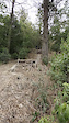
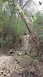
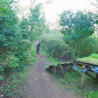
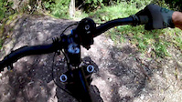
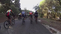
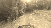
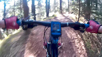
Photos of Monsanto Mountain Bike
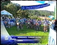
Videos of Monsanto Mountain Bike
trail: Trilho do Penedo de Monsanto
0:13 |
49 |
Oct 27, 2025
trail: Gato
0:06 |
91 |
Sep 5, 2023
trail: StepUp
0:06 |
126 |
Sep 5, 2023
trail: Trilho do Penedo de Monsanto
0:31 |
59 |
Nov 14, 2020
trail: Interminável/Prisão
0:04 |
545 |
May 18, 2018
trail: Trilho do Penedo de Monsanto
29:59 |
139 |
Oct 28, 2017
trail: Kamikase
6:01 |
492 |
Jul 29, 2015
trail: Bossas Camelo
0:14 |
417 |
Apr 15, 2015
Recent Trail Reports
| status | trail | date | condition | info | user |
|---|---|---|---|---|---|
| A1 Lower | Jun 14, 2026 @ 10:17am (Europe/Lisbon) Jun 14, 2026 | Very Dry | Rizek | ||
| A1 | Jun 14, 2026 @ 10:17am (Europe/Lisbon) Jun 14, 2026 | Very Dry | Rizek | ||
| Abelhas | Jun 14, 2026 @ 10:17am (Europe/Lisbon) Jun 14, 2026 | Dry | Rizek | ||
| Xavier/Algés | Jun 8, 2026 @ 10:45am (Europe/Lisbon) Jun 8, 2026 | Ideal | RicardoColaco | ||
| Chimarrão (full) | Jun 8, 2026 @ 10:45am (Europe/Lisbon) Jun 8, 2026 | Ideal | RicardoColaco | ||
| Os três saltos | Jun 8, 2026 @ 10:45am (Europe/Lisbon) Jun 8, 2026 | Ideal | RicardoColaco | ||
| Monte Verde | Jun 8, 2026 @ 10:45am (Europe/Lisbon) Jun 8, 2026 | Ideal | RicardoColaco | ||
| Gigantone | May 31, 2026 @ 9:16am (Europe/Lisbon) May 31, 2026 | Dry | Santinho | ||
| Johnny's III | May 31, 2026 @ 9:16am (Europe/Lisbon) May 31, 2026 | Dry | Santinho | ||
| Johnny's II | May 31, 2026 @ 9:16am (Europe/Lisbon) May 31, 2026 | Dry | Santinho |
Activity Feed
| username | action | type | title | date |
|---|---|---|---|---|
| Rizek | add | report | activity #96970344 and 2 more | Jun 14, 2026 @ 8:12am Jun 14, 2026 |
| RicardoColaco | add | report | activity #96544769 and 3 more | Jun 8, 2026 @ 9:25am Jun 8, 2026 |
| Santinho | add | report | activity #96005484 and 6 more | Jun 1, 2026 @ 2:46am Jun 1, 2026 |
| adrianoteixeira17 | wishlist | trail | activity #95620022 and 1 more | May 27, 2026 @ 1:41am May 27, 2026 |
| ZgMp1C | ridden | trail | activity #95519635 | May 25, 2026 @ 1:37pm May 25, 2026 |
Recent Comments
| username | type | title | comment | date |
|---|---|---|---|---|
| report | It’s fine. No obstacles along the way. | Apr 26, 2026 @ 8:05am Apr 26, 2026 | ||
| trail | Parabéns e obrigado por esta divertida... | Jul 2, 2025 @ 10:41am Jul 2, 2025 | ||
| report | No obstacles along the way. | May 18, 2025 @ 2:30pm May 18, 2025 | ||
| trail | Trilho com bastante saltos e curvas perfeitas! Top | Nov 18, 2024 @ 9:50am Nov 18, 2024 | ||
| trail | Would be awesome to join prisao to this one... | Oct 25, 2024 @ 6:08am Oct 25, 2024 |
Nearby Areas
| name | distance | ||||
|---|---|---|---|---|---|
| Jamor | 4 | 2.4 km | |||
| Mata de Alvalade | 4 | 1 | 4.9 km | ||
| Charneca da Caparica | 6 km | ||||
| Belas | 7 | 8 | 6.1 km | ||
| Kintal | 6.2 km |
Local Badges
-

Completionist2 awarded
Bike & Skill Parks
| name | type | city | rating |
|---|---|---|---|
| Miradouro da Tapadinha | skill park | Lisbon |
Activity Type Stats
| activitytype | trails | distance | descent | descent distance | total vertical | rating | global rank | state rank | photos | reports | routes | ridelogs |
|---|---|---|---|---|---|---|---|---|---|---|---|---|
| Mountain Bike | 48 | 14 miles | 5,020 ft | 10 miles | 597 ft | #531 | #2 | 105 | 2,577 | 2 | 20,857 | |
| E-Bike | 31 | 8 miles | 3,215 ft | 6 miles | 525 ft | #651 | #8 | 2,423 | 1 | 4,707 | ||
| Hike | 40 | 12 miles | 3,993 ft | 8 miles | 597 ft | #1,473 | #5 | 2,518 | 398 | |||
| Trail Running | 41 | 12 miles | 4,075 ft | 8 miles | 597 ft | #761 | #5 | 2,526 | 1,517 |
Frequently Asked Questions About Monsanto
▼
What are the highest rated mountain biking trails in Monsanto?
▼
What is the best time of the year to ride in Monsanto?
Based on ride log data, the most popular months to ride in Monsanto are:
- July (168 activities)
- May (71 activities)
- June (71 activities)
▼
Where can I park to ride in Monsanto?
There are 4 parking locations listed in Monsanto. The most popular parking spots are: View all parking and trailhead locations on the map to plan your visit.
▼
What is the longest trail in Monsanto?
The longest trail in Monsanto is Javali at 3,998 ft. View all trails sorted by distance.
Activities
- By daniellmendes & contributors
- Admins: CDL-PFM
- #4333 - 23,578 views
- monsanto activity log | embed map of Monsanto mountain bike trails | monsanto mountain biking points of interest
Downloading of trail gps tracks in kml & gpx formats is enabled for Monsanto.
You must login to download files.