close
-
Layers w
- Weather Layers
- Pro
- Pro
- Pro
- Pro
- Pro
- Pro
- More Layers
- Pro
- Pro
- Pro
- Pro
-
Upgrade to

3D
Trail Conditions
- Unknown
- Snow Groomed
- Snow Packed
- Snow Covered
- Snow Cover Partial
- Freeze/thaw Cycle
- Icy
- Prevalent Mud
- Wet
- Variable
- Ideal
- Dry
- Very Dry
Trail Flow (Ridden Direction)
Trailforks scans users ridelogs to determine the most popular direction each trail is ridden. A good flowing trail network will have most trails flowing in a single direction according to their intension.
The colour categories are based on what percentage of riders are riding a trail in its intended direction.
The colour categories are based on what percentage of riders are riding a trail in its intended direction.
- > 96%
- > 90%
- > 80%
- > 70%
- > 50%
- < 50%
- bi-directional trail
- no data
Trail Last Ridden
Trailforks scans ridelogs to determine the last time a trail was ridden.
- < 2 days
- < 1 week
- < 2 weeks
- < 1 month
- < 6 months
- > 6 months
Trail Ridden Direction
The intended direction a trail should be ridden.
- Downhill Only
- Downhill Primary
- Both Directions
- Uphill Primary
- Uphill Only
- One Direction
Contribute Details
Colors indicate trail is missing specified detail.
- Description
- Photos
- Description & Photos
- Videos
Trail Popularity ?
Trailforks scans ridelogs to determine which trails are ridden the most in the last 9 months.
Trails are compared with nearby trails in the same city region with a possible 25 colour shades.
Think of this as a heatmap, more rides = more kinetic energy = warmer colors.
- most popular
- popular
- less popular
- not popular
ATV/ORV/OHV Filter
Max Vehicle Width
inches
US Cell Coverage
Legend

Radar Time
Activity Recordings
Trailforks uses anonymized public activity data.
?
Activity Recordings
Trailforks uses anonymized public activity data.
?
Personal Heatmap
▶
Activity Types
all
/
none
▶
Options
2
Date range
month
–
Winter Trails
Warning
A routing network for winter maps does not exist. Selecting trails using the winter trails layer has been disabled.
Missing Trails
Most Popular
Least Popular
Trails are colored based on popularity. The more popular a trail is, the more red. Less popular trails trend towards green.
Jump Magnitude Heatmap
Heatmap of where riders jump on trails. Zoom in to see individual jumps, click circles to view jump details.
BC Backroad Status
![map legend]()
Service Road Atlas is a free to use, community-driven service for viewing and creating reports on the numerous back-country service roads around B.C. and Alberta.

Slope Aspect
Direction the slope faces
Trails Deemphasized
Trails are shown in grey.
Only show trails with no bike usage.
Suggested Layers
Based on selected activity type
Save the current map location and zoom level as your default home location whenever this page is loaded.
SaveMontana It's practically in the name mountain biking. Montana is a big state with a small population, and trails galore. There are many communities surrounded by dense trail networks, such as Missoula, Bozeman, Butte, and Helena, and there are small mountain towns with great access to big mountain epics, such as Red Lodge, Whitefish, or Philipsburg. In addition, cities such as Billings and Great Falls are finding the potential in rugged open lands nearby. Finally, there are also lift-served bike parks at Whitefish, Big Sky, and Philipsburg.
Links
Region Details
- 1,209
- 316
- 1,020
- 1,602
- 736
- 110
- 2
Stats
- Avg Trail Rating
- Trails (view details)
- 7,868
- Trails Mountain Bike
- 5,018
- Trails E-Bike
- 1,609
- Trails Gravel Bike
- 794
- Trails Adaptive Bike
- 756
- Trails Winter Fat Bike
- 2,238
- Trails Horse
- 2,586
- Trails Hike
- 5,779
- Trails Trail Running
- 5,725
- Trails Dirtbike/Moto
- 1,266
- Trails Observed Trials
- 39
- Trails ATV/ORV/OHV
- 975
- Trails Snowmobile
- 169
- Trails Snowshoe
- 1,584
- Trails Downhill Ski
- 1,287
- Trails Backcountry Ski
- 542
- Trails Nordic Ski
- 608
- Total Distance
- 16,367 miles
- Total Descent
- 2,797,198 ft
- Total Vertical
- 12,681 ft
- Highest Trailhead
- 12,684 ft
- Reports
- 42,036
- Photos
- 10,035
- Ridden Counter
- 572,718
Articles
2025-Helenduro Photo Album
Jul 6, 2025 from pinkbike.com
The World's biggest biking photo gallery of photos like, crashes, north shore. 2025-Helenduro
2025 Montana Enduro Series Round 1: Helenduro Race Report
Jul 4, 2025 from pinkbike.com
The Helenduro, North America's second-oldest enduro race, took place last weekend in Helena, Montana.
The Best Summer Weekend Trips of 2025
Jun 3, 2025 from outsideonline.com
There are only 14 weekends between Memorial Day and Labor Day this year. So you better make them count.
The Top 9 Small Adventure Towns in the U.S.
Apr 16, 2025 from outsideonline.com
These tiny hamlets, with less than 6,000 locals, provide the perfect blend of quaint vibes and outdoor fun
Sub Regions
- Central Montana Region (1,869)
- Blaine County (1)
- Broadwater County (88)
- Cascade County (108)
- Chouteau County (8)
- Deer Lodge County (123)
- Fergus County (52)
- Granite County (63)
- Hill County (1)
- Jefferson County (245)
- Judith Basin County (38)
- Lewis And Clark County (648)
- Liberty County (1)
- Meagher County (36)
- Petroleum County (1)
- Pondera County (39)
- Powell County (70)
- Silver Bow County (295)
- Teton County (23)
- Toole County (2)
- Wheatland County (2)
- Glacier Country Region (1,646)
- Flathead County (858)
- Lake County (75)
- Lincoln County (23)
- Mineral County (4)
- Missoula County (510)
- Ravalli County (Bitterroot Valley) (120)
- Sanders County (30)
- Missouri River Country Region (54)
- Garfield County (1)
- Phillips County (46)
- Valley County (7)
- Southeast Montana Region (79)
- Big Horn County (1)
- Carter County (1)
- Custer County (1)
- Dawson County (6)
- Fallon County (1)
- Golden Valley County (1)
- Musselshell County (1)
- Prairie County (1)
- Rosebud County (1)
- Treasure County (1)
- Wibaux County (1)
- Yellowstone County (63)
- Southwest Montana Region (1,049)
- Beaverhead County (268)
- Gallatin County (694)
- Madison County (85)
- Yellowstone Country Region (186)
- Carbon County (110)
- Park County (36)
- Stillwater County (19)
- Sweet Grass County (51)
Popular Montana Mountain Biking Trails
• 100 ★ 3.9 • 4,665 ft • 53 ft • 1,456 •
This is seamless with . The segment shown here connects Green Eagle loop and the bottom of Never Sweat/access rd.
• 100 ★ 4.2 • 2 miles • 547 ft • 1,437 •
Bi-directional, but definitely the best way to climb to the ridge. There's a fun rock face alternate line that can be ridden both ways. The main trail is obvious and quite popular. Switchbacks start off easy and increase in difficulty...
• 95 ★ 4.4 • 1 mile • 56 ft • 1,416 •
North half of the first loop built at Copper City. Low angle trail, wide singletrack through sagebrush and grassland. Brand new fall of 2017!
• 100 ★ 4.9 • 5 miles • 165 ft • 1,439 •
This has been newly rebuilt for 2023 and it rips. Huge berms have been put in to keep your speed up, and the trail is super fast. Nice views of the valley as to your left when the trees clear. Some of the original trail is still there...
• 100 ★ 4.9 • 4 miles • 635 ft • 1,256 •
This trail is covers rolling terrain and connects to the Triple Tree trails, providing a connection from Main Street of Bozeman to the foothills of the Gallatin Mountains. Dogs need to be on leash for this trail, the locals get cranky.
• 100 ★ 4.4 • 5 miles • 1,265 ft • 1,380 •
Great ride down, but watch out for the two creek crossings and root systems from trailside trees. Head up the trail. At the fork, head left as the sign suggests. This is very much a one way loop. Climb for a while. Check out the old...
Montana Mountain Bike Routes
Beartrap Gulch Featured
★ 4.0 • 13 miles • 2,448 ft • 4 • Loop •
Helena classic! The upper half of the Beartrap Gulch Trail is the best ribbon singletrack in the Helena...
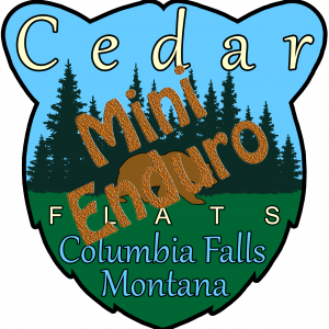
Cedar Flats Mini-Enduro Featured
★ 5.0 • 8 miles • 682 ft • 11 • Loop •
For those looking for a shorter version of the Cedar Flats Enduro route try this Cedar Flats Mini-Enduro...
MTBM - Classic Sheep Mountain Loop Featured
★ 3.6 • 25 miles • 4,731 ft • 3 • Loop •
Missoula's premier backcountry classic ride! This is the typical way most people ride the Sheep Mountain...
Northwoods Gravel Grind Featured
★ 5.0 • 11 miles • 1,487 ft • 6 • Loop •
This gravel grind is a loop ride that will get you high above the Valley floor and has view points along...
★ 4.3 • 6 miles • 689 ft • 3 • Shuttled •
This is a local's favorite Mount Helena Ridge ride, ending with . It is an extremely popular way to take...
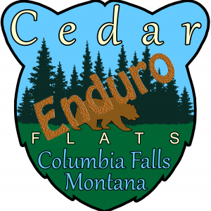
Cedar Flats Enduro Featured
★ 4.0 • 12 miles • 1,319 ft • 16 • Loop •
This is a route that gives you a comprehensive tour of all the elements of the Cedar Flats riding complex....
Photos of Montana Mountain Bike
Videos of Montana Mountain Bike
featured
![Our Trails Unite Us - Helena, Montana]()
trail: 2006 Trail (north side)
0:41 |
696 |
Nov 2, 2021 , Helena
trail: Malice in Plunderland
0:11 |
41 |
Sep 3, 2025

trail: Crevice
0:12 |
|
May 16, 2025

trail: Crevice
0:12 |
32 |
May 16, 2025
trail: Crevice
0:12 |
|
May 16, 2025
trail: Zeppelin Alt (Drop)
0:45 |
54 |
Nov 22, 2023
trail: Kashmir
4:39 |
26 |
Nov 22, 2023
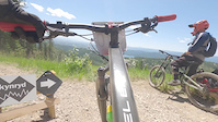
trail: Skynyrd
0:15 |
75 |
Nov 22, 2023
National Scenic Trails & Official Routes
-
Continental Divide Trail
- Mountain Bike
- Hike
- Trail Running
-
Great Western Trail
- Mountain Bike
- E-Bike
- Horse
- Hike
- Trail Running
- Dirtbike/Moto
- ATV/ORV/OHV
-
Pacific Northwest Trail
- Mountain Bike
- Horse
- Hike
- Trail Running


Activity Feed
| username | action | type | title | date |
|---|---|---|---|---|
| codyasimons | wishlist | route | activity #97542124 | Jun 21, 2026 @ 9:30pm 32 mins |
| JacksonGCKD2D | rsvp | event | activity #97538875 | Jun 21, 2026 @ 7:35pm 2 hours |
| DanHMT | add | report | activity #97536873 | Jun 21, 2026 @ 6:36pm 3 hours |
| JeffVonKiper | add | report | activity #97535289 | Jun 21, 2026 @ 6:02pm 4 hours |
| allwateraj | wishlist | region | activity #97534324 | Jun 21, 2026 @ 5:44pm 4 hours |
Recent Comments
| username | type | title | comment | date |
|---|---|---|---|---|
| report | Not open to motos | Jun 21, 2026 @ 3:43pm 6 hours | ||
| trail | Challenging trail with lots of rocks,... | Jun 21, 2026 @ 9:19am 13 hours | ||
| report | ❤️🤙 | Jun 21, 2026 @ 8:23am 14 hours | ||
| report | Thanks 💪 | Jun 21, 2026 @ 5:40am 16 hours | ||
| report | sweet | Jun 20, 2026 @ 8:26pm 1 day |
Local Badges
-
Cedar Flats Mini-Enduro0 awarded -
Cedar Flats Enduro0 awarded -

Completionist2 awarded -

Completionist2 awarded -

Green Eagle Scavenger Hunt3 awarded -

Butte 100 Racecourse0 awarded
Bike & Skill Parks
| name | type | city | rating |
|---|---|---|---|
| Big Sky Resort | bike park | Big Sky | |
| Discovery Bike Park | bike park | Phillipsburg | |
| Whitefish Mountain Resort | bike park | Whitefish | |
| Legacy Bike Park | bike park | Lakeside | |
| Great Divide Bike Park | bike park | Marysville |
Upcoming Local Events
Activity Type Stats
| activitytype | trails | distance | descent | descent distance | total vertical | rating | global rank | state rank | photos | reports | routes | ridelogs |
|---|---|---|---|---|---|---|---|---|---|---|---|---|
| Mountain Bike | 5,016 | 11,886 miles | 1,779,505 ft | 4,658 miles | 10,840 ft | #14 | 9,104 | 41,695 | 482 | 402,744 | ||
| E-Bike | 1,609 | 5,172 miles | 600,761 ft | 1,952 miles | 7,910 ft | #10 | 26 | 32,653 | 61 | 7,407 | ||
| Gravel Bike | 794 | 2,311 miles | 183,780 ft | 754 miles | 7,333 ft | #12 | 176 | 9,868 | 41 | 3,605 | ||
| Adaptive Bike | 756 | 1,844 miles | 125,794 ft | 568 miles | 7,484 ft | #11 | 3,693 | 32 | ||||
| Winter Fat Bike | 2,238 | 4,997 miles | 736,542 ft | 1,949 miles | 8,028 ft | #2 | 2 | 3,990 | 16 | 157 | ||
| Horse | 2,586 | 8,874 miles | 1,258,924 ft | 3,371 miles | 10,699 ft | #3 | 20 | 20,277 | 37 | 153 | ||
| Hike | 5,779 | 14,694 miles | 2,165,213 ft | 5,634 miles | 10,738 ft | #9 | 433 | 41,183 | 121 | 74,325 | ||
| Trail Running | 5,725 | 14,647 miles | 2,152,838 ft | 5,611 miles | 10,738 ft | #7 | 88 | 41,165 | 134 | 63,041 | ||
| Dirtbike/Moto | 1,266 | 4,994 miles | 625,745 ft | 1,926 miles | 7,703 ft | #6 | 22 | 18,060 | 22 | 803 | ||
| Observed Trials | 39 | 179 miles | 18,734 ft | 71 miles | 5,689 ft | #17 | 1 | 342 | 157 | |||
| ATV/ORV/OHV | 975 | 4,085 miles | 407,457 ft | 1,488 miles | 7,923 ft | #5 | 11 | 17,555 | 9 | 187 | ||
| Snowmobile | 169 | 856 miles | 71,867 ft | 291 miles | 7,133 ft | #11 | 1 | 8,486 | 3 | 157 | ||
| Snowshoe | 1,584 | 4,248 miles | 619,157 ft | 1,697 miles | 8,002 ft | #5 | 2 | 11,557 | 9 | 777 | ||
| Downhill Ski | 1,287 | 548 miles | 468,615 ft | 493 miles | 7,405 ft | #10 | 4 | 1,886 | 2 | 27,805 | ||
| Backcountry Ski | 542 | 1,835 miles | 276,237 ft | 707 miles | 8,488 ft | #3 | 39 | 9,286 | 19 | 16,884 | ||
| Nordic Ski | 608 | 614 miles | 50,722 ft | 246 miles | 6,070 ft | #17 | 46 | 10,581 | 9 | 26,409 |
Activities
- Montana Mountain Biking Trails
- Montana E-Biking Trails
- Montana Gravel Biking Trails
- Montana Adaptive Biking Trails
- Montana Winter Fat Biking Trails
- Montana Horseback Trails
- Montana Hiking Trails
- Montana Trail Running Trails
- Montana Dirtbiking Trails
- Montana Observed Trials Trails
- Montana ATVing/Offroading Trails
- Montana Snowmobiling Trails
- Montana Snowshoeing Trails
- Montana Skiing Trails
- Montana Backcountry Skiing Trails
- Montana Nordic Skiing Trails
Trails
Points of Interest
- South Hills trail map kiosk Information
- Long X Ranch Viewpoint
- Upper 11th Hour Rock Garden TTF
- Denny's Drop TTF
- Twogood Cabin
- May Creek Cabin
- Rock outcrop TTF
- Jump Option TTF
- View of western Helena Valley and the Continental Divide Viewpoint
- View of south-central Helena Viewpoint
- Granite Peak (12,651 ft)
- Mount Wood (12,618 ft)
- Castle Mountain (12,605 ft)
- By MONTANABIKERMAN
 FTF & contributors
 - Admins: Map Team, IMBA, chuktA, msmcfate, WillieJacobsz, PlumbBobM, ReckitRolley, colinreuter
- #3117 - 85,055 views
- montana activity log | embed map of Montana mountain bike trails | montana mountain biking points of interest polygons
Downloading of trail gps tracks in kml & gpx formats is enabled for Montana.
You must login to download files.