close
-
Layers w
- Weather Layers
- Pro
- Pro
- Pro
- Pro
- Pro
- Pro
- More Layers
- Pro
- Pro
- Pro
- Pro
-
Upgrade to

3D
Trail Conditions
- Unknown
- Snow Groomed
- Snow Packed
- Snow Covered
- Snow Cover Partial
- Freeze/thaw Cycle
- Icy
- Prevalent Mud
- Wet
- Variable
- Ideal
- Dry
- Very Dry
Trail Flow (Ridden Direction)
Trailforks scans users ridelogs to determine the most popular direction each trail is ridden. A good flowing trail network will have most trails flowing in a single direction according to their intension.
The colour categories are based on what percentage of riders are riding a trail in its intended direction.
The colour categories are based on what percentage of riders are riding a trail in its intended direction.
- > 96%
- > 90%
- > 80%
- > 70%
- > 50%
- < 50%
- bi-directional trail
- no data
Trail Last Ridden
Trailforks scans ridelogs to determine the last time a trail was ridden.
- < 2 days
- < 1 week
- < 2 weeks
- < 1 month
- < 6 months
- > 6 months
Trail Ridden Direction
The intended direction a trail should be ridden.
- Downhill Only
- Downhill Primary
- Both Directions
- Uphill Primary
- Uphill Only
- One Direction
Contribute Details
Colors indicate trail is missing specified detail.
- Description
- Photos
- Description & Photos
- Videos
Trail Popularity ?
Trailforks scans ridelogs to determine which trails are ridden the most in the last 9 months.
Trails are compared with nearby trails in the same city region with a possible 25 colour shades.
Think of this as a heatmap, more rides = more kinetic energy = warmer colors.
- most popular
- popular
- less popular
- not popular
ATV/ORV/OHV Filter
Max Vehicle Width
inches
US Cell Coverage
Legend

Radar Time
Activity Recordings
Trailforks uses anonymized public activity data.
?
Activity Recordings
Trailforks uses anonymized public activity data.
?
Personal Heatmap
▶
Activity Types
all
/
none
▶
Options
2
Date range
month
–
Winter Trails
Warning
A routing network for winter maps does not exist. Selecting trails using the winter trails layer has been disabled.
Missing Trails
Most Popular
Least Popular
Trails are colored based on popularity. The more popular a trail is, the more red. Less popular trails trend towards green.
Jump Magnitude Heatmap
Heatmap of where riders jump on trails. Zoom in to see individual jumps, click circles to view jump details.
BC Backroad Status
![map legend]()
Service Road Atlas is a free to use, community-driven service for viewing and creating reports on the numerous back-country service roads around B.C. and Alberta.

Slope Aspect
Direction the slope faces
Trails Deemphasized
Trails are shown in grey.
Only show trails with no bike usage.
Suggested Layers
Based on selected activity type
Save the current map location and zoom level as your default home location whenever this page is loaded.
Save
No description for Montara has been added yet!
Login or register to submit one.
Activities Click to view
- Mountain Bike
26 trails
- E-Bike
9 trails
- Gravel Bike
0 trails
- Adaptive Bike
0 trails
- Horse
10 trails
- Hike
31 trails
- Trail Running
31 trails
Region Details
- 7
- 1
- 2
- 8
- 4
- 1
Region Status
Caution as of 7 hoursStats
- Avg Trail Rating
- Trails (view details)
- 30
- Trails Mountain Bike
- 27
- Trails E-Bike
- 9
- Trails Horse
- 10
- Trails Hike
- 31
- Trails Trail Running
- 31
- Total Distance
- 24 miles
- Total Descent Distance
- 12 miles
- Total Descent
- 6,905 ft
- Total Vertical
- 1,832 ft
- Highest Trailhead
- 1,890 ft
- Reports
- 1,058
- Photos
- 78
- Ridden Counter
- 27,191
Popular Montara Mountain Biking Trails
• 100 ★ 4.3 • 4,324 ft • 178 ft • 2,286 •
San Pedro Mtn Trail originates from ancient indigenous population trails that were documented by the Spanish explorers upon there arrival. The route of this trail as well as nearby trails "Mile" "Crack" and "Fly Amanita" are seen from...
• 100 ★ 3.5 • 1,050 ft • 63 ft • 1,685 •
Popular blue difficulty singletrack. This mountain bike primary trail can be used both directions. On average it takes 4 minutes to complete this trail.
• 95 ★ 4.2 • 1 mile • 15 ft • 1,515 •
This segment is a partial track of what was originally know as "Half Moon Bay - Colma Road". It was built in 1879 as the first road commissioned by San Mateo County over the mountain. It was replaced in 1915 by the nearby Coastside...
• 85 ★ 2.0 • 528 ft • 4 ft • 1,287 •
Small piece of single track to avoid Old Mountain rode for a minute. There's a bench in Nick's honor: "Excuse me while I kiss the sky". A challenging climb up from the bench back towards Pacifica.
• 75 ★ 4.3 • 3,783 ft • 373 ft • 1,207 •
This is the southern portion of the 1879 Half Moon Bay - Colma Rd. It was closed in 1915 and recently recovered through volunteer efforts.
• 80 ★ 3.7 • 4,514 ft • 96 ft • 1,194 •
A very popular coastal trail, it was originally constructed as part Half-Moon Bay-Colma Road which was the original county road in the area from 1879-1915. The route extended over San Pedro Mtn and is more commonly referred to as Old...
• 5 ★ 4.2 • 1,322 ft • 0 ft • 930 •
Top half of the trail is open with Pacific views and the dirt is loose-over-hard kitty litter. There are two short rock garden sections. You eventually descend into the trees and the dirt gets a little softer. There are lots of tight,...
Montara Mountain Bike Routes
6 miles • 1,391 ft • 8 • Loop •
Quick tour of the south side of . Boyscout too busy or in rough shape after the rain? Try this.
★ 3.2 • 7 miles • 937 ft • 16 •
Park at Gray Whale Cove and take connector to Old San Pedro Mountain Road. Climb all the way to the ridge...
★ 3.0 • 9 miles • 1,517 ft • 11 • Loop •
not too hard uphills with some scenic fun singletrack downhills
★ 2.0 • 20 miles • 4,552 ft • 11 • Loop •
full climb to the peak. Theres a rewarding dowhill after but watch your speed for hikers
• 13 miles • 2,012 ft • 9 •
• 14 miles • 2,569 ft • 14 •
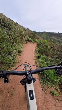
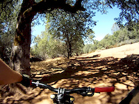
Photos of Montara Mountain Bike
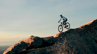
Videos of Montara Mountain Bike
trail: Tanga
0:49 |
30 |
Mar 7, 2025
trail: Tanga
0:24 |
135 |
Dec 27, 2021
trail: Tunnel
2:36 |
21608 |
Jan 19, 2015
trail: Tunnel
6:25 |
282 |
Aug 7, 2012
trail: Two Pines
20:21 |
35 |
Jan 24, 2026 , Montara
trail: Old Colma Road
7:29 |
130 |
Jul 12, 2025 , Montara
trail: Old Colma Road
8:37 |
76 |
Jul 12, 2025 , Montara
youtuber
![Fly Amanita / Pacifica, CA / MTB]()
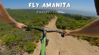
trail: Fly Amanita
4:11 |
123 |
Jun 27, 2024 , Montara
Recent Trail Reports
Activity Feed
| username | action | type | title | date |
|---|---|---|---|---|
| ruskyskier27 | add | report | activity #97211582 | Jun 17, 2026 @ 3:07pm 7 hours |
| JordanZIy1FQ | wishlist | trail | activity #96872734 | Jun 13, 2026 @ 7:07am Jun 13, 2026 |
| Curt8aVWHI | wishlist | trail | activity #96516282 and 2 more | Jun 7, 2026 @ 7:23pm Jun 7, 2026 |
| rolll703 | wishlist | trail | activity #96399422 and 2 more | Jun 6, 2026 @ 12:53pm Jun 6, 2026 |
| Jonathanli | ridden | trail | activity #96266514 | Jun 4, 2026 @ 6:02pm Jun 4, 2026 |
Recent Comments
| username | type | title | comment | date |
|---|---|---|---|---|
| trail | Epic jank in the top section. Double black for... | May 26, 2026 @ 9:39pm May 26, 2026 | ||
| trail | Fun trail with tight flow up top, bottom gets... | May 4, 2026 @ 9:06pm May 4, 2026 | ||
| trail | Conditions are perfect. Dry. Got thrown off my... | Mar 26, 2026 @ 9:17pm Mar 26, 2026 | ||
| trail | It’s a pretty good challenge climbing this... | Feb 17, 2026 @ 8:37pm Feb 17, 2026 | ||
| trail | Big tree down over the trail, about halfway... | Jan 10, 2026 @ 4:53pm Jan 10, 2026 |
Local Badges
-

Epic Mountain Bike Climb 2k34 awarded -

Climbing 10k Badge56 awarded -

Mountain Biking 100k Badge0 awarded -

Epic Ride Descent 2k34 awarded -

Descent 10k Badge55 awarded -

Descent 100k Badge0 awarded
Activity Type Stats
| activitytype | trails | distance | descent | descent distance | total vertical | rating | global rank | state rank | photos | reports | routes | ridelogs |
|---|---|---|---|---|---|---|---|---|---|---|---|---|
| Mountain Bike | 26 | 14 miles | 3,130 ft | 6 miles | 1,831 ft | #2,182 | #782 | 75 | 1,060 | 3 | 3,744 | |
| E-Bike | 9 | 6 miles | 1,004 ft | 2 miles | 1,808 ft | #5,394 | #1,676 | 5 | 967 | 675 | ||
| Horse | 10 | 10 miles | 2,638 ft | 5 miles | 1,207 ft | #2,278 | #1,258 | 19 | ||||
| Hike | 31 | 23 miles | 6,060 ft | 11 miles | 1,831 ft | #1,579 | #705 | 1,050 | 1 | 704 | ||
| Trail Running | 31 | 23 miles | 6,060 ft | 11 miles | 1,831 ft | #5,659 | #1,800 | 1,050 | 1 | 664 |
Frequently Asked Questions About Montara
▼
What are the best places to ride in Montara?
Montara has 1 areas to explore for mountain biking.
▼
What are the highest rated mountain biking trails in Montara?
The highest rated mountain biking trails in Montara are:
- Scott's (4.3/5)
- Two Pines (4.2/5)
- San Pedro Mountain Crest (4.2/5)
- Old Colma Road (4.2/5)
- Fly Amanita (4.1/5)
▼
What is the best time of the year to ride in Montara?
Based on ride log data, the most popular months to ride in Montara are:
- August (14 activities)
- June (12 activities)
- March (11 activities)
▼
Where can I park to ride in Montara?
There are 3 parking locations listed in Montara. The most popular parking spots are: View all parking and trailhead locations on the map to plan your visit.
Activities
Trails
- By brenthillier
 NSMBA TRAILFORKS & contributors
 - Admins: COB
- #7904 - 16,770 views
- montara activity log | embed map of Montara mountain bike trails | montara mountain biking points of interest
Downloading of trail gps tracks in kml & gpx formats is enabled for Montara.
You must login to download files.