close
-
Layers w
- Weather Layers
- Pro
- Pro
- Pro
- Pro
- Pro
- Pro
- More Layers
- Pro
- Pro
- Pro
- Pro
-
Upgrade to

3D
Trail Conditions
- Unknown
- Snow Groomed
- Snow Packed
- Snow Covered
- Snow Cover Partial
- Freeze/thaw Cycle
- Icy
- Prevalent Mud
- Wet
- Variable
- Ideal
- Dry
- Very Dry
Trail Flow (Ridden Direction)
Trailforks scans users ridelogs to determine the most popular direction each trail is ridden. A good flowing trail network will have most trails flowing in a single direction according to their intension.
The colour categories are based on what percentage of riders are riding a trail in its intended direction.
The colour categories are based on what percentage of riders are riding a trail in its intended direction.
- > 96%
- > 90%
- > 80%
- > 70%
- > 50%
- < 50%
- bi-directional trail
- no data
Trail Last Ridden
Trailforks scans ridelogs to determine the last time a trail was ridden.
- < 2 days
- < 1 week
- < 2 weeks
- < 1 month
- < 6 months
- > 6 months
Trail Ridden Direction
The intended direction a trail should be ridden.
- Downhill Only
- Downhill Primary
- Both Directions
- Uphill Primary
- Uphill Only
- One Direction
Contribute Details
Colors indicate trail is missing specified detail.
- Description
- Photos
- Description & Photos
- Videos
Trail Popularity ?
Trailforks scans ridelogs to determine which trails are ridden the most in the last 9 months.
Trails are compared with nearby trails in the same city region with a possible 25 colour shades.
Think of this as a heatmap, more rides = more kinetic energy = warmer colors.
- most popular
- popular
- less popular
- not popular
ATV/ORV/OHV Filter
Max Vehicle Width
inches
US Cell Coverage
Legend

Radar Time
Activity Recordings
Trailforks uses anonymized public activity data.
?
Activity Recordings
Trailforks uses anonymized public activity data.
?
Personal Heatmap
▶
Activity Types
all
/
none
▶
Options
2
Date range
month
–
Winter Trails
Warning
A routing network for winter maps does not exist. Selecting trails using the winter trails layer has been disabled.
Missing Trails
Most Popular
Least Popular
Trails are colored based on popularity. The more popular a trail is, the more red. Less popular trails trend towards green.
Jump Magnitude Heatmap
Heatmap of where riders jump on trails. Zoom in to see individual jumps, click circles to view jump details.
BC Backroad Status
![map legend]()
Service Road Atlas is a free to use, community-driven service for viewing and creating reports on the numerous back-country service roads around B.C. and Alberta.

Slope Aspect
Direction the slope faces
Trails Deemphasized
Trails are shown in grey.
Only show trails with no bike usage.
Suggested Layers
Based on selected activity type
Save the current map location and zoom level as your default home location whenever this page is loaded.
Save
No description for Monte Amiata has been added yet!
Login or register to submit one.
Activities Click to view
- Mountain Bike
75 trails
- E-Bike
66 trails
- Adaptive Bike
0 trails
- Horse
40 trails
- Hike
58 trails
- Trail Running
58 trails
- Dirtbike/Moto
10 trails
- ATV/ORV/OHV
9 trails
Region Details
- 23
- 1
- 15
- 27
- 7
- 2
Region Status
Open as of Jun 6, 2026Stats
- Avg Trail Rating
- Trails (view details)
- 77
- Trails Mountain Bike
- 75
- Trails E-Bike
- 66
- Trails Horse
- 40
- Trails Hike
- 58
- Trails Trail Running
- 58
- Trails Dirtbike/Moto
- 10
- Trails ATV/ORV/OHV
- 9
- Trails Downhill Ski
- 2
- Trails Nordic Ski
- 2
- Total Distance
- 40 miles
- Total Descent Distance
- 25 miles
- Total Descent
- 15,164 ft
- Total Vertical
- 3,570 ft
- Highest Trailhead
- 5,608 ft
- Reports
- 797
- Photos
- 121
- Ridden Counter
- 5,567
Sub Regions
-
Amiata Freeride Bike Resort
- 1
- 5
- 7
- 4
- 1
-
Santa Fiora
- 3
- 7
- 4
- 1
Popular Monte Amiata Mountain Biking Trails
• 55 ★ 4.7 • 1 mile • 0 ft • 417 •
✦ Trovate il vostro flow ✦ Trail molto fluido e veloce ricco di appoggi, paraboliche e piccoli salti. Per questa sua caratteristica è adatto sia per i principianti, sia per gli esperti che vogliono osare con salti realizzati a...
• 100 ★ 4.5 • 1,148 ft • 0 ft • 399 •
✦ Conoscere le proprie possibilità ✦ Un’area dedicata all’apprendimento ed al miglioramento della tecnica del salto. Caratterizzata da panettoni di tutti i livelli per biker alle prime armi e concedendo ai biker più esperti,...
• 75 ★ 4.4 • 738 ft • 0 ft • 363 •
Area dedicata all'apprendimento con 4 linee suddivise per difficoltà con ostacoli di vario genere per poter far approcciare neofiti e bambini al mondo della MTB. ------------ Area dedicated to learning with 4 lines divided by...
• 85 ★ 4.9 • 4,396 ft • 17 ft • 362 •
✦ Lasciatevi andare ✦ Un trail dedicato al nostro amico e rider Giacomo Forti. Ricco di curve, strutture in legno, drop, step up e passaggi tecnici: una vera pista completa. Adatta ad un biker di medio livello che si vuole mettere...
• 65 ★ 4.9 • 1,772 ft • 0 ft • 354 •
Serie di Curve e salti con doppia alternativa percorribile ad ogni velocità con ogni struttura copiabile. ---------- Series of berms and jumps with double alternative practicable at any speed.
• 45 ★ 4.0 • 456 ft • 0 ft • 299 •
✦ Conoscere le proprie possibilità ✦ Un’area dedicata all’apprendimento ed al miglioramento della tecnica del salto. Caratterizzata da panettoni di tutti i livelli per biker alle prime armi. -------------- ✦ Know your...
• 30 ★ 4.2 • 1,545 ft • 0 ft • 262 •
✦ Provare per credere ✦ Il trail è veloce e tecnico con un rock garden ideato per mettere a dura prova le vostre sospensioni. Passaggi stretti fra alberi, sassi e curve paraboliche adatti ad un biker esperto. Il giusto mix scassato...
• 40 ★ 4.6 • 2,421 ft • 0 ft • 261 •
✦ Mettersi in Gioco ✦ Trail per i rider più esperti che cercano qualcosa in più. Passaggi tecnici, drop naturali dalla roccia, salti doppi per tutti i gusti e una sharkfin. Veloce e tecnico, metti alla prova le tue abilità! PER...
Monte Amiata Mountain Bike Routes
17 miles • 2,890 ft • 3 • Loop •
Un anello che, partendo dal Prato delle Macinaie, permette di percorrere la Sposina e di tornare poi alla...
★ 5.0 • 6 miles • 790 ft • 0 • Loop •
......................................................
★ 1.0 • 17 miles • 3,919 ft • 4 • Loop •
Giro Enduro/All-Mountain che include le seguenti discese: Prima discesa - completa Seconda discesa -...
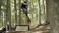
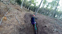
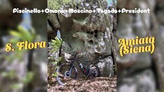
Photos of Monte Amiata Mountain Bike
Videos of Monte Amiata Mountain Bike
featured
![Amiata Freeride Bike Resort]()
trail: 8volante High
2:12 |
248 |
Feb 18, 2019
trail: Fluida
3:31 |
206 |
May 25, 2018

trail: Flipper
19:28 |
38 |
May 5, 2026 , Monte Amiata

trail: President
19:28 |
50 |
May 5, 2026 , Monte Amiata

trail: Ta Ga Da
19:28 |
48 |
May 5, 2026 , Monte Amiata

trail: Moscino
19:28 |
39 |
May 5, 2026 , Monte Amiata
trail: Omone
19:28 |
45 |
May 5, 2026 , Monte Amiata
Current Trail Warnings
| status | trail | date | condition | user | info |
|---|---|---|---|---|---|
| Sposina | Jun 2, 2026 @ 5:31pm (Europe/Rome) Jun 2, 2026 | Unknown | notyoungnotalent | Do not ride! Completely abandoned, does... |
Recent Trail Reports
| status | trail | date | condition | info | user |
|---|---|---|---|---|---|
| Bollicine | Jun 6, 2026 @ 9:34am (Europe/Rome) Jun 6, 2026 | Ideal | Talebano | ||
| La Scopaia | Jun 6, 2026 @ 9:34am (Europe/Rome) Jun 6, 2026 | Ideal | Talebano | ||
| Capomacchia | Jun 6, 2026 @ 9:34am (Europe/Rome) Jun 6, 2026 | Ideal | Talebano | ||
| Jael Line | Jun 6, 2026 @ 9:34am (Europe/Rome) Jun 6, 2026 | Ideal | Talebano | ||
| Black Garden | Jun 6, 2026 @ 9:34am (Europe/Rome) Jun 6, 2026 | Ideal | Talebano | ||
| Dirty Sanchez | Jun 6, 2026 @ 9:34am (Europe/Rome) Jun 6, 2026 | Ideal | Talebano | ||
| Red Jack | Jun 6, 2026 @ 9:34am (Europe/Rome) Jun 6, 2026 | Ideal | Talebano | ||
| Froggy | Jun 6, 2026 @ 9:34am (Europe/Rome) Jun 6, 2026 | Ideal | Talebano | ||
| Redjack Easy start | Jun 6, 2026 @ 9:34am (Europe/Rome) Jun 6, 2026 | Ideal | Talebano | ||
| Hip Hop | Jun 6, 2026 @ 9:34am (Europe/Rome) Jun 6, 2026 | Ideal | Talebano |
Activity Feed
| username | action | type | title | date |
|---|---|---|---|---|
| DeMoN3 | wishlist | trail | activity #97183267 and 5 more | Jun 17, 2026 @ 7:47am 2 days |
| sugus | ridden | trail | activity #96554272 | Jun 8, 2026 @ 11:41am Jun 8, 2026 |
| Talebano | add | report | activity #96537056 and 3 more | Jun 8, 2026 @ 7:06am Jun 8, 2026 |
| Talebano | add | report | activity #96537052 and 9 more | Jun 8, 2026 @ 7:06am Jun 8, 2026 |
| Talebano | add | report | activity #96521742 and 1 more | Jun 7, 2026 @ 10:39pm Jun 7, 2026 |
Recent Comments
| username | type | title | comment | date |
|---|---|---|---|---|
| trail | Take Bollicine to access. Rode Sposina from... | May 25, 2026 @ 1:47am May 25, 2026 | ||
| trail | REALLY GOOD! Techy bits, clever lines,... | Oct 9, 2025 @ 9:28am Oct 9, 2025 | ||
| trail | Rode it today, nice black trail, flowy with... | Oct 9, 2025 @ 9:25am Oct 9, 2025 | ||
| trail | Fighissima , ti alleni bene e trovi il ritmo... | Sep 24, 2023 @ 12:00pm Sep 24, 2023 | ||
| trail | Caruccio! Divertente e ottimo per allenarsi,... | Sep 24, 2023 @ 11:57am Sep 24, 2023 |
Local Badges
-

Monte Amiata 2k descend782 awarded -

Epic Ride Climb 2k392 awarded -

Climbing 10k Badge41 awarded -

Climbing 100k Badge4 awarded -

Epic Ride Descent 2k588 awarded -

Descent 10k Badge54 awarded
Bike & Skill Parks
| name | type | city | rating |
|---|---|---|---|
| Amiata Freeride Bike Resort | bike park | Monte Amiata | |
| Skillpark Santa Fiora | skill park | Monte Amiata | |
| Pumptrack Castel del Piano | skill park | Monte Amiata |
Activity Type Stats
| activitytype | trails | distance | descent | descent distance | total vertical | rating | global rank | state rank | photos | reports | routes | ridelogs |
|---|---|---|---|---|---|---|---|---|---|---|---|---|
| Mountain Bike | 75 | 39 miles | 13,875 ft | 24 miles | 3,488 ft | #1,570 | #52 | 122 | 794 | 4 | 4,402 | |
| E-Bike | 66 | 32 miles | 8,228 ft | 17 miles | 2,795 ft | #611 | #72 | 583 | 3 | 867 | ||
| Horse | 40 | 29 miles | 6,680 ft | 15 miles | 2,290 ft | #763 | #19 | 151 | ||||
| Hike | 58 | 31 miles | 8,077 ft | 17 miles | 2,795 ft | #3,922 | #144 | 518 | 1 | 160 | ||
| Trail Running | 58 | 31 miles | 8,077 ft | 17 miles | 2,795 ft | #3,384 | #124 | 512 | 1 | 27 | ||
| Dirtbike/Moto | 10 | 10 miles | 308 ft | 2 miles | 1,191 ft | #545 | #11 | 93 | ||||
| ATV/ORV/OHV | 9 | 10 miles | 308 ft | 2 miles | 1,191 ft | #324 | #6 | 93 | ||||
| Downhill Ski | 2 | 1 mile | 1,289 ft | 1 mile | 784 ft | 2 | 7 | |||||
| Nordic Ski | 2 | 1 mile | 1,289 ft | 1 mile | 784 ft | 2 |
Frequently Asked Questions About Monte Amiata
▼
What are the best places to ride in Monte Amiata?
Monte Amiata has 3 areas to explore for mountain biking. The top rated areas are:
▼
What are the highest rated mountain biking trails in Monte Amiata?
The highest rated mountain biking trails in Monte Amiata are:
- Froggy (4.6/5)
- Red Jack (4.6/5)
- 8volante High (4.5/5)
- Il Confine (4.4/5)
- Angry Pirate (4.3/5)
▼
What is the best time of the year to ride in Monte Amiata?
Based on ride log data, the most popular months to ride in Monte Amiata are:
- September (29 activities)
- August (20 activities)
- June (11 activities)
▼
Where can I park to ride in Monte Amiata?
There are 6 parking locations listed in Monte Amiata. The most popular parking spots are: View all parking and trailhead locations on the map to plan your visit.
Activities
Trails
- By brenthillier
 NSMBA TRAILFORKS & contributors
 - Admins: DanielePracchia, Stinketto
- #21836 - 8,098 views
- monte amiata activity log | embed map of Monte Amiata mountain bike trails | monte amiata mountain biking points of interest
Downloading of trail gps tracks in kml & gpx formats is enabled for Monte Amiata.
You must login to download files.