close
-
Layers w
- Weather Layers
- Pro
- Pro
- Pro
- Pro
- Pro
- Pro
- More Layers
- Pro
- Pro
- Pro
- Pro
-
Upgrade to

3D
Trail Conditions
- Unknown
- Snow Groomed
- Snow Packed
- Snow Covered
- Snow Cover Partial
- Freeze/thaw Cycle
- Icy
- Prevalent Mud
- Wet
- Variable
- Ideal
- Dry
- Very Dry
Trail Flow (Ridden Direction)
Trailforks scans users ridelogs to determine the most popular direction each trail is ridden. A good flowing trail network will have most trails flowing in a single direction according to their intension.
The colour categories are based on what percentage of riders are riding a trail in its intended direction.
The colour categories are based on what percentage of riders are riding a trail in its intended direction.
- > 96%
- > 90%
- > 80%
- > 70%
- > 50%
- < 50%
- bi-directional trail
- no data
Trail Last Ridden
Trailforks scans ridelogs to determine the last time a trail was ridden.
- < 2 days
- < 1 week
- < 2 weeks
- < 1 month
- < 6 months
- > 6 months
Trail Ridden Direction
The intended direction a trail should be ridden.
- Downhill Only
- Downhill Primary
- Both Directions
- Uphill Primary
- Uphill Only
- One Direction
Contribute Details
Colors indicate trail is missing specified detail.
- Description
- Photos
- Description & Photos
- Videos
Trail Popularity ?
Trailforks scans ridelogs to determine which trails are ridden the most in the last 9 months.
Trails are compared with nearby trails in the same city region with a possible 25 colour shades.
Think of this as a heatmap, more rides = more kinetic energy = warmer colors.
- most popular
- popular
- less popular
- not popular
ATV/ORV/OHV Filter
Max Vehicle Width
inches
US Cell Coverage
Legend

Radar Time
Activity Recordings
Trailforks uses anonymized public activity data.
?
Activity Recordings
Trailforks uses anonymized public activity data.
?
Personal Heatmap
▶
Activity Types
all
/
none
▶
Options
2
Date range
month
–
Winter Trails
Warning
A routing network for winter maps does not exist. Selecting trails using the winter trails layer has been disabled.
Missing Trails
Most Popular
Least Popular
Trails are colored based on popularity. The more popular a trail is, the more red. Less popular trails trend towards green.
Jump Magnitude Heatmap
Heatmap of where riders jump on trails. Zoom in to see individual jumps, click circles to view jump details.
BC Backroad Status
![map legend]()
Service Road Atlas is a free to use, community-driven service for viewing and creating reports on the numerous back-country service roads around B.C. and Alberta.

Slope Aspect
Direction the slope faces
Trails Deemphasized
Trails are shown in grey.
Only show trails with no bike usage.
Suggested Layers
Based on selected activity type
Save the current map location and zoom level as your default home location whenever this page is loaded.
SaveAll mountain e freeride area con possibilità di risalite con seggiovia autorizzata al trasporto bici per l’accesso a numerosi trail naturali.
I sentieri sono condivisi con gli escursionisti quindi prestare sempre la massima attenzione
I sentieri sono condivisi con gli escursionisti quindi prestare sempre la massima attenzione
Primary Trail Type: All-Mountain & Downhill
eBikes Allowed:
Yes
Shuttleable: YES
Land Status: Managed by Local Riding Association
Land Manager: Ride The Giant ASD
 google parking directions
This region uses the Uk/Euro style trail grading system.
Activities Click to view
- Mountain Bike
34 trails
- E-Bike
36 trails
- Horse
6 trails
- Hike
31 trails
- Trail Running
31 trails
- Observed Trials
5 trails
- Downhill Ski
5 trails
- Backcountry Ski
6 trails
Region Details
- 3
- 4
- 11
- 8
- 5
Region Status
Open as of Jun 3, 2026Stats
- Avg Trail Rating
- Trails (view details)
- 32
- Trails Mountain Bike
- 37
- Trails E-Bike
- 36
- Trails Horse
- 6
- Trails Hike
- 31
- Trails Trail Running
- 31
- Trails Dirtbike/Moto
- 1
- Trails Observed Trials
- 5
- Trails Snowshoe
- 1
- Trails Downhill Ski
- 5
- Trails Backcountry Ski
- 6
- Trails Nordic Ski
- 1
- Total Distance
- 50 miles
- Total Descent
- 25,089 ft
- Total Vertical
- 4,564 ft
- Highest Trailhead
- 6,769 ft
- Reports
- 192
- Photos
- 83
- Ridden Counter
- 1,856
Popular Monte Cusna Mountain Biking Trails
• 70 ★ 5.0 • 3 miles • 65 ft • 60 •
Sentiero di crinale molto panoramico. Qualche sezione tecnica ed alcune brevi risalite. Ultimo tratto nel bosco flow bellissimo! Panoramic trail on the Ridge from . Some tecnical sections e schort uphill. the finish into the wood is...
• 65 ★ 3.7 • 2 miles • 0 ft • 38 •
Qualche saliscendi iniziale, a seguire bel flow veloce, poi alcuni tratti dove il sentiero è più scassato. Saliscendi sul finire Up and Down in the beginning, then beatiful flow and in the end some loose rocks. Up and down in the end
• 35 ★ 5.0 • 1 mile • 74 ft • 33 •
Stretto sentiero tagliato in una magnifica prateria dal carattere alpino. Spettacolare! Spectacular thin single track in a beautiful alpine prairie.
• 60 ★ 5.0 • 2 miles • 30 ft • 33 •
Bellissimo sentiero flow in un bosco di faggi e abeti. beautiful flow trail in the wood.
• 45 ★ 5.0 • 1 mile • 49 ft • 32 •
Bel sentiero di crinale. Alcuni tratti presentano pietre smosse. Qualche passaggio tecnico e molto spettacolare. Trail on a beatiful ridge. Some sections with loose rocks and some tecnical passage. Spectacular!
• 70 ★ 5.0 • 3 miles • 123 ft • 32 •
Sentiero storico, utilizzato nella seconda guerra mondiale dalla resistenza, durante l'operazione Tombola. Principalmente flow con qualche sezione tecnica. Flow trail with some tecnical sections
• 25 ★ 4.5 • 4,587 ft • 5 ft • 31 •
Bel sentiero molto panoramico. Prima parte piuttosto ripida su fondo erboso. Poi qualche tratto ostico con pietre. Ultima parte flow nel bosco.
• 50 ★ 5.0 • 1 mile • 281 ft • 28 •
Prima parte con qualche saliscendi. Attenzione a un tratto molto esposto dove è fortemente consigliabile spingere la bici! Dalla fine del traverso sotto la cima del , bici a spinta. Up and down in the beginning. Very attention at one...
Monte Cusna Mountain Bike Routes
22 miles • 3,466 ft • 5 • Loop •
Tour di media difficoltà con partenza dall'arrivo della seggiovia Febbio 2000. Sentieri prevalentemente...
13 miles • 1,931 ft • 0 • Loop •
Anello all-mountain con partenza dal rifugio del crinale salendo in seggiovia da Rescadore (Febbio). Dal...
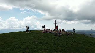
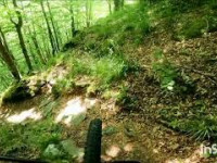
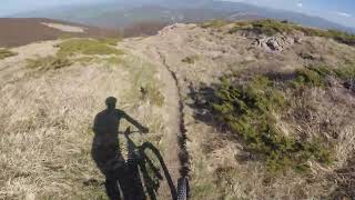
Videos of Monte Cusna Mountain Bike
trail: Alta Tensione
0:27 |
81 |
Jul 10, 2023
trail: Il Passone
0:42 |
69 |
May 8, 2023
trail: Lamaccio
5:02 |
61 |
Jul 7, 2021

trail: Febbio 2000 - Passone
0:26 |
56 |
Jun 28, 2021
trail: Febbio 2000 - Passone
0:26 |
20 |
Jun 28, 2021
trail: Alta Tensione
4:29 |
119 |
Jun 3, 2026 , Febbio
trail: Monte Ravino
54 |
Jun 11, 2025 , Febbio
trail: Wild&Prampa
10:02 |
102 |
Apr 15, 2024 , Febbio
Current Trail Warnings
| status | trail | date | condition | user | info |
|---|---|---|---|---|---|
| Abetina Reale | Jun 2, 2026 @ 3:27pm (Europe/Rome) Jun 2, 2026 | Unknown | Gambero75 | E-Bike purtroppo le piogge invernali hanno reso... |
Recent Trail Reports
| status | trail | date | condition | info | user |
|---|---|---|---|---|---|
| Alta Tensione | Jun 3, 2026 @ 11:24pm (Europe/Rome) Jun 3, 2026 | Ideal | ArteBici | ||
| Contessa | Jun 3, 2026 @ 11:21pm (Europe/Rome) Jun 3, 2026 | Snow Covered | ArteBici | ||
| Governara | May 1, 2026 @ 7:28am (Pacific/Midway) May 1, 2026 | Variable | serginov | ||
| Mararam | May 1, 2026 @ 7:28am (Pacific/Midway) May 1, 2026 | Variable | serginov | ||
| Le Prese | May 1, 2026 @ 7:28am (Pacific/Midway) May 1, 2026 | Variable | serginov | ||
| Lupo Bianco | Apr 26, 2026 @ 9:48pm (Europe/Rome) Apr 26, 2026 | Unknown | Fr3nk0 | ||
| Peschiera Zamboni - Rescadore | Oct 12, 2025 @ 11:02am (Europe/San_Marino) Oct 12, 2025 | Ideal | andreac4 | ||
| Monteorsaro - Passo Cisa | Oct 12, 2025 @ 11:02am (Europe/San_Marino) Oct 12, 2025 | Dry | andreac4 | ||
| La Maremmana | Oct 4, 2025 @ 10:07am (Europe/San_Marino) Oct 4, 2025 | Variable | boicmtb | ||
| Febbio 2000 - Monte Cusna | Aug 15, 2025 @ 9:56am Aug 15, 2025 | Dry | Giugio |
Activity Feed
| username | action | type | title | date |
|---|---|---|---|---|
| marcoscurano | wishlist | trail | activity #96724721 and 2 more | Jun 11, 2026 @ 2:18am Jun 11, 2026 |
| chadyOtlmY | wishlist | region | activity #96246623 | Jun 4, 2026 @ 12:47pm Jun 4, 2026 |
| ArteBici | add | video | activity #96180581 | Jun 3, 2026 @ 2:23pm Jun 3, 2026 |
| ArteBici | add | report | activity #96180492 and 1 more | Jun 3, 2026 @ 2:22pm Jun 3, 2026 |
| ArteBici | comment | trail | activity #96180337 and 1 more | Jun 3, 2026 @ 2:18pm Jun 3, 2026 |
Recent Comments
| username | type | title | comment | date |
|---|---|---|---|---|
| trail | Sentiero "multilinea" sul crinale della... | Jun 3, 2026 @ 2:21pm Jun 3, 2026 | ||
| trail | Parte iniziale su banale carrareccia senza... | Jun 3, 2026 @ 2:18pm Jun 3, 2026 | ||
| report | Rimovibili con motosega piccola? | Oct 15, 2025 @ 7:53am Oct 15, 2025 | ||
| report | Spettacolare trail di cresta. Panorama da urlo... | Jul 28, 2025 @ 1:03pm Jul 28, 2025 | ||
| trail | Dopo i lavori di manutenzione del trail fatte... | Jul 22, 2025 @ 3:31am Jul 22, 2025 |
Nearby Areas
| name | distance | ||||
|---|---|---|---|---|---|
| Alpe di Cusna Bike Park | 2 | 3 | 0.7 km | ||
| Torricella Trail Area | 1 | 7 | 4 | 1.5 km | |
| CuPra Bike Area Ligonchio/Cusna | 7 | 20 | 10 | 1 | 5 km |
| Frassinoro Trail Area | 1 | 5 | 2 | 5.9 km | |
| Garfagnana | 25 | 36 | 4 | 1 | 8.4 km |
Local Badges
-

Completionist0 awarded
Activity Type Stats
| activitytype | trails | distance | descent | descent distance | total vertical | rating | global rank | state rank | photos | reports | routes | ridelogs |
|---|---|---|---|---|---|---|---|---|---|---|---|---|
| Mountain Bike | 34 | 50 miles | 25,089 ft | 32 miles | 4,564 ft | #2,082 | #71 | 87 | 203 | 2 | 572 | |
| E-Bike | 36 | 49 miles | 25,089 ft | 32 miles | 4,564 ft | #2,076 | #147 | 199 | 2 | 170 | ||
| Horse | 6 | #706 | #26 | 6 | ||||||||
| Hike | 31 | 39 miles | 19,058 ft | 24 miles | 3,458 ft | #3,949 | #101 | 201 | 181 | |||
| Trail Running | 31 | 39 miles | 19,058 ft | 24 miles | 3,458 ft | #3,154 | #88 | 201 | 21 | |||
| Dirtbike/Moto | 1 | 3 | ||||||||||
| Observed Trials | 5 | #134 | #6 | 5 | ||||||||
| Snowshoe | 1 | 1 | ||||||||||
| Downhill Ski | 5 | #420 | #25 | 3 | 1 | |||||||
| Backcountry Ski | 6 | #185 | #18 | 3 | 41 | |||||||
| Nordic Ski | 1 |
Frequently Asked Questions About Monte Cusna
▼
What are the highest rated mountain biking trails in Monte Cusna?
The highest rated mountain biking trails in Monte Cusna are:
- Monte Prado (4.2/5)
- Abetina Reale (4.2/5)
- Febbio 2000 - Passone (4.2/5)
- Mararam (4.1/5)
- Foglio Rosa (4.1/5)
▼
What is the best time of the year to ride in Monte Cusna?
Based on ride log data, the most popular months to ride in Monte Cusna are:
- July (7 activities)
- October (4 activities)
- August (4 activities)
▼
Where can I park to ride in Monte Cusna?
There are 1 parking locations listed in Monte Cusna. The most popular parking spots are:
▼
What is the longest trail in Monte Cusna?
The longest trail in Monte Cusna is Cannone at 4.3 miles. View all trails sorted by distance.
Activities
Trails
- By linomak
 GMTBL & contributors
 - Admins: GMTBL
- #18034 - 10,925 views
- monte cusna activity log | embed map of Monte Cusna mountain bike trails | monte cusna mountain biking points of interest
Downloading of trail gps tracks in kml & gpx formats is enabled for Monte Cusna.
You must login to download files.