close
-
Layers w
- Weather Layers
- Pro
- Pro
- Pro
- Pro
- Pro
- Pro
- More Layers
- Pro
- Pro
- Pro
- Pro
-
Upgrade to

3D
Trail Conditions
- Unknown
- Snow Groomed
- Snow Packed
- Snow Covered
- Snow Cover Partial
- Freeze/thaw Cycle
- Icy
- Prevalent Mud
- Wet
- Variable
- Ideal
- Dry
- Very Dry
Trail Flow (Ridden Direction)
Trailforks scans users ridelogs to determine the most popular direction each trail is ridden. A good flowing trail network will have most trails flowing in a single direction according to their intension.
The colour categories are based on what percentage of riders are riding a trail in its intended direction.
The colour categories are based on what percentage of riders are riding a trail in its intended direction.
- > 96%
- > 90%
- > 80%
- > 70%
- > 50%
- < 50%
- bi-directional trail
- no data
Trail Last Ridden
Trailforks scans ridelogs to determine the last time a trail was ridden.
- < 2 days
- < 1 week
- < 2 weeks
- < 1 month
- < 6 months
- > 6 months
Trail Ridden Direction
The intended direction a trail should be ridden.
- Downhill Only
- Downhill Primary
- Both Directions
- Uphill Primary
- Uphill Only
- One Direction
Contribute Details
Colors indicate trail is missing specified detail.
- Description
- Photos
- Description & Photos
- Videos
Trail Popularity ?
Trailforks scans ridelogs to determine which trails are ridden the most in the last 9 months.
Trails are compared with nearby trails in the same city region with a possible 25 colour shades.
Think of this as a heatmap, more rides = more kinetic energy = warmer colors.
- most popular
- popular
- less popular
- not popular
ATV/ORV/OHV Filter
Max Vehicle Width
inches
US Cell Coverage
Legend

Radar Time
Activity Recordings
Trailforks uses anonymized public activity data.
?
Activity Recordings
Trailforks uses anonymized public activity data.
?
Personal Heatmap
▶
Activity Types
all
/
none
▶
Options
2
Date range
month
–
Winter Trails
Warning
A routing network for winter maps does not exist. Selecting trails using the winter trails layer has been disabled.
Missing Trails
Most Popular
Least Popular
Trails are colored based on popularity. The more popular a trail is, the more red. Less popular trails trend towards green.
Jump Magnitude Heatmap
Heatmap of where riders jump on trails. Zoom in to see individual jumps, click circles to view jump details.
BC Backroad Status
![map legend]()
Service Road Atlas is a free to use, community-driven service for viewing and creating reports on the numerous back-country service roads around B.C. and Alberta.

Slope Aspect
Direction the slope faces
Trails Deemphasized
Trails are shown in grey.
Only show trails with no bike usage.
Suggested Layers
Based on selected activity type
Save the current map location and zoom level as your default home location whenever this page is loaded.
Save
No description for Monte Malbe has been added yet!
Login or register to submit one.
This region uses the Uk/Euro style trail grading system.
Activities Click to view
- Mountain Bike
94 trails
- E-Bike
90 trails
- Adaptive Bike
0 trails
- Hike
79 trails
- Trail Running
78 trails
Region Details
- 19
- 48
- 19
Region Status
Caution as of Jun 13, 2026Stats
- Avg Trail Rating
- Trails (view details)
- 93
- Trails Mountain Bike
- 95
- Trails E-Bike
- 90
- Trails Horse
- 1
- Trails Hike
- 79
- Trails Trail Running
- 78
- Total Distance
- 63 miles
- Total Descent
- 19,280 ft
- Total Vertical
- 1,306 ft
- Highest Trailhead
- 2,127 ft
- Reports
- 501
- Photos
- 23
- Ridden Counter
- 4,267
Popular Monte Malbe Mountain Biking Trails
• 100 ★ 3.0 • 3,822 ft • 147 ft • 93 •
Popular green difficulty singletrack. This mountain bike primary trail can be used both directions and has a easy overall physical rating with a 147 ft green climb. Trail visibility is always easy to follow. On average it takes 8 minutes to complete this trail.
• 90 ★ 3.5 • 4,357 ft • 25 ft • 67 •
Popular green difficulty singletrack. This mountain bike primary trail can be used both directions. On average it takes 4 minutes to complete this trail.
• 85 ★ 3.0 • 3,427 ft • 50 ft • 65 •
Popular green difficulty singletrack. This mountain bike primary trail can be used both directions. On average it takes 4 minutes to complete this trail.
• 95 ★ 4.0 • 1 mile • 385 ft • 62 •
Popular green difficulty singletrack. This mountain bike primary trail can be used uphill primary. On average it takes 15 minutes to complete this trail.
• 95 ★ 5.0 • 863 ft • 67 ft • 59 •
Popular green difficulty singletrack. This mountain bike primary trail can be used both directions and has a easy overall physical rating with a 67 ft green climb. Trail visibility is always easy to follow. On average it takes 1 minutes to complete this trail.
• 90 ★ 5.0 • 2,051 ft • 170 ft • 56 •
Popular green difficulty singletrack. This mountain bike primary trail can be used uphill primary and has a easy overall physical rating with a 170 ft green climb. Trail visibility is always easy to follow. On average it takes 5 minutes to complete this trail.
Monte Malbe Mountain Bike Routes
7 miles • 1,176 ft • 3 •
Giro in bici intermedio. Buon allenamento richiesto. Adatto a ogni livello di abilità.
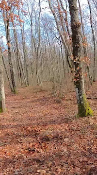
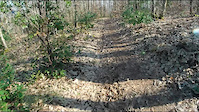
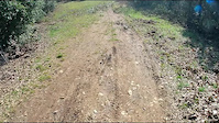
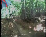
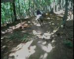
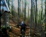
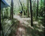
Photos of Monte Malbe Mountain Bike
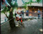
Videos of Monte Malbe Mountain Bike
trail: Orco Trail
4:56 |
38 |
Feb 21, 2026
trail: Madball
6:53 |
|
Feb 22, 2021
trail: Pennywise
5:07 |
|
Feb 22, 2021
trail: Helmet
0:42 |
376 |
Oct 20, 2008
trail: Helmet
7:06 |
137 |
Oct 20, 2008
trail: Helmet
6:20 |
87 |
Oct 20, 2008
trail: Helmet
3:09 |
136 |
Oct 19, 2008
trail: Helmet
3:27 |
120 |
Oct 19, 2008
Recent Trail Reports
| status | trail | date | condition | info | user |
|---|---|---|---|---|---|
| Tasselli Trail 1 | Jun 14, 2026 @ 8:23am (Europe/Rome) Jun 13, 2026 | Dry | Alepg88 | ||
| Pastore link | Jun 14, 2026 @ 8:23am (Europe/Rome) Jun 13, 2026 | Ideal | Alepg88 | ||
| Against Me! | Jun 14, 2026 @ 8:23am (Europe/Rome) Jun 13, 2026 | Ideal | Alepg88 | ||
| Sottopressione | Jun 7, 2026 @ 9:59pm (Europe/Rome) Jun 7, 2026 | Variable | CaptainStark | ||
| Catasta | Jun 7, 2026 @ 9:57pm (Europe/Rome) Jun 7, 2026 | Ideal | CaptainStark | ||
| Snake | Apr 27, 2026 @ 9:17pm (Europe/Rome) Apr 27, 2026 | Unknown | Juliopg | ||
| T.S.O.L. | Apr 27, 2026 @ 9:14pm (Europe/Rome) Apr 27, 2026 | Unknown | Juliopg | ||
| Youth Brigade | Apr 27, 2026 @ 9:13pm (Europe/Rome) Apr 27, 2026 | Ideal | Juliopg | ||
| Orco Trail | Apr 25, 2026 @ 9:28am (Europe/San_Marino) Apr 25, 2026 | Ideal | Tasso75 | ||
| S.O.I.A. | Apr 6, 2026 @ 3:03pm (Europe/Rome) Apr 6, 2026 | Unknown | Juliopg |
Activity Feed
| username | action | type | title | date |
|---|---|---|---|---|
| Alepg88 | add | report | activity #96955957 and 2 more | Jun 14, 2026 @ 4:56am Jun 14, 2026 |
| CaptainStark | add | report | activity #96490512 and 1 more | Jun 7, 2026 @ 12:57pm Jun 7, 2026 |
| fpnelli | ridden | trail | activity #96300853 | Jun 5, 2026 @ 9:05am Jun 5, 2026 |
| RiccardoPG | update | trail | activity #94484988 | May 11, 2026 @ 3:15am May 11, 2026 |
| Juliopg | add | report | activity #93533373 and 2 more | Apr 27, 2026 @ 12:13pm Apr 27, 2026 |
Recent Comments
| username | type | title | comment | date |
|---|---|---|---|---|
| trail | Il Trail è estremamente dissestato, sassi e... | Dec 17, 2023 @ 5:31am Dec 17, 2023 | ||
| trail | Bellissimo Trail, all'inizio stretto in mezzo... | Dec 8, 2023 @ 5:03am Dec 8, 2023 | ||
| trail | Top, sassi e massi , fatta col... | Oct 22, 2023 @ 4:44am Oct 22, 2023 | ||
| trail | NON PRATICABILE!!! | Aug 11, 2023 @ 1:47am Aug 11, 2023 | ||
| trail | fattibile con front da xc, a patto di avere... | Jun 7, 2021 @ 7:32am Jun 7, 2021 |
Local Badges
-

10 Green Trails60 awarded -

Epic Ride Climb 2k43 awarded -

Climbing 10k Badge39 awarded -

Climbing 100k Badge4 awarded -

Epic Ride Descent 2k43 awarded -

Descent 10k Badge39 awarded
Activity Type Stats
| activitytype | trails | distance | descent | descent distance | total vertical | rating | global rank | state rank | photos | reports | routes | ridelogs |
|---|---|---|---|---|---|---|---|---|---|---|---|---|
| Mountain Bike | 94 | 63 miles | 19,278 ft | 36 miles | 1,306 ft | #2,022 | #84 | 23 | 501 | 3 | 3,785 | |
| E-Bike | 90 | 61 miles | 17,569 ft | 34 miles | 1,306 ft | #2,166 | #209 | 436 | 1 | 964 | ||
| Horse | 1 | 23 | ||||||||||
| Hike | 79 | 55 miles | 16,010 ft | 31 miles | 1,306 ft | #4,081 | #155 | 475 | 192 | |||
| Trail Running | 78 | 55 miles | 15,725 ft | 30 miles | 1,306 ft | #3,575 | #138 | 468 | 25 |
Frequently Asked Questions About Monte Malbe
▼
What are the highest rated mountain biking trails in Monte Malbe?
The highest rated mountain biking trails in Monte Malbe are:
- Sottopressione (4.4/5)
- Pennywise (4.3/5)
- DH Tennent's (4.2/5)
- Cornerline UP (4.2/5)
- Agnostic Front (4.2/5)
▼
What is the best time of the year to ride in Monte Malbe?
Based on ride log data, the most popular months to ride in Monte Malbe are:
- April (29 activities)
- May (27 activities)
- July (26 activities)
▼
Where can I park to ride in Monte Malbe?
There are 4 parking locations listed in Monte Malbe. The most popular parking spots are: View all parking and trailhead locations on the map to plan your visit.
▼
What is the longest trail in Monte Malbe?
The longest trail in Monte Malbe is Catasta at 3.0 km. View all trails sorted by distance.
Activities
Trails
- By IlBitter
 FFR & contributors
 - Admins: magnomagnini, RiccardoPG
- #24575 - 3,395 views
- monte malbe activity log | embed map of Monte Malbe mountain bike trails | monte malbe mountain biking points of interest
Downloading of trail gps tracks in kml & gpx formats is enabled for Monte Malbe.
You must login to download files.