close
-
Layers w
- Weather Layers
- Pro
- Pro
- Pro
- Pro
- Pro
- Pro
- More Layers
- Pro
- Pro
- Pro
- Pro
-
Upgrade to

3D
Trail Conditions
- Unknown
- Snow Groomed
- Snow Packed
- Snow Covered
- Snow Cover Partial
- Freeze/thaw Cycle
- Icy
- Prevalent Mud
- Wet
- Variable
- Ideal
- Dry
- Very Dry
Trail Flow (Ridden Direction)
Trailforks scans users ridelogs to determine the most popular direction each trail is ridden. A good flowing trail network will have most trails flowing in a single direction according to their intension.
The colour categories are based on what percentage of riders are riding a trail in its intended direction.
The colour categories are based on what percentage of riders are riding a trail in its intended direction.
- > 96%
- > 90%
- > 80%
- > 70%
- > 50%
- < 50%
- bi-directional trail
- no data
Trail Last Ridden
Trailforks scans ridelogs to determine the last time a trail was ridden.
- < 2 days
- < 1 week
- < 2 weeks
- < 1 month
- < 6 months
- > 6 months
Trail Ridden Direction
The intended direction a trail should be ridden.
- Downhill Only
- Downhill Primary
- Both Directions
- Uphill Primary
- Uphill Only
- One Direction
Contribute Details
Colors indicate trail is missing specified detail.
- Description
- Photos
- Description & Photos
- Videos
Trail Popularity ?
Trailforks scans ridelogs to determine which trails are ridden the most in the last 9 months.
Trails are compared with nearby trails in the same city region with a possible 25 colour shades.
Think of this as a heatmap, more rides = more kinetic energy = warmer colors.
- most popular
- popular
- less popular
- not popular
ATV/ORV/OHV Filter
Max Vehicle Width
inches
US Cell Coverage
Legend

Radar Time
Activity Recordings
Trailforks uses anonymized public activity data.
?
Activity Recordings
Trailforks uses anonymized public activity data.
?
Personal Heatmap
▶
Activity Types
all
/
none
▶
Options
2
Date range
month
–
Winter Trails
Warning
A routing network for winter maps does not exist. Selecting trails using the winter trails layer has been disabled.
Missing Trails
Most Popular
Least Popular
Trails are colored based on popularity. The more popular a trail is, the more red. Less popular trails trend towards green.
Jump Magnitude Heatmap
Heatmap of where riders jump on trails. Zoom in to see individual jumps, click circles to view jump details.
BC Backroad Status
![map legend]()
Service Road Atlas is a free to use, community-driven service for viewing and creating reports on the numerous back-country service roads around B.C. and Alberta.

Slope Aspect
Direction the slope faces
Trails Deemphasized
Trails are shown in grey.
Only show trails with no bike usage.
Suggested Layers
Based on selected activity type
Save the current map location and zoom level as your default home location whenever this page is loaded.
Save
No description for Monte Mario has been added yet!
Login or register to submit one.
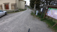
 google parking directions
Primary Trail Type: Cross-Country
AKA: Parco del Contrafforte Pliocenico
Land Status: Provincial Park
google parking directionsThis region uses the Uk/Euro style trail grading system.
Activities Click to view
- Mountain Bike
26 trails
- E-Bike
18 trails
- Hike
24 trails
- Trail Running
26 trails
Region Details
- 6
- 7
- 7
Region Status
Open as of Apr 27, 2026Stats
- Avg Trail Rating
- Trails (view details)
- 24
- Trails Mountain Bike
- 26
- Trails E-Bike
- 18
- Trails Horse
- 2
- Trails Hike
- 24
- Trails Trail Running
- 26
- Total Distance
- 18 miles
- Total Descent
- 5,067 ft
- Total Vertical
- 1,886 ft
- Highest Trailhead
- 2,093 ft
- Reports
- 1,013
- Photos
- 32
- Ridden Counter
- 3,751
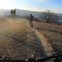
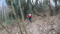
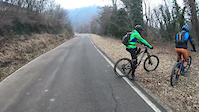
Popular Monte Mario Mountain Biking Trails
• 90 ★ 5.0 • 1 mile • 258 ft • 196 •
Discesa facile che parte dal e termina su via delle Orchidee (via degli Dei) passando una sbarra. Sentiero che collega diversi trail. Verso metà è presente una roccia pitturata con le sembianze di un gorilla
• 85 ★ 4.0 • 3,789 ft • 5 ft • 192 •
Discesa classica dai Prati di Mugnano a via Vizzano. Tracciato cambiato molto nel corso degli anni, prima da un restyling a favore dei pedoni, poi dalle frane. Presenta alcuni punti molto tecnici con relative varianti per i meno esperti
• 95 ★ 4.5 • 3,885 ft • 355 ft • 166 •
Popular green difficulty singletrack. This mountain bike primary trail can be used both directions and has a moderate overall physical rating with a 355 ft blue climb. Trail visibility is always easy to follow. On average it takes 10 minutes to complete this trail.
• 95 ★ 4.4 • 866 ft • 21 ft • 150 •
Breve singletrack nel bosco che collega via Orchidee col , ideale anche per principianti. Si trova sulla Via degli Dei, prestare attenzione
• 70 ★ 5.0 • 2,712 ft • 10 ft • 123 •
Popular blue difficulty singletrack. This mountain bike primary trail can be used downhill primary and has a easy overall physical rating. On average it takes 3 minutes to complete this trail.
• 70 ★ 4.7 • 928 ft • 12 ft • 121 •
Breve tratto che parte dal braciere (panchine) zona e si innesta nel Sentiero Gianna. Presenti due tratti molto difficili (all'inizio e alla fine) solo per esperti. Presenti vari chicken line lungo il percorso
• 60 ★ 0.0 • 3,747 ft • 101 ft • 119 •
Moderately popular green difficulty singletrack. This mountain bike primary trail can be used both directions and has a moderate overall physical rating with a 101 ft blue climb. On average it takes 9 minutes to complete this trail.
• 80 ★ 5.0 • 3,638 ft • 38 ft • 102 •
Highly rated popular blue difficulty singletrack. This mountain bike primary trail and has a moderate overall physical rating with a 38 ft blue climb. It features drop, rock face and skinny. Adaptive MTB rating: amtb black. Trail visibility is always easy to follow. On average it takes 6 minutes to complete this trail.
Monte Mario Mountain Bike Routes
18 miles • 3,610 ft • 9 • Loop •
Giro ad "8" dei trail caratteristici della zona di e Monte Mario. Consigliata e-bike e buona preparazione...
• 26 miles • 6,552 ft • 11 •
• 25 miles • 6,091 ft • 10 •
• 12 miles • 3,318 ft • 14 •
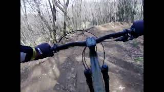
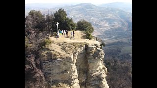
Photos of Monte Mario Mountain Bike
Videos of Monte Mario Mountain Bike
trail: Badolo DH
5:04 |
77 |
Apr 5, 2023
trail: Via Villa Quiete
0:21 |
|
Feb 20, 2023
trail: Herr Wagabunder
6:20 |
66 |
Sep 20, 2022
trail: Bighellone Trail
6:09 |
55 |
Sep 20, 2022

trail: Freeride
2:12 |
70 |
Apr 11, 2025 , Sasso Marconi

trail: Toboga
4:48 |
43 |
Apr 11, 2025 , Sasso Marconi
trail: Leoni
4:53 |
85 |
Mar 18, 2024 , Sasso Marconi
youtuber
![Monte Mario completo: California & Monte Adone]()
trail: Monte Adone
25:32 |
214 |
Mar 1, 2023 , Sasso Marconi
Recent Trail Reports
Activity Feed
| username | action | type | title | date |
|---|---|---|---|---|
| AlessandrodFq3n4 | ridden | trail | activity #96235833 | Jun 4, 2026 @ 9:59am Jun 4, 2026 |
| Kline21 | ridden | trail | activity #95127418 and 1 more | May 20, 2026 @ 12:40pm May 20, 2026 |
| Marco67exc | wishlist | trail | activity #94759873 | May 15, 2026 @ 11:40am May 15, 2026 |
| noWildcard | ridden | trail | activity #94042661 | May 4, 2026 @ 1:02pm May 4, 2026 |
| MBSS | add | report | activity #93525170 and 4 more | Apr 27, 2026 @ 10:08am Apr 27, 2026 |
Recent Comments
| username | type | title | comment | date |
|---|---|---|---|---|
| trail | Prima parte con uno splendido paesaggio sulla... | Jan 2, 2026 @ 7:46am Jan 2, 2026 | ||
| trail | Beh, spettacolo...mix tra flow e drop su... | Jan 2, 2026 @ 7:45am Jan 2, 2026 | ||
| report | Hi, here in Italy natural trails usually have... | Jul 3, 2025 @ 2:37am Jul 3, 2025 | ||
| trail | Grassa frana verso la fine, da non fare più | Jul 3, 2025 @ 12:39am Jul 3, 2025 | ||
| trail | This trail has double black sections!!! Steep,... | May 4, 2025 @ 6:31am May 4, 2025 |
Nearby Areas
| name | distance | ||||
|---|---|---|---|---|---|
| Monte Sole | 2 | 4 | 4.6 km | ||
| Medelana | 1 | 5 | 5 | 4.8 km | |
| Monte Capra | 2 | 7.5 km | |||
| Monzuno / Monte Venere | 3 | 2 | 7.7 km | ||
| Bregoli | 11 | 2 | 1 | 7.9 km |
Local Badges
-

Completionist0 awarded
Activity Type Stats
| activitytype | trails | distance | descent | descent distance | total vertical | rating | global rank | state rank | photos | reports | routes | ridelogs |
|---|---|---|---|---|---|---|---|---|---|---|---|---|
| Mountain Bike | 26 | 18 miles | 5,069 ft | 9 miles | 1,886 ft | #3,533 | #148 | 32 | 1,013 | 1 | 3,572 | |
| E-Bike | 18 | 10 miles | 3,255 ft | 5 miles | 1,772 ft | #4,497 | #303 | 989 | 2 | 995 | ||
| Horse | 2 | 2 miles | 79 ft | 3,809 ft | 600 ft | 22 | ||||||
| Hike | 24 | 17 miles | 4,652 ft | 8 miles | 1,886 ft | #7,241 | #275 | 1,009 | 87 | |||
| Trail Running | 26 | 18 miles | 5,069 ft | 9 miles | 1,886 ft | #6,247 | #259 | 1,013 | 18 |
Frequently Asked Questions About Monte Mario
▼
What are the highest rated mountain biking trails in Monte Mario?
The highest rated mountain biking trails in Monte Mario are:
- Herr Wagabunder (4.5/5)
- Bighellone Trail (4.5/5)
- Calzinare (4.4/5)
- Gorilla (4.3/5)
- Freeride (4.2/5)
▼
What is the best time of the year to ride in Monte Mario?
Based on ride log data, the most popular months to ride in Monte Mario are:
- May (26 activities)
- October (25 activities)
- June (20 activities)
▼
Where can I park to ride in Monte Mario?
▼
What is the longest trail in Monte Mario?
The longest trail in Monte Mario is Via Valverde at 1.8 miles. View all trails sorted by distance.
Activities
Trails
Points of Interest
- By Gullo & contributors
- Admins: apply
- #9334 - 4,790 views
- monte mario activity log | embed map of Monte Mario mountain bike trails | monte mario mountain biking points of interest
Downloading of trail gps tracks in kml & gpx formats is enabled for Monte Mario.
You must login to download files.