close
-
Layers w
- Weather Layers
- Pro
- Pro
- Pro
- Pro
- Pro
- Pro
- More Layers
- Pro
- Pro
- Pro
- Pro
-
Upgrade to

3D
Trail Conditions
- Unknown
- Snow Groomed
- Snow Packed
- Snow Covered
- Snow Cover Partial
- Freeze/thaw Cycle
- Icy
- Prevalent Mud
- Wet
- Variable
- Ideal
- Dry
- Very Dry
Trail Flow (Ridden Direction)
Trailforks scans users ridelogs to determine the most popular direction each trail is ridden. A good flowing trail network will have most trails flowing in a single direction according to their intension.
The colour categories are based on what percentage of riders are riding a trail in its intended direction.
The colour categories are based on what percentage of riders are riding a trail in its intended direction.
- > 96%
- > 90%
- > 80%
- > 70%
- > 50%
- < 50%
- bi-directional trail
- no data
Trail Last Ridden
Trailforks scans ridelogs to determine the last time a trail was ridden.
- < 2 days
- < 1 week
- < 2 weeks
- < 1 month
- < 6 months
- > 6 months
Trail Ridden Direction
The intended direction a trail should be ridden.
- Downhill Only
- Downhill Primary
- Both Directions
- Uphill Primary
- Uphill Only
- One Direction
Contribute Details
Colors indicate trail is missing specified detail.
- Description
- Photos
- Description & Photos
- Videos
Trail Popularity ?
Trailforks scans ridelogs to determine which trails are ridden the most in the last 9 months.
Trails are compared with nearby trails in the same city region with a possible 25 colour shades.
Think of this as a heatmap, more rides = more kinetic energy = warmer colors.
- most popular
- popular
- less popular
- not popular
ATV/ORV/OHV Filter
Max Vehicle Width
inches
US Cell Coverage
Legend

Radar Time
Activity Recordings
Trailforks uses anonymized public activity data.
?
Activity Recordings
Trailforks uses anonymized public activity data.
?
Personal Heatmap
▶
Activity Types
all
/
none
▶
Options
2
Date range
month
–
Winter Trails
Warning
A routing network for winter maps does not exist. Selecting trails using the winter trails layer has been disabled.
Missing Trails
Most Popular
Least Popular
Trails are colored based on popularity. The more popular a trail is, the more red. Less popular trails trend towards green.
Jump Magnitude Heatmap
Heatmap of where riders jump on trails. Zoom in to see individual jumps, click circles to view jump details.
BC Backroad Status
![map legend]()
Service Road Atlas is a free to use, community-driven service for viewing and creating reports on the numerous back-country service roads around B.C. and Alberta.

Slope Aspect
Direction the slope faces
Trails Deemphasized
Trails are shown in grey.
Only show trails with no bike usage.
Suggested Layers
Based on selected activity type
Save the current map location and zoom level as your default home location whenever this page is loaded.
SaveDISCLAIMER
Non si conosce lo stato legale dei sentieri riportati. Sono stati riportati i trail che "tutti conoscono".
Il Monte Pisano, noto anche con la forma plurale Monti Pisani (da non confondere con la denominazione omonima delle Colline pisane), è un sistema montuoso di modeste dimensioni, situato nella parte centro-nord della Toscana, e separa Pisa e Lucca.
source: Wikipedia
Primary Trail Type: All-Mountain & Downhill
Shuttleable: YES
Land Status: Unmanaged Wilderness Area
 google parking directions
This region uses the Uk/Euro style trail grading system.
Activities Click to view
- Mountain Bike
94 trails
- E-Bike
93 trails
- Hike
90 trails
- Trail Running
90 trails
Region Details
- 32
- 1
- 20
- 22
Region Status
Caution as of Jun 8, 2026Local Trail Association
Stats
- Avg Trail Rating
- Trails (view details)
- 86
- Trails Mountain Bike
- 94
- Trails E-Bike
- 93
- Trails Hike
- 90
- Trails Trail Running
- 90
- Total Distance
- 87 miles
- Total Descent
- 36,156 ft
- Total Vertical
- 2,989 ft
- Highest Trailhead
- 3,009 ft
- Reports
- 1,577
- Photos
- 206
- Ridden Counter
- 10,705
Popular Monte Pisano Mountain Biking Trails
• 65 ★ 4.6 • 1 mile • 8 ft • 212 •
Highly rated moderately popular black difficulty singletrack. This mountain bike primary trail and has a hard overall physical rating. On average it takes 15 minutes to complete this trail.
• 90 ★ 4.2 • 2,473 ft • 3 ft • 160 •
Highly rated popular blue difficulty singletrack. This mountain bike primary trail can be used downhill only and has a easy overall physical rating. On average it takes 3 minutes to complete this trail.
• 65 ★ 5.0 • 1,214 ft • 9 ft • 139 •
Moderately popular black difficulty singletrack. This mountain bike primary trail. On average it takes 2 minutes to complete this trail.
• 70 ★ 3.8 • 2,283 ft • 0 ft • 138 •
Popular blue difficulty singletrack. This mountain bike primary trail can be used downhill only and has a easy overall physical rating. On average it takes 3 minutes to complete this trail.
Monte Pisano Mountain Bike Routes
2,461 ft • 0 • Point to Point •
S.T. breve ma tecnico. Fondo compatto con diverse pietre sulla traiettoria. Prestare attenzione...
4,501 ft • 20 ft • 0 • Point to Point •
Continuazione del ST Caduti di Piavola; le pendenze sono più impegnative e qualche passaggio esige...
• 11 miles • 3,409 ft • 6 •
• 10 miles • 2,629 ft • 5 •
• 5 miles • 1,453 ft • 1 •
• 21 miles • 4,142 ft • 1 •
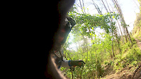
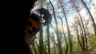
Photos of Monte Pisano Mountain Bike
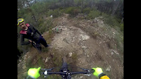
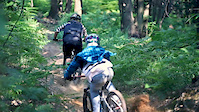
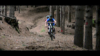
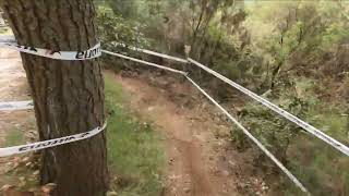
Videos of Monte Pisano Mountain Bike
trail: Fuego
0:00 |
122 |
Feb 6, 2017
trail: Macine
13:00 |
993 |
Feb 21, 2015
trail: Secco
7:54 |
5397 |
Sep 26, 2012
trail: Secco
2:52 |
5004 |
Sep 18, 2012
trail: Cancello rosso
2:32 |
708 |
Apr 22, 2012
trail: Secco
3:24 |
741 |
Apr 22, 2012
trail: Poppo
4:26 |
38 |
May 6, 2025 , Pisa

trail: Picabeba
4:26 |
27 |
May 6, 2025 , Pisa
Recent Trail Reports
| status | trail | date | condition | info | user |
|---|---|---|---|---|---|
| Piavola ST | Jun 8, 2026 @ 11:12am (Europe/Rome) Jun 8, 2026 | Ideal | FraV8 | ||
| Linea ElleErre | Jun 7, 2026 @ 8:53am (Europe/Rome) Jun 6, 2026 | Ideal | FraV8 | ||
| Puppurrì | Jun 7, 2026 @ 8:53am (Europe/Rome) Jun 6, 2026 | Dry | FraV8 | ||
| Casetta | Jun 7, 2026 @ 8:53am (Europe/Rome) Jun 6, 2026 | Ideal | FraV8 | ||
| MecLeod | Jun 7, 2026 @ 8:53am (Europe/Rome) Jun 6, 2026 | Ideal | FraV8 | ||
| Via di Ragnaia | Jun 4, 2026 @ 9:22am (Europe/San_Marino) Jun 4, 2026 | Snow Groomed | Gaddo60 | ||
| Zampirone | Jun 6, 2026 @ 9:09am (Europe/Rome) Jun 6, 2026 | Dry | wavelele | ||
| RET 141 - babusrazzo | Jun 3, 2026 @ 9:36am (Europe/Rome) Jun 3, 2026 | Dry | wavelele | ||
| Access To Faeta | May 10, 2026 @ 11:31am (Europe/Rome) May 10, 2026 | Ideal | Pallacce91 | ||
| Secco | Apr 19, 2026 @ 8:55am (Europe/Rome) Apr 18, 2026 | Ideal | wavelele |
Activity Feed
| username | action | type | title | date |
|---|---|---|---|---|
| FraV8 | add | report | activity #96526913 and 4 more | Jun 8, 2026 @ 2:10am Jun 8, 2026 |
| Gaddo60 | add | report | activity #96526047 | Jun 8, 2026 @ 1:17am Jun 8, 2026 |
| wavelele | add | report | activity #96385668 and 1 more | Jun 6, 2026 @ 10:32am Jun 6, 2026 |
| AlessioFMTV0t | wishlist | trail | activity #96259463 | Jun 4, 2026 @ 4:26pm Jun 4, 2026 |
| wavelele | add | report | activity #96246502 and 1 more | Jun 4, 2026 @ 12:44pm Jun 4, 2026 |
Recent Comments
| username | type | title | comment | date |
|---|---|---|---|---|
| trail | Rosso? Io non capisco come sia percorribile in... | Dec 19, 2025 @ 4:30am Dec 19, 2025 | ||
| trail | albero parte alta ontaneto ,,albero su ciuchini | Dec 12, 2025 @ 12:44am Dec 12, 2025 | ||
| trail | Completamente chiuso dalla vegetazione. Non... | Jun 27, 2025 @ 12:27pm Jun 27, 2025 | ||
| trail | Sentiero stretto, relativamente ripito e... | Apr 18, 2025 @ 2:31pm Apr 18, 2025 | ||
| trail | Carino, Red tendente al black | Jan 12, 2025 @ 9:58am Jan 12, 2025 |
Nearby Areas
| name | distance | ||||
|---|---|---|---|---|---|
| Vorno Trail Area | 23 | 20 | 4.1 km | ||
| Compitese | 19 | 2 | 1 | 4.6 km | |
| Padule | 2 | 6.3 km | |||
| 4 Venti | 12 | 16 | 3 | 6.7 km | |
| Ciapino Trail Area | 7 | 8 | 1 | 7.3 km |
Local Badges
-

Completionist0 awarded
Activity Type Stats
| activitytype | trails | distance | descent | descent distance | total vertical | rating | global rank | state rank | photos | reports | routes | ridelogs |
|---|---|---|---|---|---|---|---|---|---|---|---|---|
| Mountain Bike | 94 | 87 miles | 36,155 ft | 46 miles | 2,989 ft | #735 | #12 | 197 | 1,577 | 2 | 11,479 | |
| E-Bike | 93 | 86 miles | 35,180 ft | 45 miles | 2,989 ft | #660 | #92 | 6 | 1,241 | 2 | 2,252 | |
| Hike | 90 | 85 miles | 34,593 ft | 44 miles | 2,989 ft | #1,180 | #34 | 1,533 | 338 | |||
| Trail Running | 90 | 85 miles | 34,593 ft | 44 miles | 2,989 ft | #140 | #5 | 1,533 | 546 |
Frequently Asked Questions About Monte Pisano
▼
What are the highest rated mountain biking trails in Monte Pisano?
▼
What is the best time of the year to ride in Monte Pisano?
Based on ride log data, the most popular months to ride in Monte Pisano are:
- December (54 activities)
- May (45 activities)
- February (41 activities)
▼
Where can I park to ride in Monte Pisano?
There are 4 parking locations listed in Monte Pisano. The most popular parking spots are: View all parking and trailhead locations on the map to plan your visit.
▼
What is the longest trail in Monte Pisano?
The longest trail in Monte Pisano is Verruca Climb classica at 3.8 km. View all trails sorted by distance.
Activities
Trails
Points of Interest
- By matteom
 STMP Trail Loverz & contributors
 - Admins: STMP, M.PisanoCrew, macx
- #5860 - 24,823 views
- monte pisano activity log | embed map of Monte Pisano mountain bike trails | monte pisano mountain biking points of interest
Downloading of trail gps tracks in kml & gpx formats is enabled for Monte Pisano.
You must login to download files.