close
-
Layers w
- Weather Layers
- Pro
- Pro
- Pro
- Pro
- Pro
- Pro
- More Layers
- Pro
- Pro
- Pro
- Pro
-
Upgrade to

3D
Trail Conditions
- Unknown
- Snow Groomed
- Snow Packed
- Snow Covered
- Snow Cover Partial
- Freeze/thaw Cycle
- Icy
- Prevalent Mud
- Wet
- Variable
- Ideal
- Dry
- Very Dry
Trail Flow (Ridden Direction)
Trailforks scans users ridelogs to determine the most popular direction each trail is ridden. A good flowing trail network will have most trails flowing in a single direction according to their intension.
The colour categories are based on what percentage of riders are riding a trail in its intended direction.
The colour categories are based on what percentage of riders are riding a trail in its intended direction.
- > 96%
- > 90%
- > 80%
- > 70%
- > 50%
- < 50%
- bi-directional trail
- no data
Trail Last Ridden
Trailforks scans ridelogs to determine the last time a trail was ridden.
- < 2 days
- < 1 week
- < 2 weeks
- < 1 month
- < 6 months
- > 6 months
Trail Ridden Direction
The intended direction a trail should be ridden.
- Downhill Only
- Downhill Primary
- Both Directions
- Uphill Primary
- Uphill Only
- One Direction
Contribute Details
Colors indicate trail is missing specified detail.
- Description
- Photos
- Description & Photos
- Videos
Trail Popularity ?
Trailforks scans ridelogs to determine which trails are ridden the most in the last 9 months.
Trails are compared with nearby trails in the same city region with a possible 25 colour shades.
Think of this as a heatmap, more rides = more kinetic energy = warmer colors.
- most popular
- popular
- less popular
- not popular
ATV/ORV/OHV Filter
Max Vehicle Width
inches
US Cell Coverage
Legend

Radar Time
Activity Recordings
Trailforks uses anonymized public activity data.
?
Activity Recordings
Trailforks uses anonymized public activity data.
?
Personal Heatmap
▶
Activity Types
all
/
none
▶
Options
2
Date range
month
–
Winter Trails
Warning
A routing network for winter maps does not exist. Selecting trails using the winter trails layer has been disabled.
Missing Trails
Most Popular
Least Popular
Trails are colored based on popularity. The more popular a trail is, the more red. Less popular trails trend towards green.
Jump Magnitude Heatmap
Heatmap of where riders jump on trails. Zoom in to see individual jumps, click circles to view jump details.
BC Backroad Status
![map legend]()
Service Road Atlas is a free to use, community-driven service for viewing and creating reports on the numerous back-country service roads around B.C. and Alberta.

Slope Aspect
Direction the slope faces
Trails Deemphasized
Trails are shown in grey.
Only show trails with no bike usage.
Suggested Layers
Based on selected activity type
Save the current map location and zoom level as your default home location whenever this page is loaded.
Save
No description for Monte Tamaro has been added yet!
Login or register to submit one.
 google parking directions
Primary Trail Type: All-Mountain & Downhill
google parking directionsThis region uses the Uk/Euro style trail grading system.
Activities Click to view
- Mountain Bike
24 trails
- E-Bike
23 trails
- Hike
22 trails
- Trail Running
22 trails
Region Details
- 3
- 2
- 5
- 11
- 3
Region Status
Caution as of Jun 12, 2026Stats
- Avg Trail Rating
- Trails (view details)
- 24
- Trails Mountain Bike
- 24
- Trails E-Bike
- 23
- Trails Hike
- 22
- Trails Trail Running
- 22
- Total Distance
- 32 miles
- Total Descent Distance
- 22 miles
- Total Descent
- 19,191 ft
- Total Vertical
- 4,747 ft
- Highest Trailhead
- 6,202 ft
- Reports
- 239
- Photos
- 72
- Ridden Counter
- 1,713
Popular Monte Tamaro Mountain Biking Trails
• 95 ★ 4.6 • 4,400 ft • 17 ft • 339 •
Highly rated popular black difficulty alpine singletrack. This multi-use trail can be used one direction. It features rock face and rock garden. On average it takes 23 minutes to complete this trail.
• 80 ★ 5.0 • 2,838 ft • 0 ft • 137 • • hike
Popular blue difficulty singletrack. This hike primary trail can be used downhill primary. On average it takes 8 minutes to complete this trail.
• 100 ★ 5.0 • 1,493 ft • 60 ft • 127 •
Popular red difficulty alpine singletrack. This multi-use trail can be used uphill primary. On average it takes 7 minutes to complete this trail.
• 95 ★ 4.3 • 3 miles • 137 ft • 105 •
Popular blue difficulty alpine singletrack. This multi-use trail can be used downhill primary. On average it takes 27 minutes to complete this trail.
• 90 ★ 4.0 • 3,002 ft • 0 ft • 53 •
Popular blue difficulty singletrack. This mountain bike primary trail can be used downhill only with a 0 ft blue climb. Trail visibility is always easy to follow. On average it takes 7 minutes to complete this trail.
• 55 ★ 4.2 • 3 miles • 259 ft • 52 • • hike
Moderately popular red difficulty singletrack. This hike primary trail can be used downhill only. It features rock garden. Trail visibility is always easy to follow. On average it takes 54 minutes to complete this trail.
• 65 ★ 3.2 • 3 miles • 21 ft • 47 • • hike
Im obersten Sottoceneri im Südtessin liegt gleich nach dem Monte Ceneri Autobahntunnel das Dorf Rivera. Dort liegt auch die Talstation der bekannten Monte Seilbahn. Mit dieser bewältigen wir rund 1100 Höhenmeter bis zur Bergstation...
• 85 ★ 4.0 • 1,683 ft • 0 ft • 42 •
Popular blue difficulty singletrack. This mountain bike primary trail can be used downhill only and has a moderate overall physical rating with a 0 ft blue climb. It features skinny. Trail visibility is always easy to follow. On average it takes 1 minutes to complete this trail.
Monte Tamaro Mountain Bike Routes
Monte Tamaro Bike #362 Featured
20 miles • 2,659 ft • 6 • Loop •
This loop trail is quite an experience: the ascent from to Capanna is rough, but the fantastic views of...
8 miles • 1,295 ft • 8 • Point to Point •
Die ultimative Top-Abfahrt im Monte Gebiet. 1500 Höhenmeter auf knackigen Singletrails vernichten und...
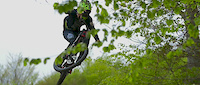
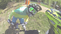
Photos of Monte Tamaro Mountain Bike
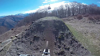
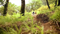
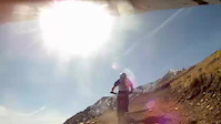
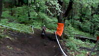
Videos of Monte Tamaro Mountain Bike
trail: Tamaro
2:32 |
17174 |
Jul 21, 2017
trail: Tamaro
0:58 |
296 |
Apr 6, 2015
trail: Tamaro
4:18 |
553 |
Sep 14, 2014
trail: Tamaro
0:50 |
755 |
May 22, 2014
trail: Tamaro
4:51 |
170 |
May 5, 2014
trail: Tamaro
0:55 |
190 |
May 15, 2013

trail: Tamaro
9:38 |
203 |
Apr 22, 2012
trail: Tamaro
3:34 |
834 |
Jan 11, 2012
Recent Trail Reports
| status | trail | date | condition | info | user |
|---|---|---|---|---|---|
| Alpe Pioda Flow | Jun 13, 2026 @ 8:58am (Europe/Vaduz) Jun 12, 2026 | Ideal | francesco-mgn | ||
| Tamaro Cruiser | May 25, 2026 @ 8:51pm (Europe/Zurich) May 25, 2026 | Ideal | nordwindlicht | ||
| Tamaro | May 25, 2026 @ 8:47pm (Europe/Zurich) May 25, 2026 | Ideal | nordwindlicht | ||
| Merrigione | May 25, 2026 @ 11:07am (Europe/Vaduz) May 25, 2026 | Ideal | matherj | ||
| Tamaro Capanna | May 25, 2026 @ 11:07am (Europe/Vaduz) May 25, 2026 | Ideal | matherj | ||
| Tamaro Access | May 25, 2026 @ 11:07am (Europe/Vaduz) May 25, 2026 | Ideal | matherj | ||
| Alpe Foppa | May 25, 2026 @ 11:07am (Europe/Vaduz) May 25, 2026 | Ideal | matherj | ||
| Tamaro North | Apr 16, 2026 @ 11:34pm (Europe/Zurich) Apr 16, 2026 | Snow Covered | colioni | ||
| Alpe Foppa - Alpe Duragno | Apr 5, 2026 @ 12:54pm (Europe/Zurich) Apr 5, 2026 | Snow Covered | nike-ch | ||
| Ai Monti in Nenaz | Apr 5, 2026 @ 12:53pm (Europe/Zurich) Apr 5, 2026 | Dry | nike-ch |
Activity Feed
| username | action | type | title | date |
|---|---|---|---|---|
| Zigers | ridden | trail | activity #97034643 and 5 more | Jun 15, 2026 @ 5:35am Jun 15, 2026 |
| trailpapst | update | route | activity #97028072 | Jun 15, 2026 @ 1:31am Jun 15, 2026 |
| francesco-mgn | add | report | activity #96903482 | Jun 13, 2026 @ 12:04pm Jun 13, 2026 |
| Seraina12 | ridden | route | activity #96490307 | Jun 7, 2026 @ 12:55pm Jun 7, 2026 |
| nickpozzi | ridden | trail | activity #96089457 | Jun 2, 2026 @ 9:21am Jun 2, 2026 |
Recent Comments
| username | type | title | comment | date |
|---|---|---|---|---|
| trail | The lower part is a old roman road which is... | Oct 21, 2025 @ 11:41pm Oct 21, 2025 | ||
| trail | Streep climb, many rocks. Not comfortable but... | Jul 30, 2024 @ 8:33am Jul 30, 2024 | ||
| trail | The 1th open alpine path seccion is difficult... | Jul 9, 2023 @ 1:12pm Jul 9, 2023 | ||
| trail | Better than Tamaro (Standard) | Jul 9, 2023 @ 1:10pm Jul 9, 2023 | ||
| trail | Very exposed and rocky on the upper part.... | Jul 4, 2023 @ 2:09am Jul 4, 2023 |
Nearby Areas
| name | distance | ||||
|---|---|---|---|---|---|
| Monte Lema | 2 | 12 | 4.7 km | ||
| Val Veddasca | 4.7 km | ||||
| Black Deer Project | 1 | 4 | 5 km | ||
| Monte Bar | 4 | 14 | 7 km | ||
| Cardada Cimetta | 7 | 14 | 7.6 km |
Local Badges
-

Completionist0 awarded
Activity Type Stats
| activitytype | trails | distance | descent | descent distance | total vertical | rating | global rank | state rank | photos | reports | routes | ridelogs |
|---|---|---|---|---|---|---|---|---|---|---|---|---|
| Mountain Bike | 24 | 32 miles | 19,190 ft | 22 miles | 4,747 ft | #2,467 | #29 | 128 | 239 | 2 | 627 | |
| E-Bike | 23 | 31 miles | 17,234 ft | 20 miles | 4,747 ft | #1,541 | #35 | 211 | 2 | 47 | ||
| Hike | 22 | 31 miles | 16,939 ft | 20 miles | 4,619 ft | #1,631 | #29 | 238 | 1 | 37 | ||
| Trail Running | 22 | 31 miles | 16,939 ft | 20 miles | 4,619 ft | #1,189 | #24 | 238 | 1 | 10 |
Frequently Asked Questions About Monte Tamaro
▼
What are the highest rated mountain biking trails in Monte Tamaro?
The highest rated mountain biking trails in Monte Tamaro are:
- Tamaro (4.4/5)
- Alpe Canigiolo (4.2/5)
- Monti di Sigirino part 2 (4.2/5)
- Monti di Sigirino Part 3 (4.2/5)
- Tamaro Capanna (4.1/5)
▼
What is the best time of the year to ride in Monte Tamaro?
Based on ride log data, the most popular months to ride in Monte Tamaro are:
- October (4 activities)
- September (3 activities)
- April (3 activities)
▼
Where can I park to ride in Monte Tamaro?
There are 1 parking locations listed in Monte Tamaro. The most popular parking spots are:
▼
What is the longest trail in Monte Tamaro?
The longest trail in Monte Tamaro is Tamaro Cruiser at 3.2 miles. View all trails sorted by distance.
Activities
Trails
Points of Interest
- By brenthillier
 NSMBA TRAILFORKS & contributors
 - Admins: apply
- #11887 - 6,740 views
- monte tamaro activity log | embed map of Monte Tamaro mountain bike trails | monte tamaro mountain biking points of interest
Downloading of trail gps tracks in kml & gpx formats is enabled for Monte Tamaro.
You must login to download files.