close
-
Layers w
- Weather Layers
- Pro
- Pro
- Pro
- Pro
- Pro
- Pro
- More Layers
- Pro
- Pro
- Pro
- Pro
-
Upgrade to

3D
Trail Conditions
- Unknown
- Snow Groomed
- Snow Packed
- Snow Covered
- Snow Cover Partial
- Freeze/thaw Cycle
- Icy
- Prevalent Mud
- Wet
- Variable
- Ideal
- Dry
- Very Dry
Trail Flow (Ridden Direction)
Trailforks scans users ridelogs to determine the most popular direction each trail is ridden. A good flowing trail network will have most trails flowing in a single direction according to their intension.
The colour categories are based on what percentage of riders are riding a trail in its intended direction.
The colour categories are based on what percentage of riders are riding a trail in its intended direction.
- > 96%
- > 90%
- > 80%
- > 70%
- > 50%
- < 50%
- bi-directional trail
- no data
Trail Last Ridden
Trailforks scans ridelogs to determine the last time a trail was ridden.
- < 2 days
- < 1 week
- < 2 weeks
- < 1 month
- < 6 months
- > 6 months
Trail Ridden Direction
The intended direction a trail should be ridden.
- Downhill Only
- Downhill Primary
- Both Directions
- Uphill Primary
- Uphill Only
- One Direction
Contribute Details
Colors indicate trail is missing specified detail.
- Description
- Photos
- Description & Photos
- Videos
Trail Popularity ?
Trailforks scans ridelogs to determine which trails are ridden the most in the last 9 months.
Trails are compared with nearby trails in the same city region with a possible 25 colour shades.
Think of this as a heatmap, more rides = more kinetic energy = warmer colors.
- most popular
- popular
- less popular
- not popular
ATV/ORV/OHV Filter
Max Vehicle Width
inches
US Cell Coverage
Legend

Radar Time
Activity Recordings
Trailforks uses anonymized public activity data.
?
Activity Recordings
Trailforks uses anonymized public activity data.
?
Personal Heatmap
▶
Activity Types
all
/
none
▶
Options
2
Date range
month
–
Winter Trails
Warning
A routing network for winter maps does not exist. Selecting trails using the winter trails layer has been disabled.
Missing Trails
Most Popular
Least Popular
Trails are colored based on popularity. The more popular a trail is, the more red. Less popular trails trend towards green.
Jump Magnitude Heatmap
Heatmap of where riders jump on trails. Zoom in to see individual jumps, click circles to view jump details.
BC Backroad Status
![map legend]()
Service Road Atlas is a free to use, community-driven service for viewing and creating reports on the numerous back-country service roads around B.C. and Alberta.

Slope Aspect
Direction the slope faces
Trails Deemphasized
Trails are shown in grey.
Only show trails with no bike usage.
Suggested Layers
Based on selected activity type
Save the current map location and zoom level as your default home location whenever this page is loaded.
Save
No description for Montecampione has been added yet!
Login or register to submit one.
This region uses the Uk/Euro style trail grading system.
Activities Click to view
- Mountain Bike
6 trails
- E-Bike
6 trails
- Adaptive Bike
0 trails
- Downhill Ski
19 trails
Region Details
- 3
- 2
Region Status
Caution as of Sep 18, 2025Stats
- Avg Trail Rating
- Trails (view details)
- 5
- Trails Mountain Bike
- 6
- Trails E-Bike
- 6
- Trails Downhill Ski
- 19
- Total Distance
- 14 miles
- Total Descent
- 5,232 ft
- Total Vertical
- 4,494 ft
- Highest Trailhead
- 5,947 ft
- Reports
- 7
- Photos
- 13
- Ridden Counter
- 73
Sub Regions
-
Montecampione Bike park
- 1
- 2
Popular Montecampione Mountain Biking Trails
• 80 ★ 4.0 • 2 miles • 287 ft • 10 •
Una delle poche strade che collega la Val Palot alla Val Negra. Il trail é a tratti bello, ma il fondo molto sconnesso richiede di fare anche molti tratti scendendo dalla bici.
• 100 ★ 5.0 • 7 miles • 1,538 ft • 9 •
Popular green difficulty alpine singletrack. This mountain bike primary trail and has a moderate overall physical rating with a 1,538 ft blue climb. It features rock garden. Adaptive MTB rating: amtb green. Trail visibility is always easy to follow. On average it takes 40 minutes to complete this trail.
• 60 ★ 0.0 • 3 miles • 1,301 ft • 7 •
Moderately popular green difficulty family friendly mixed. This mountain bike primary trail can be used both directions and has a easy overall physical rating. Adaptive MTB rating: amtb green. Trail visibility is always easy to follow. On average it takes 21 minutes to complete this trail.
• 5 ★ 0.0 • 2 miles • 144 ft • 6 •
Less popular blue difficulty singletrack. This mountain bike primary trail can be used downhill only. It features berm, bridge, drop and jump.
• 40 ★ 0.0 • 4,272 ft • 14 ft • 2 •
Moderately popular blue difficulty singletrack. This mountain bike primary trail can be used downhill only and has a moderate overall physical rating with a 14 ft blue climb. Trail visibility is always easy to follow.
Montecampione Mountain Bike Routes
20 miles • 5,544 ft • 0 •
Itinerario impegnativo che porta a percorrere i sentieri più panoramici dell’alta Valtrompia. Si parte...
11 miles • 3,090 ft • 0 •
Il sentiero che attraversa la Valle dell’Inferno è molto tecnico e richiede ottime capacità di...
16 miles • 3,974 ft • 0 •
Lunga e affascinante salita che dalle frazioni di Bovegno, conduce quasi fino al Dosso Falcone, a 1600mt...
17 miles • 3,374 ft • 0 •
Il Prati Magri tour e’ un itinerario cross country di media difficolta’, molto adatto alle e-bike. Il...
16 miles • 3,746 ft • 0 •
Itinerario all mountain piuttosto vario. Il primo tratto è la lunga salita asfaltata che porta a...
13 miles • 2,573 ft • 0 •
Tour molto divertente e vario tra le montagne e i boschi di Marmentino e Pertica Alta, in un contesto...
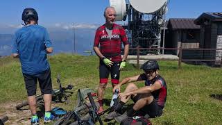
Photos of Montecampione Mountain Bike
Videos of Montecampione Mountain Bike
0:51 |
42 |
Aug 10, 2025 , Montecampione
Recent Trail Reports
| status | trail | date | condition | info | user |
|---|---|---|---|---|---|
| Creste di Montecampione - Rifugio Medelet | Sep 18, 2025 @ 10:38pm (Europe/Rome) Sep 18, 2025 | Dry | SlayerHippie | ||
| Val Palot - Montecampione | Sep 18, 2025 @ 10:32pm (Europe/Rome) Sep 18, 2025 | Variable | SlayerHippie | ||
| Il sentiero delle moie | Nov 3, 2024 @ 6:09am Nov 3, 2024 | Dry | NicolahlP4Ii |
Activity Feed
| username | action | type | title | date |
|---|---|---|---|---|
| Williamavelo | wishlist | trail | activity #97170988 | Jun 17, 2026 @ 3:11am Jun 17, 2026 |
| Stefanof2Io9R | ridden | trail | activity #94198133 | May 6, 2026 @ 9:34pm May 6, 2026 |
| Bikepacker1183 | wishlist | trail | activity #90522821 | Mar 13, 2026 @ 5:37pm Mar 13, 2026 |
| micheletraversi | update | region | activity #83924098 | Nov 10, 2025 @ 11:20am Nov 10, 2025 |
| SlayerHippie | ridden | trail | activity #80619348 | Sep 18, 2025 @ 1:35pm Sep 18, 2025 |
Activity Type Stats
| activitytype | trails | distance | descent | descent distance | total vertical | rating | global rank | state rank | photos | reports | routes | ridelogs |
|---|---|---|---|---|---|---|---|---|---|---|---|---|
| Mountain Bike | 6 | 14 miles | 5,233 ft | 8 miles | 4,495 ft | #8,081 | #727 | 7 | 7 | 14 | 482 | |
| E-Bike | 6 | 14 miles | 5,233 ft | 8 miles | 4,495 ft | #1,016 | #130 | 6 | 7 | 13 | 261 | |
| Downhill Ski | 19 | #399 | #33 | 131 |
- By cheorch
 & contributors
 - Admins: marcoangeletti, adessoomaipiu, micheletraversi
- #29670 - 1,095 views
- montecampione activity log | embed map of Montecampione mountain bike trails |
Downloading of trail gps tracks in kml & gpx formats is enabled for Montecampione.
You must login to download files.