close
-
Layers w
- Weather Layers
- Pro
- Pro
- Pro
- Pro
- Pro
- Pro
- More Layers
- Pro
- Pro
- Pro
- Pro
-
Upgrade to

3D
Trail Conditions
- Unknown
- Snow Groomed
- Snow Packed
- Snow Covered
- Snow Cover Partial
- Freeze/thaw Cycle
- Icy
- Prevalent Mud
- Wet
- Variable
- Ideal
- Dry
- Very Dry
Trail Flow (Ridden Direction)
Trailforks scans users ridelogs to determine the most popular direction each trail is ridden. A good flowing trail network will have most trails flowing in a single direction according to their intension.
The colour categories are based on what percentage of riders are riding a trail in its intended direction.
The colour categories are based on what percentage of riders are riding a trail in its intended direction.
- > 96%
- > 90%
- > 80%
- > 70%
- > 50%
- < 50%
- bi-directional trail
- no data
Trail Last Ridden
Trailforks scans ridelogs to determine the last time a trail was ridden.
- < 2 days
- < 1 week
- < 2 weeks
- < 1 month
- < 6 months
- > 6 months
Trail Ridden Direction
The intended direction a trail should be ridden.
- Downhill Only
- Downhill Primary
- Both Directions
- Uphill Primary
- Uphill Only
- One Direction
Contribute Details
Colors indicate trail is missing specified detail.
- Description
- Photos
- Description & Photos
- Videos
Trail Popularity ?
Trailforks scans ridelogs to determine which trails are ridden the most in the last 9 months.
Trails are compared with nearby trails in the same city region with a possible 25 colour shades.
Think of this as a heatmap, more rides = more kinetic energy = warmer colors.
- most popular
- popular
- less popular
- not popular
ATV/ORV/OHV Filter
Max Vehicle Width
inches
US Cell Coverage
Legend

Radar Time
Activity Recordings
Trailforks uses anonymized public activity data.
?
Activity Recordings
Trailforks uses anonymized public activity data.
?
Personal Heatmap
▶
Activity Types
all
/
none
▶
Options
2
Date range
month
–
Winter Trails
Warning
A routing network for winter maps does not exist. Selecting trails using the winter trails layer has been disabled.
Missing Trails
Most Popular
Least Popular
Trails are colored based on popularity. The more popular a trail is, the more red. Less popular trails trend towards green.
Jump Magnitude Heatmap
Heatmap of where riders jump on trails. Zoom in to see individual jumps, click circles to view jump details.
BC Backroad Status
![map legend]()
Service Road Atlas is a free to use, community-driven service for viewing and creating reports on the numerous back-country service roads around B.C. and Alberta.

Slope Aspect
Direction the slope faces
Trails Deemphasized
Trails are shown in grey.
Only show trails with no bike usage.
Suggested Layers
Based on selected activity type
Save the current map location and zoom level as your default home location whenever this page is loaded.
Save
No description for Montecreto has been added yet!
Login or register to submit one.
This region uses the Uk/Euro style trail grading system.
Activities Click to view
- Mountain Bike
14 trails
- E-Bike
6 trails
- Gravel Bike
0 trails
- Adaptive Bike
0 trails
- Winter Fat Bike
0 trails
- Hike
9 trails
- Trail Running
9 trails
Region Details
- 2
- 3
- 3
Region Status
Caution as of May 31, 2026Stats
- Avg Trail Rating
- Trails (view details)
- 13
- Trails Mountain Bike
- 14
- Trails E-Bike
- 6
- Trails Hike
- 9
- Trails Trail Running
- 9
- Total Distance
- 28 miles
- Total Descent
- 15,929 ft
- Total Vertical
- 3,508 ft
- Highest Trailhead
- 5,889 ft
- Reports
- 106
- Photos
- 34
- Ridden Counter
- 915
Popular Montecreto Mountain Biking Trails
• 65 ★ 5.0 • 1 mile • 13 ft • 59 •
Dopo l’imbocco sulla , il single track si snoda lungo la pineta, con tratti guidati molto divertenti e scorrevoli. Alcune curve in contropendenza e due piccoli guadi rendono il percorso non banale ma molto soddisfacente.
• 50 ★ 4.7 • 4,462 ft • 0 ft • 59 •
Moderately popular blue difficulty singletrack. This mountain bike primary trail can be used downhill only and has a moderate overall physical rating with a 0 ft blue climb. It features roller coaster and skinny. Trail visibility is always easy to follow. On average it takes 7 minutes to complete this trail.
• 55 ★ 5.0 • 3,829 ft • 0 ft • 32 •
Moderately popular green difficulty singletrack. This mountain bike primary trail can be used downhill primary and has a moderate overall physical rating with a 0 ft blue climb. It features skinny. Trail visibility is always easy to follow. On average it takes 6 minutes to complete this trail.
• 35 ★ 5.0 • 3 miles • 11 ft • 28 •
Less popular blue difficulty singletrack. This mountain bike primary trail can be used downhill primary and has a moderate overall physical rating. On average it takes 26 minutes to complete this trail.
• 70 ★ 0.0 • 3 miles • 530 ft • 22 •
Sentiero n.4 Comune di Sestola, che coincide con il sentiero CAI n.455 Si innesta su Via Piastre nel Comune di Montecreto da cui parte il collegamento per la Via dei Monti
• 5 ★ 5.0 • 5,020 ft • 20 ft • 13 •
Less popular red difficulty singletrack. This mountain bike primary trail can be used downhill primary and has a hard overall physical rating. It features rock face and rock garden. On average it takes 19 minutes to complete this trail.
• 85 ★ 0.0 • 1 mile • 15 ft • 12 •
Single track sottobosco che partendo dal raccordo basso delle Polle raggiunge il trail "Poggio Perduto". Fa parte del percorso del raduno MTB “La Randagia” del Cimone, i cui cartelli e targhette sugli alberi aiutano a seguire il...
• 5 ★ 5.0 • 2,238 ft • 7 ft • 11 •
variante Nera del Gufo, molto ripido in alcuni punti e passaggi abbastanza lenti. Da evitare col bagnato.
Photos of Montecreto Mountain Bike
Videos of Montecreto Mountain Bike
0:50 |
74 |
Apr 7, 2020
0:00 |
132 |
Apr 7, 2020

trail: N. 1
0:29 |
257 |
Feb 29, 2012
youtuber
![Avventura sul crinale in MTB: Doganaccia –...]()

19:48 |
66 |
Jun 30, 2025 , Montecreto
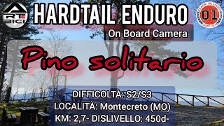
trail: Pino Solitario
14:17 |
118 |
Apr 9, 2025 , Montecreto
trail: N. 1
8:53 |
85 |
Nov 27, 2011
trail: Rio Canalone Full
9:09 |
119 |
Oct 17, 2023 , Montecreto
Recent Trail Reports
Activity Feed
| username | action | type | title | date |
|---|---|---|---|---|
| aggadaway | wishlist | trail | activity #96526865 | Jun 8, 2026 @ 2:06am Jun 8, 2026 |
| trailbrigo | wishlist | trail | activity #96083020 | Jun 2, 2026 @ 7:34am Jun 2, 2026 |
| Garru | add | report | activity #95999463 and 3 more | May 31, 2026 @ 10:18pm May 31, 2026 |
| Pavesino | ridden | trail | activity #95849515 | May 30, 2026 @ 7:24am May 30, 2026 |
| Odentom | add | photo | activity #95490106 | May 25, 2026 @ 8:14am May 25, 2026 |
Recent Comments
| username | type | title | comment | date |
|---|---|---|---|---|
| report | Some sections wet. Lot of leaves on the path,... | May 12, 2026 @ 11:39pm May 12, 2026 | ||
| trail | "Preso" dal km 2,0 dove inizia anche il "The... | Apr 7, 2025 @ 11:45pm Apr 7, 2025 | ||
| trail | Ingresso parte alta dal parcheggio FarWest... | Apr 7, 2025 @ 11:32pm Apr 7, 2025 | ||
| trail | Andrebbe modificata la traccia. La parte... | Oct 9, 2024 @ 9:17am Oct 9, 2024 | ||
| trail | the start is actually closed but still... | Jun 4, 2022 @ 3:48am Jun 4, 2022 |
Local Badges
-

Epic Mountain Bike Climb 2k97 awarded -

Climbing 10k Badge13 awarded -

Mountain Biking 100k Badge0 awarded -

Epic Ride Descent 2k97 awarded -

Descent 10k Badge14 awarded -

Descent 100k Badge0 awarded
Bike & Skill Parks
| name | type | city | rating |
|---|---|---|---|
| Bike Republic Montecreto | skill park | Montecreto |
Activity Type Stats
| activitytype | trails | distance | descent | descent distance | total vertical | rating | global rank | state rank | photos | reports | routes | ridelogs |
|---|---|---|---|---|---|---|---|---|---|---|---|---|
| Mountain Bike | 14 | 27 miles | 14,478 ft | 15 miles | 3,507 ft | #3,741 | #222 | 34 | 106 | 494 | ||
| E-Bike | 6 | 4 miles | 4,587 ft | 4 miles | 2,438 ft | #6,674 | #698 | 90 | 129 | |||
| Hike | 9 | 20 miles | 10,876 ft | 11 miles | 3,507 ft | #7,192 | #395 | 102 | 156 | |||
| Trail Running | 9 | 20 miles | 10,876 ft | 11 miles | 3,507 ft | #6,752 | #384 | 102 |
Frequently Asked Questions About Montecreto
▼
What are the highest rated mountain biking trails in Montecreto?
The highest rated mountain biking trails in Montecreto are:
- Pino Solitario (4.3/5)
- The Dogs (4.2/5)
- The Bomb (4.2/5)
- The Animal (4.1/5)
- Magrignana FR (4.1/5)
▼
What is the best time of the year to ride in Montecreto?
Based on ride log data, the most popular months to ride in Montecreto are:
- June (21 activities)
- August (11 activities)
- May (3 activities)
▼
Where can I park to ride in Montecreto?
There are 1 parking locations listed in Montecreto. The most popular parking spots are:
▼
What is the longest trail in Montecreto?
The longest trail in Montecreto is 455 Via Piastre collegamento Via dei Monti at 3.3 miles. View all trails sorted by distance.
Activities
Trails
Points of Interest
- By anatas & contributors
- Admins: apply
- #14127 - 3,801 views
- montecreto activity log | embed map of Montecreto mountain bike trails | montecreto mountain biking points of interest
Downloading of trail gps tracks in kml & gpx formats is enabled for Montecreto.
You must login to download files.