close
-
Layers w
- Weather Layers
- Pro
- Pro
- Pro
- Pro
- Pro
- Pro
- More Layers
- Pro
- Pro
- Pro
- Pro
-
Upgrade to

3D
Trail Conditions
- Unknown
- Snow Groomed
- Snow Packed
- Snow Covered
- Snow Cover Partial
- Freeze/thaw Cycle
- Icy
- Prevalent Mud
- Wet
- Variable
- Ideal
- Dry
- Very Dry
Trail Flow (Ridden Direction)
Trailforks scans users ridelogs to determine the most popular direction each trail is ridden. A good flowing trail network will have most trails flowing in a single direction according to their intension.
The colour categories are based on what percentage of riders are riding a trail in its intended direction.
The colour categories are based on what percentage of riders are riding a trail in its intended direction.
- > 96%
- > 90%
- > 80%
- > 70%
- > 50%
- < 50%
- bi-directional trail
- no data
Trail Last Ridden
Trailforks scans ridelogs to determine the last time a trail was ridden.
- < 2 days
- < 1 week
- < 2 weeks
- < 1 month
- < 6 months
- > 6 months
Trail Ridden Direction
The intended direction a trail should be ridden.
- Downhill Only
- Downhill Primary
- Both Directions
- Uphill Primary
- Uphill Only
- One Direction
Contribute Details
Colors indicate trail is missing specified detail.
- Description
- Photos
- Description & Photos
- Videos
Trail Popularity ?
Trailforks scans ridelogs to determine which trails are ridden the most in the last 9 months.
Trails are compared with nearby trails in the same city region with a possible 25 colour shades.
Think of this as a heatmap, more rides = more kinetic energy = warmer colors.
- most popular
- popular
- less popular
- not popular
ATV/ORV/OHV Filter
Max Vehicle Width
inches
US Cell Coverage
Legend

Radar Time
Activity Recordings
Trailforks uses anonymized public activity data.
?
Activity Recordings
Trailforks uses anonymized public activity data.
?
Personal Heatmap
▶
Activity Types
all
/
none
▶
Options
2
Date range
month
–
Winter Trails
Warning
A routing network for winter maps does not exist. Selecting trails using the winter trails layer has been disabled.
Missing Trails
Most Popular
Least Popular
Trails are colored based on popularity. The more popular a trail is, the more red. Less popular trails trend towards green.
Jump Magnitude Heatmap
Heatmap of where riders jump on trails. Zoom in to see individual jumps, click circles to view jump details.
BC Backroad Status
![map legend]()
Service Road Atlas is a free to use, community-driven service for viewing and creating reports on the numerous back-country service roads around B.C. and Alberta.

Slope Aspect
Direction the slope faces
Trails Deemphasized
Trails are shown in grey.
Only show trails with no bike usage.
Suggested Layers
Based on selected activity type
Save the current map location and zoom level as your default home location whenever this page is loaded.
Save
No description for Montefaro has been added yet!
Login or register to submit one.
Primary Trail Type: All-Mountain & Downhill
eBikes Allowed:
Yes
This region uses the Uk/Euro style trail grading system.
Activities Click to view
- Mountain Bike
48 trails
- E-Bike
48 trails
- Hike
33 trails
- Trail Running
33 trails
Region Details
- 8
- 2
- 24
- 10
- 2
Region Status
Open as of May 21, 2026Stats
- Avg Trail Rating
- Trails (view details)
- 46
- Trails Mountain Bike
- 48
- Trails E-Bike
- 48
- Trails Hike
- 33
- Trails Trail Running
- 33
- Total Distance
- 16 miles
- Total Descent Distance
- 11 miles
- Total Descent
- 6,057 ft
- Total Vertical
- 809 ft
- Highest Trailhead
- 841 ft
- Reports
- 149
- Photos
- 2
- Ridden Counter
- 1,625
Popular Montefaro Mountain Biking Trails
• 100 ★ 0.0 • 551 ft • 0 ft • 73 •
Popular blue difficulty singletrack. This multi-use trail can be used both directions. On average it takes 1 minutes to complete this trail.
• 85 ★ 4.0 • 1 mile • 0 ft • 69 •
Popular blue difficulty singletrack. This multi-use trail can be used downhill primary and has a hard overall physical rating with a 0 ft black diamond climb. It features drop, rock face and rock garden. Trail visibility is sometimes hard to follow. On average it takes 8 minutes to complete this trail.
• 100 ★ 0.0 • 525 ft • 0 ft • 58 •
Popular blue difficulty singletrack. This mountain bike primary trail can be used downhill primary. Trail visibility is always easy to follow. On average it takes 1 minutes to complete this trail.
• 100 ★ 0.0 • 1,427 ft • 7 ft • 58 •
Popular blue difficulty singletrack. This mountain bike primary trail can be used downhill only. Trail visibility is always easy to follow. On average it takes 5 minutes to complete this trail.
• 95 ★ 0.0 • 751 ft • 0 ft • 51 •
Popular blue difficulty singletrack. This multi-use trail can be used both directions and has a hard overall physical rating with a 0 ft blue climb. It features rock garden. Trail visibility is sometimes hard to follow. On average it takes 1 minutes to complete this trail.
• 70 ★ 0.0 • 1,545 ft • 3 ft • 50 •
Popular blue difficulty singletrack. This multi-use trail can be used downhill primary and has a moderate overall physical rating with a 3 ft blue climb. It features rock garden. Trail visibility is always easy to follow. On average it takes 1 minutes to complete this trail.
• 90 ★ 0.0 • 374 ft • 0 ft • 46 •
Popular red difficulty singletrack. This multi-use trail can be used downhill only. On average it takes 3 minutes to complete this trail.
• 90 ★ 5.0 • 1,234 ft • 0 ft • 46 •
Popular red difficulty singletrack. This mountain bike primary trail can be used downhill only. It features rock face and rock garden. On average it takes 5 minutes to complete this trail.
Montefaro Mountain Bike Routes
23 miles • 4,084 ft • 25 • Loop • Race •
Ruta del Campeonato de España de Enduro 2026.
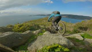
Videos of Montefaro Mountain Bike
trail: Cortafuegos Classic
7:48 |
96 |
Jan 30, 2022
trail: Cortafuegos Classic
9:04 |
|
Dec 2, 2020

trail: Cortafuegos Classic
4:04 |
|
Dec 2, 2020
trail: Cortafuegos Classic
6:08 |
274 |
Jan 8, 2023 , Mugardos
Recent Trail Reports
| status | trail | date | condition | info | user |
|---|---|---|---|---|---|
| Pena da Bailadora | May 21, 2026 @ 9:16pm (Europe/Madrid) May 21, 2026 | Dry | marcossantamaria TFSPAIN | ||
| Pedra das Pegas | May 21, 2026 @ 9:16pm (Europe/Madrid) May 21, 2026 | Dry | marcossantamaria TFSPAIN | ||
| Paralela Xe | May 21, 2026 @ 9:16pm (Europe/Madrid) May 21, 2026 | Dry | marcossantamaria TFSPAIN | ||
| Os Frades | May 21, 2026 @ 9:16pm (Europe/Madrid) May 21, 2026 | Dry | marcossantamaria TFSPAIN | ||
| Octopus 2 | May 21, 2026 @ 9:16pm (Europe/Madrid) May 21, 2026 | Dry | marcossantamaria TFSPAIN | ||
| Octopus 1 | May 21, 2026 @ 9:16pm (Europe/Madrid) May 21, 2026 | Dry | marcossantamaria TFSPAIN | ||
| O Río Pequeno | May 21, 2026 @ 9:16pm (Europe/Madrid) May 21, 2026 | Dry | marcossantamaria TFSPAIN | ||
| O Cuco | May 21, 2026 @ 9:16pm (Europe/Madrid) May 21, 2026 | Dry | marcossantamaria TFSPAIN | ||
| Montefaro Principal | May 21, 2026 @ 9:16pm (Europe/Madrid) May 21, 2026 | Dry | marcossantamaria TFSPAIN | ||
| Montefaro Principal | May 21, 2026 @ 9:16pm (Europe/Madrid) May 21, 2026 | Dry | marcossantamaria TFSPAIN |
Activity Feed
| username | action | type | title | date |
|---|---|---|---|---|
| marcossantamaria | add | report | activity #95193278 and 41 more | May 21, 2026 @ 12:16pm May 21, 2026 |
| marcossantamaria | rsvp | event | activity #95193189 | May 21, 2026 @ 12:14pm May 21, 2026 |
| marcossantamaria | update | trail | activity #95191331 and 7 more | May 21, 2026 @ 11:47am May 21, 2026 |
| iurzab | wishlist | region | activity #94487027 | May 11, 2026 @ 4:32am May 11, 2026 |
| marcossantamaria | add | trail | activity #91805385 and 5 more | Apr 3, 2026 @ 1:03am Apr 3, 2026 |
Nearby Areas
| name | distance | ||||
|---|---|---|---|---|---|
| Ares | 6 | 28 | 2.5 km | ||
| Pedroso | 2 | 1 | 10.5 km | ||
| A Zapateira | 2 | 15 | 11.6 km | ||
| Novo Mesoiro | 1 | 12.4 km | |||
| Arteixo | 2 | 3 | 14 km |
Local Badges
-

Completionist0 awarded
Bike & Skill Parks
| name | type | city | rating |
|---|---|---|---|
| Pumptrack Mugardos | skill park | Mugardos |
Activity Type Stats
| activitytype | trails | distance | descent | descent distance | total vertical | rating | global rank | state rank | photos | reports | routes | ridelogs |
|---|---|---|---|---|---|---|---|---|---|---|---|---|
| Mountain Bike | 48 | 16 miles | 6,056 ft | 11 miles | 810 ft | #7,316 | #521 | 2 | 157 | 5 | 649 | |
| E-Bike | 48 | 16 miles | 6,056 ft | 11 miles | 810 ft | #3,747 | #697 | 152 | 5 | 150 | ||
| Hike | 33 | 13 miles | 4,052 ft | 8 miles | 804 ft | #7,539 | 151 | 14 | ||||
| Trail Running | 33 | 13 miles | 4,052 ft | 8 miles | 804 ft | #6,712 | #733 | 151 | 9 |
Frequently Asked Questions About Montefaro
▼
What are the highest rated mountain biking trails in Montefaro?
The highest rated mountain biking trails in Montefaro are:
- A Bailadora (4.2/5)
- Maderistas (4.2/5)
- Faro (4.1/5)
- Octopus 1 (4.1/5)
- Cortafuegos Classic (4/5)
▼
What is the best time of the year to ride in Montefaro?
Based on ride log data, the most popular months to ride in Montefaro are:
- January (1 activities)
- June (1 activities)
- December (1 activities)
▼
Where can I park to ride in Montefaro?
Check the Montefaro trail map for trailhead and parking information. Community members regularly update access and parking details for trails in the area.
▼
What is the longest trail in Montefaro?
The longest trail in Montefaro is Bugallón at 1.2 miles. View all trails sorted by distance.
Activities
Trails
Points of Interest
- By cliffbikermagazine & contributors
- Admins: apply
- #32289 - 1,962 views
- montefaro activity log | embed map of Montefaro mountain bike trails | montefaro mountain biking points of interest
Downloading of trail gps tracks in kml & gpx formats is enabled for Montefaro.
You must login to download files.