close
-
Layers w
- Weather Layers
- Pro
- Pro
- Pro
- Pro
- Pro
- Pro
- More Layers
- Pro
- Pro
- Pro
- Pro
-
Upgrade to

3D
Trail Conditions
- Unknown
- Snow Groomed
- Snow Packed
- Snow Covered
- Snow Cover Partial
- Freeze/thaw Cycle
- Icy
- Prevalent Mud
- Wet
- Variable
- Ideal
- Dry
- Very Dry
Trail Flow (Ridden Direction)
Trailforks scans users ridelogs to determine the most popular direction each trail is ridden. A good flowing trail network will have most trails flowing in a single direction according to their intension.
The colour categories are based on what percentage of riders are riding a trail in its intended direction.
The colour categories are based on what percentage of riders are riding a trail in its intended direction.
- > 96%
- > 90%
- > 80%
- > 70%
- > 50%
- < 50%
- bi-directional trail
- no data
Trail Last Ridden
Trailforks scans ridelogs to determine the last time a trail was ridden.
- < 2 days
- < 1 week
- < 2 weeks
- < 1 month
- < 6 months
- > 6 months
Trail Ridden Direction
The intended direction a trail should be ridden.
- Downhill Only
- Downhill Primary
- Both Directions
- Uphill Primary
- Uphill Only
- One Direction
Contribute Details
Colors indicate trail is missing specified detail.
- Description
- Photos
- Description & Photos
- Videos
Trail Popularity ?
Trailforks scans ridelogs to determine which trails are ridden the most in the last 9 months.
Trails are compared with nearby trails in the same city region with a possible 25 colour shades.
Think of this as a heatmap, more rides = more kinetic energy = warmer colors.
- most popular
- popular
- less popular
- not popular
ATV/ORV/OHV Filter
Max Vehicle Width
inches
US Cell Coverage
Legend

Radar Time
Activity Recordings
Trailforks uses anonymized public activity data.
?
Activity Recordings
Trailforks uses anonymized public activity data.
?
Personal Heatmap
▶
Activity Types
all
/
none
▶
Options
2
Date range
month
–
Winter Trails
Warning
A routing network for winter maps does not exist. Selecting trails using the winter trails layer has been disabled.
Missing Trails
Most Popular
Least Popular
Trails are colored based on popularity. The more popular a trail is, the more red. Less popular trails trend towards green.
Jump Magnitude Heatmap
Heatmap of where riders jump on trails. Zoom in to see individual jumps, click circles to view jump details.
BC Backroad Status
![map legend]()
Service Road Atlas is a free to use, community-driven service for viewing and creating reports on the numerous back-country service roads around B.C. and Alberta.

Slope Aspect
Direction the slope faces
Trails Deemphasized
Trails are shown in grey.
Only show trails with no bike usage.
Suggested Layers
Based on selected activity type
Save the current map location and zoom level as your default home location whenever this page is loaded.
SaveMontenegro is naturally divided into several geographic regions, based on its diverse topography, climate, and natural landmarks. These regions include:
Coastal Region (Primorje)
Located along the Adriatic Sea, the coastal region is characterized by beautiful beaches, resorts, and towns. It is the most developed region in terms of tourism.
Key areas: Budva, Kotor, Herceg Novi, Bar, Tivat, and Ulcinj.
This region is also known for the Bay of Kotor (Boka Kotorska), a UNESCO World Heritage site.
Central Montenegro (Središnja Crna Gora)
This region is characterized by the central plain and the capital, Podgorica. The terrain is mostly flat, and it is the country’s economic and political heart.
It includes smaller towns and is home to significant agricultural activity and industrial areas.
The Skadar Lake area, shared with Albania, is also part of this region and is famous for its biodiversity.
Northern Montenegro (Sjeverna Crna Gora)
Known for its mountainous terrain, this region includes the Durmitor National Park, Biogradska Gora, and the Prokletije Mountains.
It’s the least populated region but is popular for nature tourism, including hiking, skiing, and eco-tourism.
Key areas: Nikšić, Žabljak, Berane, and Pljevlja.
This region is particularly famous for the Durmitor mountain range, a UNESCO-listed natural site.
Region Details
- 56
- 17
- 36
- 29
- 4
Stats
- Avg Trail Rating
- Trails (view details)
- 156
- Trails Mountain Bike
- 158
- Trails E-Bike
- 114
- Trails Gravel Bike
- 2
- Trails Adaptive Bike
- 1
- Trails Horse
- 13
- Trails Hike
- 150
- Trails Trail Running
- 149
- Trails Dirtbike/Moto
- 18
- Trails Observed Trials
- 3
- Trails ATV/ORV/OHV
- 8
- Trails Snowmobile
- 1
- Trails Snowshoe
- 1
- Total Distance
- 170 miles
- Total Descent
- 53,156 ft
- Total Vertical
- 6,806 ft
- Highest Trailhead
- 6,829 ft
- Reports
- 100
- Photos
- 221
- Ridden Counter
- 876
Articles
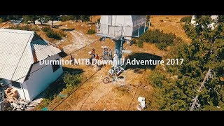
Video: A Mountain Bike Adventure with Jerome Clementz & Ludo May in 'Peaks of the Balkans'
Oct 29, 2025 from pinkbike.com
Ride wild trails. Cross untouched valleys. Meet remote mountain communities. This is mountain biking in its purest form.
Popular Trail Networks
view all areas »Sub Regions
- Primorje (Coastal Region) (64)
- Opština Bar (15)
- Bar (13)
- Opština Budva (2)
- Budva (1)
- Zečevo Selo (1)
- Opština Herceg Novi (10)
- Herceg Novi (2)
- Kameno (3)
- Radovanici (3)
- Opština Kotor (8)
- Opština Tivat (33)
- Gornja Lastva (13)
- Gošići (2)
- Tivat (12)
- Đuraševići (5)
- Opština Ulcinj (1)
- Ulcinj - Ulqin (1)
- Opština Bar (15)
- Sjeverna Crna Gora (Northern Montenegro) (59)
- Opština Andrijevica (14)
- Andrijevica (4)
- Opština Berane (5)
- Berane (4)
- Opština Gusinje (4)
- Gusinje (4)
- Opština Kolašin (12)
- Katun Goleš (1)
- Kolašin (7)
- Opština Plav (8)
- Plav (8)
- Opština Pljevlja (1)
- Opština Rožaje (4)
- Rožaje (4)
- Opština Žabljak (13)
- Žabljak (13)
- Opština Andrijevica (14)
- Središnja Crna Gora (Central Montenegro) (27)
- Opština Cetinje (15)
- Opština Danilovgrad (2)
- Danilovgrad (2)
- Opština Mojkovac (2)
- Mojkovac (2)
- Opština Nikšić (1)
- Nikšić (1)
- Opština Plužine (2)
- Plužine (2)
- Opština Podgorica (4)
- Podgorica (4)
- Opština Šavnik (1)
- Šavnik (1)
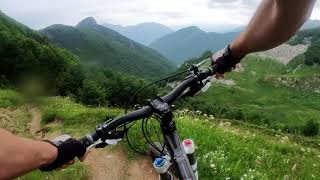
Popular Montenegro Mountain Biking Trails
• 100 ★ 5.0 • 1,594 ft • 0 ft • 83 •
Popular blue difficulty singletrack. This mountain bike primary trail can be used both directions with a 0 ft blue climb. It features rock garden. Trail visibility is always easy to follow. On average it takes 1 minutes to complete this trail.
• ★ 4.3 • 4 miles • 65 ft • 34 •
Old Roman road which became a trail. Upper part in the forest is nice enduro, lower part very rough open trail with magnificent views of Kotor bay
• 100 ★ 4.5 • 1 mile • 0 ft • 28 •
A track specially bult for DH competition, though it is better described as enduro as it has some flat parts. There are drops and jumps and track crosses the road (few traffic there) several times, be careful.
• 25 ★ 3.7 • 1 mile • 30 ft • 20 •
Hard trail from the plan near Jablan lake, traversing a narrow path under peak and into conifer forest to village. Easy & beautiful start, followed by very scenic but exposed ride below the ridge. Narrow & dangerous path, be...
• 5 ★ 3.7 • 2 miles • 96 ft • 17 •
Long bit of singletrack between the two main peaks of Lovcen. Only the first and last part are easy. It's a hiking trail and really not recommended for a bike. BEWARE: Most of the trail is very rocky, with huge boulders and zero flow....
• ★ 5.0 • 2 miles • 77 ft • 12 •
Old Austrian road with a beautiful view to Kotor. Easy & wide first part, but after 5,6 switchbacks it becomes really hard, with large fallen rocks, and very skinny rocky trail which is highly exposed to the steep terrain. Dangerous...
• 100 ★ 0.0 • 1,381 ft • 139 ft • 11 •
Forest trail just under Sveti Ilija peak, which crosses the main gravel access road to the summit.
• 60 ★ 0.0 • 3,547 ft • 6 ft • 10 •
Easy trail in amazing black pine forest of Vrmac hill, with views of Tivat and Adriatic sea. It can be riden in both directions, as there's a small vertical gain. The Trail is still unmarked, but even if you miss the turn somewhere,...
Montenegro Mountain Bike Routes
17 miles • 2,387 ft • 0 • Loop •
Bike up and down Vrmac, a hill peninsula set in the middle of the UNESCO-listed Boka Bay with stunning...
19 miles • 1,637 ft • 0 • Point to Point •
Easy cross-country ride Trešnjevik pass - Bjelasica ski center - Kolašin.
Photos of Montenegro Mountain Bike
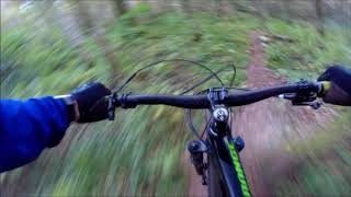
Videos of Montenegro Mountain Bike
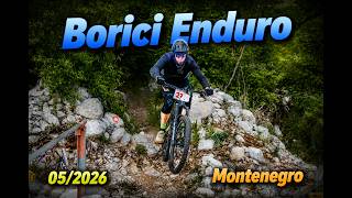
trail: Borici Trail
5:49 |
15 |
May 27, 2026 , Kameno

trail: Borici Trail
4:25 |
9 |
May 27, 2026 , Kameno
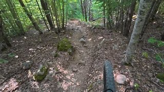
trail: Izlasci forest trail
3:59 |
58 |
Sep 1, 2025 , Katun Goleš
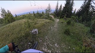
trail: Stuoc DH
5:33 |
119 |
Aug 26, 2025 , Žabljak
trail: Vajushes Pas - Grebaja
9:18 |
85 |
Feb 16, 2025 , Gusinje
trail: Golesh Trail
6:16 |
98 |
Jan 25, 2025 , Kolašin
trail: Stuoc DH
4:09 |
157 |
Jan 25, 2025 , Žabljak

trail: Peani Enduro Trail
4:07 |
142 |
Jan 25, 2025 , Tivat
Recent Comments
| username | type | title | comment | date |
|---|---|---|---|---|
| trail | Cable car doesn’t take bikes along! Very... | Jun 1, 2026 @ 6:36am Jun 1, 2026 | ||
| trail | Second day I was riding with the locals from... | Jun 1, 2026 @ 6:28am Jun 1, 2026 | ||
| trail | Went for a full day shuttle around the area a... | Jun 1, 2026 @ 6:02am Jun 1, 2026 | ||
| trail | Good trail and well build! Thanks! | May 30, 2026 @ 9:54am May 30, 2026 | ||
| trail | Fun trail if you find it. It starts well on a... | May 30, 2026 @ 9:48am May 30, 2026 |
Activity Type Stats
| activitytype | trails | distance | descent | descent distance | total vertical | rating | global rank | state rank | photos | reports | routes | ridelogs |
|---|---|---|---|---|---|---|---|---|---|---|---|---|
| Mountain Bike | 155 | 154 miles | 49,738 ft | 80 miles | 6,808 ft | #76 | 221 | 100 | 3 | 2,775 | ||
| E-Bike | 114 | 106 miles | 29,754 ft | 50 miles | 6,306 ft | #67 | 75 | 2 | 295 | |||
| Gravel Bike | 2 | #43 | 1 | 43 | ||||||||
| Adaptive Bike | 1 | #43 | ||||||||||
| Horse | 13 | 8 miles | 945 ft | 1 mile | 3,353 ft | #73 | ||||||
| Hike | 150 | 155 miles | 49,731 ft | 82 miles | 6,808 ft | #66 | 101 | 1,378 | ||||
| Trail Running | 149 | 155 miles | 49,731 ft | 82 miles | 6,808 ft | #74 | 101 | 62 | ||||
| Dirtbike/Moto | 18 | 6 miles | 213 ft | 1 mile | 4,108 ft | #68 | 1 | 2 | ||||
| Observed Trials | 3 | 4 miles | 82 ft | 2,113 ft | 1,184 ft | #52 | ||||||
| ATV/ORV/OHV | 8 | 4 miles | 82 ft | 2,113 ft | 1,184 ft | #57 | 1 | |||||
| Snowmobile | 1 | 4 miles | 82 ft | 2,113 ft | 1,184 ft | #36 | ||||||
| Snowshoe | 1 | 1 mile | 784 ft | 3,415 ft | 597 ft | #42 | 6 |
Activities
Trails
- By StuHolley & contributors
- Admins: Other Trails
- #11014 - 20,306 views
- montenegro activity log | embed map of Montenegro mountain bike trails | montenegro mountain biking points of interest
Downloading of trail gps tracks in kml & gpx formats is enabled for Montenegro.
You must login to download files.