
close
-
Layers w
- Weather Layers
- Pro
- Pro
- Pro
- Pro
- Pro
- Pro
- More Layers
- Pro
- Pro
- Pro
- Pro
-
Upgrade to

3D
Trail Conditions
- Unknown
- Snow Groomed
- Snow Packed
- Snow Covered
- Snow Cover Partial
- Freeze/thaw Cycle
- Icy
- Prevalent Mud
- Wet
- Variable
- Ideal
- Dry
- Very Dry
Trail Flow (Ridden Direction)
Trailforks scans users activity logs to determine the most popular direction each trail is ridden. A good flowing trail network will have most trails flowing in a single direction according to their intension.
The colour categories are based on what percentage of users are riding a trail in its intended direction.
The colour categories are based on what percentage of users are riding a trail in its intended direction.
- > 96%
- > 90%
- > 80%
- > 70%
- > 50%
- < 50%
- bi-directional trail
- no data
Trail Last Ridden
Trailforks scans activity logs to determine the last time a trail was ridden.
- < 2 days
- < 1 week
- < 2 weeks
- < 1 month
- < 6 months
- > 6 months
Trail Ridden Direction
The intended direction a trail should be ridden.
- Downhill Only
- Downhill Primary
- Both Directions
- Uphill Primary
- Uphill Only
- One Direction
Contribute Details
Colors indicate trail is missing specified detail.
- Description
- Photos
- Description & Photos
- Videos
Trail Popularity ?
Trailforks scans activity logs to determine which trails are ridden the most in the last 9 months.
Trails are compared with nearby trails in the same city region with a possible 25 colour shades.
Think of this as a heatmap, more activities = more kinetic energy = warmer colors.
- most popular
- popular
- less popular
- not popular
ATV/ORV/OHV Filter
Max Vehicle Width
inches
US Cell Coverage
Legend

Radar Time
Activity Recordings
Trailforks uses anonymized public activity data.
?
Activity Recordings
Trailforks uses anonymized public activity data.
?
Personal Heatmap
▶
Activity Types
all
/
none
▶
Options
2
Date range
month
–
Winter Trails
Warning
A routing network for winter maps does not exist. Selecting trails using the winter trails layer has been disabled.
Missing Trails
Most Popular
Least Popular
Trails are colored based on popularity. The more popular a trail is, the more red. Less popular trails trend towards green.
Jump Magnitude Heatmap
Heatmap of where users jump on trails. Zoom in to see individual jumps, click circles to view jump details.
BC Backroad Status
![map legend]()
Service Road Atlas is a free to use, community-driven service for viewing and creating reports on the numerous back-country service roads around B.C. and Alberta.

Slope Aspect
Direction the slope faces
Trails Deemphasized
Trails are shown in grey.
Only show trails with no bike usage.
Suggested Layers
Based on selected activity type
Save the current map location and zoom level as your default home location whenever this page is loaded.
SaveSANT’EUSEBIO
Sant’Eusebio (Santo Zeuggio in Genovese) è un quartiere della Val Bisagno di circa 3mila abitanti.
Il centro del Paese, dove sorge l’antico Campanile Romanico del XII secolo, è situato a 222 metri s.l.d.m.
È una zona di campagna a pochi passi dal centro città e, a cavallo della fine dell’ 800 e gli inizi del 900, veniva usato dalle famiglie Genovesi come luogo di villeggiature e di gite domenicali tanto da guadagnarsi la denominazione di “Svizzera Genovese”.
Il paese è ancora oggi molto frequentato da chi ama fare passeggiate o andare in bicicletta in mezzo al verde, visti i numerosi sentieri che percorrono i boschi e le colline circostanti.
I principali rilievi che svettano sul centro abitato sono:
Il Monte Ratti (560 s.l.m.) dove sorge l’ononimo Forte edificato tra il 1831 e il 1842 dal Governo Sabaudo per difendere la Val Bisagno da eventuali attacchi a nord-est della città. Lo stesso venne utilizzato sia durante la Prima Guerra Mondiale come prigione per i Coatti Austriaci, sia durante il secondo conflitto mondiale come batteria contraerea.
Oggi il Forte, anche se pericolante, è meta di gite da parte di numerose persone.
Il Monte Croce (384 m.s.l.m) sulla cui sommità si erge una croce in ferro.
La collina dove sorge Torre Quezzi (315 m.s.l.m.) piccola fortificazione costruita dal Corpo Reale del genio Sardo tra il 1818 e il 1823.
Da Sant’Eusebio osservando verso Nord e Nord-Est sono ben visibili i maggiori rilievi della Val Bisagno:
Monte Candelozzo (1034 m.s.l.m.)
Monte AlpeSisa (989 m.s.l.m.)
Monte Prati di Capenardo (880 m.sl.m.)
Monte Alpe (799 m.s.l.m.)
Da Sant’Eusebio si possono osservare:
Forte Sperone (489 m.s.l.m.)
Forte Puin (512 m.s.l.m.)
Forte Diamante (672 m.s.l.m.)
La località è posta in una zona dove la media pluviometrica risulta piuttosto alta, circa 1400/1500 mm annui.
Immagine Pluviometria – tratta da Nimbus – Rivista Ligure di Meteorologia
Dai rilievi che circondano Sant’Eusebio, scendono numerosi ruscelli e piccoli corsi d’acqua da cui trae origine il Rio Mermi che, nascosto dalle tombinature a nord e dalla vegetazione procedendo verso sud, sfocia nel Torrente Bisagno all’altezza di Pontecarrega.
https://www.gaiaincam.com/webcam/genova-santeusebio/
Sant’Eusebio (Santo Zeuggio in Genovese) è un quartiere della Val Bisagno di circa 3mila abitanti.
Il centro del Paese, dove sorge l’antico Campanile Romanico del XII secolo, è situato a 222 metri s.l.d.m.
È una zona di campagna a pochi passi dal centro città e, a cavallo della fine dell’ 800 e gli inizi del 900, veniva usato dalle famiglie Genovesi come luogo di villeggiature e di gite domenicali tanto da guadagnarsi la denominazione di “Svizzera Genovese”.
Il paese è ancora oggi molto frequentato da chi ama fare passeggiate o andare in bicicletta in mezzo al verde, visti i numerosi sentieri che percorrono i boschi e le colline circostanti.
I principali rilievi che svettano sul centro abitato sono:
Il Monte Ratti (560 s.l.m.) dove sorge l’ononimo Forte edificato tra il 1831 e il 1842 dal Governo Sabaudo per difendere la Val Bisagno da eventuali attacchi a nord-est della città. Lo stesso venne utilizzato sia durante la Prima Guerra Mondiale come prigione per i Coatti Austriaci, sia durante il secondo conflitto mondiale come batteria contraerea.
Oggi il Forte, anche se pericolante, è meta di gite da parte di numerose persone.
Il Monte Croce (384 m.s.l.m) sulla cui sommità si erge una croce in ferro.
La collina dove sorge Torre Quezzi (315 m.s.l.m.) piccola fortificazione costruita dal Corpo Reale del genio Sardo tra il 1818 e il 1823.
Da Sant’Eusebio osservando verso Nord e Nord-Est sono ben visibili i maggiori rilievi della Val Bisagno:
Monte Candelozzo (1034 m.s.l.m.)
Monte AlpeSisa (989 m.s.l.m.)
Monte Prati di Capenardo (880 m.sl.m.)
Monte Alpe (799 m.s.l.m.)
Da Sant’Eusebio si possono osservare:
Forte Sperone (489 m.s.l.m.)
Forte Puin (512 m.s.l.m.)
Forte Diamante (672 m.s.l.m.)
La località è posta in una zona dove la media pluviometrica risulta piuttosto alta, circa 1400/1500 mm annui.
 |
Immagine Pluviometria – tratta da Nimbus – Rivista Ligure di Meteorologia
Dai rilievi che circondano Sant’Eusebio, scendono numerosi ruscelli e piccoli corsi d’acqua da cui trae origine il Rio Mermi che, nascosto dalle tombinature a nord e dalla vegetazione procedendo verso sud, sfocia nel Torrente Bisagno all’altezza di Pontecarrega.
https://www.gaiaincam.com/webcam/genova-santeusebio/
Primary Trail Type: All-Mountain & Downhill
Land Status: Managed by Local Riding Association
 google parking directions
 Access Info:
CXVP+57 Genova, Città Metropolitana di Genova
Disclaimer:
Rispettate il terriorio ovunque...lasciate il bosco come lo trovate, sostenete le associazioni di volontariato
This region uses the Uk/Euro style trail grading system.
Activities Click to view
- Mountain Bike
53 trails
- E-Bike
25 trails
- Horse
4 trails
- Hike
50 trails
- Trail Running
48 trails
Region Details
- 15
- 1
- 13
- 22
Region Status
Caution as of Jun 16, 2026
Stats
- Avg Trail Rating
- Trails (view details)
- 53
- Trails Mountain Bike
- 53
- Trails E-Bike
- 25
- Trails Horse
- 4
- Trails Hike
- 50
- Trails Trail Running
- 48
- Total Distance
- 30 miles
- Total Descent
- 12,392 ft
- Total Vertical
- 1,708 ft
- Highest Trailhead
- 1,832 ft
- Reports
- 1,201
- Photos
- 459
- Completed Counter
- 3,854
Popular Monteratti - S. Eusebio Mountain Biking Trails
• 100 ★ 3.8 • 3,022 ft • 355 ft • 134 •
Popular green difficulty doubletrack. This mountain bike primary trail can be used both directions and has a easy overall physical rating with a 355 ft green climb. On average it takes 9 minutes to complete this trail.
• 100 ★ 4.5 • 2,476 ft • 256 ft • 132 •
Popular green difficulty singletrack. This mountain bike primary trail can be used both directions and has a moderate overall physical rating with a 256 ft blue climb. Trail visibility is always easy to follow. On average it takes 9 minutes to complete this trail.
• 90 ★ 4.5 • 4,094 ft • 218 ft • 130 •
Popular green difficulty singletrack. This mountain bike primary trail can be used both directions and has a easy overall physical rating with a 218 ft green climb. On average it takes 7 minutes to complete this trail.
• 85 ★ 4.0 • 2 miles • 451 ft • 130 •
Popular green difficulty family friendly mixed. This mountain bike primary trail can be used both directions and has a moderate overall physical rating with a 451 ft green climb. Trail visibility is always easy to follow. On average it takes 14 minutes to complete this trail.
• 80 ★ 4.8 • 3,812 ft • 18 ft • 121 •
Popular green difficulty singletrack. This mountain bike primary trail can be used downhill primary and has a easy overall physical rating with a 18 ft blue climb. On average it takes 6 minutes to complete this trail.
• 75 ★ 3.9 • 1 mile • 95 ft • 109 •
Popular blue difficulty singletrack. This mountain bike primary trail can be used downhill primary and has a easy overall physical rating with a 95 ft green climb. On average it takes 11 minutes to complete this trail.
• 80 ★ 4.0 • 4,123 ft • 396 ft • 107 •
Popular blue difficulty doubletrack. This mountain bike primary trail can be used both directions and has a moderate overall physical rating with a 396 ft black diamond climb. It features rock garden. On average it takes 17 minutes to complete this trail.
• 95 ★ 4.4 • 1,153 ft • 18 ft • 99 •
Popular green difficulty singletrack. This mountain bike primary trail can be used both directions. On average it takes 8 minutes to complete this trail.
Monteratti - S. Eusebio Mountain Bike Routes
13 miles • 2,464 ft • 4 •
Percorso misto ad anello di varia difficoltà. Partenza dal quartiere di Borgoratti e salita verso Bavari...
★ 2.0 • 12 miles • 2,684 ft • 7 • Loop •
Forte Ratti Richelieu Ratti Richelieu fort Description: The route starts from Monteratti fort, which can...
23 miles • 5,104 ft • 7 • Loop •
This route connects the Eremita trail that starts from the top of the Monte Fasce with the descending...
Photos of Monteratti - S. Eusebio Mountain Bike
Videos of Monteratti - S. Eusebio Mountain Bike
trail: Due grotte
0:10 |
61 |
May 26, 2021

trail: Tour Interno Forte Ratti
4:22 |
26 |
Feb 16, 2021
trail: Accesso - Cava - Trivio
3:28 |
45 |
Feb 16, 2021
trail: Accesso - Cava - Trivio
3:49 |
40 |
Feb 16, 2021
trail: Formaggia
4:03 |
61 |
Feb 16, 2021
trail: Piratti
0:54 |
287 |
Mar 12, 2019
0:08 |
356 |
Jan 7, 2019
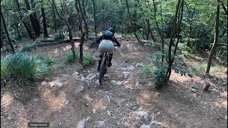
trail: Due grotte
8:38 |
231 |
Jul 24, 2023 , Genova
Recent Trail Reports
| status | trail | date | condition | info | user |
|---|---|---|---|---|---|
| Variante due grotte | Jun 16, 2026 @ 8:46pm (Europe/Rome) Jun 16, 2026 | Ideal | Kaprazozza | ||
| Stelle e Stalle - Accesso al trail Piratti | Jun 6, 2026 @ 10:17pm (Europe/Rome) Jun 6, 2026 | Unknown | Panetz | ||
| Due grotte | May 30, 2026 @ 8:06pm (Europe/Rome) May 30, 2026 | Ideal | Kaprazozza | ||
| Quercia Rossa | May 23, 2026 @ 7:05am (Europe/Rome) May 22, 2026 | Ideal | Kaprazozza | ||
| Super Gil | May 23, 2026 @ 7:03am (Europe/Rome) May 22, 2026 | Ideal | Kaprazozza | ||
| Anello di ZE' | May 23, 2026 @ 6:59am (Europe/Rome) May 22, 2026 | Ideal | Kaprazozza | ||
| Orpea - Ex Cementifera | May 19, 2026 @ 2:15pm (Europe/Rome) May 19, 2026 | Dry | Evidario | ||
| Piratti | May 16, 2026 @ 8:04pm (Europe/Rome) May 16, 2026 | Ideal | Kaprazozza | ||
| Maiali - Marassi | May 4, 2026 @ 8:00am (Europe/Rome) May 3, 2026 | Wet | Corradoz6LCJs | ||
| Cappelletta Cacciatori - Pietraia | May 4, 2026 @ 7:59am (Europe/Rome) May 3, 2026 | Ideal | Corradoz6LCJs |
Activity Feed
| username | action | type | title | date |
|---|---|---|---|---|
| Kaprazozza | add | report | activity #97127920 | Jun 16, 2026 @ 11:46am Jun 16, 2026 |
| Kaprazozza | add | report | activity #97087396 | Jun 15, 2026 @ 9:52pm Jun 15, 2026 |
| Panetz | add | report | activity #96401365 | Jun 6, 2026 @ 1:17pm Jun 6, 2026 |
| Kaprazozza | add | report | activity #95870439 | May 30, 2026 @ 11:06am May 30, 2026 |
| SidVicS | add | video | activity #95825844 | May 29, 2026 @ 11:41pm May 29, 2026 |
Recent Comments
| username | type | title | comment | date |
|---|---|---|---|---|
| trail | A parte il ponte crollato, il sentiero è... | Mar 30, 2026 @ 1:20am Mar 30, 2026 | ||
| report | Dove gli alberi?in che punto? | Apr 26, 2025 @ 4:51am Apr 26, 2025 | ||
| report | Percorso bello e in questo momento asciutto e... | Mar 9, 2025 @ 8:18am Mar 9, 2025 | ||
| report | Dopo appena circa due ore qualcuno aveva... | Oct 20, 2024 @ 9:33pm Oct 20, 2024 | ||
| trail | sembra essere un “trail report” più che... | May 5, 2024 @ 9:06pm May 5, 2024 |
Nearby Areas
| name | distance | ||||
|---|---|---|---|---|---|
| Spunciabike Trails Area | 3 | 6 | 3 | 2 km | |
| Righi Valbisagno Trails Area | 18 | 20 | 6 | 3 | 2.6 km |
| Santolcese trails area | 9 | 9 | 2.7 km | ||
| Monte Fasce Bike Trails Area | 4 | 12 | 6 | 3.3 km | |
| Pedemonte | 5 | 11 | 2 | 1 | 4.8 km |
Local Badges
-

Completionist0 awarded





Activity Type Stats
| activitytype | trails | distance | descent | descent distance | total vertical | rating | global rank | state rank | photos | reports | routes | activity logs |
|---|---|---|---|---|---|---|---|---|---|---|---|---|
| Mountain Bike | 53 | 30 miles | 12,392 ft | 17 miles | 1,709 ft | #1,802 | #58 | 449 | 1,201 | 3 | 5,069 | |
| E-Bike | 25 | 14 miles | 5,400 ft | 7 miles | 1,654 ft | #3,584 | #240 | 10 | 1,056 | 1,079 | ||
| Horse | 4 | 2 miles | 476 ft | 4,193 ft | 243 ft | #882 | #39 | 130 | ||||
| Hike | 50 | 29 miles | 11,962 ft | 16 miles | 1,709 ft | #4,677 | #128 | 1,190 | 1 | 169 | ||
| Trail Running | 48 | 27 miles | 11,486 ft | 15 miles | 1,709 ft | #3,841 | #121 | 1,181 | 1 | 257 |
Frequently Asked Questions About Monteratti - S. Eusebio
▼
What are the highest rated mountain biking trails in Monteratti - S. Eusebio?
The highest rated mountain biking trails in Monteratti - S. Eusebio are:
- Due grotte (4.3/5)
- Piratti deviazione per Due Grotte (4.2/5)
- Piratti (4.2/5)
- Fermata Provvisoria - Forte Ratti (4.2/5)
- Scorpione (4.1/5)
▼
What is the best time of the year to ride in Monteratti - S. Eusebio?
Based on ride log data, the most popular months to ride in Monteratti - S. Eusebio are:
- June (38 activities)
- April (19 activities)
- May (17 activities)
▼
Where can I park to ride in Monteratti - S. Eusebio?
There are 6 parking locations listed in Monteratti - S. Eusebio. The most popular parking spots are: View all parking and trailhead locations on the map to plan your visit.
▼
What is the longest trail in Monteratti - S. Eusebio?
The longest trail in Monteratti - S. Eusebio is Piazza S.Eusebio - Torretta Quezzi at 1.6 miles. View all trails sorted by distance.
Activities
Trails
- Hard trails in Monteratti - S. Eusebio
- Easy trails in Monteratti - S. Eusebio
- Favorite trails in Monteratti - S. Eusebio
- Most ridden trails in Monteratti - S. Eusebio
- Singletrack in Monteratti - S. Eusebio
- Viewpoint trails in Monteratti - S. Eusebio
- Trails with technical features in Monteratti - S. Eusebio
- Race routes in Monteratti - S. Eusebio
Points of Interest
- By linomak
 GMTBL & contributors
 - Admins: linomak
- #20566 - 8,897 views
- monteratti - s. eusebio activity log | embed map of Monteratti - S. Eusebio mountain bike trails | monteratti - s. eusebio mountain biking points of interest
Downloading of trail gps tracks in kml & gpx formats is enabled for Monteratti - S. Eusebio.
You must login to download files.